Hurricane Bertha growing in size and could hit UK on the weekend
It is expected to downgrade to a post-tropical storm, but could bring with it torrential rains and strong winds
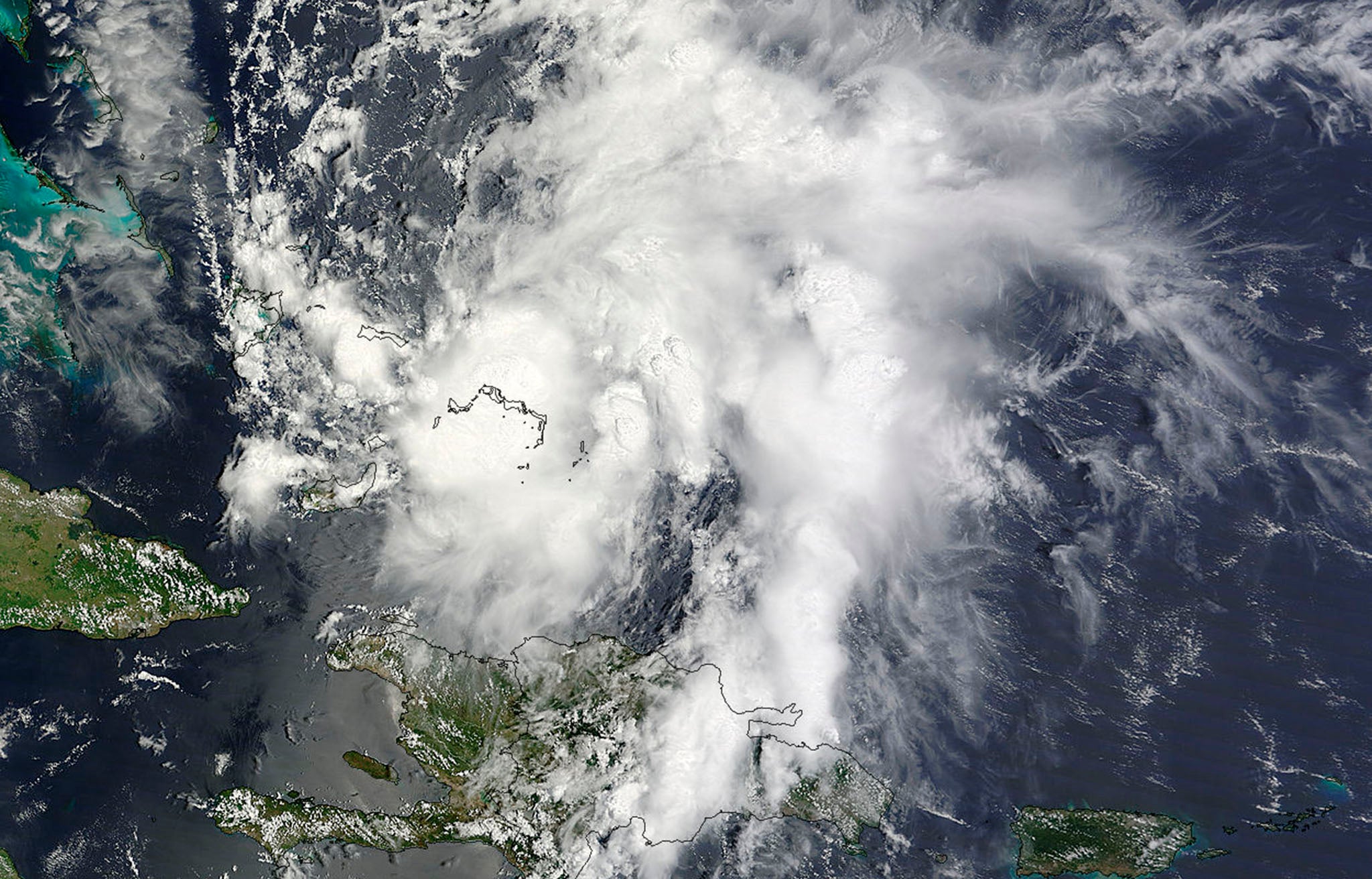
Strong winds, torrential rains and large waves next weekend could put the brakes on the recent glorious weather experienced in the UK, thanks to a hurricane making its way over from the Caribbean.
Hurricane Bertha began heading north and then east after gaining momentum in the Bahamas yesterday.
According to the National Hurricane Centre in the US, it is expected to grow in size before becoming a post-tropical cyclone with winds of up to 73mph, reaching Ireland on Saturday night.
The Met Office has said, however, that its definite course is still unknown – hypotheses include Bertha heading towards France “as a weak feature which will completely miss the UK, to its arriving as a fairly active summer storm.”
In a blog post on its website, the Met Office continued: “In terms of timing, there’s also a spread of possibilities – but it looks likely that the earliest Bertha would affect the UK would be on Sunday or into the start of next week.”
According to its Storm Tracker, Bertha is now a tropical storm barrelling along at 60 knots.
The Met Office has advised people to stay up-to-date with the storm's course on its website.
Andy Ratcliffe, of MeteoGroup, said: "The moisture associated with the hurricane could well lead to us having some heavy rain across the UK towards the end of the week. All parts of the country will be affected.
"There will also be a new low-pressure system caused by the disturbance from the remains of Bertha, leading to more unsettled weather. It could be quite breezy at times."
North America and Canada have avoided the worst of Bertha, with the hurricane skating past its periphery.
However, the East Coast is expected to be hit with rough surf and the threat of dangerous rip currents.
AccuWeather.com's Meteorologist Andy Mussoline said: “Bertha will stay far away from a direct hit on the United States, but beachgoers along the East Coast should prepare for dangerous surf and rip currents early this week.”
Join our commenting forum
Join thought-provoking conversations, follow other Independent readers and see their replies
Comments
Bookmark popover
Removed from bookmarks