Tropical Storm Fay batters Northeast with strong winds and rain after gaining strength
Tropical Storm Warnings and flash flood watches remain in effect for the tri-state coastal area, including New York City
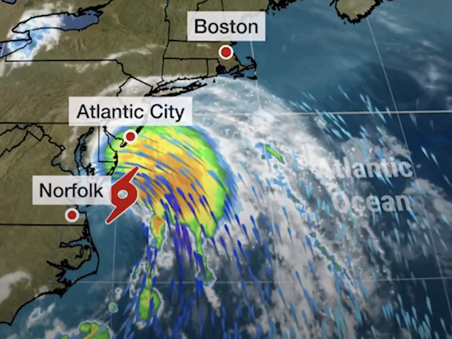
Tropical Storm Fay hits the Northeast after the storm picked up strength and speed before reaching land on Friday.
Rain and flooding battered the East Coast, starting in states like southern New Jersey before moving up towards Massachusetts.
Tropical Storm Warnings and flash flood watches remain in effect for the tri-state coastal area, with a majority of the heavy rain starting Friday afternoon into early Saturday morning.
Widespread flooding of rivers is not yet expected from the storm, according to the National Hurricane Centre.
In New York City, the area will have 12 hours of heavy rain that could reach 2-4in. Other areas of the East Coast expect up to 5in of rain.
Another 1-2in is also possible, according to the National Weather Service.
The storm is moving north on Friday at 10 mph, and will produce 50-mph winds later in the day in areas of the East Coast.
Fay is the earliest sixth-named storm on record, according to Colorado State University hurricane researcher Phil Klotzbach. The previous record was Franklin on July 22, 2005, he said in a tweet.
Sixth-named storms typically start in September, according to the Weather Channel.
The tropical storm comes as a heat wave, entitled a "heat dome", is set to expand across the United States next week.
Areas like Las Vegas and Phoenix are expected to hit temperatures of 110 degrees on Saturday. This heat wave will then move towards the East Coast next week with temperatures to reach 100 degrees in certain areas.
Join our commenting forum
Join thought-provoking conversations, follow other Independent readers and see their replies
Comments
Bookmark popover
Removed from bookmarks