Magnitude 6.3 earthquake strikes southern Philippines
Southeast Asian nation sits on geologically active Pacific Ring of Fire
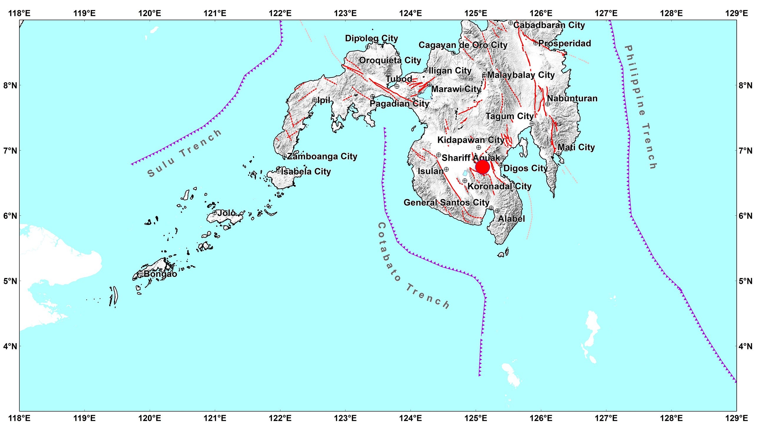
A 6.3 magnitude earthquake struck the southern province of Davao del Sur in the Philippines on Sunday, with damage and aftershocks expected, the country's seismology agency said.
The earthquake was initially recorded at magnitude 6 at a depth of 10 km (6.2 miles), the GFZ German Research Center for Geosciences earlier said.
The Philippines Institute of Volcanology and Seismology (Philvolcs) said it recorded the depth at 15 km, adding that the earthquake was tectonic.
The Southeast Asian country is on the geologically active Pacific Ring of Fire and experiences frequent earthquakes, particularly in the south.
In January, a powerful earthquake shook parts of the southern Philippines.


Authorities said that earthquake was too deep under the sea to cause major damage, and no tsunami warning was issued.
The quake, initially reported as of magnitude 7.2 and later downgraded to 6.8, hit close to the Indonesian Talaud Islands near the Philippines, but it was felt in nearby cities and provinces across the region.
Weeks earlier, an earthquake of magnitude 6.2 struck West Sulawesi, Indonesia.
Reuters
Join our commenting forum
Join thought-provoking conversations, follow other Independent readers and see their replies
Comments
Bookmark popover
Removed from bookmarks