Where did it go? Australian scientists un-discover phantom Pacific island that appears on world maps
It is every explorer’s wish to discover unmapped territory – but few expect to undiscover territory that is already mapped. That is what happened to a team of Australian scientists who found themselves sailing through what appeared on charts as a large island during a research trip in the South Pacific.
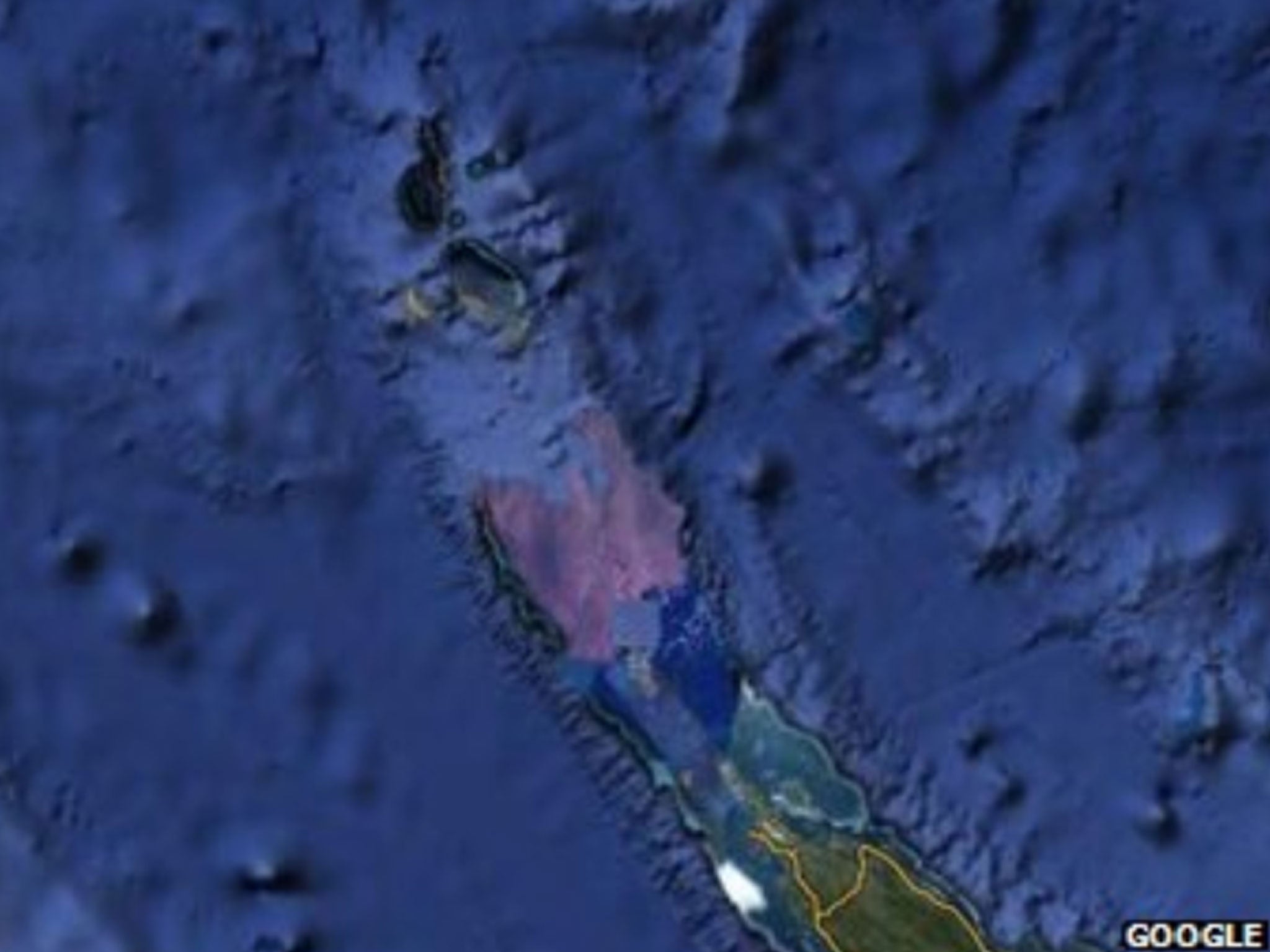
Sandy Island – according to Google Earth, world maps, marine charts and scientific publications – lies in the Coral Sea, between northern Australia and the French territory of New Caledonia. Except that it doesn’t, as the scientists discovered – or undiscovered – during their recent 25-day voyage. Where the island was marked on maps they found only deep blue ocean – very deep, as it turned out.
The team, led by Maria Seton, a geologist from the University of Sydney, had gone out looking for fragments of the Australian continental crust submerged in the eastern Coral Sea. But as they pored over maps on board their maritime research vessel, the Southern Surveyor, their suspicions were aroused by navigation charts showing a water depth of 4,620 feet where Sandy Island was supposed to be located.
“We sailed over it,” Dr Seton told ABC radio yesterday. “We’re actually not sure [how it got on the maps]. It must just be that there was some error that was created in one of the coastline data studies, and it’s just propagated through the scientific literature.” She added: “The weather maps that the captain had on board showed the island there.”
Although the mystery island was not marked on the ship’s navigation charts, the captain was, understandably, somewhat nervous about setting course for an apparently large landmass.
Another team member, Steve Micklethwaite from the University of Western Australia, told the Sydney Morning Herald: “We all had a good giggle at Google as we sailed through the island. Then we started compiling information about the seafloor, which we will send to the relevant authorities so that we can change the world map.”
Even that most authoritative of sources, the Times Atlas of the World, appears to shows the island in the same location – although under the name Sable Island. “We went to check and there was no island,” Dr Seton told Agence France-Presse. “We’re really puzzled. It’s quite bizarre. How did it find its way on to the maps? We just don’t know, but we plan to follow up and find out.”
Nabil Naghdy, the Google Maps product manager for Australia and New Zealand, said a range of reputable public and commercial sources were used to build its maps. “The world is a constantly changing place, and keeping on top of these changes is a never-ending endeavour,” he observed.
Mike Prince, the director of charting services for the Australian Hydrographic Service, a department within the Navy, said that while some map-makers added non-existent streets in order to keep tabs on people stealing their data, that was not standard practice with nautical charts. “[That would] reduce confidence in what is actually correct,” he said.
Were Sandy Island to exist, it would lie in French territorial waters. Significantly, it does not appear on French maps.
The island has been mentioned regularly in scientific publications since at least 2000. The closest landmass to it is the Chesterfields, a French archipelago of uninhabited coral sand cays.
Join our commenting forum
Join thought-provoking conversations, follow other Independent readers and see their replies
Comments
Bookmark popover
Removed from bookmarks