Newest US weather satellite releases first images
The Goes-18 satellite just sent down a full color image of the Western hemisphere
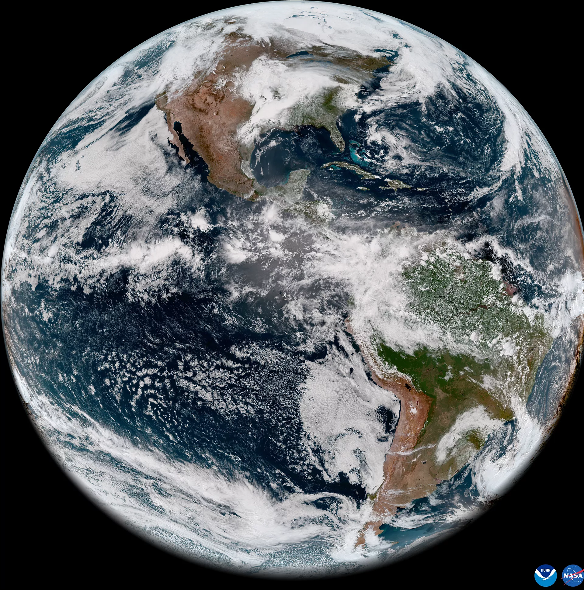
The US National Oceanic and Atmospheric Administration’s newest and most advanced weather satellite just returned its first image — a full color scan of the Western hemisphere.
Taken on 5 May, and released to the public 11 May, it’s the first of many images to come from a satellite that will help monitor severe weather, pollution, wildfires, and climate change for the next decade.
The Geostationary Operational Environmental Satellite (Goes) T satellite launched from Cape Canaveral, Florida on 1 March and from there made its way to geostationary orbit, 35,888 kilometers above the equatorial Pacific ocean.
At that altitude and latitude, Goes-18 orbits at the same rate as the Earth’s rotation, allowing it to keep a constant position relative to the ground below.
Sitting at 137.2 degrees West longitude, GOES-18 will serve as the more westerly partner to GOES-16, already monitoring the eastern reaches of the Western hemisphere from its orbit over South America at 75.2 degrees West longitude. Together, they will monitor severe weather and climate from West Africa to eastern Australia, and Alaska to Antarctica.
The color image GOES-18 produced is actually a synthesis of 16 different images, each taken in one of the 16 different channels of the infrared and visible light GOES-18 uses to monitor the Earth.
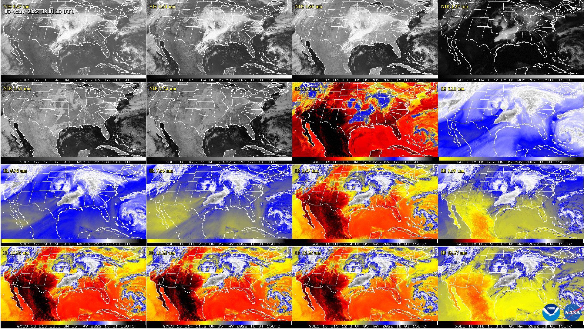
Monitoring the 16 channels allows GOES-18 to provide data to forecasters to help predict severe weather, monitor for fog that can affect ocean and air travel, and detect smoke from wild fires. The satellite also carries a lightning mapper for monitoring lightning strikes, and will help NOAA monitor the effects of climate change.
GOES-18 will replace GOES-17 sometime in 2023. GOES-17 suffered a cooling system malfunction that prevents the satellited from sufficiently cooling down its infrared detectors, and GOES-18 will assist the ailing satellite with observations throughout 2022 before stepping in to replace it outright.
Goes-18 is the third of four satellites planned for the Goes-r series. The fourth, Goes-U, is planned for launch sometime in 2024, though that satellite will focus on space weather rather than terrestrial weather.
The Goes-r series satellites will serve into the early 2030s, when NOAA plans to replace them with the GeoXO series, a next generation constellation of weather satellites already under development as a joint project between Nasa and NOAA.
Join our commenting forum
Join thought-provoking conversations, follow other Independent readers and see their replies
Comments
Bookmark popover
Removed from bookmarks