Heat health alert extended as more hot weather ahead
Heavy thunderstorms set to hit UK over Saturday and Sunday as high temperatures remain
A heat alert has been extended for the whole of England as more hot and humid weather is in store for the weekend.
The UK Health Security Agency (UKHSA) has placed five regions of England under a yellow health alert until Monday 19 June.
The alert was previously set for Tuesday 13 June.

A yellow health alert means that there is likely to be an increased use of health services by vulnerable populations, according to the UKHSA.
There is also an increase in risk to health for people over the age of 65 or with pre-existing health conditions, including respiratory and cardiovascular diseases.


It comes as Britons swelter in the UK’s first heatwave of the year after temperatures climbed past 32C over the weekend.
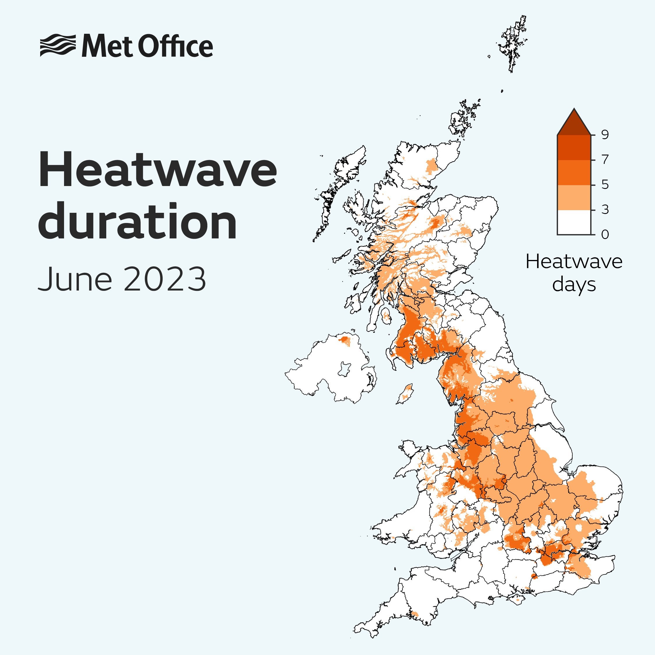
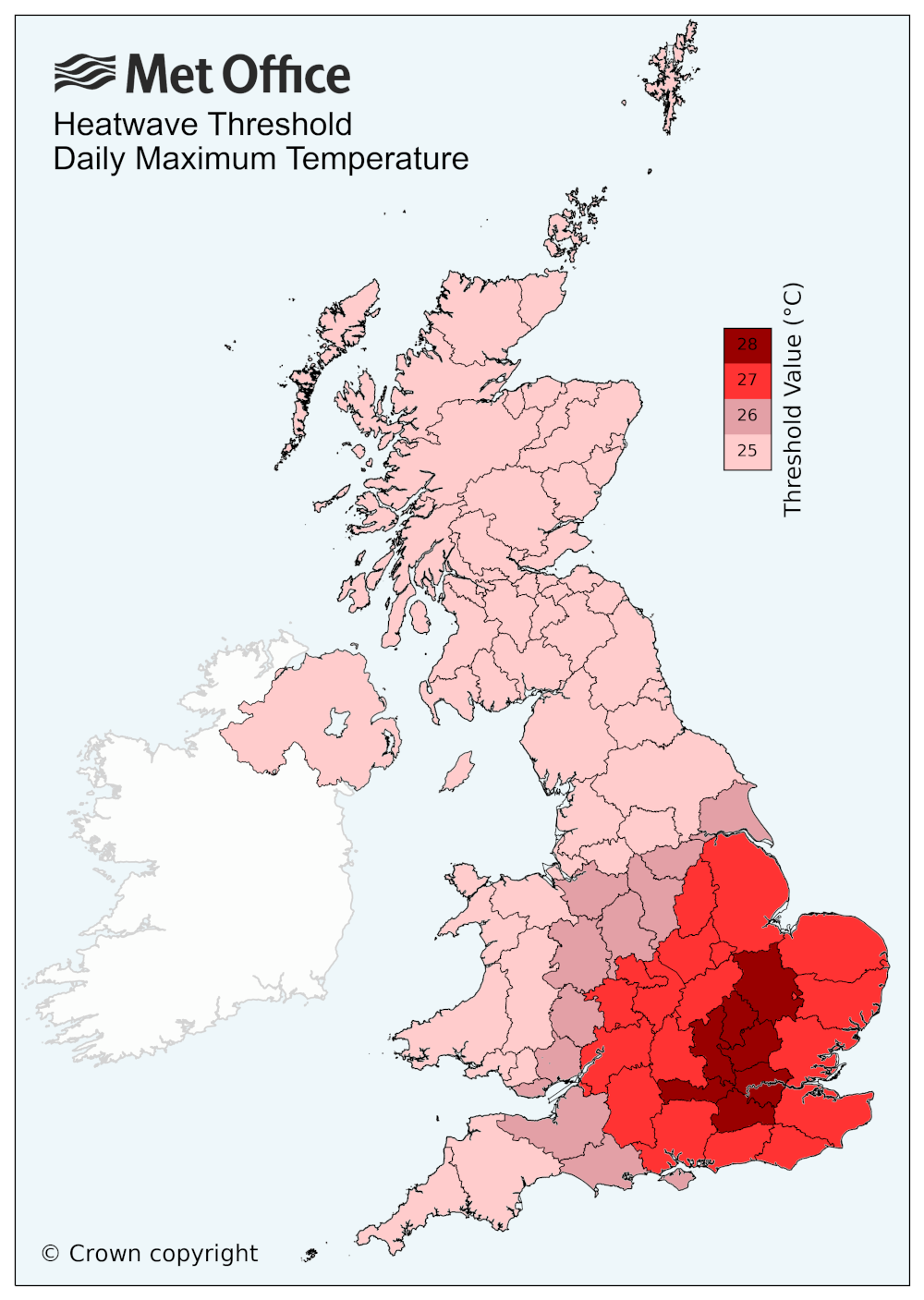
Most of the south east, central and the western part of northern England as well as as western Scotland are now in a heatwave according to the Met Office.
Based on maximum temperatures recorded up to and including Wednesday 14 June, the places shown in the map below have met the criteria for a heatwave.
Despite the high temperatures, the Met Office has said unsettled weather and thunderstorms are expected on Saturday and Sunday.
Met Office deputy chief meteorologist Steven Keates said the UK will be “transitioning to a more unsettled regime” in the coming days though temperatures will “remain high” resulting in humid conditions.
He said: “Heavy showers and thunderstorms are likely to become more frequent through the weekend, with the potential for associated hail, lightning and some gusty winds.
“While the focus of thundery showers on Friday afternoon will be Northern Ireland, that risk spreads more widely across western and southern areas of the UK on Saturday, before pushing further north on Sunday.”
Met Office 5-day forecast
Tonight:
Any showers in the far west will slowly fade during the evening. Elsewhere long clear spells will lead to a few isolated mist patches forming, these mostly in the east.
Friday:
Any early morning mist will quickly clear leaving another day with plenty of sunshine for most. Feeling very warm, locally hot. Increasing chance of showers in the west later.
Outlook for Saturday to Monday:
Dry with long sunny spells. Turning more humid with an increasing chance of thunderstorms across the south on Saturday and then more widely by Sunday and Monday.
Join our commenting forum
Join thought-provoking conversations, follow other Independent readers and see their replies
Comments
Bookmark popover
Removed from bookmarks