UK weather: Hundreds of flood alerts issued as Britain braces for week of heavy downpours
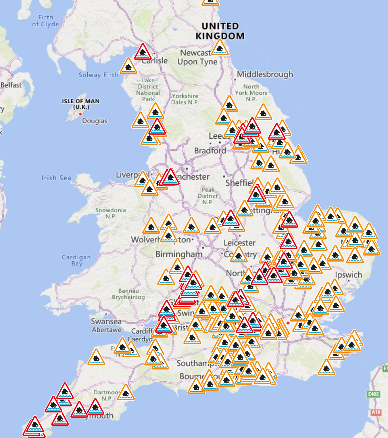
There are almost 300 flood alerts and warnings in place across the country
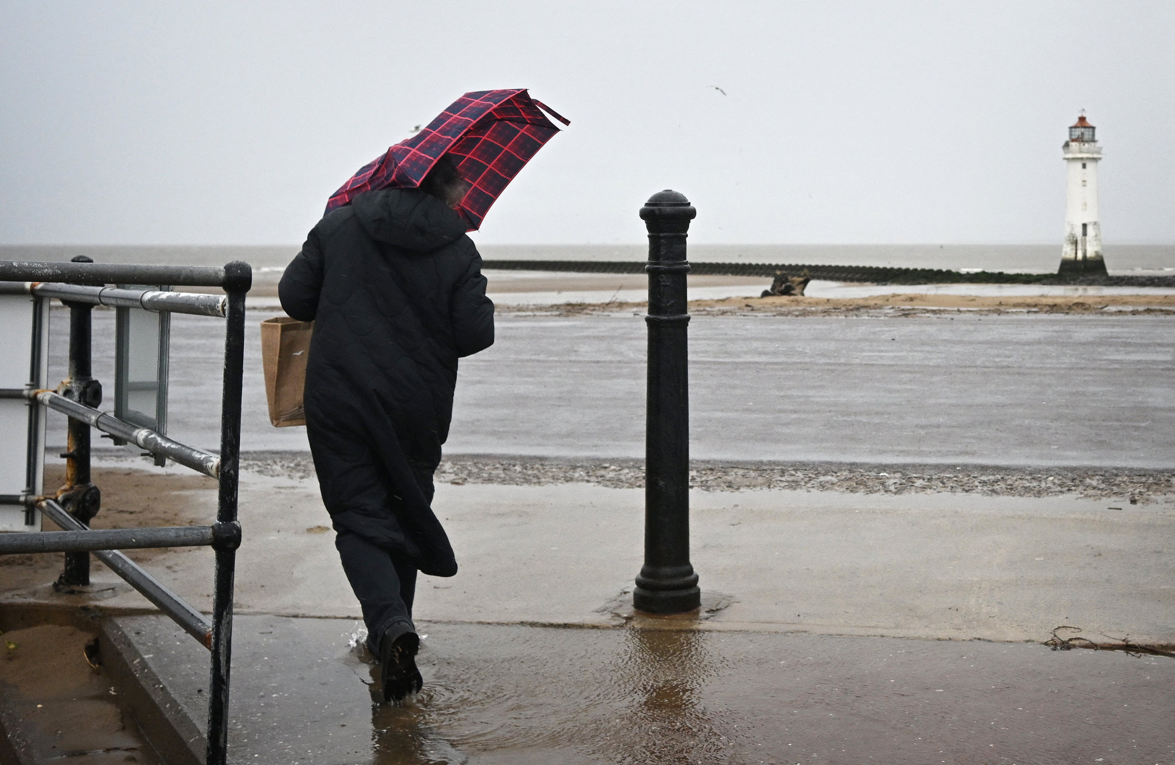
Britain faces a week of heavy rain with hundreds of flood alerts and warnings already in place across the UK.
With many areas already on saturated ground after a weekend washout, the Met Office has warned that more heavy downpours will soak parts of Britain from Tuesday.
Forecasters said that some areas of Britain will see up to 20mm of rainfall this week, with the wettest day set to be Thursday, but said temperatures would be milder.
Met Office forecaster Andrea Bishop said: “It does look a wet week, with Thursday looking the wettest day.
“With regards to Thursday’s rain, the rain will push northeastwards across most of the country, with many places seeing 20mm or so over the course of a day or two.
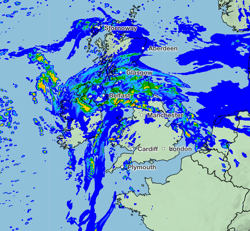
“There is still some uncertainly in the location details, but there could be some reasonably heavy bursts almost anywhere, including close to the south coast, where the ground is already saturated.”
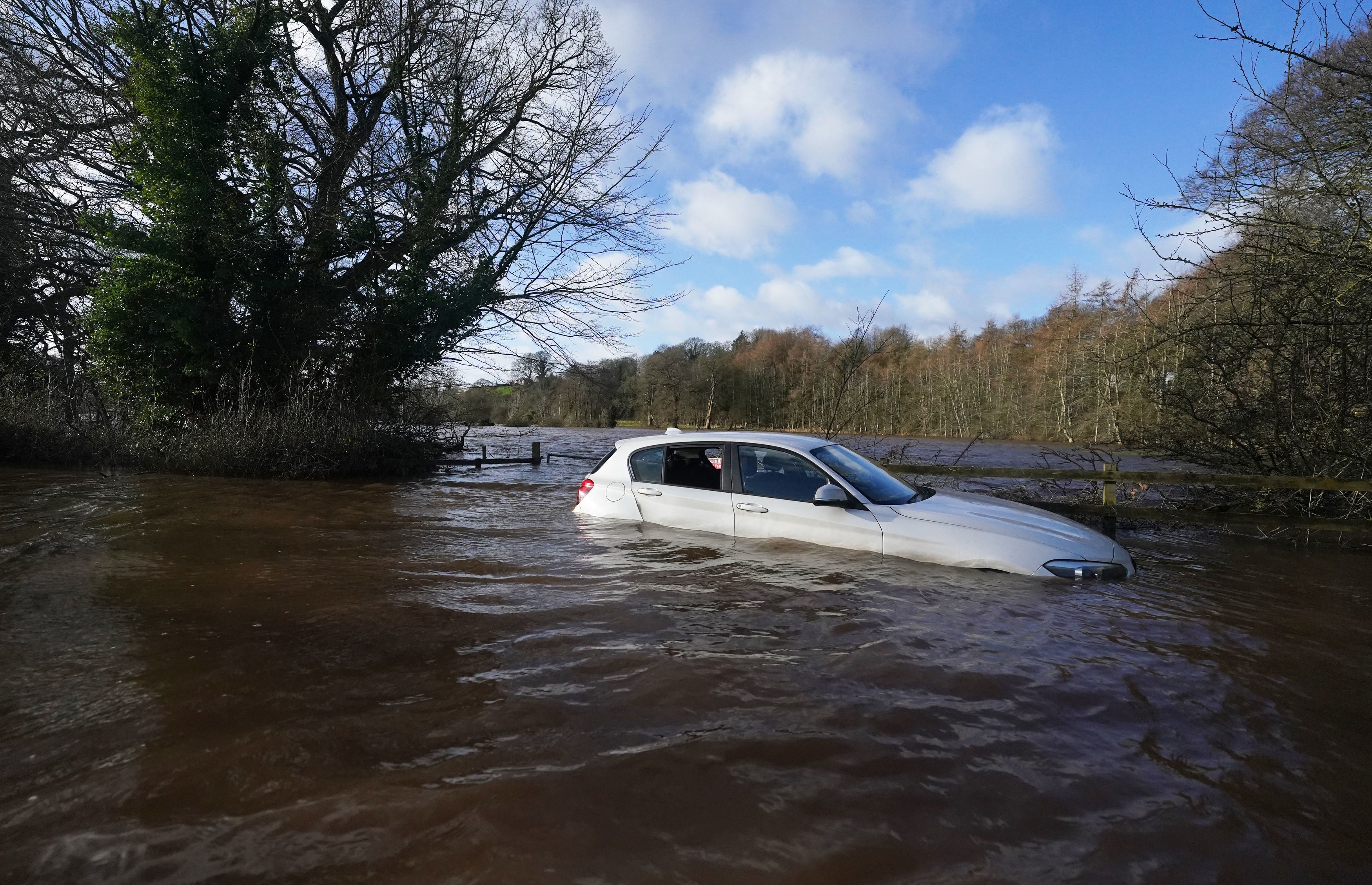
The continuous wet weather has triggered a concerning amount of flood warnings for much of the country. In England, over 200 flood alerts and 59 flood warnings are currently in place.
Meanwhile, in Scotland, there are 14 flood warnings and 10 less severe alerts. Wales has issued at least 10 as well.
The Met Office said that while there are no weather warnings in place for rain as of yet, the saturated ground “increases the sensitivity for rain events”.
The Environment Agency has warned residents in flood warning zones to avoid walking, cycling or driving through flood water.
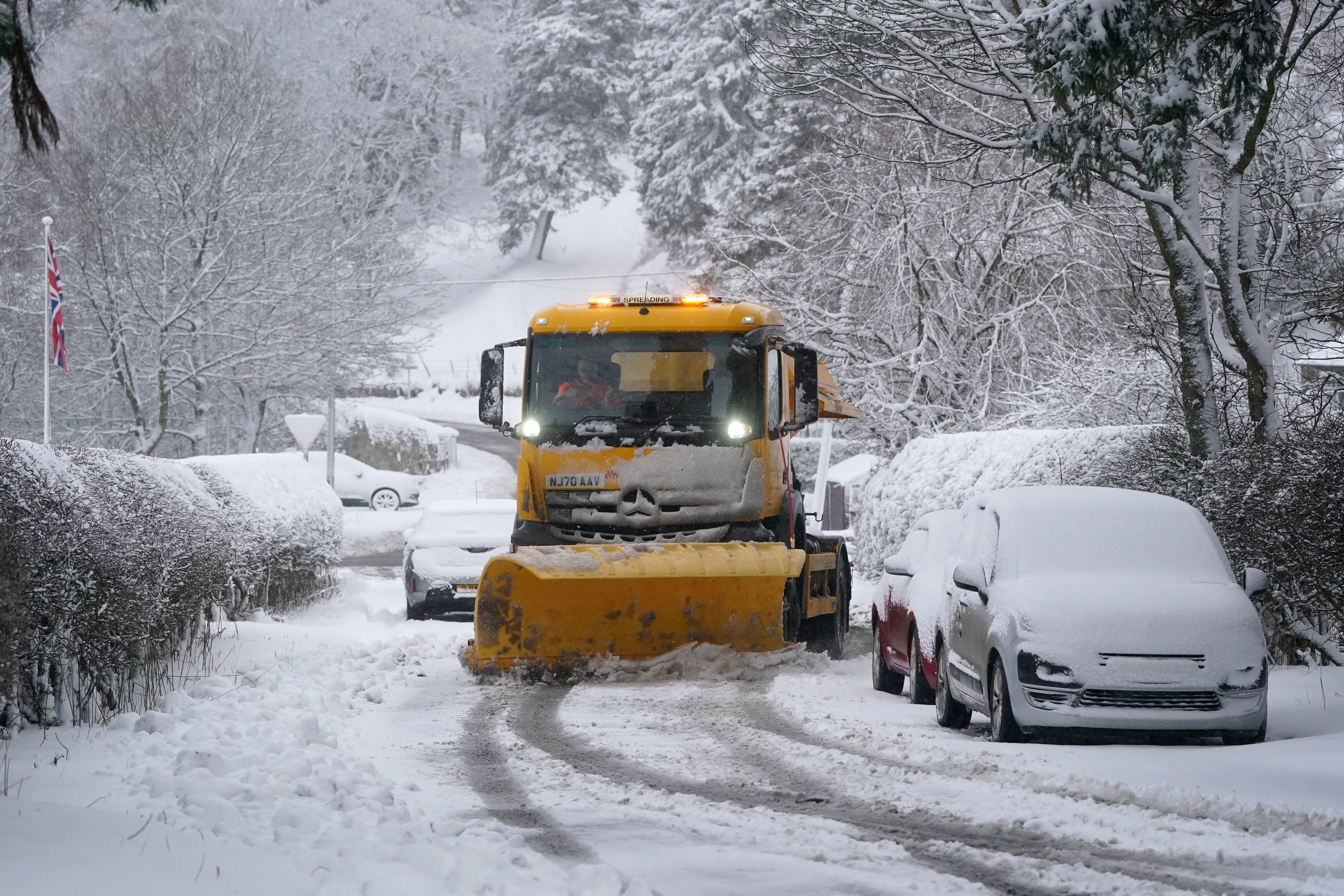
In addition to the rain, the forecasters said some areas of the UK will see more bouts of snow this week. It comes after much of the country was under yellow and amber weather warnings for ice and snow last week.
Ms Bishop said: “Snow this week will largely be confined to high ground in the north, as is usual for the time of year.
“It’ll gradually get milder from the south this week, with periods of heavy rain for some. There’s a chance of a northerly airflow bringing cooler conditions at times later in February, but it’s too early to determine details.”
It added that the UK is still under a “polar influence”, meaning there will be cooler temperatures with wintry showers.
However temperatures are set to rise to possible highs of 14C in some areas on Wednesday and Thursday.
The snow will be more confined than last week – which saw schools close and power cuts as it blanketed much of Scotland, Wales, and Yorkshire. Flooding also wreaked havoc on the country last week, triggering train cancellations and over 400 warnings and alerts in England on Friday.
Here is the Met Office’s full forecast for the week ahead:
Today:
A day of sunny spells and showers, the showers most widespread in the northwest, where they will be blustery, and could turn wintry over some hills. Further south and east any early showers will fade, leaving it mostly fine.
Tonight:
Clear spells and showers. Showers remaining heaviest, most widespread and blustery in the northwest, with snow on high ground. Patchy frost and ice. Rain arriving in the far southwest later.
Tuesday:
Heavy blustery showers in the far north. Elsewhere sunshine and isolated showers. However, cloud thickening from the southwest, with rain reaching much of England, Wales and Northern Ireland by evening.
Outlook for Wednesday to Friday:
Generally unsettled on Wednesday and Thursday, with wet and rather windy weather affecting most areas at times. Mild though. Perhaps becoming somewhat drier and less windy on Friday.
Join our commenting forum
Join thought-provoking conversations, follow other Independent readers and see their replies
Comments