Mapped: When and where heavy rain will hit UK as Met Office issues warning
Yellow weather warning is in force for parts of England and Wales
The UK is bracing for a deluge of rain throughout the week, with a yellow weather warning in force for parts of England and Wales.
Hundreds of flood alerts are currently in place and the Met Office issued a yellow weather warning for parts of England and Wales on Wednesday.
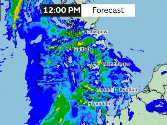
The warning covers southwest England and parts of Wales, starting midnight on Wednesday and staying in place until midday. It covers cities like Plymouth, Exeter, Cardiff, Bath, Swansea and St Davids in the far west of Wales.
Up to 70mm or 2.75 inches of rain can fall on higher grounds with 15-25mm or 0.5 to 1 inches expected widely.
The forecaster warned millions of Britons could face travel chaos and power disruptions because of the heavy rain and flooding is possible.
“Take care if you are travelling as there could be difficult driving conditions, with spray and surface water flooding on the roads,” the Met Office wrote on X, formerly known as Twitter.
So when and where in the UK are downpours expected? The Independent has put together maps and all of the information below.
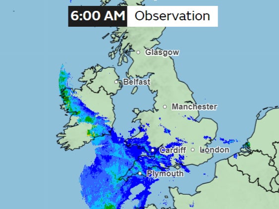
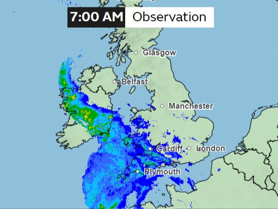
As temperatures dipped on Tuesday night after a mild day of drizzle, a band of rain could be seen entering Southwest England early morning on Wednesday.
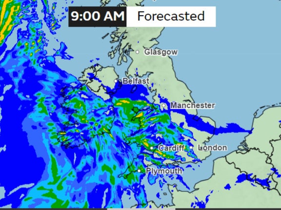
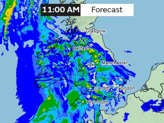
This will give the UK a wet and windy start, with the rain gradually intensifying on Wednesday morning.
“We could see quite widely across western parts of the UK 10 to 20mm (0.4 to 0.8in) of rain,” Met Office meteorologist Greg Dewhurst said.
“But over those higher ground spots of parts of Wales, south-west England in particular, we could see 40 to 50mm (1.5 to 1.96in) and then locally 60 or 70mm (2.36 to 2.75in) of rain.”
Rain is heavily forecast across the South West of England throughout Wednesday morning, with yellow warning in place until noon.
Met Office meteorologist Alex Deakin said the rain will be a cause for concern “because the ground is saturated in places”.
“That is likely to cause some issues, so there is a warning in place,” he said.
Over 170 flood alerts and warnings have been issued by the environment agency – 157 are in place across England and Wales.
Further local flooding from rivers and surface water is possible on Wednesday across parts of southwest England and the West Midlands.
Local groundwater flooding is possible for the next five days in the Malton area of North Yorkshire, leading to travel disruption and damage to properties.
In the afternoon, the clouds will begin clearing in most areas, leaving bright and breezy weather behind, the forecaster says.
Temperatures will be mild at between 11C-13C across most of the country on Wednesday. Bright and breezy weather will ensue, though it will feel cooler due to the lingering wind.
However, later this week, temperatures are expected to drop to between 7C and 10C on Thursday as wind from the north Atlantic sweeps away the rain clouds.
Some rain and showers are expected to persist, along with intermittent sunny spells that may break through the clouds. There is a likelihood of wintry showers over hilltops in the north.
Join our commenting forum
Join thought-provoking conversations, follow other Independent readers and see their replies
Comments
Bookmark popover
Removed from bookmarks