UK weather: Storm Noa to hit Britain with 70mph winds as rain and snow expected
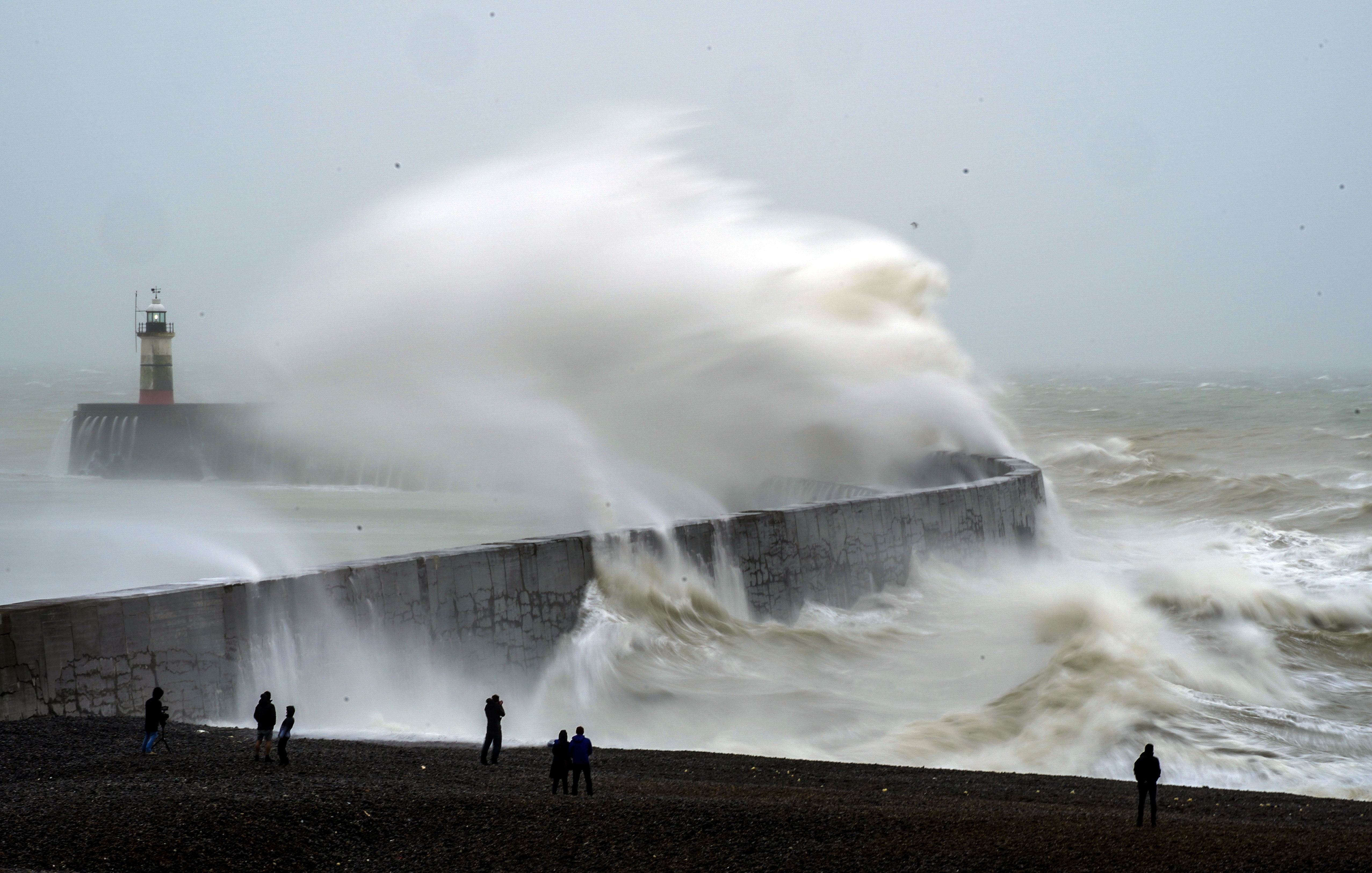
Potential for power outages and large waves in coastal areas across the south and west
Storm Noa is set to hit the UK today with 70mph winds, with forecasters even warning that snow could fall across parts of the country.
The gloomy conditions followed what was a sunny Easter weekend for many, but more heavy downpours are on the way.
Easter Sunday’s heat had been expected to top this year’s record of 17.8C but instead fell just short, hitting 17.3C in Chertsey, Surrey.
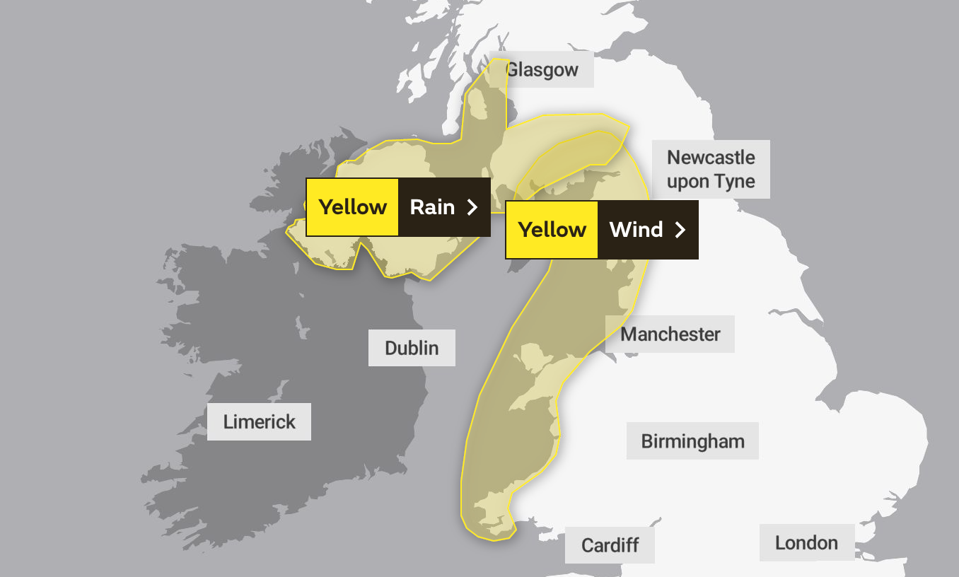
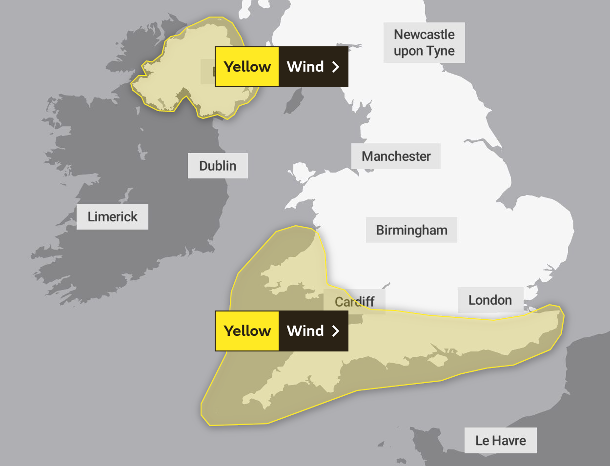
The Met Office has issued a series of yellow weather warnings for Wednesday, alerting people to potential disruption to transportation and other services due to strong winds.
The weather system, named Storm Noa by Meteo France, is predicted to grow stronger over the course of the day with coastal areas in south-west England, particularly Devon and Cornwall, likely to be worst affected.
The yellow weather warnings are for wind. One covers Northern Ireland, while the other is in force for the entire south coast of England.
The alerts highlight potential power outages and large waves in coastal areas across the south and west, with gusts up to 70 mph expected.


Despite the unpleasant conditions, temperatures are expected to be around average for the time of year.
An Atlantic low-pressure system moving slowly eastwards across the UK is responsible for the stirring up of the dramatic winds – and also for the incoming spell of low temperatures, heavy rain and potential snow.
Although the weather is a named storm in France, it has not been named by the Met Office. The first storm to be named by the Met Office, or Irish or Dutch weather services, this season will still be Storm Antoni, in accordance with the 2022/23 name list.
Met Office chief meteorologist Matthew Lehnert said: “A low pressure system will bring a period of wet and windy weather today and tomorrow.
“Thick cloud and heavy rain will continue to push in from west bringing 50 to 60 mph winds along western coasts. Snow is likely to fall over parts of upland Scotland overnight.
“Some disruption due to strong winds is likely on Wednesday, especially in southern and western areas, as well as the potential for heavy rainfall and even some snow, though the latter probably confined to high ground in the north.
“It will be another cool day with temperatures of 7 to 10C in the west, with 11 to 13C possible in the southeast, however it will feel colder in the strong winds.”
The Met Office expects the unsettled trend to continue through the rest of the week, with sunshine and heavy showers for many on Thursday, and persistent rain in the south on Friday.

By the weekend and into next week, it will likely turn drier and brighter, with temperatures starting to rise.
Met Office five-day forecast
Wednesday:
Cold and very windy with frequent heavy showers, merging into a longer spell of rain for a time. Risk of disruptive winds in some southern and western areas.
Outlook for Thursday to Saturday:
Sunshine and heavy showers for many Thursday, with persistent rain in the south on Friday. Feeling cold, but winds easing. Many places drier Saturday with some sun, and warmer.
Join our commenting forum
Join thought-provoking conversations, follow other Independent readers and see their replies
Comments
Bookmark popover
Removed from bookmarks