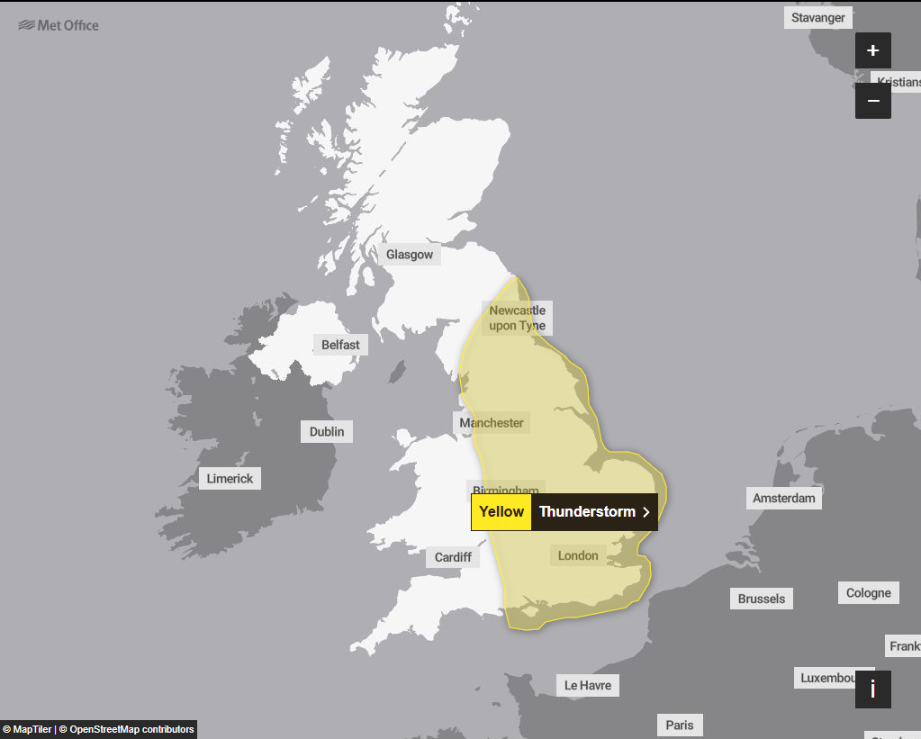
Mapped: Yellow weather warnings issued for thunderstorms across the UK
The Met Office says up to 90mm of rain is expected in just a few hours in some areas of England on Saturday

England is braced for “heavy, thundery rain” after weeks of soaring temperatures and multiple heatwaves.
Two yellow weather alerts are in place for Friday covering much of England. Only Cornwall and areas of Devon are likely to be unaffected.
The Met Office says that areas of North East England are likely to be affected by torrential rain, as much as 40-60 mm of rain, on Friday. The highest levels are most likely to be seen over the North York Moors.
“As well as rain, frequent lightning and large hail are possible,” the Met Office warns.
Storms are then expected to “ease and clear into the North Sea Friday evening”.
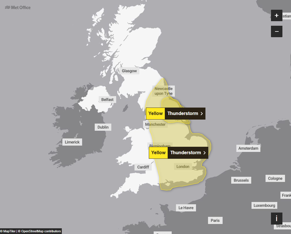
Moving into Saturday, areas of “heavy, thundery rain” are expected across much of England.
“Thundery rain will reach the south of the warning area later Friday before spreading north to affect much of England through Saturday,” the Met Office said.
“Rain will likely be locally torrential, bringing 20-30 mm in less than an hour in many places, with 60-90 mm in less than three hours possible in a few places.
“Whilst rain will clear from the south of the area by early Saturday afternoon, further thunderstorms are likely to develop here.
“As well as heavy rain, impacts from frequent lightning, gusty winds and large hail are also likely.”
Across other parts of the UK, temperatures will climb to 28C with a chance of 29C on Thursday, before peaking at a potential 30C in London on Friday in another burst of hot weather.
Met Office meteorologist Jonathan Vautrey said: “This heat is not going to be as widespread as what we’ve just come out of, areas to the north aren’t going to be seeing the same highs.
“The heat we had last time was home grown, it wasn’t that humid, but because this heat is coming in from the south westerly direction, it is more humid. It’s going to be feeling more sticky.”
It comes as Southern Water has become the latest company to bring in a hosepipe ban, to protect rare chalk stream habitat, as England battles exceptionally dry weather.
The company said restrictions on hosepipes for activities such as watering gardens, filling paddling pools or washing cars would come in for households in Hampshire and the Isle of Wight from Monday.
Join our commenting forum
Join thought-provoking conversations, follow other Independent readers and see their replies
Comments
Bookmark popover
Removed from bookmarks