UK jubilee weather: Thunderstorm warning issued by Met Office with lightning and rain to follow 25C heat
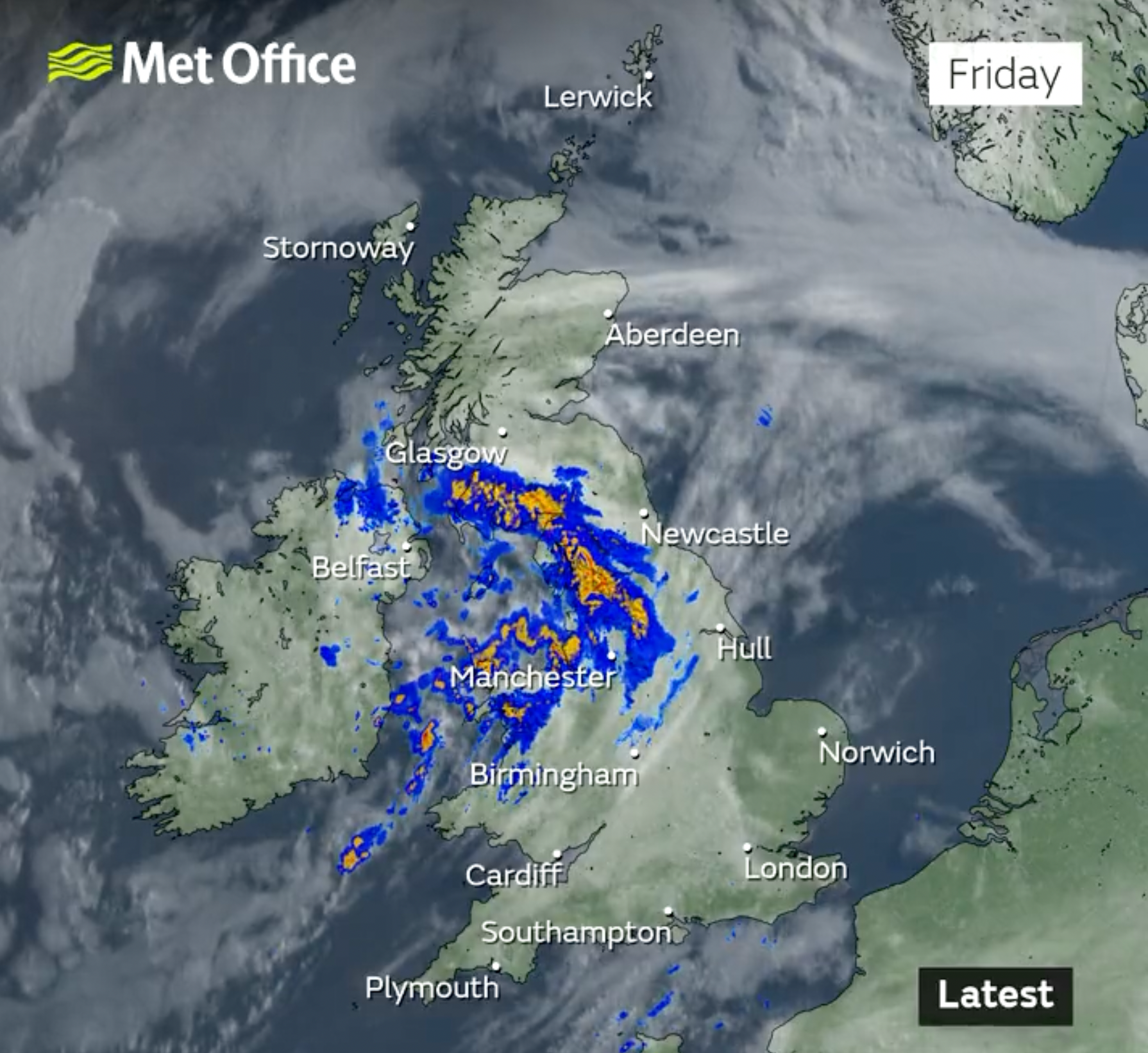
Most of the UK will be dry and sunny on Friday with isolated showers
Britons are set to bask in 25C heat on Friday but looming rain and thunderstorms look set to dampen the jubilee celebrations.
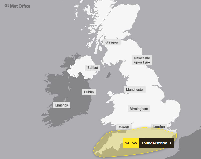
The Met Office has issued a thunderstorm warning for Saturday from midnight until 10am, with heavy rain and lightning forecast cross the south of England.
Thunderstorms were also expected on Friday afternoon in parts of Wales, with a yellow warning covering much of Gwynedd on the west coast until 6pm.
It comes after the Met Office said on Thursday that thunderstorms were on the cards after the pleasant conditions for the first day of the four day bank holiday break.
Britons are encouraged to make the most the most of the warmer weather while it lasts, with the highest temperatures expected on Friday.
It was a mild night going into Friday morning with dry conditions throughout most of the country, with some cloud and isolated showers in Scotland.
There will be some mist in southern areas of England but it will quickly brighten up and temperatures could be as high as 25C, which would be one of hottest days of the year so far.
On the eastern coast there will be a brisk northeasterly breeze that will pull in cloud on Friday evening.
Met Office Deputy Chief Meteorologist Rebekah Sherwin said: “Temperatures could reach 25C in the south on Friday, although this will likely be the warmest day and later in the weekend the highest temperatures are likely to be in the northwest.
“A plume of warm air, currently across the continent, then pushes north over the UK through the weekend.”
On Saturday it will be a dry day for most of the UK but there is the possiblity of heavy rain and thunderstorms in the afternoon in southern and central areas of England.
Ms Sherwin added:”There remains some uncertainty on how far north it will stretch but southern areas are likely to see a spell of showers on Saturday and Sunday, which could turn heavy and thundery at times.
“However, there will also be some breaks in the cloud even here, and northern areas are most likely to stay fine and dry.
“Northern Ireland, Scotland and northern England look like they’ll see the driest conditions from Saturday onwards, most likely enjoying some prolonged periods of sunshine.”

On Sunday further downpours are expected in the south and then spreading north across England and Wales as the day progresses.
They will be warmer temperatures in northwest Scotland and the intermittent showers and sunshine is expected to be a feature of the weather next week.
MET OFFICE OUTLOOK
Today:
Rain across Northern Ireland, southern Scotland, northern England and Wales easing to be replaced by heavy showers across central and western parts. Sunshine between, best in the northwest and southeast. Cool and cloudy near some North Sea coasts otherwise warm.
Tonight:
Showers, perhaps heavy, continuing across the southwest and perhaps extending to other southern counties by morning. Elsewhere becoming dry with clear spells although remaining cloudy near North Sea coasts.
Saturday:
Further thundery showers likely to affect parts of the south. Elsewhere sunny spells and becoming rather warm away from eastern coasts which will remain cool and rather cloudy at times.
Outlook for Sunday to Tuesday:
Showers, sometimes heavy in the south, spreading north across England and Wales Sunday. Fine with sunny periods elsewhere; warm in northwest Scotland in particular. Showers with sunny spells next week.
Join our commenting forum
Join thought-provoking conversations, follow other Independent readers and see their replies
Comments
Bookmark popover
Removed from bookmarks