UK weather forecast: Britain facing ‘significant snowfall’ as temperatures plummet to at least -10C
Snow closes schools and causes travel disruption but worse weather expected to hit country, forecasters warn
Bitterly cold temperatures hit Britain as a blanket of snow and ice swept across the country, causing schools to close and travel disruption.
Commuters have been warned to expect further disruption this week after the Met Office extended four weather warnings of snow and ice across most of the UK.
Many parts of the country, including northern England, Scotland and the southwest, woke to thick snow and icy conditions on Tuesday morning.
It forced Highland Council to close 13 primary schools and nurseries, while pupils in north Wales were also told to stay home.
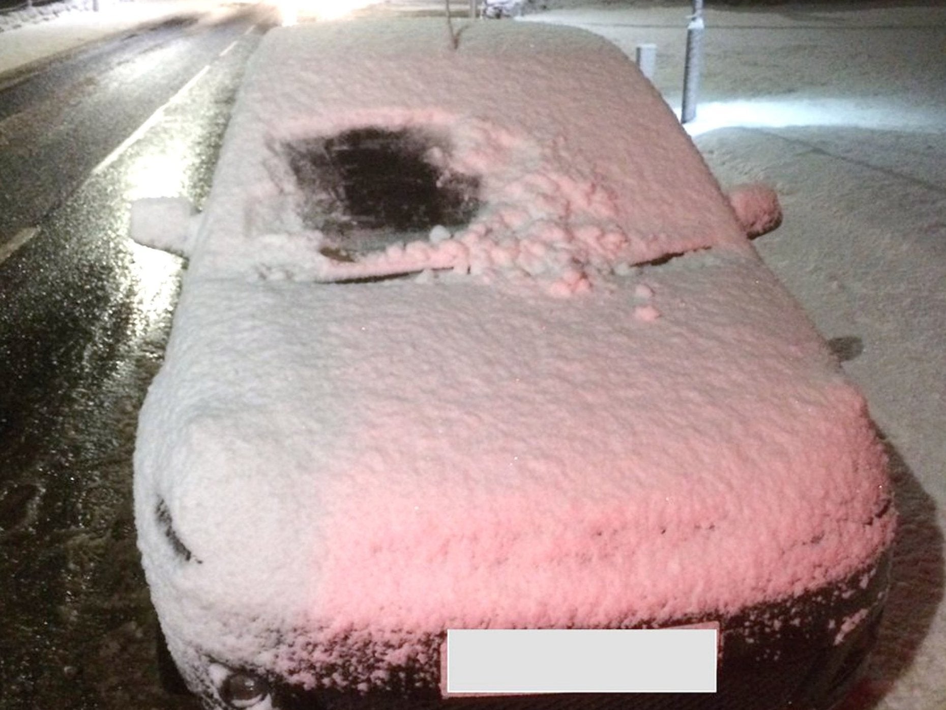
A motorist in the Highlands was stopped by police and handed a fixed penalty notice in the early hours after they were caught driving a snow-covered car with just a small square of windscreen cleared.
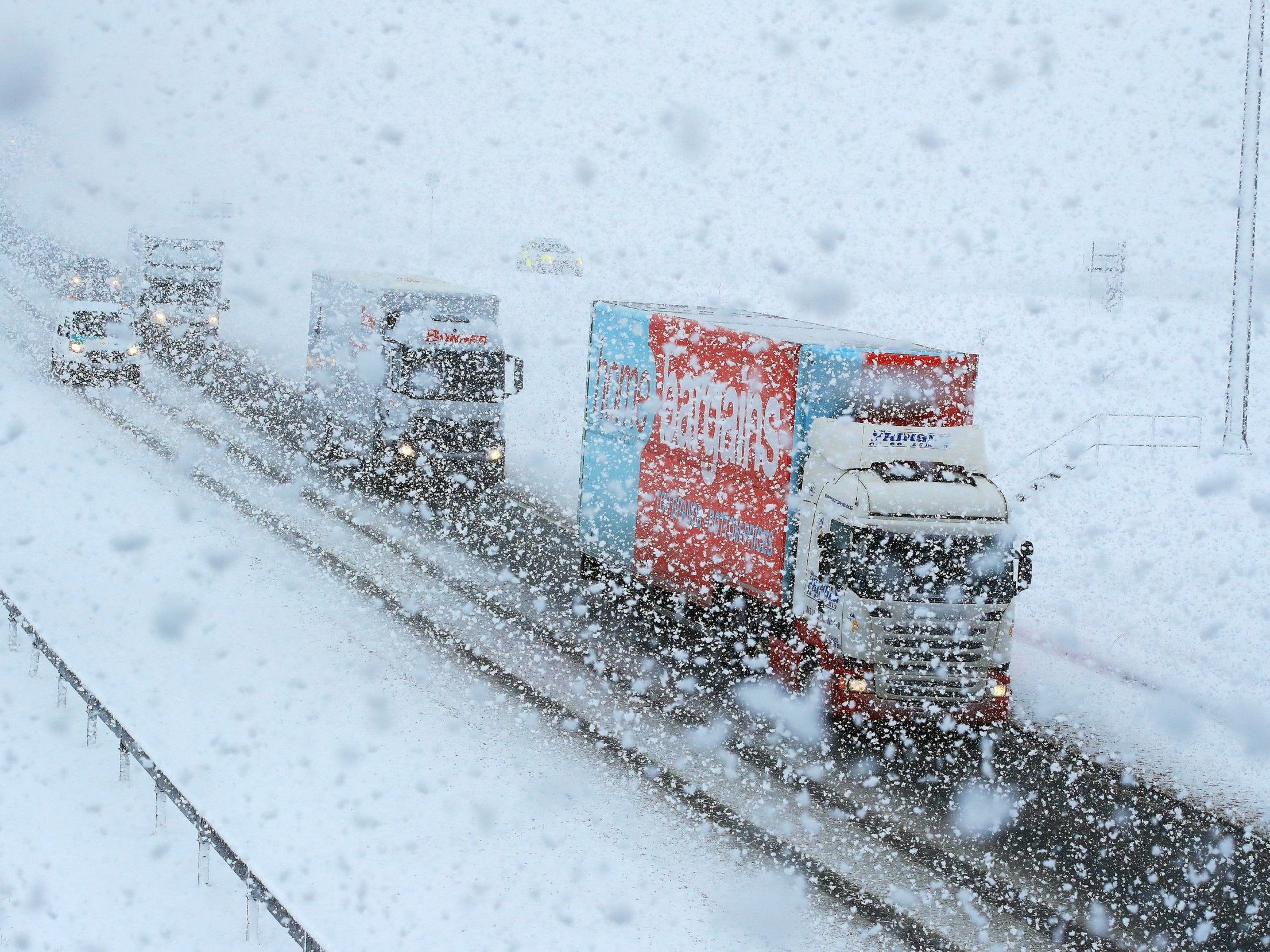
Police in Cumbria also urged motorists to slow down after tweeting an image of an overturned car lying on its roof on the M6.
Forecasters have warned that Britain is facing “very significant snowfall” this week, as temperatures plummet to at least -10C across the country overnight, while a “bitingly cold” Wednesday will only see highs of 2C or 3C in some places.
A weather system forecast on Thursday could break this winter's current record low of -10.8C and bring up to 10cm of snow to parts of southern England.
Met Office forecaster Alex Berkill warned journeys on roads could take “a lot” longer than usual and should be avoided if possible.
Four weather warnings of snow and ice in place across much of country were brought forward on Tuesday and also extended to Thursday, Friday and Saturday by the Met Office.
Current yellow weather warnings might also be upped to amber, and vulnerable people have been warned to take extra precautions.
Mr Berkill said: “Looking further ahead, it’s what happens on Thursday that has the potential to be more disruptive. It does have the potential to bring some very significant snow. It's currently just a yellow warning, but it’s not out of the question that will be ramped up nearer the time. It’s looking like it will be a spell of persistent snow.”
Benton, in Oxfordshire, and Santon Downham, Suffolk, are among parts of England which could be the coldest.
“I think Scotland will probably be the coldest place but it’s not out of the question we got into negative double figures in parts of England,” Mr Berkill added. “If you’re heading out on the roads, be aware your journey will take a lot longer than normal.”
Official Met Office figures for snowfall on Tuesday showed the worst-hit areas were Tulloch Bridge, Inverness-shire, with 11cm, and Spadeadam, Cumbria, with 10cm.
Councils have prepared for heavy snowfall, with more than 1.4million tonnes of salt stockpiled, the Local Government Association said.
Public Health England has also warned at-risk people, including the elderly, to take precautions.
Join our commenting forum
Join thought-provoking conversations, follow other Independent readers and see their replies
Comments
Bookmark popover
Removed from bookmarks