UK weather latest: Warnings issued as storm surge threatens east coast with ice expected to grip country
However, the snow is mostly over
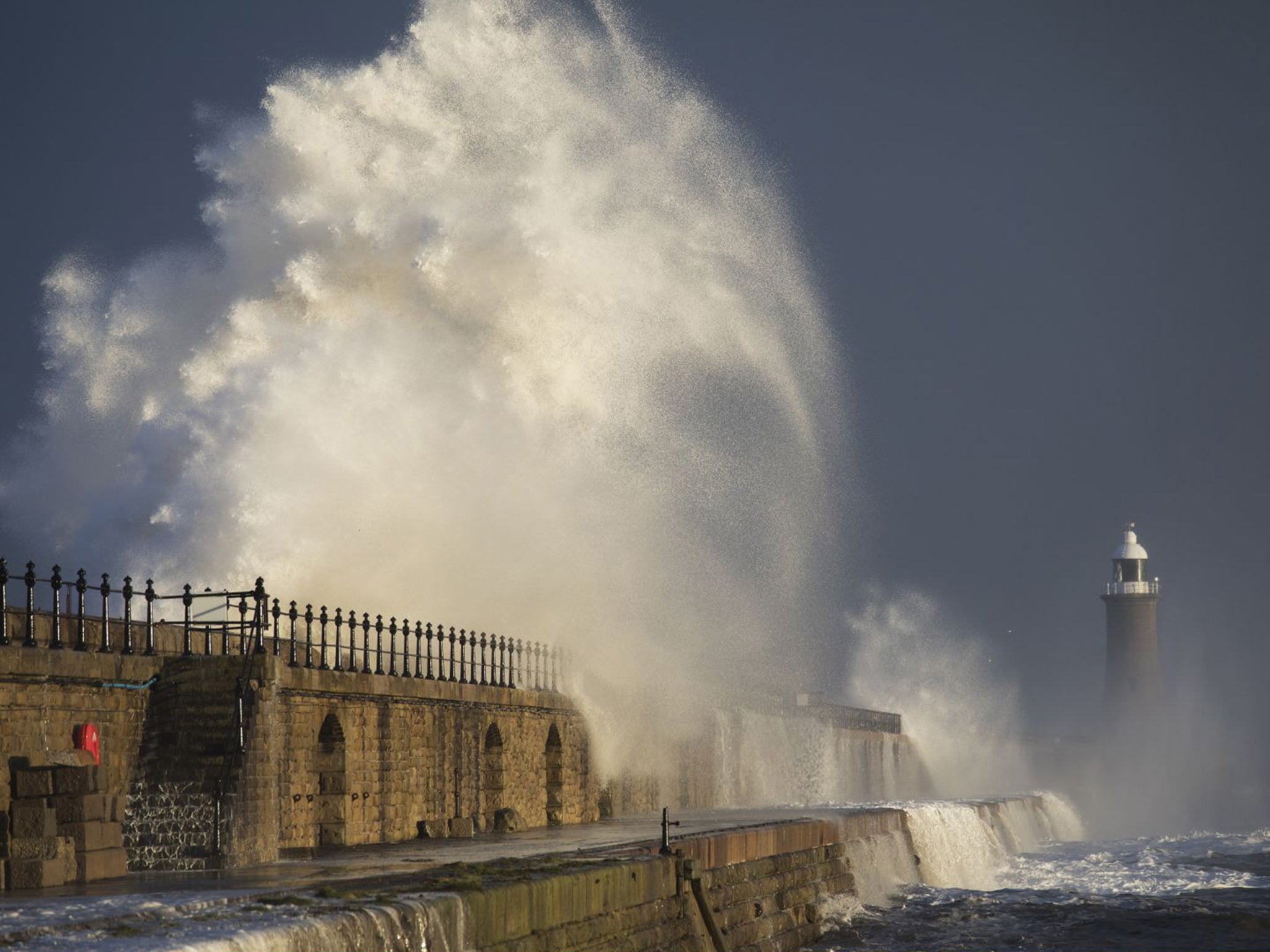
Thousands of people have been evacuated from their homes on the east coast on Friday after warnings of storm surges and severe flooding.
The Environment Agency has issued 17 severe flood warnings – meaning 'danger to life' – along the east coast, 91 flood warnings, and 73 flood alerts. Freezing temperatures and ice are expected to grip much of the country on Saturday.
The areas affected can be viewed here.
High tides are expected to be exacerbated by storm surges, threatening residents in Essex, Norfolk and Suffolk.
Residents in Jaywick, Essex and Great Yarmouth, Norfolk, have been told to evacuate their homes.
The Environment Agency has moved more than five miles of temporary barriers and 25 pumps to depots and towns along the east coast, while the Chief Fire Officers Association said it had mobilised 15 fire and rescue services to assist in Lincolnshire, Norfolk, Suffolk and Humberside.
Jess Hudson, 19, from Gorleston-on-Sea, Norfolk, said: "I was surprised at the number of people who stayed in their homes when they were asked to leave. If it was me, I wouldn't want to risk that."
In addition, the Met Office has issued a Yellow severe weather warning for ice – meaning ‘be aware’ – for the entire west coast, including all of Wales, Cornwall and the Midlands, and much of the east coast.
But forecasters said ice could appear anywhere. The warning is set to continue into noon on Saturday.
Met Office forecaster Craig Snell said: “On Friday night, many parts will be dry but cold and frosty, but there may be wintry showers in the coastal areas, especially in the east and west, bringing with them an ice risk.
“There may be more snow in parts of Scotland but it will be minimal elsewhere.”
Temperatures will dip to -3C across the county, but as cold as -9C in areas of Scotland which have seen snow.
Ice could make surfaces slippery on Saturday morning.
However, while motorists are warned to take care, there is less expectation of travel disruption on Saturday because of the smaller number of people on the road.
Black ice could be present in areas which have seen snowmelt.
However, by Saturday afternoon it will be less cold and Sunday will be a “much different day,” Mr Snell said, with temperatures returning to the seasonal norm in the west and centre of the country, and there will be sporadic showers.
Colder temperatures will persist in the east.
Met Office records show that the coldest January temperature has been recorded towards the end of the month nine times in the past 15 years.
Last year, the thermometer hit its lowest point on 19 January, when - 12.4C was recorded in Kinbrace, Sutherland.
In 2015 the lowest temperature was again on 19 January, in Loch Glascarnoch in the Highlands, at - 13.7C.
The coldest temperature so far this month was - 8.2C, recorded on 5 January in Tyndrum, Perthshire.
The coldest January day since current records began was on 10 January 1982, when - 27.2C was recorded in Braemar, Aberdeenshire.
Join our commenting forum
Join thought-provoking conversations, follow other Independent readers and see their replies
Comments
Bookmark popover
Removed from bookmarks