Met Office issues new yellow thunderstorm warning across south of UK
The thunderstorm warning is in place until 5pm on Wednesday
The Met Office has issued a new yellow weather warning for thunderstorms across the south of the UK.
The forecasters warned residents of Brighton and Hove, East Sussex and Kent to expect heavy showers and thunderstorms on Wednesday afternoon.
The yellow warning came into force as soon as it was issued at 12.52pm and will remain in place until 5pm.
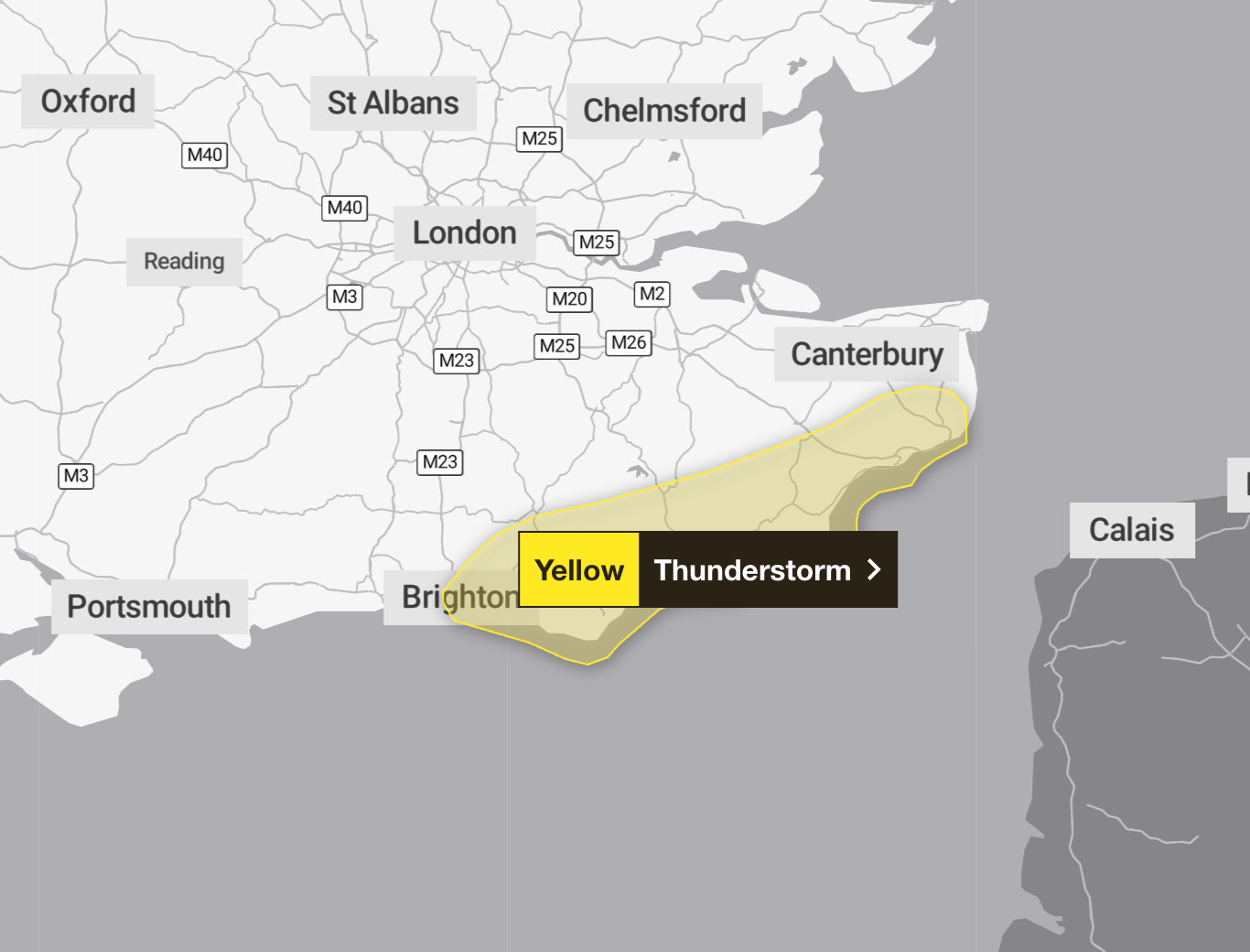
The Met Office said slow-moving heavy showers and thunderstorms will hit parts of Kent and Sussex through Wednesday afternoon.
It said some places will miss the downpours, but where they do occur 20 to 25mm of rain is likely in less than an hour, with a chance of 30 to 40mm falling over one to two hours in a few locations.
This is likely to lead to some surface water flooding and disruption, while lightning strikes may be an additional hazard.
The forecaster said the showers and thunderstorms are expected to slowly die out on Wednesday evening.
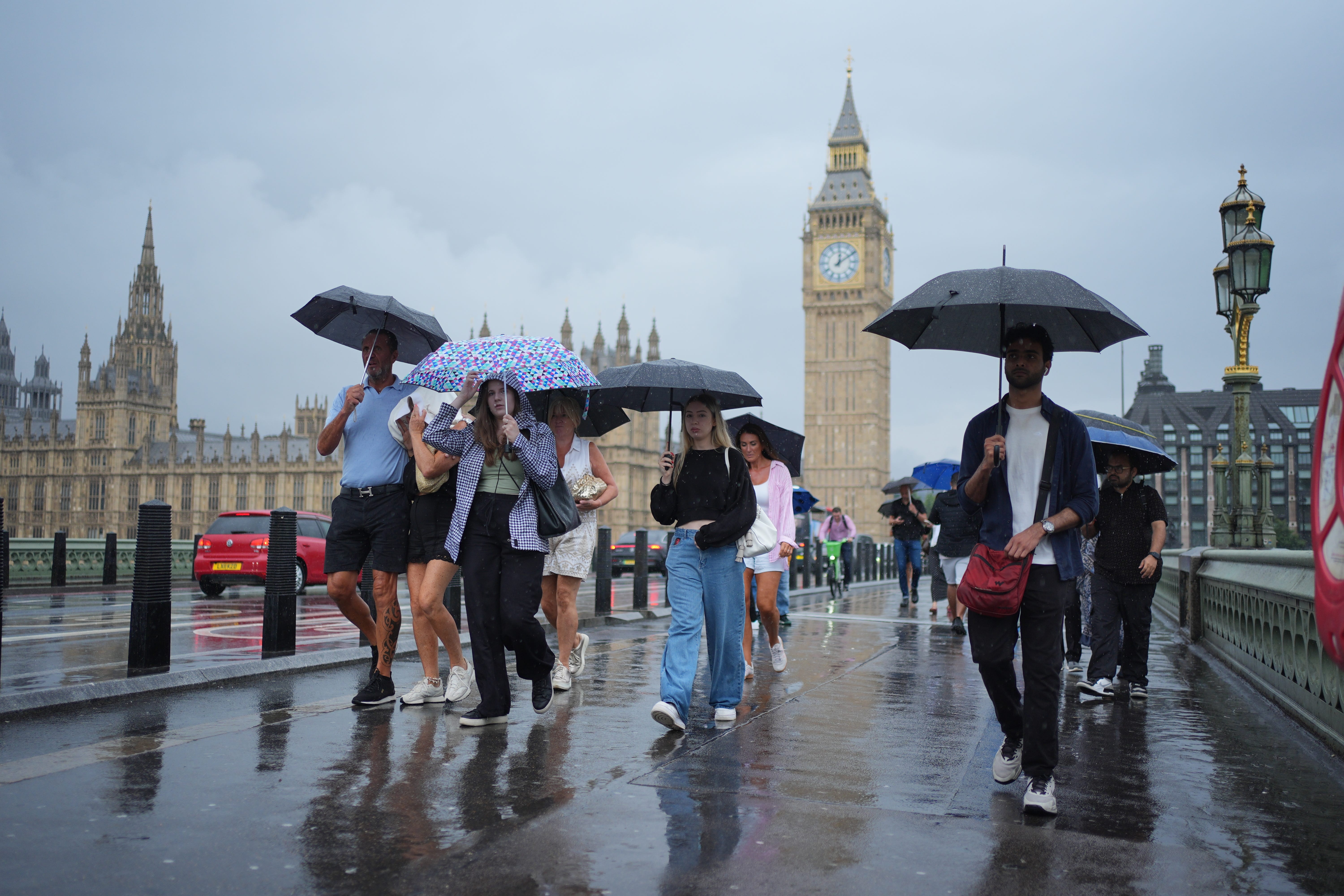
It is the latest in a series of weather warnings issued for most of the country over the past weekend.
An amber ‘danger to life’ alert came into force for London, parts of the South and southeast England on Saturday. Downpours were seen across the capital in what was the first amber warning issued for London since January 2024.
There were six weather warnings in place on Sunday for either rain or thunderstorms, and three on Monday.
The wet weather comes after a dry and hot spring and three heatwaves so far this summer, which left four regions of England in drought.
England recorded its driest March to June period since 1893, according to the Environment Agency, and dry ground can make flooding more likely as it is unable to absorb as much water.
Met Office’s full five-day forecast:
Wednesday
Scattered showers today across western and southern parts with the showers potentially turning heavy and thundery into the afternoon. A mix of bright spells and a few light showers elsewhere. Feeling warm in any sunshine.
Wednesday evening
Showers slowly fading, though a few continuing across East Anglia and southwest England. Otherwise, a mix of cloud and clear spells, with perhaps some patchy drizzle in north-west Scotland.
Thursday
Rain and showers developing across eastern England during Thursday, but mostly dry elsewhere. Brightest conditions in the west and feeling warm once again in any sunshine.
Outlook for Friday to Sunday:
Largely dry and fine across the South and East on Friday and Saturday, with patchy rain elsewhere. Showery in the North on Sunday, with potentially some heavy rain developing further south.
Join our commenting forum
Join thought-provoking conversations, follow other Independent readers and see their replies
Comments
Bookmark popover
Removed from bookmarks