UK weather maps show which areas will see most rain amid Met Office warnings
Southern regions will see strong winds with coastal gales possible, along with heavy rainfall slowly easing through the day
More rainfall is set to lash southern parts of England amid a dry and bright start to the week for the rest of the country.
Most of the UK will see a largely dry start to the week with sunny spells and a few isolated showers in the northeast.
But the Met Office has extended its yellow weather warning for heavy rains for southern England, including London, which now remain in place until 9am on Monday.
Southern regions will see strong winds with coastal gales possible, along with heavy rainfall slowly easing through the day.
Overnight rain can cause morning travel delays and flooding, the Met Office and Environment Agency have warned.
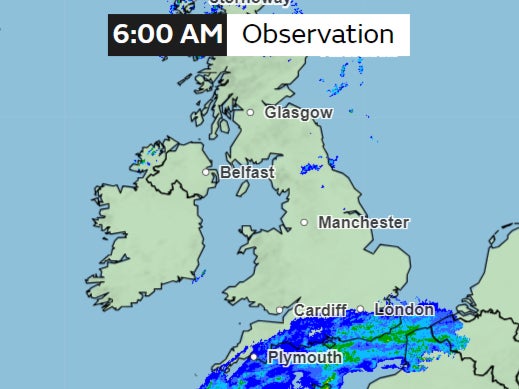
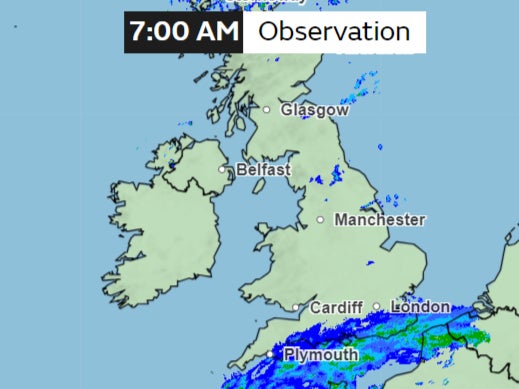
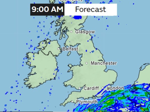
Here’s an hourly rain forecast for Monday morning:
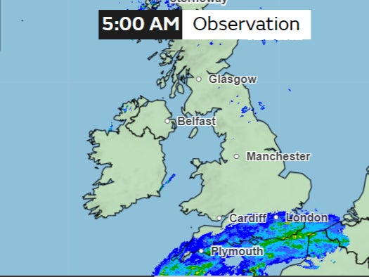
The rain will be heaviest early in the morning with the potential to cause travel disruption and flooding.
Up to 4mm per hour can be experienced in some coastal regions, with 0.5-2mm per hour expected widely.
Over 213 flood alerts where flooding is possible, and 63 warnings where flooding is expected, were in place across Southern England and the Midlands for Monday morning.
Met Office meteorologist Greg Dewhurst urged people to “take care if you are travelling”.
“It will bring some heavy rain and some strong winds as well. This rain is falling on saturated ground and could lead to some localised flooding problems.”
Last week, rainfall led to the closure of several schools in Herefordshire and Worcestershire because of rising flood levels and “treacherous road conditions”, councils said.
Many roads across the West Midlands in particular were submerged and rail operators struggled to resolve issues on the tracks, with Transport for Wales and West Midlands Railway services operating a replacement bus service between Shrewsbury and Wolverhampton.
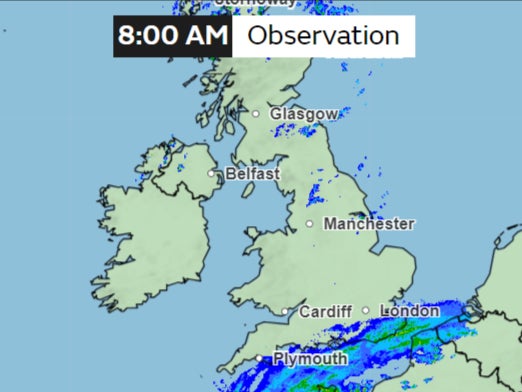
As the day progresses, the clouds will begin moving towards the west, clearing the eastern parts of England and slowly moving away from the island.
While temperatures are expected to be around average, the Met Office says it could still feel cold in the wind.
The rest of the day is expected to be mostly dry with clear spells, the Met Office says. Some rain will arrive in the far northwest towards the end of the day, with widespread frost forming with mist and fog patches too.
This will be the last week of meteorological winter for the UK with the official start of the spring season from 1 March.
Largely the week is expected to be dry and bright, but some showers will be developing on Wednesday and Thursday in the west, with colder conditions expected on Friday.
Join our commenting forum
Join thought-provoking conversations, follow other Independent readers and see their replies
Comments
Bookmark popover
Removed from bookmarks