UK weather: Met Office issues yellow warning as heavy rain set to flood England and Wales
Rain will be cause for concern ‘because the ground is saturated in places’, Met Office warns
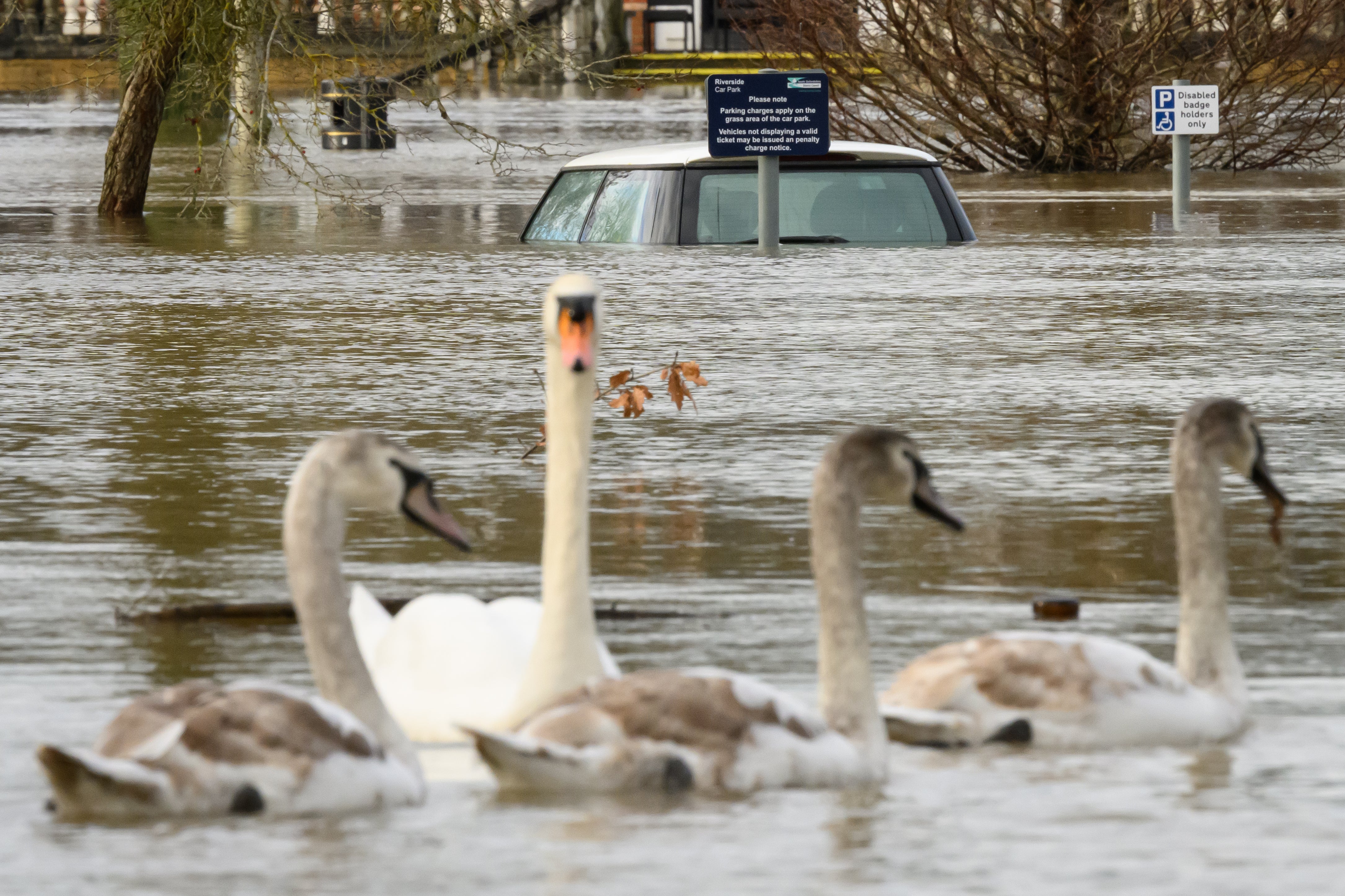
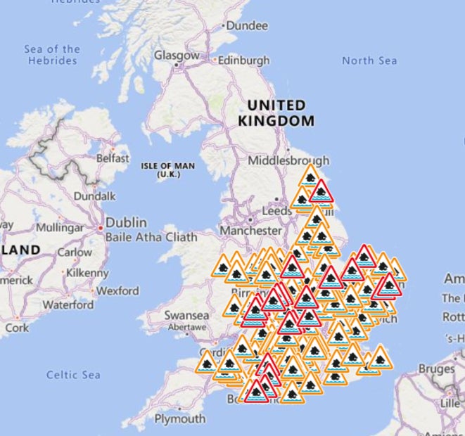
The Met Office has issued a yellow weather warning for parts of England and Wales as heavy rain is set to soak the country, prompting over a hundred flood alerts.
The warning will be effective for southwest England and parts of Wales starting midnight on Wednesday and will stay in place until noon.
It covers cities like Plymouth, Exeter, Cardiff and Bath in England and Swansea and St Davids in the far west of Wales.
The Met Office warned millions of Britons could face travel chaos and power disruptions as heavy rainfall could prompt localised floodings.
Met Office meteorologist Alex Deakin said the rain will be a cause for concern “because the ground is saturated in places”.
“That is likely to cause some issues, so there is a warning in place,” he said.
Over 120 flood alerts and warnings have been issued by the environment agency.
The rainfall is set to intensify on Wednesday morning but a band of rain will begin moving across the northern and western regions of the country on Tuesday, accompanied by heavy bursts in some areas, the forecast shows.
Scotland will experience a mix of sunny spells and heavy showers in the afternoon, with temperatures turning chilly. The southeast, on the other hand, will remain largely dry, cloudy, and mild on Tuesday.
Cloudy conditions with drizzle are anticipated in the south during the evening, while the north will experience colder temperatures with clear skies.
Overnight, heavy rain and strong winds are forecast to sweep across the entire UK, particularly affecting western coasts with the possibility of gales.
Following a wet and windy start on Wednesday, the rain is expected to gradually clear from most areas in the afternoon, the Met Office said.
Temperatures will be mild at between 11C-13C across most of the country on Wednesday. Bright and breezy weather will ensue, though it will feel cooler due to the lingering wind.
However, later this week, temperatures are expected to drop to between 7C-10C on Thursday as wind from the north Atlantic sweeps away the rain clouds.
Some rain and showers are expected to persist, along with intermittent sunny spells that may break through the clouds. There is a likelihood of wintry showers over hilltops in the north.
Join our commenting forum
Join thought-provoking conversations, follow other Independent readers and see their replies
Comments
Bookmark popover
Removed from bookmarks