Tsunami map shows how San Francisco could be devastated
A 2021 map showing how a tsunami could impact San Francisco was thrust back into the spotlight after a 2024 earthquake
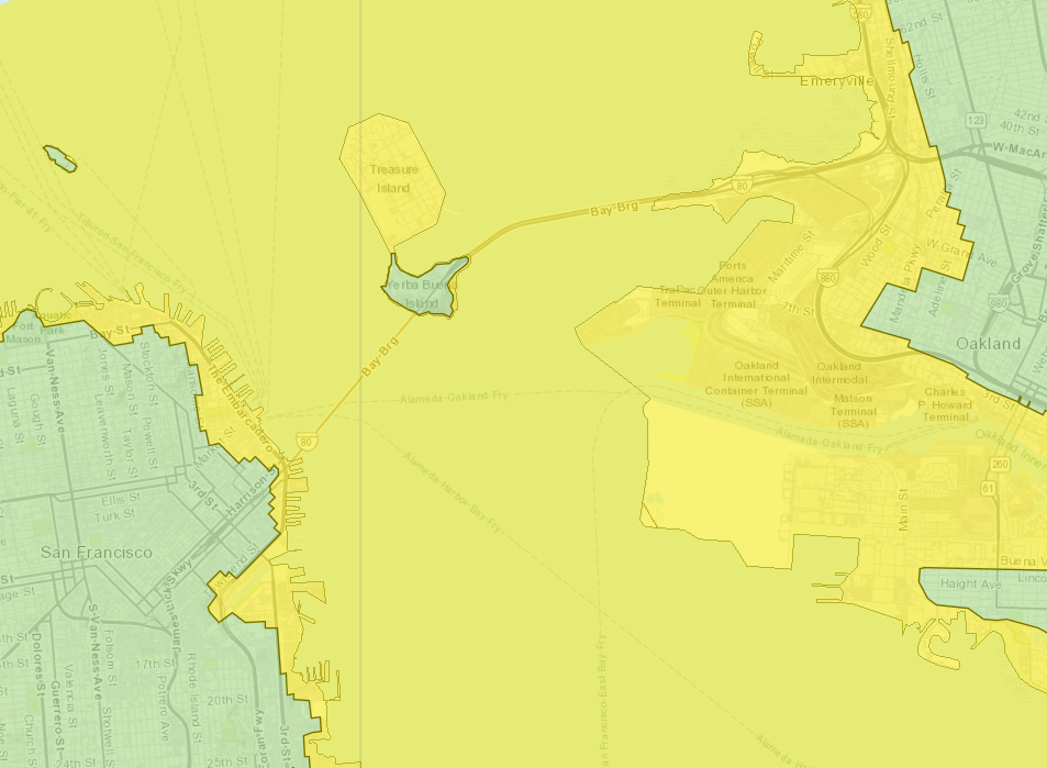
A 2021 map shows the impact of a tsunami hitting the San Fransisco area - and the devastation it could cause.
The map was thrust back into the spotlight Thursday when a 7.0-magnitude earthquake hit off the California coast. It led to 5 million people being put under tsunami warnings in the immediate aftermath.
The interactive hazard maps released online in 2021 provide a look at just how much of the region could be inundated if a once-in-a-lifetime catastrophe strikes.
“We are preparing for a worst-case scenario. A 9.3 magnitude quake off Alaska, that would be the worst-case for San Francisco,” Adrienne Bechelli, deputy director of San Francisco’s Department of Emergency Management, told ABC7 at the time.
New technology in 2021 allowed the state’s geological survey to update its maps from 2009.
A tsunami triggered by a large earthquake in Alaska would take approximately five hours to reach the city, the 2021 maps showed. Those findings were based on how, in 1964, a 9.2-magnitude earthquake in Alaska sent a tsunami toward California and did heavy damage along the coast near San Francisco.
Thursday’s quake was much closer and created tsunami warnings, but officials said quickly after the quake that the threat had passed.
The 2021 maps based on an Alaska quake showed that a tsunami hitting downtown San Francisco was more significant than had been assumed. It was previously believed that areas that are immediately adjacent to the water, such as the Fisherman’s Wharf, the Embarcadero and the area around the famous Ferry Building would receive the brunt of any wave.
However, the 2021 maps show water potentially surging into parts of North Beach and the Financial District as far as Fremont Street.
The same is true across the region with waves hitting West Oakland and Lake Merritt. The entire Oakland Container Terminal and the city’s international airport would be inundated.

"Bottom line: If you’re near the coast and feel strong shaking from a local earthquake or get an official notification to evacuate, move inland or to a higher elevation as soon as possible,” Rick Wilson, head of the CGS Tsunami Program, said in 2021. “A large tsunami surge might be fascinating to watch but you don’t want to be anywhere near it.”
The tsunami triggered by the 2011 Japan earthquake rippled across the entire Pacific Ocean wreaking havoc in Santa Cruz harbour to the south of San Francisco, leaving heavy damage. Approximately $100m in damage occurred up and down the coast.
More than 150 tsunamis have hit California’s shore since 1800. Most were barely noticeable, but a few have caused fatalities or significant damage.
The most destructive tsunami to hit California occurred on March, 28, 1964. Several surges reaching 21 feet high swept into Crescent City four hours after a magnitude 9.2 earthquake in Alaska, killing 12 and levelling much of the town’s business district.
Join our commenting forum
Join thought-provoking conversations, follow other Independent readers and see their replies
Comments
Bookmark popover
Removed from bookmarks