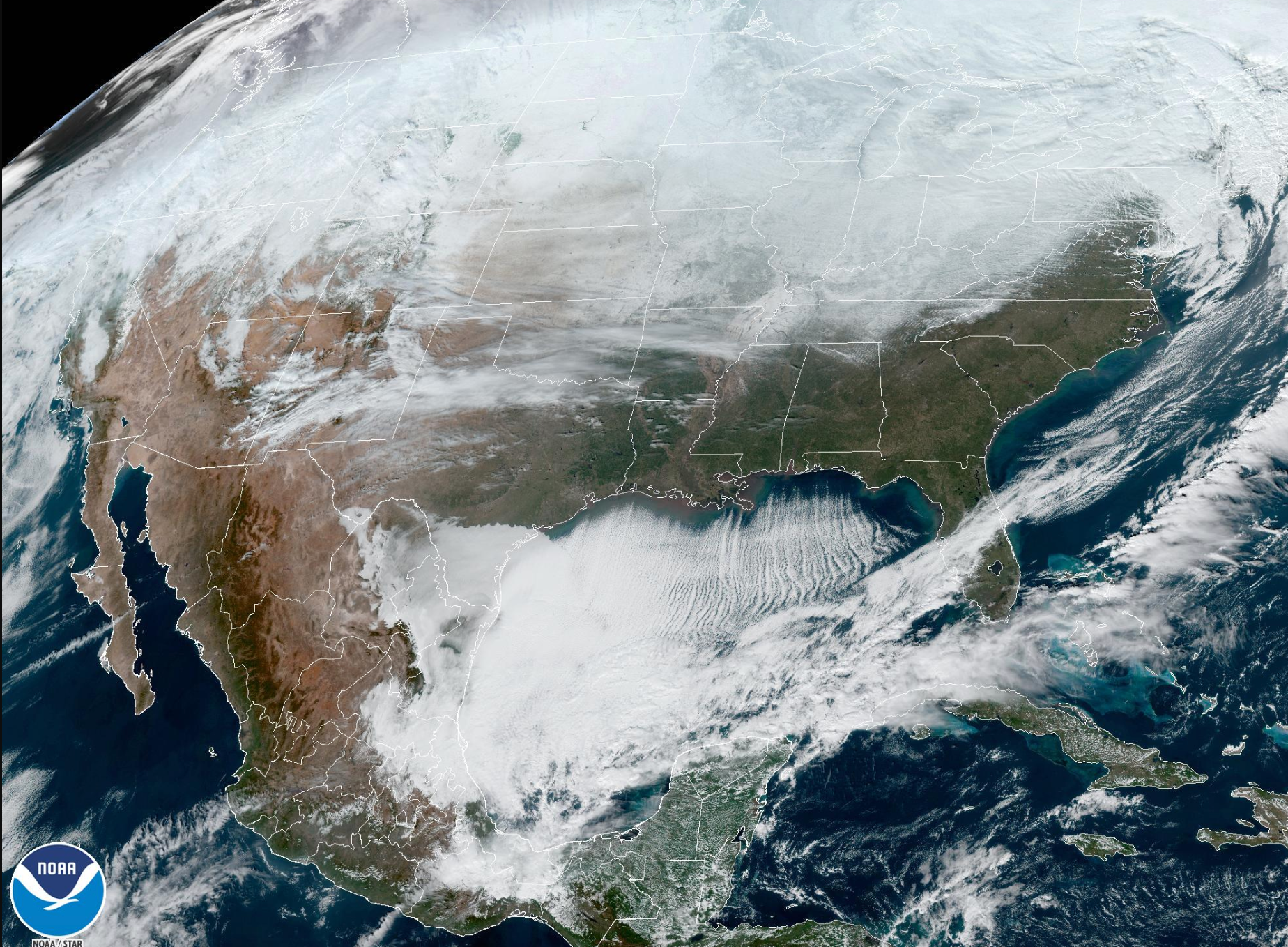
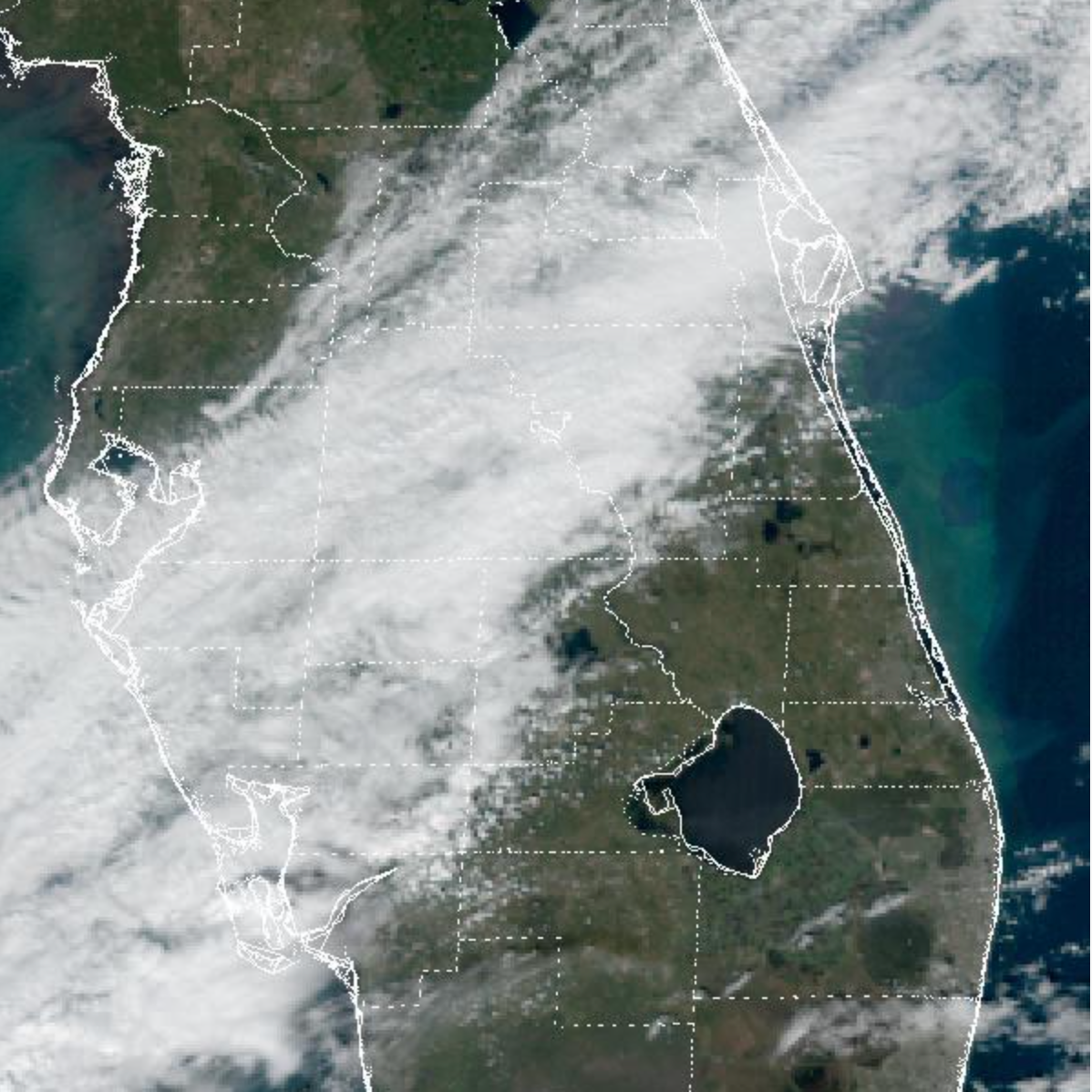
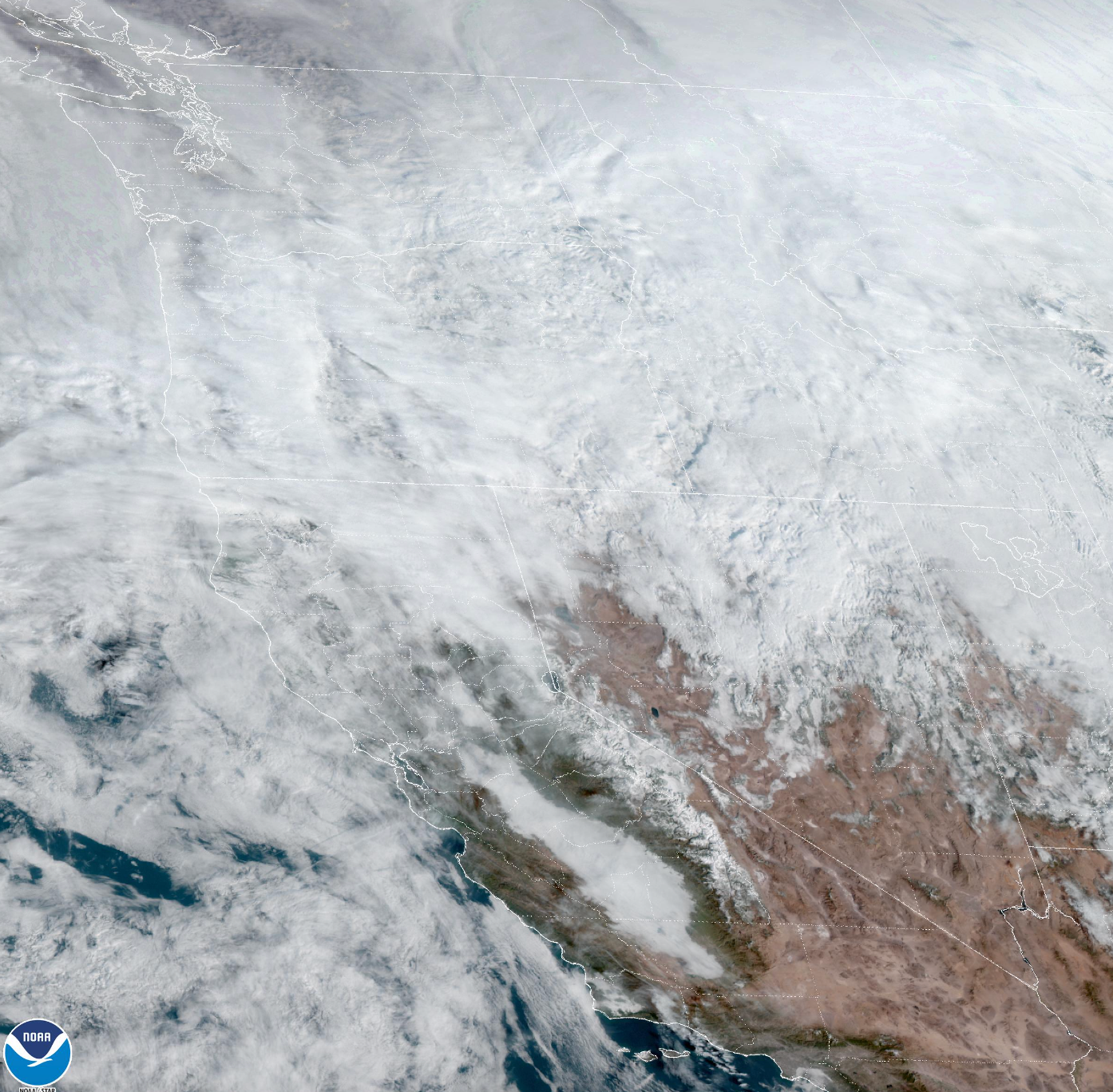
Satellite images show winter storm Elliot’s deadly path through the US
Satellite images sourced by NASA and the National Oceanic and Atmospheric Administration (NOAA) show Elliot’s path from coast to coast
Deadly winter storm Elliot has ravaged the US from coast to coast, leaving nearly two-thirds of the country without power as millions of Americans brave plunging temperatures.
Satellite images sourced by NASA and the National Oceanic and Atmospheric Administration (NOAA) show Elliot making its way from Canada before landing south to the Rio Grande, Gulf Coast and central Florida, and from the Pacific Northwest to the Eastern Seaboard.
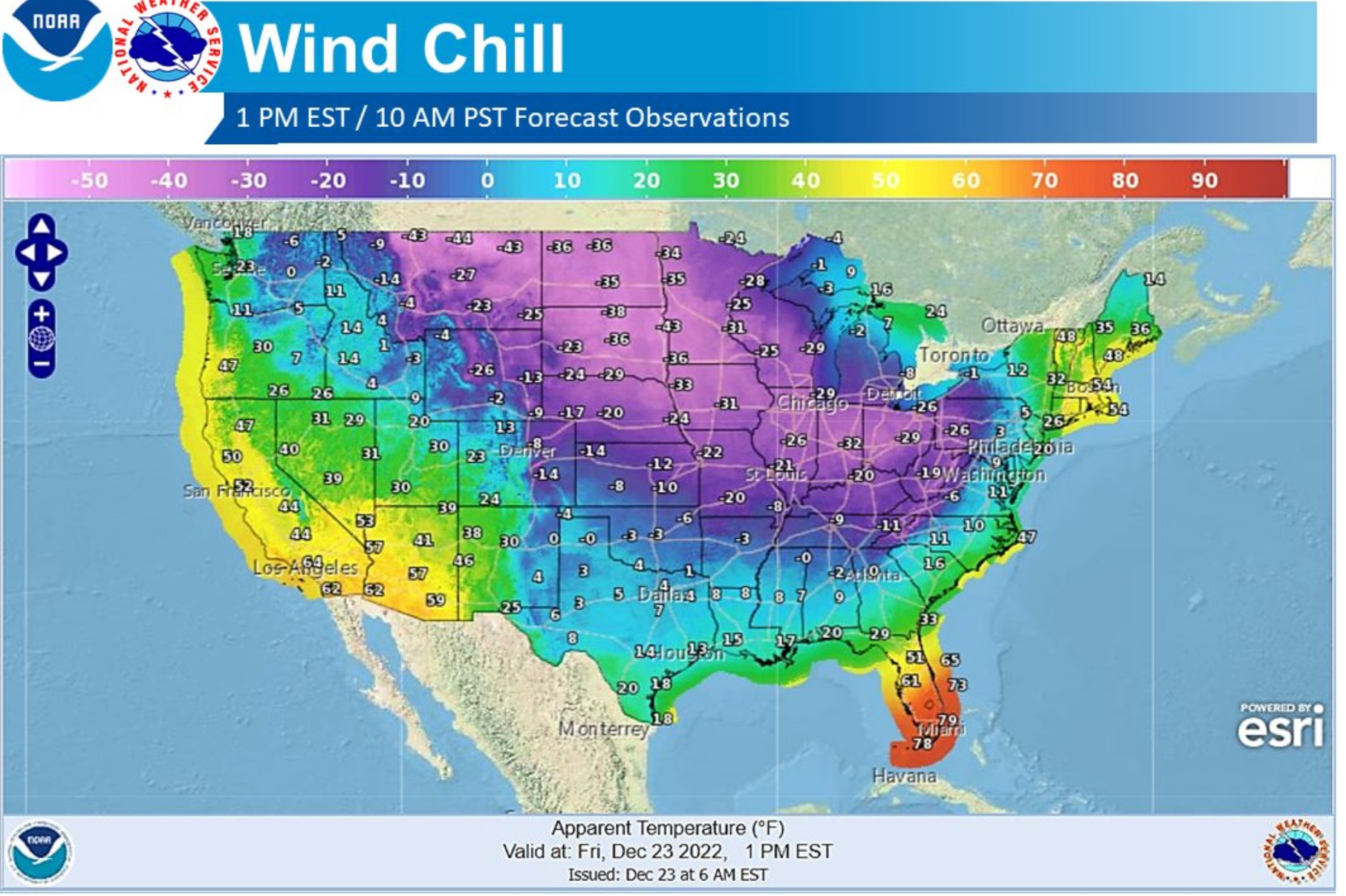
The storm, which brought dangerous howling winds, and blinding, heavy snowfall, was described as “one of the greatest extents of winter weather warnings and advisories ever,” by the National Weather Service. With temperatures continuing to plunge as low as minus 40 degrees, the service warned that Elliot could become a bomb cyclone if it meets warmer air in its path.
Animations from the GOES-16/GOES-East satellite of Elliot’s development over the last six hours, which can be monitored on the NOAA online viewer, show the historic polar vortex sweeping the United States ahead of Christmas.
Three people were reportedly killed in vehicle accidents caused by icy roads in Oklahoma while more than 1.5 million customers are without power and thousands of flights have been cancelled or delayed. More fatal car crashes were also confirmed by the Weather Channel in Nebraska, Kansas and Kentucky on Friday.


On Friday, injuries were reported from a pile-up on the Interstate-94 near Benton Harbor, Michigan, when visibility dropped to one-eighth of a mile. The east-west highway is a major route through northern US states.
“This is not like a snow day when you were a kid. This is serious stuff,” President Joe Biden said on Thursday, noting that he was planning to send his staff home early before the weather deteriorated.
New York Governor Kathy Hochul declared a state of emergency on Friday, with the storm bringing 50 mph winds to the Empire State. Holiday travellers are advised to postpone their trips after Sunday, Ms Hochul said.
In New Jersey, Governor Phil Murphy closed all state offices and issued road restrictions as flash freezes are expected.
Governors in Kentucky, Oklahoma, Missouri, North Carolina and Georgia have also issued weather warnings.
More than 5,000 flights have been cancelled in the US on Friday and delays topped 14,000 planes. Major transit hubs in New York, Chicago, Washington, Denver, Minneapolis and Detroit were just a few of those impacted.
At Seattle-Tacoma airport in Washington, operations went down to one runway after the rest were closed indefinitely due to icy conditions.
More than 1.18 million customers are without power in states across the country from Texas to Connecticut, according to the utlity tracker poweroutage.us.
While western states, the Midwest and parts of the south and plains were in the grips of brutal conditions, more was still to come for the East Coast as the holiday weekend approaches and the development of a so-called “bomb cyclone” becomes more likely.
The NWS Buffalo office in upstate New York warned of a “once-in-a-generation storm”. Due to the Arctic front, temperatures have been able to drop more than 20 degrees in an hour or less, creating a serious risk of frostbite or hypothermia for those exposed.
Weather service meteorologist Ashton Robinson Cook told The Associated Press that places like Des Moines, Iowa, will feel like minus 37 degrees, making it possible to suffer frostbite in less than five minutes.
In addition to the very cold temperatures, high winds in the wake of the front will produce dangerous wind chill readings across nearly all of the central to eastern US, the NWS reported.
Kentucky Governor Andy Beshear described the conditions as ‘really, really dangerous” as he declared a state of emergency ahead of the storm.
“After tornadoes and floods, pandemics and multiple ice storms just in these last three years, I don’t want to lose one person to this Arctic front that is coming through,” Governor Beshear said.
More than 181 million Americans are under wind chill warnings or advisories, over 11 million under blizzard warnings, and over 500,000 under ice storm warnings, according to USA Today.
Join our commenting forum
Join thought-provoking conversations, follow other Independent readers and see their replies
Comments
Bookmark popover
Removed from bookmarks