UK weather: Met Office warning for heavy rain and strong winds after Storm Claudio
Britons warned of further disruption after Storm Claudio battered the country this week
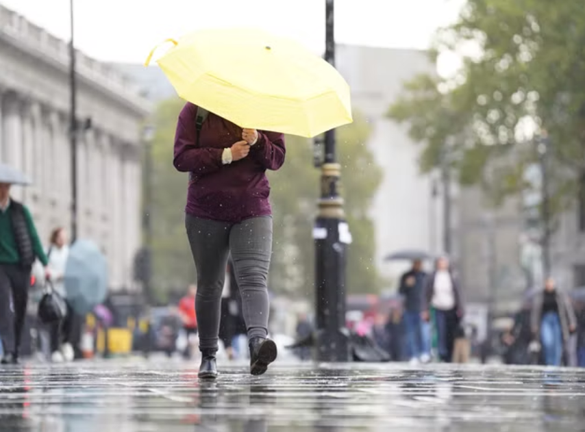
Britain is facing more heavy rain and strong winds on Wednesday after Storm Claudio wreaked havoc in parts of the country.
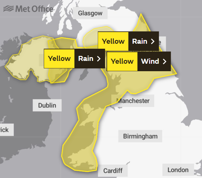
The Met Office issued a yellow weather warning for some areas of the UK from 7am to 8pm, which could lead to travel disruption or loss of power.
Downpours and gales are expected to hit coastal parts of Ireland off the Irish Sea and then spread to northern England.

It comes after Storm Claudio battered parts of the country earlier this week.
A section of Brighton’s iconic West Pier was destroyed during the storm. The pier, which now stands as a ruin after being closed to the public in 1975, has partially collapsed into the sea.


A pre-school in Devon was evacuated on Tuesday afternoon after a suspected lightning strike. Fire services were called out to Willand Pre-school at 2.20pm on Tuesday after a small fire was found in an office there.
A spokesperson for Devon and Somerset Fire and Rescue Service said: “We were called to Willand Pre-School at 2.20pm due to a loud bang, possible lightning strike and a smell of burning. Two crews attended and investigated the building.
“There was a small fire in a first-floor office, out on our arrival, believed to have been caused by a lightning strike on an external telephone cable. The building was evacuated, no reports of injuries.”
Video clips and photos shared on social media showed more devastation caused by Storm Claudio, including trees that fell on cars and severe flooding.
Trains and other forms of public transport were affected, with lines blocked due to floods on the tracks.
Disruption even hit one train route because of a trampoline on the line, potentially blown onto the tracks by the wind.
Southern Rail tweeted: “Due to a trampoline on the line between Brighton and Worthing, services are being disrupted. This is affecting trains in both directions.”
MET OFFICE OUTLOOK
Wednesday:
Heavy rain will move east through the day, with blustery showers following. Very windy, especially around coasts in the west, but also along the rain band as it moves eastwards.
Outlook for Thursday to Saturday:
Rain lingering across southeast England on Thursday. Otherwise showery on Thursday, but generally drier with lighter winds on Friday. Cold to start Saturday, then rain moving east through the day.
Join our commenting forum
Join thought-provoking conversations, follow other Independent readers and see their replies
Comments
Bookmark popover
Removed from bookmarks