Coldest night of year so far as temperatures drop to -15.2C in UK
Met Office issues severe weather warnings as Arctic blast brings coldest March night since 2010, forcing school and airport closures
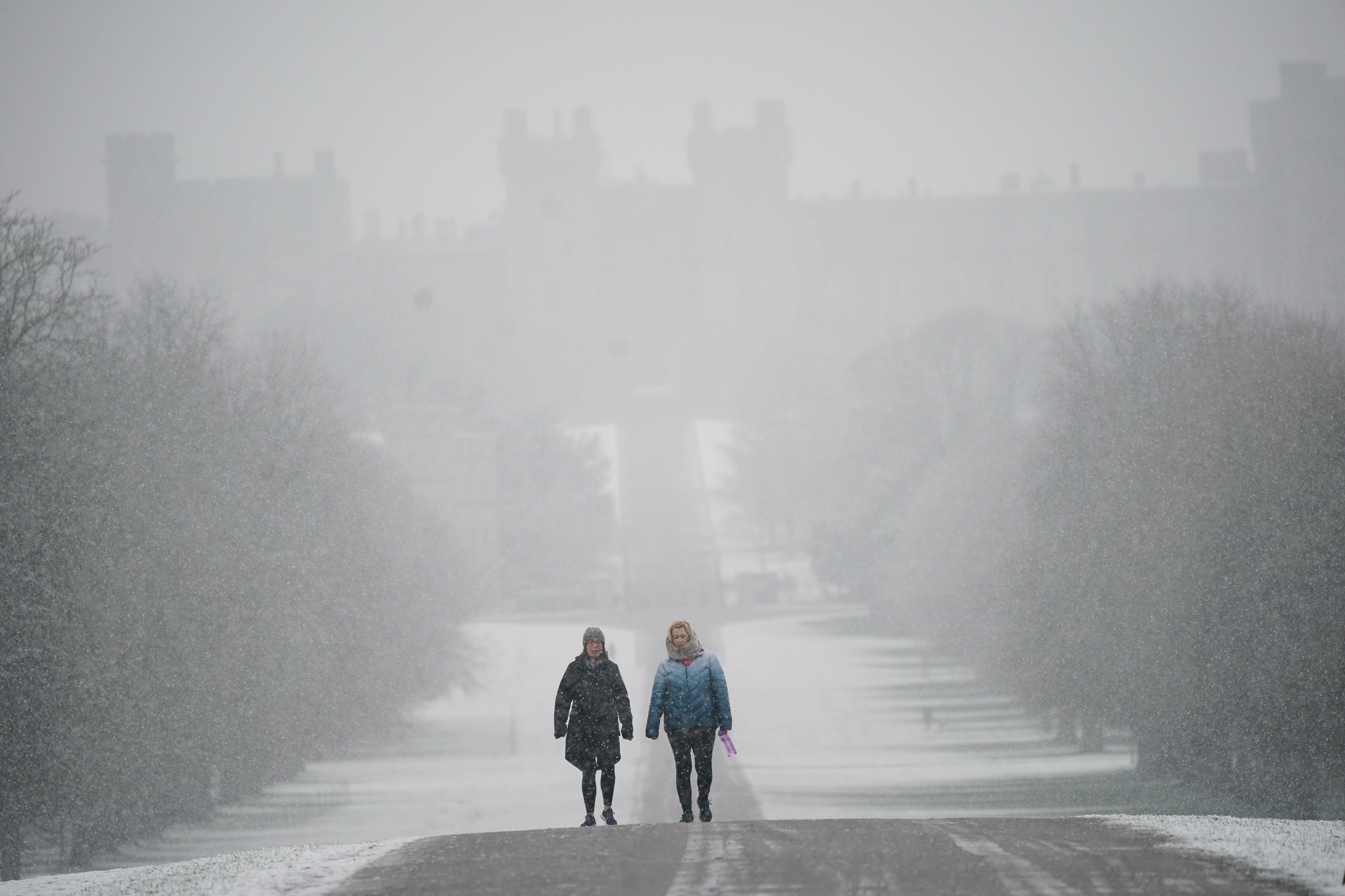
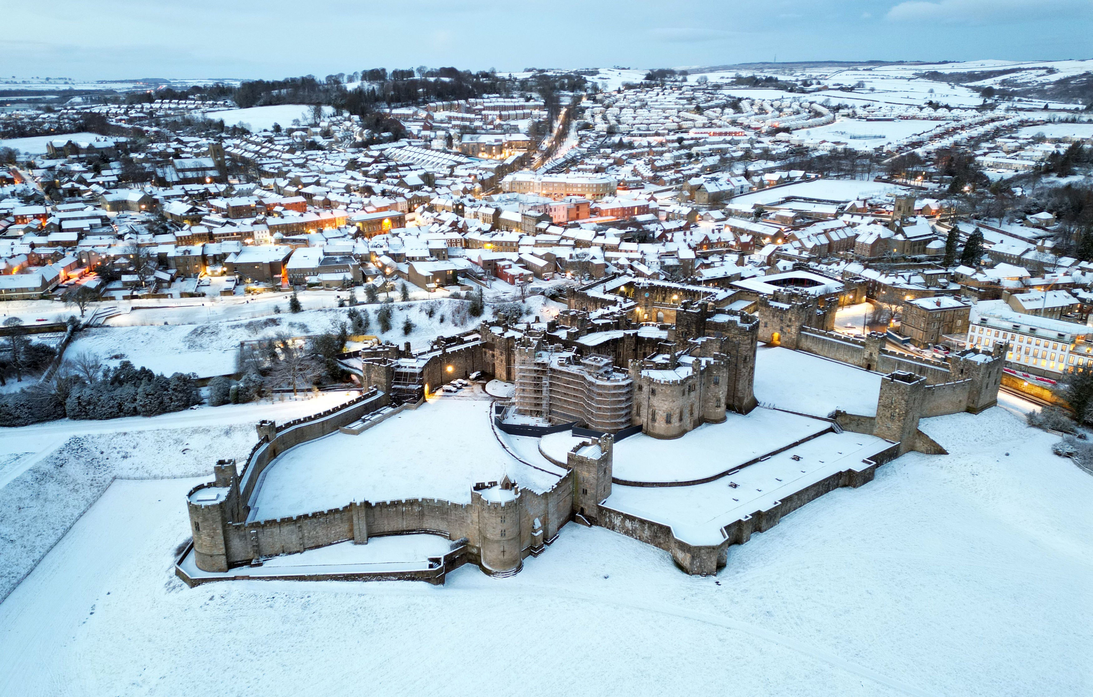
The UK has braved its coldest night of the year so far, with temperatures dropping below -15C in the Scottish Highlands as snow blanketed parts of London.
Thermometers at Kinbrace in the Highlands gave readings of -15.2C overnight on Tuesday, the Met Office said – marking the coldest March night since 2010.
A blast of Arctic air means that sleet and snow is expected across southern England and south Wales on Wednesday, with 14cm of snow recorded in the Highlands ahead of further ice and hail as the cold snap intensifies through the week.
Motorists in some areas have been urged only to make essential journeys, as Bristol Airport was forced to close and thousands of pupils across the UK were told not to come into school on Wednesday.
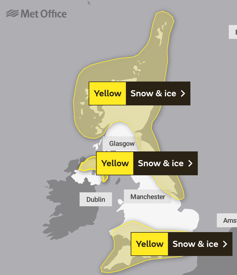
A number of national severe weather warnings for snow and ice are in force, with the Met Office saying further alerts and or updates are “very likely”.


Alerts stretching from Nottingham to Inverness are in place until 6pm on Friday, warning “that roads may become blocked by deep snow, with many stranded vehicles and passengers”.
“There is a small chance that long interruptions to power supplies and other services, such as gas, water, telephone and mobile phone coverage, may occur,” it added, warning that some communities could be cut off for several days.
Temperatures were widely below freezing across the entire country as of 7am on Wednesday, save for the western tip of Cornwall, which appeared unaffected by the Arctic blast as the mercury there hit double digits.
Night-time sub-zero climes are predicted in all four UK nations until at least Friday.
The UK Health and Security Agency has also issued a Level 3 Cold Weather Alert for the whole of England, which alerts social and healthcare services to take specific actions to help protect high-risk individuals.
The agency’s head of extreme events and health protection, Dr Agostinho Sousa, said people should check on vulnerable relatives and told pensioners and anyone with an underlying health condition to heat their home to at least 18C.
While Wiltshire Police urged motorists to avoid all but essential journeys after heavy snowfall overnight created “very dangerous” driving conditions, National Highways has urged people to pack extra provisions in vehicles in case they become stranded.
“Keeping a kit of essential items like a torch and warm clothes, in your vehicle, can be vital in case you and your passengers become stranded in winter,” said Dale Hipkiss, the company’s national network manager.
“Freezing conditions bring so many hazards, such as snow and ice, and take every possible step to understand your journey in advance and allow lots of extra time when travelling to prepare for the unexpected.”
Bristol Airport was also forced to suspend flights until at least 11am on Wednesday morning as teams of staff worked to clear the snow, which the airport said was continuing to fall in an update at 8:20am.
The Met Office’s chief meteorologist, Matthew Lehnert warned that “a further spell of sleet and snow is likely to develop across southern England and South Wales” during the afternoon, “which could cause travel disruption into the evening”.
“The impact of lying snow and ice on untreated surfaces may have an impact on Thursday morning travel,” the meteorologist added.
His colleague Helen Caughey, the Met Office’s deputy chief meteorologist, said that the risk of snow will spread to central and northern parts of the UK through Thursday and Friday – creating the potential for blizzard conditions.
“Parts of Northern Ireland, Wales and northern England are expected to see the worst of the conditions develop from early on Thursday, with parts of Scotland and northern England then seeing snow arrive through Thursday afternoon,” Ms Caughey said.


"Snow across the northern half of the UK will persist through much of Friday, while further south, any snow will turn back to rain through Thursday afternoon and evening.
“Strong winds are also expected to develop through Thursday and Friday which may create drifting snow and blizzard conditions in places.”
Join our commenting forum
Join thought-provoking conversations, follow other Independent readers and see their replies
Comments
Bookmark popover
Removed from bookmarks