Met Office issues fresh snow and ice weather warnings for large parts of UK
Forecasters predict rain, sleet and snow to spread southeastwards
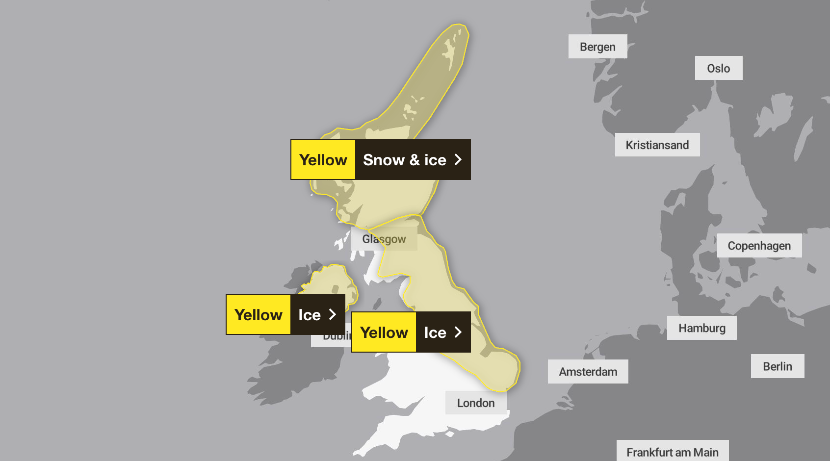
The Met Office has issued fresh snow and ice warnings for large parts of the UK.
A yellow weather warning for snow and ice has been issued in Central Tayside and Fife, Grampian, Highlands and Eilean Siar, Orkney and Shetland and Strathclyde. The alert is set to commence at 3pm on Monday and last until 10am on Tuesday.
Rain, sleet and snow is predicted to spread southeastwards across Scotland at times through Monday afternoon and night.
Two more yellow weather warnings have been issued for ice in Northern Ireland, Central Tayside and Fife, east Midlands, east of England, north east England, north west England, southwest Scotland, Lothian Borders, Strathclyde, West Midlands and Yorkshire and Humber.
This warning will take place at 8pm on Monday and remain until 10am on Tuesday.
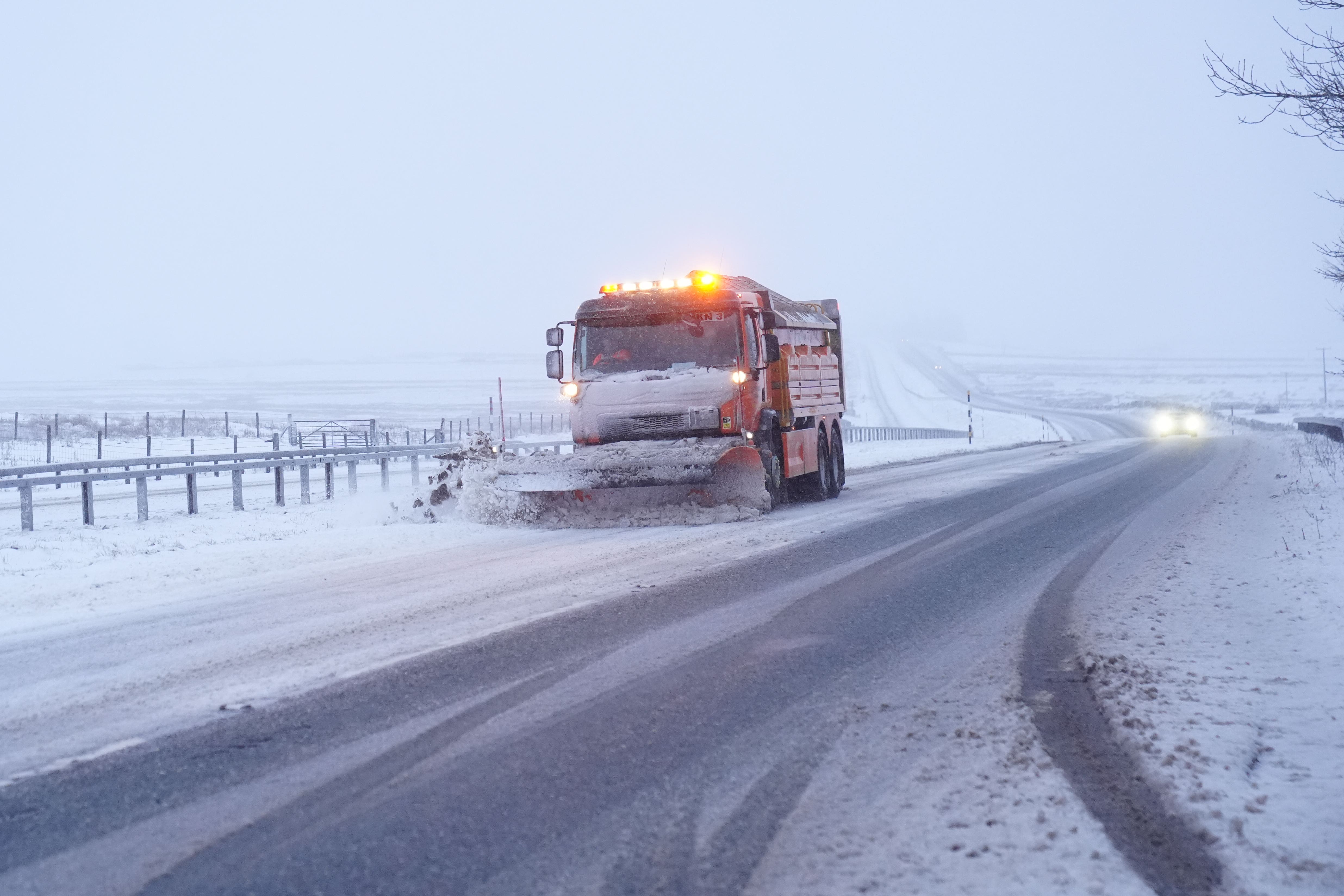
The Met Office has warned that snowy, wintry weather can cause travel disruptions, with railways, bus and train services likely to be affected with longer journey times, due to the dangerous conditions and icy surfaces on the roads.
The national forecasting service has advised drivers to keep themselves and others safe by planning their route and giving themselves extra time to make their journey. Additionally people are advised to check for road closures or delays to public transport and amend plans if necessary.
The accumulating snow will initially hit hills (typically above 200m elevation) but later in the day fall to lower levels at times.
Further scattered wintry showers will arrive from the northwest later in the night and into Tuesday morning.
The greatest accumulations of snow will be during Monday evening and night, where 1-2 cm will be possible in places at low levels (away from north-facing coasts), 2-5 cm above about 150m elevation and 5-8 cm above 300m.
With temperatures falling below freezing, ice is likely on untreated surfaces, even where precipitation may have fallen as rain or sleet.
A few isolated lightning strikes will be additional hazards, according to the Met Office.
The Met Office said: “Strong north to northwesterly winds are also probable during Monday evening and night across the Northern Isles and northeastern parts of the mainland, where gusts in more exposed areas could reach 50-60 mph.”
In Northern Ireland, showers through the course of Monday will leave many surfaces wet by the evening, with a risk of ice forming on untreated roads and pavements during Monday night as temperatures fall to or below freezing.
A few additional wintry showers may feed inland at times overnight, potentially washing off treatment before skies once again clear and surface temperatures drop.
Across other parts of the country the Met has said “areas of rain, sleet, and hill snow will move southeastwards through Monday evening and night before clearing to the North Sea.
“Whilst some patchy accumulations of snow will be possible, more especially on ground above 150-200 m elevation, ice will be a greater hazard as temperatures fall fairly quickly once showers clear away.In addition, a period of strong northwesterly winds are also likely along some North Sea coasts later in the night and into Tuesday morning.”
Join our commenting forum
Join thought-provoking conversations, follow other Independent readers and see their replies
Comments
Bookmark popover
Removed from bookmarks