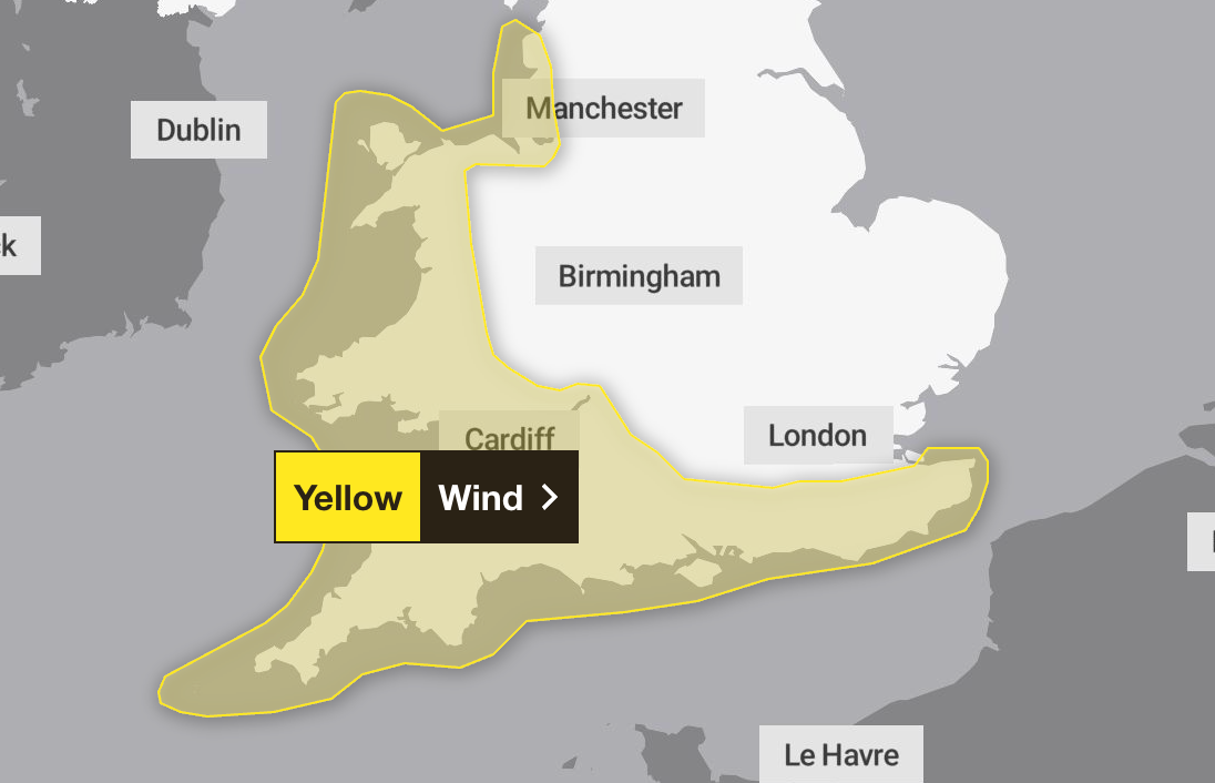
Strong winds of up to 80mph to hit UK with yellow weather warning issued
The yellow weather warning for wind was issued for Sunday and Monday
The Met Office has issued a yellow weather warning for wind across parts of the UK over the weekend.
Forecasters say parts of England and Wales could see “strong and gusty winds” and possible thunderstorms on Sunday and into Monday evening.
The Met Office is warning of potential disruption and delays to road, rail, air and ferry transport, with a chance that some roads and bridges may close.
There is also a chance that power cuts may occur, with the potential to affect other services, such as mobile phone coverage.
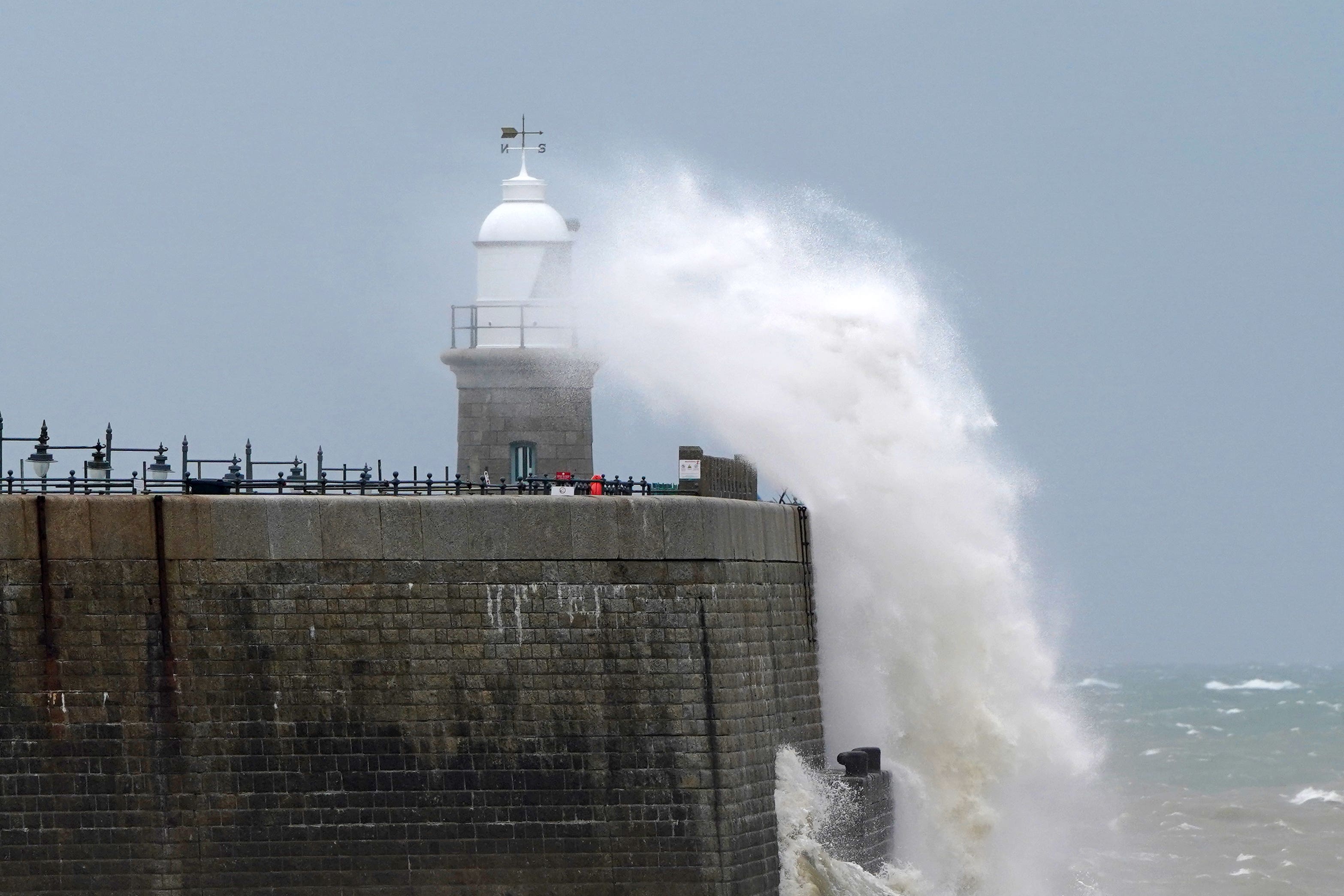
It is likely that some communities near coastal routes and sea fronts may be affected by spray and large waves.
The yellow weather warning is in place from 8pm on Sunday until 6pm on Monday, across London and South East England, North West England, South West England and Wales.
Gusts of around 50 to 60mph are likely around coasts and hills and 70 to 80mph is possible in the most exposed locations, with the windiest conditions expected on Monday morning.
The Met Office warned that it will be windy in the far northwest of Scotland on Thursday, combined with spells of rain.
In other parts of the country, there will be a mixture of sunshine and blustery showers, with a risk of heavy rain, hail and thunder, particularly in the Western region.
Forecasters said those affected should prepare to protect their property and people from injury. They recommend checking for loose items outside the home and planning how to secure items such as bins, garden furniture, trampolines, tents, sheds and fences.
They also advise checking road conditions and bus and train timetables, and amending travel plans if necessary to have the best chance of avoiding delays.
Despite the unpredictable conditions, forecasters said they are not expecting a named storm to hit the country.
Paul Gundersen, chief meteorologist at the Met Office, said: "We have been monitoring a deepening area of low pressure over the North Atlantic that might bring impactful weather to the UK, most likely on Sunday and Monday. At present, a named storm is unlikely."

Here is the weather forecast in the UK for the coming week, according to the Met Office.
Today
Windy, especially in the North West, with showers merging into longer spells of rain across Scotland. Elsewhere, a mixture of sunshine and showers, these sometimes heavy and carrying a risk of hail and thunder. Temperatures will be near normal but feeling cool.
Tonight
Remaining wet and windy in the far North West, but elsewhere showers will be fading with dry spells developing. Further heavy showers in the West. Feeling cool beneath clear skies in rural spots.
Friday:
Another breezy day with showers continuing to feed in from the West, these sometimes heavy and merging into longer spells of rain. Best of the sunshine in the East. Overnight showers in the western coastal areas becoming more widespread.
Outlook for Saturday to Monday
On Saturday, showers may be heavy in places with isolated thunderstorms. Stronger winds and coastal gales are also possible.
Remaining changeable with sunny spells and blustery showers. More widely wet and windy on Sunday with coastal gales possible.
Sunshine and drier conditions are most likely to be found in the East, though temperatures will remain on the cooler side, with highs of around 17C to 18C expected in London on both Saturday and Sunday.
Staying windy on Monday with further blustery showers, and feeling cool.
Join our commenting forum
Join thought-provoking conversations, follow other Independent readers and see their replies
Comments
Bookmark popover
Removed from bookmarks