Storm Jocelyn to bring 80mph winds after Isha wreaks havoc across UK
Weather warnings in place across large swathes of UK on Tuesday as Storm Isha clean-up operation continues
The British Isles are bracing for a new storm with wind speeds of up to 80mph, with many areas still reeling from Storm Isha’s trail of destruction.
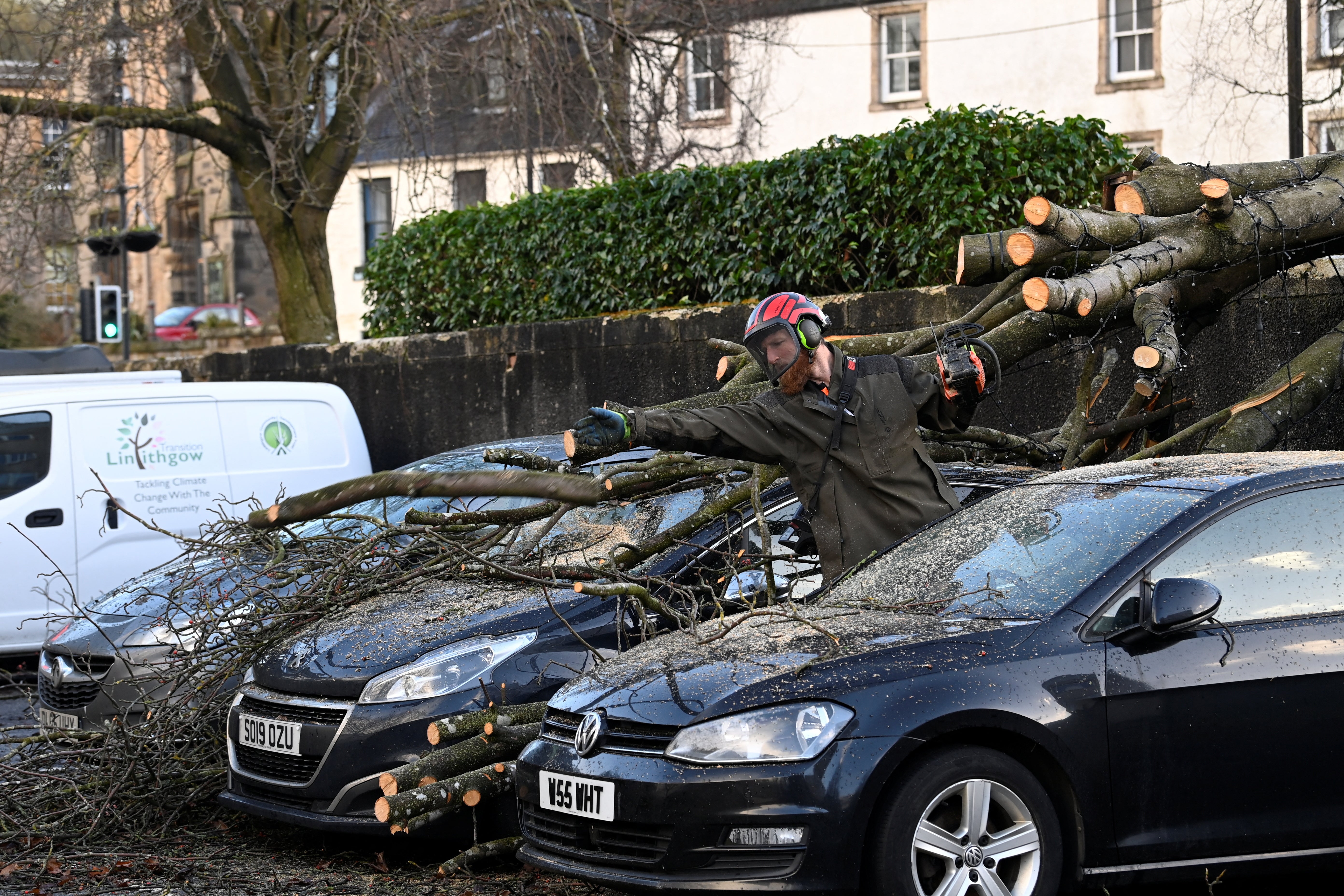
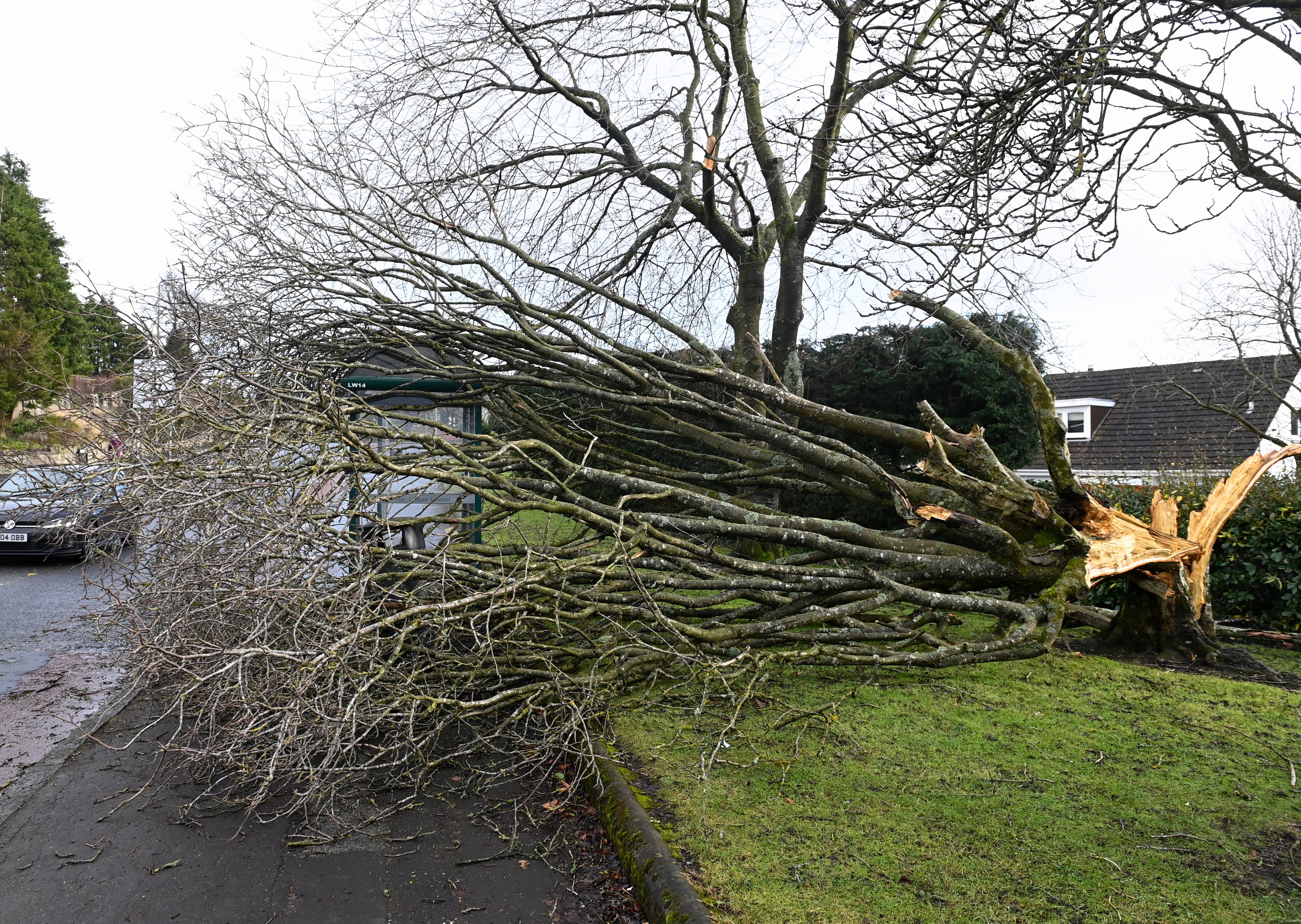
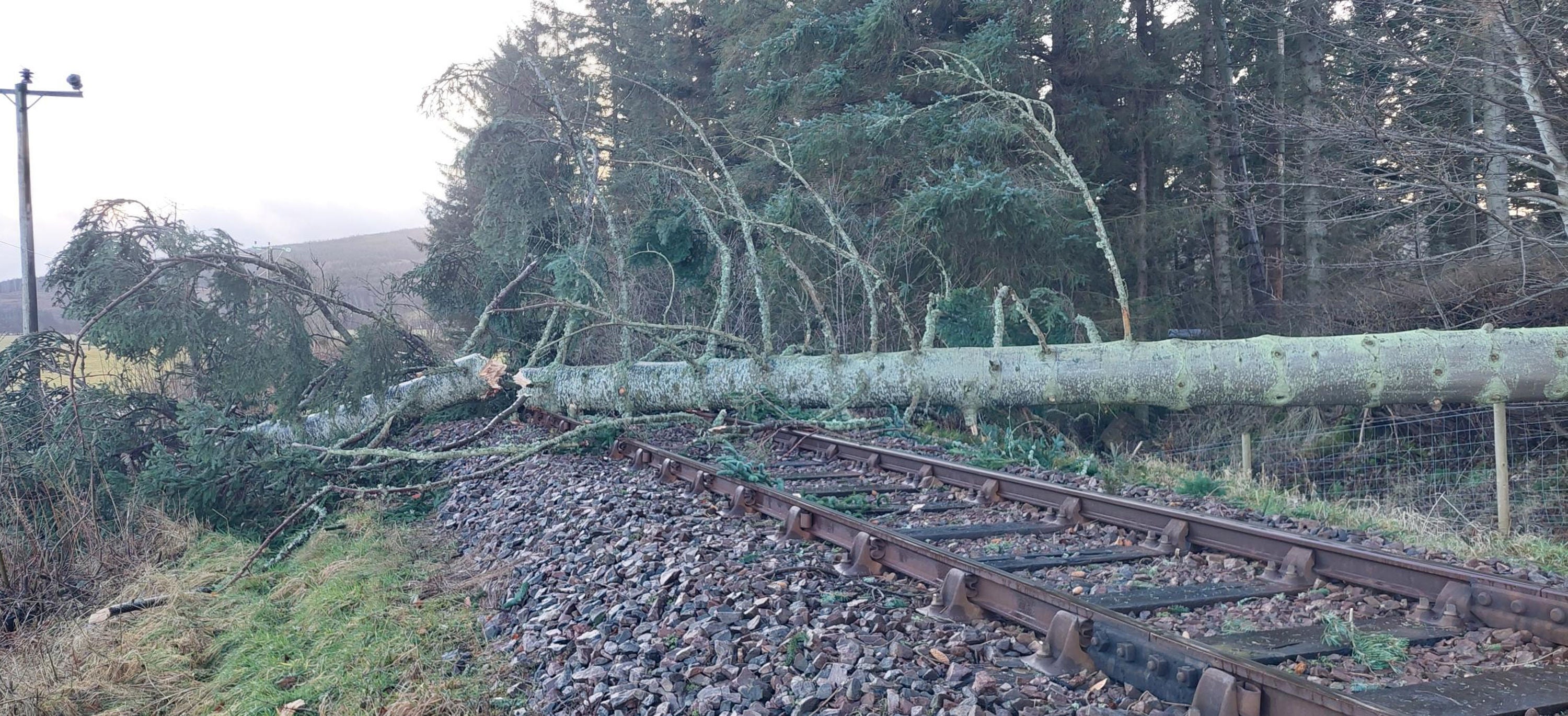
Tens of thousands were left without power and rail, and air services were heavily disrupted, as the UK and Ireland was hit by gales of up to 107mph from Storm Isha from Sunday evening.
Four people were killed on the roads including two by fallen trees: an 84-year-old man in Fife, Scotland, and a man in his sixties in Limavady, Northern Ireland. Two others, a woman in her twenties and a man, were killed in Ireland.
But as the weather started to calm on Monday, people living in many parts of the UK were warned by the Met Office of the newly named Storm Jocelyn, which is set to hit on Tuesday morning, bringing with it strong winds and rain.
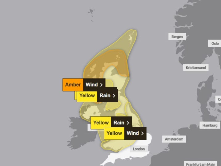
An amber “danger-to-life” weather warning will be in place for northwest and northern Scotland from 6pm on Tuesday until 8am on Wednesday. Yellow weather warnings for wind and rain cover the Midlands and the north of the UK from Tuesday morning.
It will come only hours after Storm Isha caused significant travel disruption and left tens of thousands of homes without power. Power outages affected about 53,000 houses at the height of the storm in Northern Ireland.
Around 30,000 properties were without power across England, Wales and Scotland on Monday morning, according to the Energy Networks Association, which represents energy providers.
Energy provider Ireland ESB said 155,000 homes and businesses remained without power by lunchtime on Monday, down from 230,000 at its peak, with the worst-hit areas in the northwest of the country.
Fallen trees affected transport, with Traffic Scotland reporting stretches of the M9 and M74 among the roads closed, while the A1 southbound was blocked at Thorntonloch because of an overturned lorry.
And there could be more disruption on the way as a new weather system, which has been named Storm Jocelyn by Met Eireann, Ireland’s meteorological office, makes landfall on Tuesday. It will be the 10th named storm to hit the UK since September.
ScotRail announced late on Monday afternoon that all services will be suspended from 7pm on Tuesday.
The UK Met Office said there was a “good chance” of power cuts again in Scotland, which have the potential to affect other services, such as mobile phone coverage.
There will “probably” be some damage to buildings from tiles blowing off roofs, longer journey times are possible and cancellations also likely as road, rail, air and ferry services may be affected.
People are also urged to take care when visiting the coast, where larger than normal waves are expected.
Yellow warnings for wind and rain are also in force across parts of England, Wales, Northern Ireland and Scotland. The Met Office said that 2.5in (63mm) of rain could fall in some of the worst-affected areas of Cumbria and Lancashire.
The Met Office said the weather conditions were being driven by another strong jet stream, pushing a large-scale, low-pressure system from the Atlantic across the northern half of the UK, bringing wet and windy conditions on Tuesday evening and into Wednesday.
Steve Willington, the Met Office chief meteorologist, said: “Although this system will be a step down relative to Storm Isha, with the damage and clean-up still underway, we could potentially see more impacts from Storm Jocelyn.
“Outbreaks of heavy rain on Tuesday could bring rainfall accumulations of 15 to 20mm quite widely with 40 to 50mm over higher ground in southwest Scotland, the Scottish Highlands and parts of northwest England.
“Wind gusts are expected to reach 55 to 65mph across northwestern Scotland, while there is potential for winds to gust to 75 to 80mph in a few places, in particular exposed parts of the Western Isles and coastal northwest Scotland early on Wednesday morning.”
Join our commenting forum
Join thought-provoking conversations, follow other Independent readers and see their replies
Comments
Bookmark popover
Removed from bookmarks