Tube strike: This London transport map will get you home during station staff walkout
Diagrams separately show the minutes and the steps it takes to walk between Tube stations
Commuters clueless as to how they will make it home tonight in the face of on-going strike action can use this very helpful map.
The #walklondon diagram, which gives the walking time in minutes between Tube stations, is being re-shared on social media.
The shortest times include between Paddington and Edgware Road, at two minutes, and between Caledonian Road and Holloway Road, at three minutes.
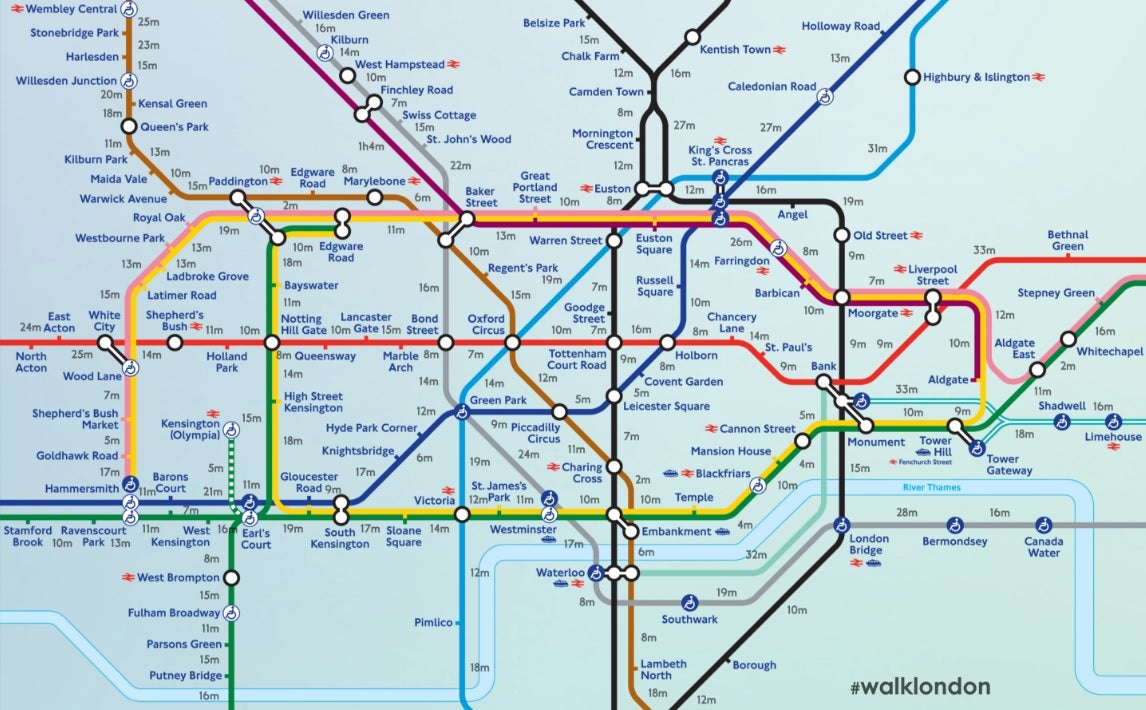
A walk from London Liverpool Street and Bethnal Green on the other hand will take 33 minutes, and a stroll from King’s Cross St. Pancras to Highbury & Islington, will last 31 minutes.
Transport for London has already told customers it may be easier and quicker to walk their commutes rather than take convoluted Tube journeys.
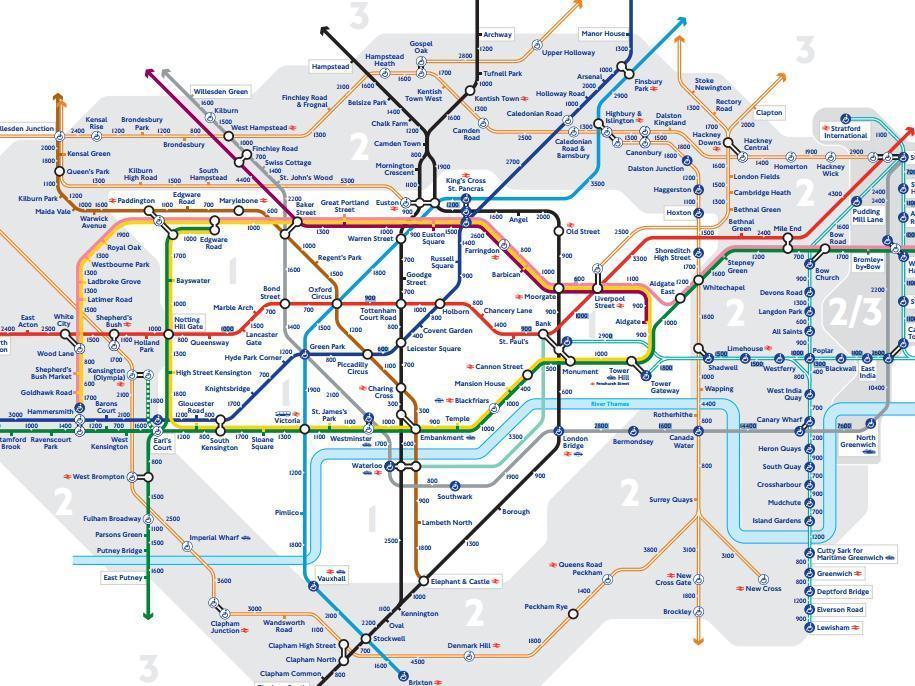
TfL also released a map earlier this year showing how many steps are necessary between each station.
Leicester Square to Covent Garden is 400 steps, although King’s Cross to Euston is 1,200 steps.
London Mayor Sadiq Khan, who promised 'zero days of strikes' during his campaign and has criticised the strikers, said at the time: “The new steps map will encourage more of us to walk these short journeys instead – it’s good for our health and it will help support London’s small businesses.”
Hundreds of TfL workers either walked out or did not turn up to work between 6pm on Sunday and 6am today in a dispute over job cuts and office closures.
The Victoria and Waterloo & City lines, plus key interchange stations including Victoria, King's Cross St Pancras, Waterloo, Paddington, Euston, Bank and London Bridge, were closed.
The vast majority of lines crossing through the Zone 1 patch were also closed.
Join our commenting forum
Join thought-provoking conversations, follow other Independent readers and see their replies
Comments