Mapped: Where heavy rain will lash UK as yellow weather warning begins
Some areas are expected to see as much as 100mm of rain
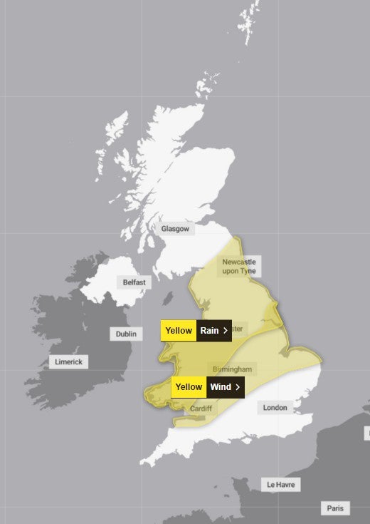
A yellow weather warning is in place across several parts of the UK, with wind and blustery showers expected across most of the country.
Heavy rain and strong gusty winds are due in areas of northeast England, northwest England, southwest Scotland, Strathclyde, Yorkshire and Humber, Central, Tayside and Fife, and Northern Ireland.
The Met Office said flooding and power cuts may be expected in homes, businesses, and on the roads and warned of a small chance of fast-flowing or deep water that could cause “danger to life”.
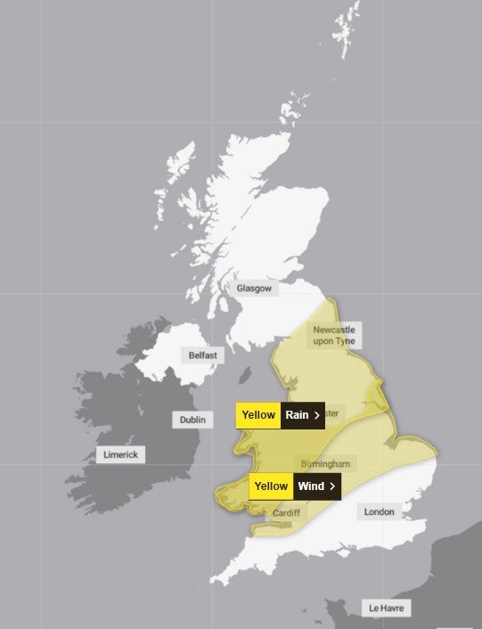
In a statement posted online, the Met Office said: “Be prepared for weather warnings to change quickly: when a weather warning is issued, the Met Office recommends staying up to date with the weather forecast in your area.”
Heavy rainfall is expected to last until 3am on Sunday morning. The Met Office anticipates around 20 to 40mm of rain, with some areas seeing up to 100mm.
The weather agency said rainfall will spread northeastwards on Saturday and areas may see increasingly strong gusty winds and thunder.
In Northern Ireland, there will be up to 80mm of rain from midday on Saturday to 3am on Sunday morning in County Antrim and County Down.
The persistent heavy rain will have cleared from Wales in the early hours of Sunday morning and will ease in northern England and Scotland by dawn on Sunday. Strong winds and showers will remain strong throughout the day.
Met Office Chief Meteorologist, Matthew Lehnert, said: “Through this period, 20-30 mm of rain is expected to fall widely across Wales and northern England, with some locations perhaps seeing 60-80 mm. Where these higher rainfall amounts fall remains uncertain and it is possible that this warning may be updated if confidence increases, particularly if the heaviest rain falls in urban areas.”
He added that there was also a chance of a short spell of strong, gusty winds could develop as the area of low pressure moves east.
“Winds will initially strengthen across some western and southwestern areas, before migrating north-eastwards, clearing into the North Sea during the early hours of Sunday morning. Whilst not everywhere in the warning area is expected to experience very strong winds, some inland locations may see gusts of 50-60 mph whilst gusts of 65-75 mph are possible around some coasts.”
The strongest winds are likely to be along the Bristol Channel and the west Wales coast on Saturday afternoon and early evening, then along the North Sea coast of east and northeast England overnight into early Sunday morning, he said.
The Met Office has reminded people to check the road conditions to avoid delays and see if their property is at risk of flooding (if so, advice is to prepare a flood plan and an emergency flood kit). A yellow weather warning has a very low likelihood and a medium impact.
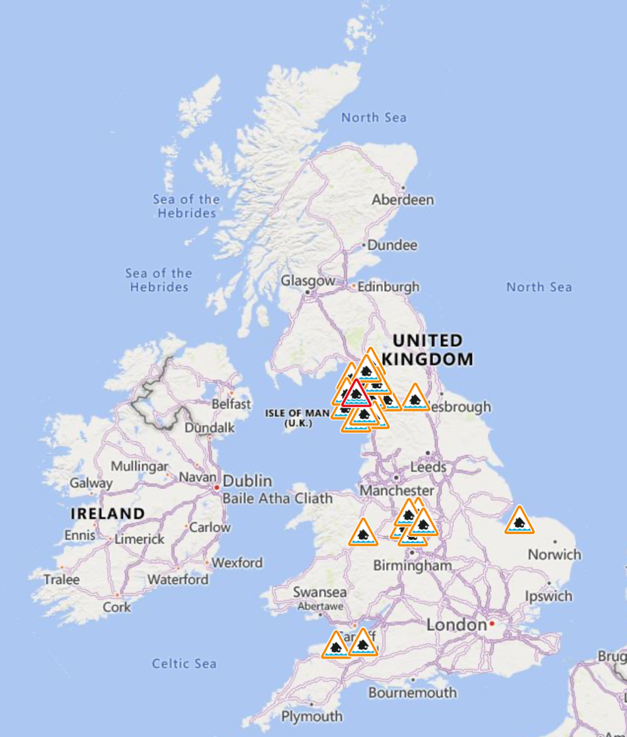
Flooding is expected at Keswick Campsite in the Lake District, the only flood warning issued by the Environment Agency this weekend, while 24 flood alerts have been issued across the country, suggesting that a deluge may be possible.
Here is the weather forecast in the UK for the coming week, according to the Met Office.

Today
Band of rain positioned southwest to northeast across the UK, heavy in the afternoon for parts of Wales and northern England. Sunny spells either side of this but with some showers, perhaps thundery in the far southeast for a time.
Tonight
Rain, heavy at first, gradually clearing southeastwards with strong winds possible for a time. Blustery showers and clear spells in the north. Patchy rural frost possible in Scotland.
Sunday
Cloud and light rain moving south across England and Wales. Showers follow from the north, heralding a cooler feel with temperatures falling below average. Marked wind chill in the northeast.
Outlook for Monday to Wednesday
Turning drier for most areas next week with a good number of sunny spells. Repeated showers possible across southeast England. Feeling fairly cool with patchy overnight fog and frost.
Join our commenting forum
Join thought-provoking conversations, follow other Independent readers and see their replies
Comments
Bookmark popover
Removed from bookmarks