UK weather latest: Radar image shows highly localised Cornwall storm hitting Coverack
Estimated 100mm of rain falls in just three hours
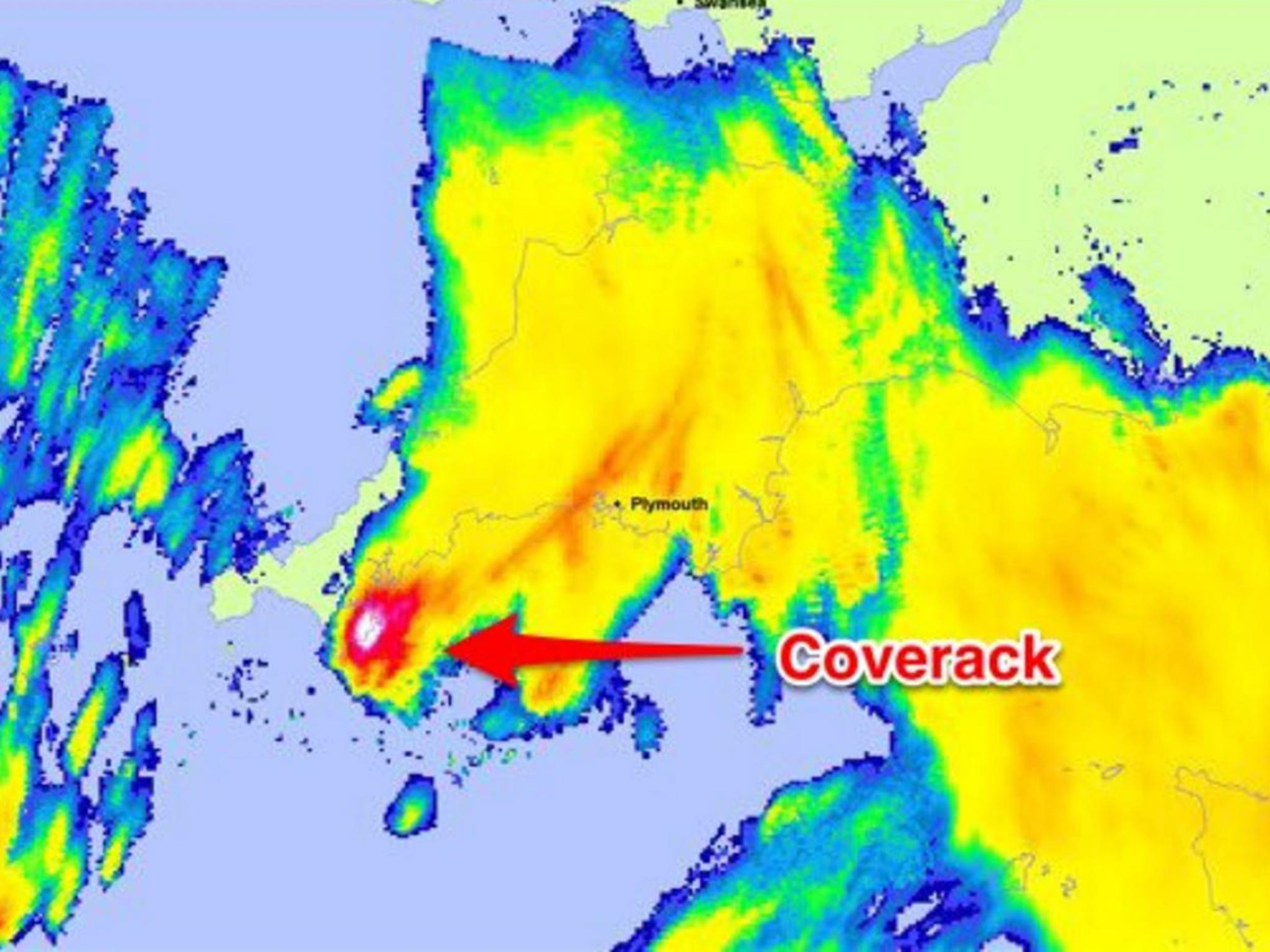
This weather radar image shows the intensity of the storm that battered the southern Cornish coast, leading to flash flooding.
Coverack took the worst of the weather during heavy rain and lightning on Tuesday, with an estimated 100mm of rainfall in just three hours.
Flooding caused huge damage, including the destruction of homes and road surfaces.
The image, tweeted by John Curtin, the Environment Agency's executive director for flood and coastal risk management, shows an extremely localised red-and-white patch of intense rain centred over the coastal village.
He said: "Weather radar image showing just how localised #Coverack storm was - unverified totals look like 100mm in three hours."
Residents and business owners affected by the flooding in Coverack have been told council reserves will be used to help repair the damage.
Adam Paynter, leader of Cornwall Council, told the BBC: "With things like this, money won't be a problem - we do have reserves we can use for this type of incident."
Speaking from the west Cornwall village, he added: "It's been absolutely unbelievable to see. I think it's going to take a little while to get this sorted out and tidied up but obviously the main thing is that nobody's been injured and everybody is okay in the village.
"The council and the emergency services have done a great job, they've been here all night to ensure that everybody is safe and they are doing what they can to make sure everything can get back to normal as soon as possible."
Additional reporting by agencies
Join our commenting forum
Join thought-provoking conversations, follow other Independent readers and see their replies
Comments