UK weather mapped: Where snow and torrential downpours will hit Britain
Snow, hail and heavy rain will batter parts of the UK on Wednesday morning
The UK can expect snow on Wednesday morning following a week of temperatures in the double figures, far above the average for February.
Last week may have seen temperatures rocket to 16C in parts of the country, but it’s set to become cooler early into Wednesday morning.
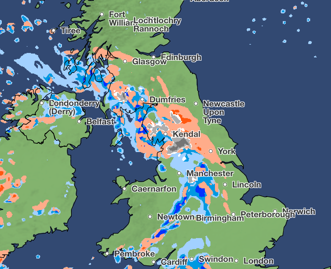
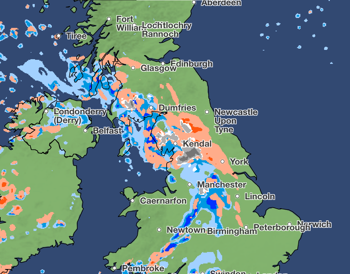
The Met Office weather map showed a flurry of snow drifting in from the West from 6am, getting stronger over Kendal and Dumfries, with more than four millimetres an hour predicted. Preston and Manchester may also experience a dusting of this snow at around 6.30am.

As part of this wintry mix, light hail is expected to cover parts of the Midlands going further north, between, Birmingham, Manchester and Kendal.
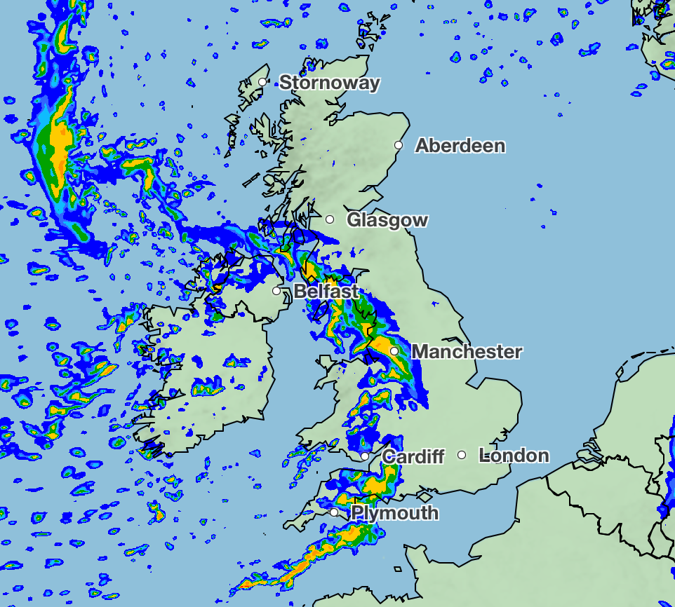
Meanwhile, heavy rain is expected across the south west of England, moving eastwards along with the snow and hail expected up north.

The snow and hail is expected to drop off into midday, according to the map, with temperatures getting slightly warmer towards 7C.
Met Office meteorologist Honor Criswick said that on Wednesday afternoon there would be “plenty of showers on the cards, once again may even bring a sprinkling of snow across parts of the Pennines, some hail, possibly even some thunder”.
A spokesperson for the forecaster said: “As a front moves in from the west on Wednesday morning there could be some snow for a time over higher ground in southern Scotland and northern England. Snow could fall in locations in the Pennines and Southern Uplands at elevations over 300m but is only likely to settle in locations above 400-450m in elevation.
“Any accumulations are expected to be modest, with no warnings issued. The front will move through and weaken through the day, leaving mostly showers by the afternoon.”

Tuesday night:
A chilly evening, with a few showers still possible. Dry for eastern areas overnight with some mist and fog patches developing. Western areas though will see cloud and rain move in by dawn. A patchy frost under the clearest skies.
Wednesday:
Outbreaks of heavy rain will sweep eastwards through Wednesday, followed by sunny spells and frequent showers. Rather breezy across the country and feeling cool.
Thursday through Saturday:
Dry for many on Thursday and Friday, with sunny spells and just a few showers. Patchy rain slowly moving southwards through Saturday. Overnight frosts developing where skies remain clear.
Join our commenting forum
Join thought-provoking conversations, follow other Independent readers and see their replies
Comments
Bookmark popover
Removed from bookmarks