What’s happening at Mauna Loa right now?
‘Lava flows are not threatening any downslope communities,’ USGS says
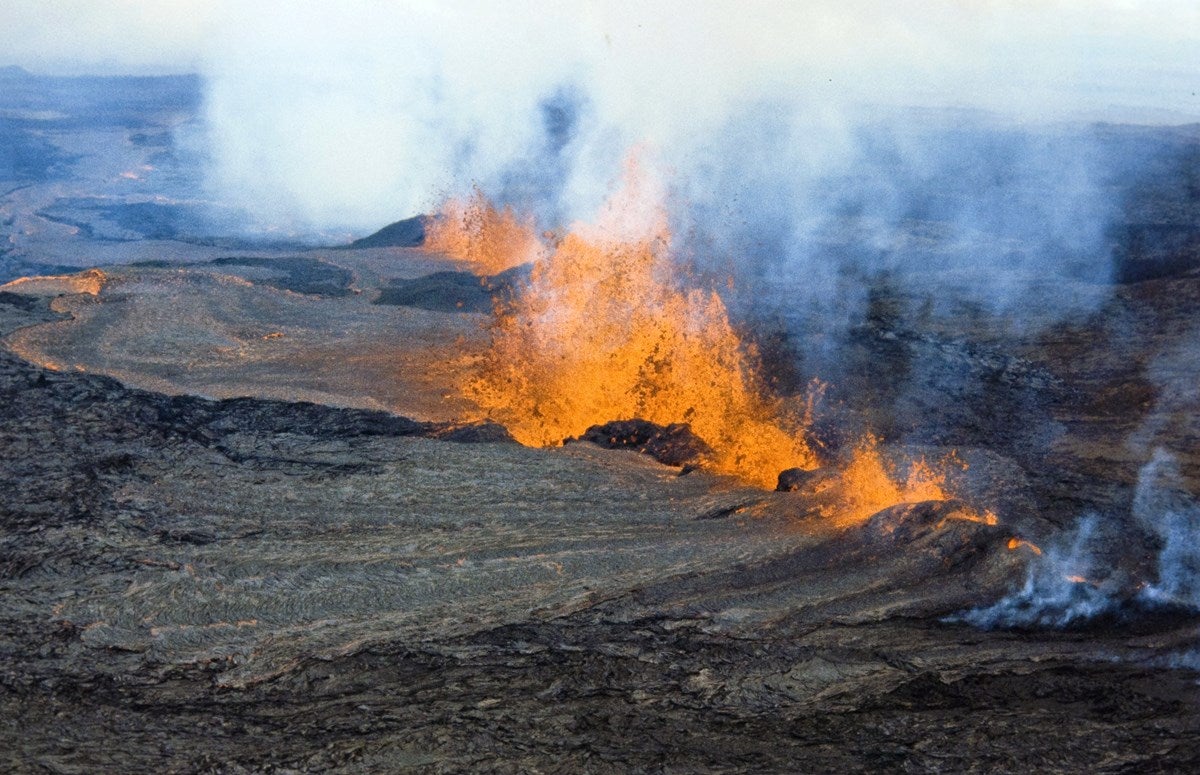
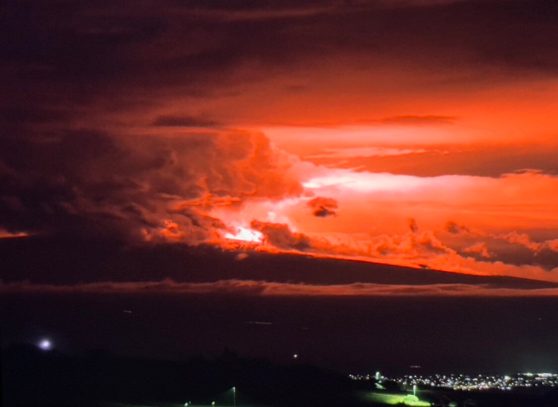
Hawaii’s National Weather Service branch has issued an ashfall warning after an eruption began on Mauna Loa, the largest volcano on Earth, on the state’s Big Island.
The eruption, the volcano’s first in nearly four decades, has triggered dozens of earthquakes of more than 2.5 magnitudes on the Richter scale, one of them clocking in at 4.2.
According to the Hawaiian Volcano Observatory, the eruption began at approximately 11.30pm Hawaii time on Sunday night. The service warned that “winds may carry volcanic gas and possibly fine ash and Pele’s Hair downwind”.
So far, the service has said that lava flows “are contained within the summit area and are not threatening downslope communities”, but also warned that the early stages of eruption can be highly changeable, with lava flows prone to changing rapidly.
This comes after a series of earthquakes rattled beneath Mauna Loa, leaving geologists to warn that it’s in a “state of heightened unrest” ahead of the eruption.


News of the increased seismic activity in October prompted the National Park Service to close access to the summit to climbers and tourists, a move that the agency said at the time was “a precautionary measure”.
On 27 October, the Hawaii Emergency Management Agency issued its first news release on the Mauna Loa unrest, noting that while the seismic activity is concerning for residents there are currently “no signs an eruption is imminent”.
Following the eruption overnight on 28 November, the Hawaiian Volcano Observatory said that “if the eruption remains in Moku‘āweoweo, lava flows will most likely be confined within the caldera walls. However, if the eruptive vents migrate outside its walls, lava flows may move rapidly downslope”.
Talmadge Magno, the Hawai‘i County civil defence administrator said last month that the seismic activity was a reminder “to take this opportunity to register for county emergency alert messages and prepare or review their plans to be ready for any disaster”.
The civil defence agency has been holding meetings across the island in an effort to educate residents about how to be prepared for a possible emergency, which includes recommendations like equipping their homes with a “go bag” with food.
“Not to panic everybody, but they have to be aware of that you live on the slopes of Mauna Loa. There’s a potential for some kind of lava disaster,” Mr Magno said last month, noting that the volcano makes up 51 per cent of the island’s landmass.
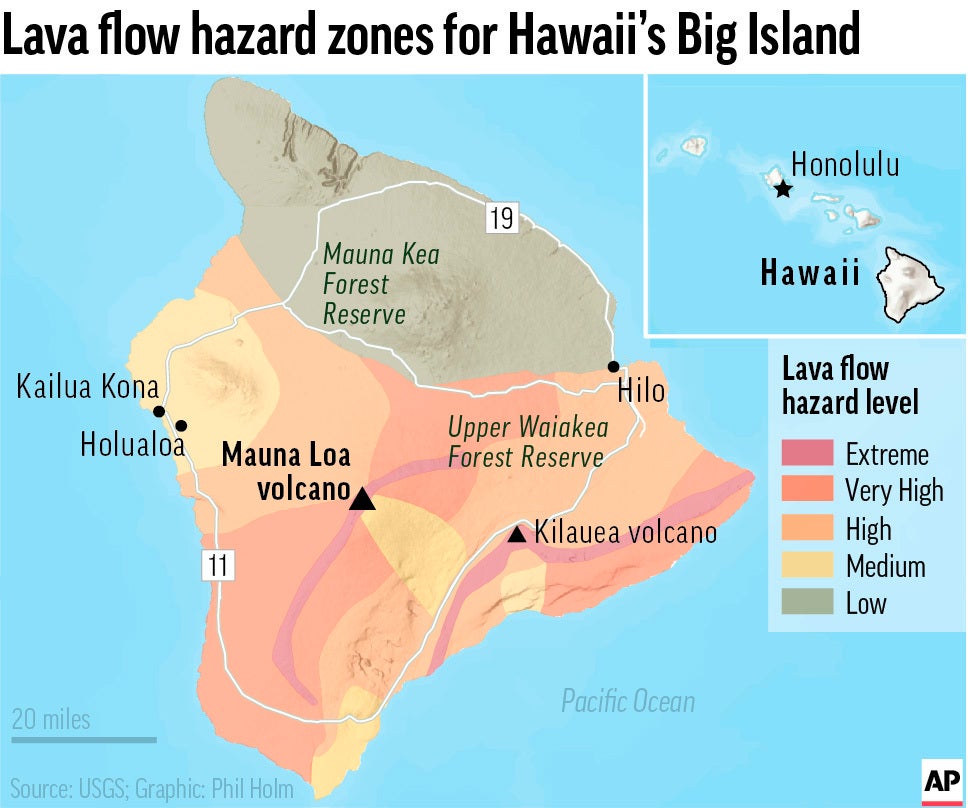
What is Mauna Loa?
In addition to Mauna Loa, Hawaii’s big island is made up of four major volcanoes: Kilauea, Mauna Kea, Hualalai and Kohala. Mauna Loa is by far the largest of the group and also holds the record among active volcanoes on the planet for being the biggest.
Mauna Loa – aptly named “Long Mountain” – stretches 13,679 feet into the air above sea level where it covers half of the island’s length at 60 miles long and 30 miles wide. The summit caldera, called Mokuaweoweo, is three miles long.
When did Mauna Loa last erupt?
The sky-scraping formation has been relatively quiet over the past few decades, as scientists celebrated the 30th anniversary of its last eruption on 25 March 2014.
Though the last one occurred in 1984, eruptions at Mauna Loa have been occurring for generations.
Since 1832, there have been 39 eruptions documented while the USGS estimates that – on average – one has occurred every six years over the past 3,000 years.
When did the new activity begin?
Warnings began to be issued part way through September when geologists began to record an uptick in the number of earthquakes trembling below its surface. For a typical day in mid-September, the site was experiencing approximately 20 quakes a day, but that number shifted up to 40 by the beginning of October.
In response to this shift in seismic activity, the US Geological Survey Hawaiian Volcano Observatory updated its advisory level from green to yellow out of precaution for the volcano’s “heightened unrest”.
In this four-tier advisory system, green is the lowest and equates to normal activity; yellow intimates that the “volcano is exhibiting signs of elevated unrest above known background activity”; orange is watch and means that there is “escalating unrest with increased potential of eruption”; and red means an eruption is “imminent, underway, or suspected”.
Is it erupting now?
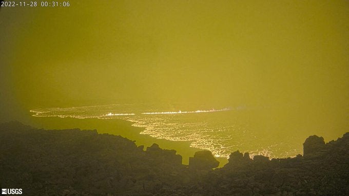
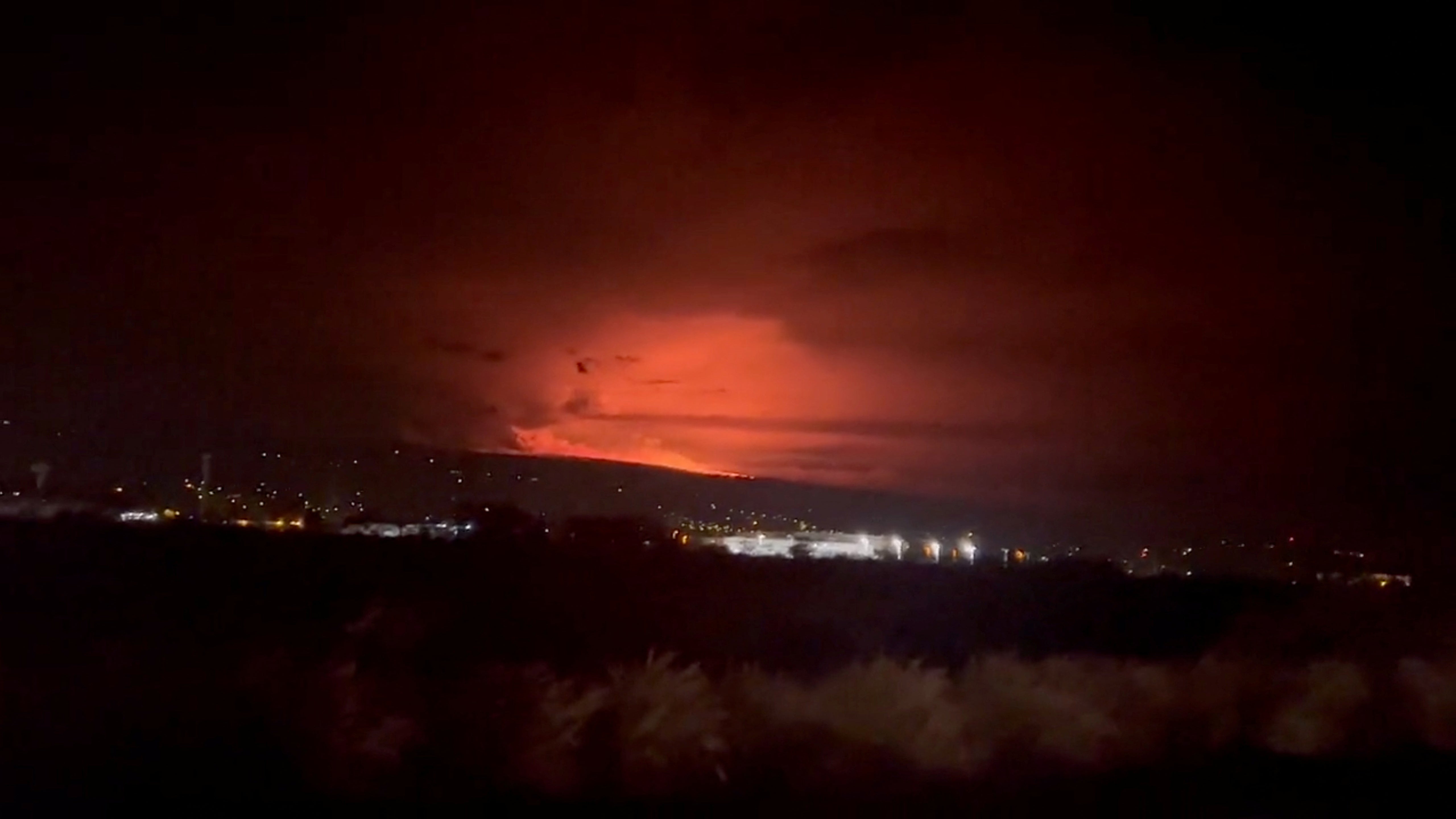
At 7.20am local time on Monday, the USGS said that “the eruption of Mauna Loa has migrated from the summit to the Northeast Rift Zone where fissures are feeding several lava flows. HVO staff on an overflight at approximately 6:30 a.m. HST confirmed fissures at high elevations within Hawai‘i Volcanoes National Park are feeding lava flows upslope of the Mauna Loa Weather Observatory”.
“Lava flows are not threatening any downslope communities and all indications are that the eruption will remain in the Northeast Rift Zone. Volcanic gas and possibly fine ash and Pele’s Hair may be carried downwind,” the agency said, adding that residents should follow guidance from Hawai‘i County Civil Defense.
Pele’s Hair is the name for thin strands of glass fibres formed during some eruptions. The National Park Service warns that the fibres, which are light enough to be carried on strong winds, are sharp enough to embed themselves in human skin and eyes.
“Based on past events, the early stages of a Mauna Loa rift zone eruption can be very dynamic, and the location and advance of lava flows can change rapidly,” the USGS added.
What’s causing the increase in seismic activity?
Ahead of the 1975 eruption at the site, earthquakes topped out at more than 1,000 per day, while during the last eruption in 1984, scientists were recording hundreds per day in the weeks leading up to its final blow.
Geologists from the USGS Hawaiian Volcano Observatory explained in an update provided on 16 October that the cause behind the increased activity is stemming from “renewed input of magma” into the volcano’s reservoir system, which is described by the USGS as the region beneath the vent of a volcano where molten rock (magma) is stored prior to eruption. Also known as a magma storage zone or magma reservoir.
“As the reservoir expands it is triggering small earthquakes directly beneath Mokuaweoweo caldera and in a region just to the northwest of the caldera,” the agency said in an update at the time.
Some of the signals that experts rely on to provide them with estimations are the earthquakes themselves, in addition to satellite imagery, temperature data and visual observation.
For instance, one such device that measures important visual elements are tiltmeters, which are installed to measure the tilt on the ground surface of a volcano.
Warnings leading up to the latest eruption were first issued in September, with geologists noting an uptick in the frequency of earthquakes around the volcano. By the start of October, there were around 40 being deteced every day, resulting in the warning level for the volcano being upgraded. The alert is now at the highest level.
What risk is posed to Hawaii residents?
Residents of the area around the eruption have been warned that up to a quarter-inch of ash may fall on some areas. Those with respiratory illnesses have been told to remain indoors, while all others are advised to wear face coverings when outdoors.
Since 1868, it has produced large amounts of basalt – which is the very fluid, dark lava – that have reached the shores of the ocean eight times.
When it erupted last in 1984, its molten flow came within 7.2 km of Hilo, the largest urban centre on the island with approximately 44,000 residents.
“Residents at risk from Mauna Loa lava flows should review preparedness and refer to Hawai‘i County Civil Defense information for further guidance,” the USGS said Monday morning.
Join our commenting forum
Join thought-provoking conversations, follow other Independent readers and see their replies
Comments
Bookmark popover
Removed from bookmarks