Before and after satellite images reveal shocking extent of tornadoes’ destruction
More than 80 people are feared dead and hundreds of thousands of customers are without power
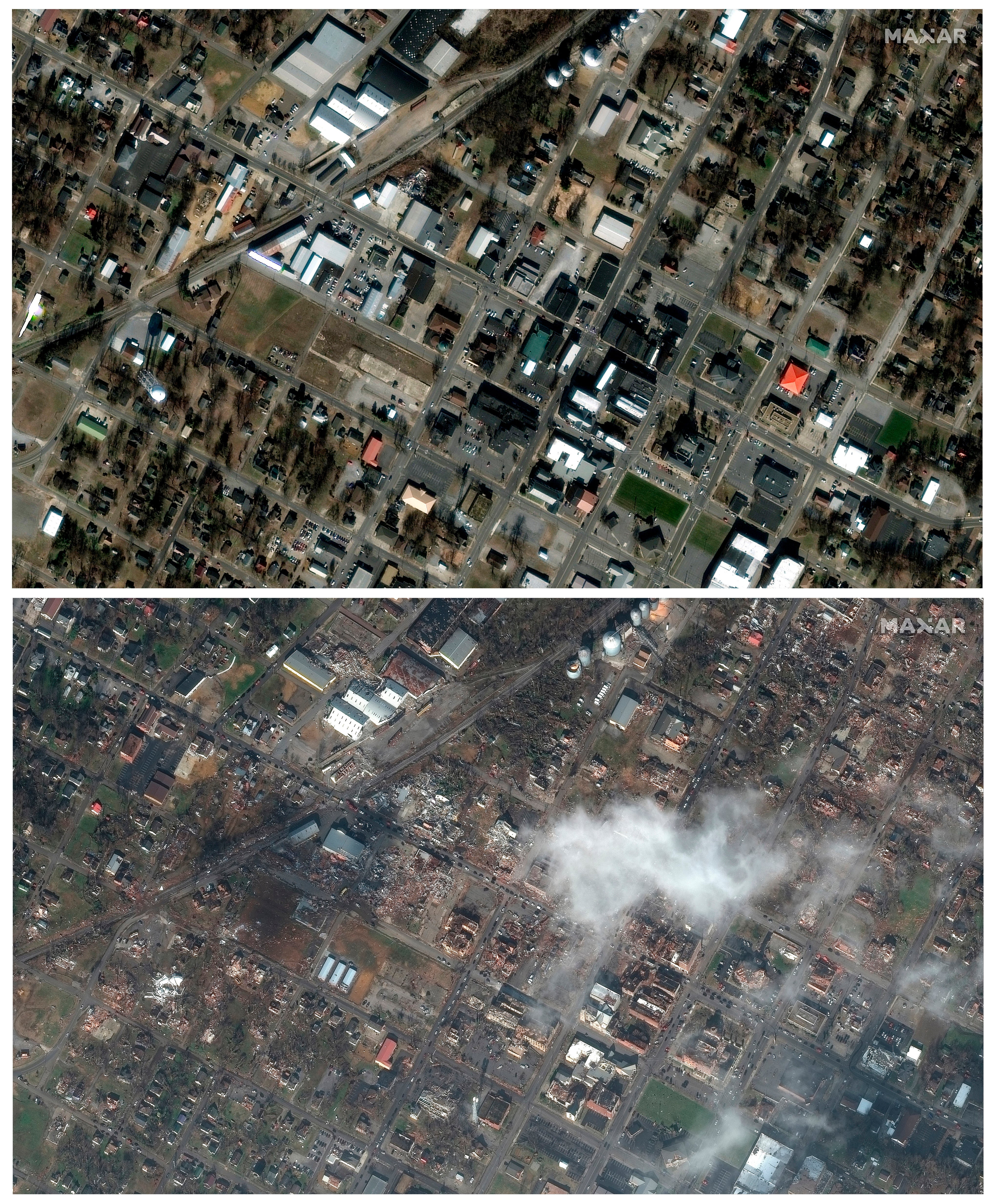
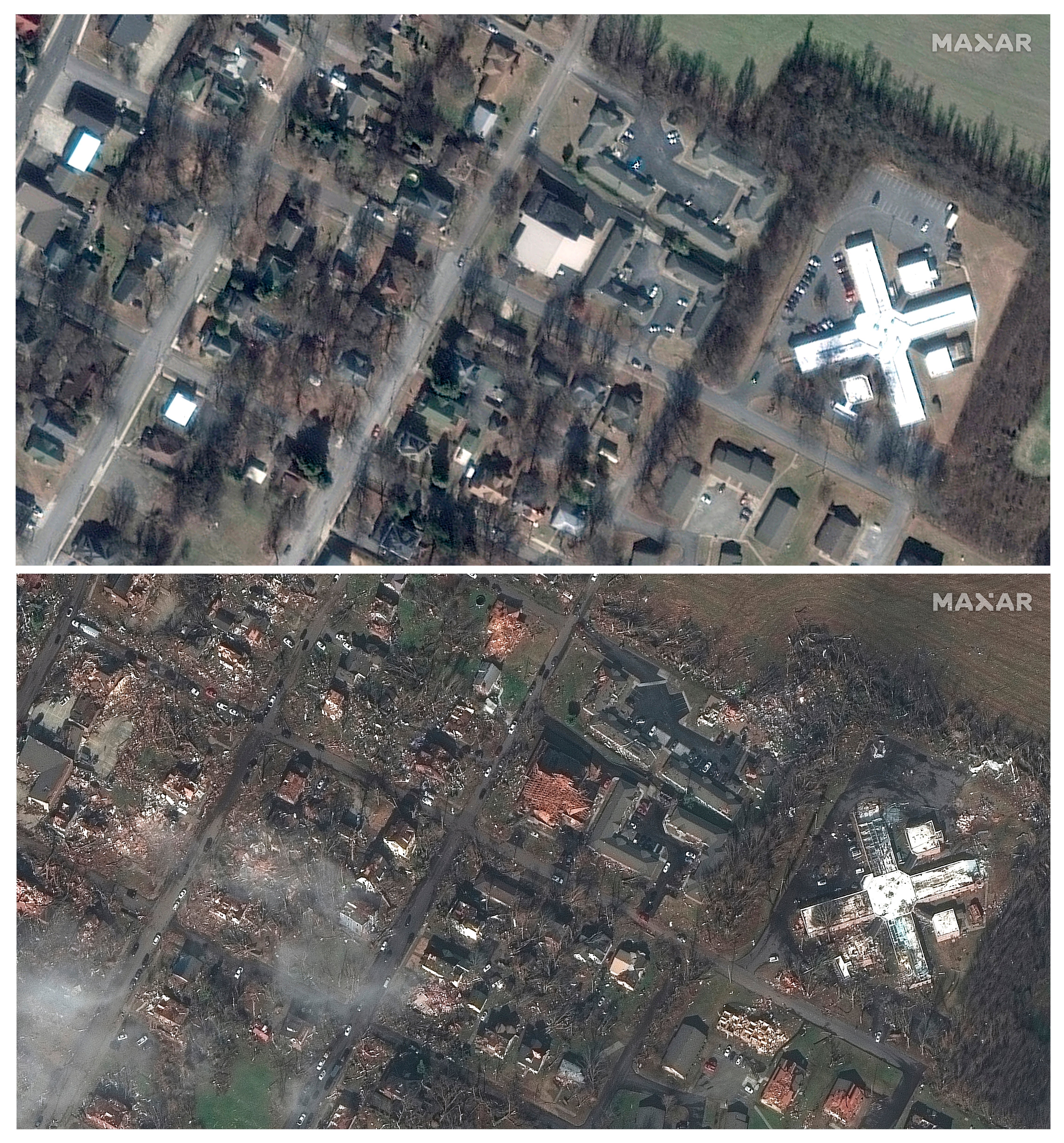
Satellite images of the tornadoes that swept through six states in the US show the extent of damage and destruction they left in their wake.
Scores are feared dead across the midwest and the southern US following the string of strong nocturnal tornadoes overnight between Friday and Saturday.
The winter storm began in the early hours on Friday and tore through tore through Arkansas, Illinois, Kentucky, Mississippi, Missouri and Tennessee.
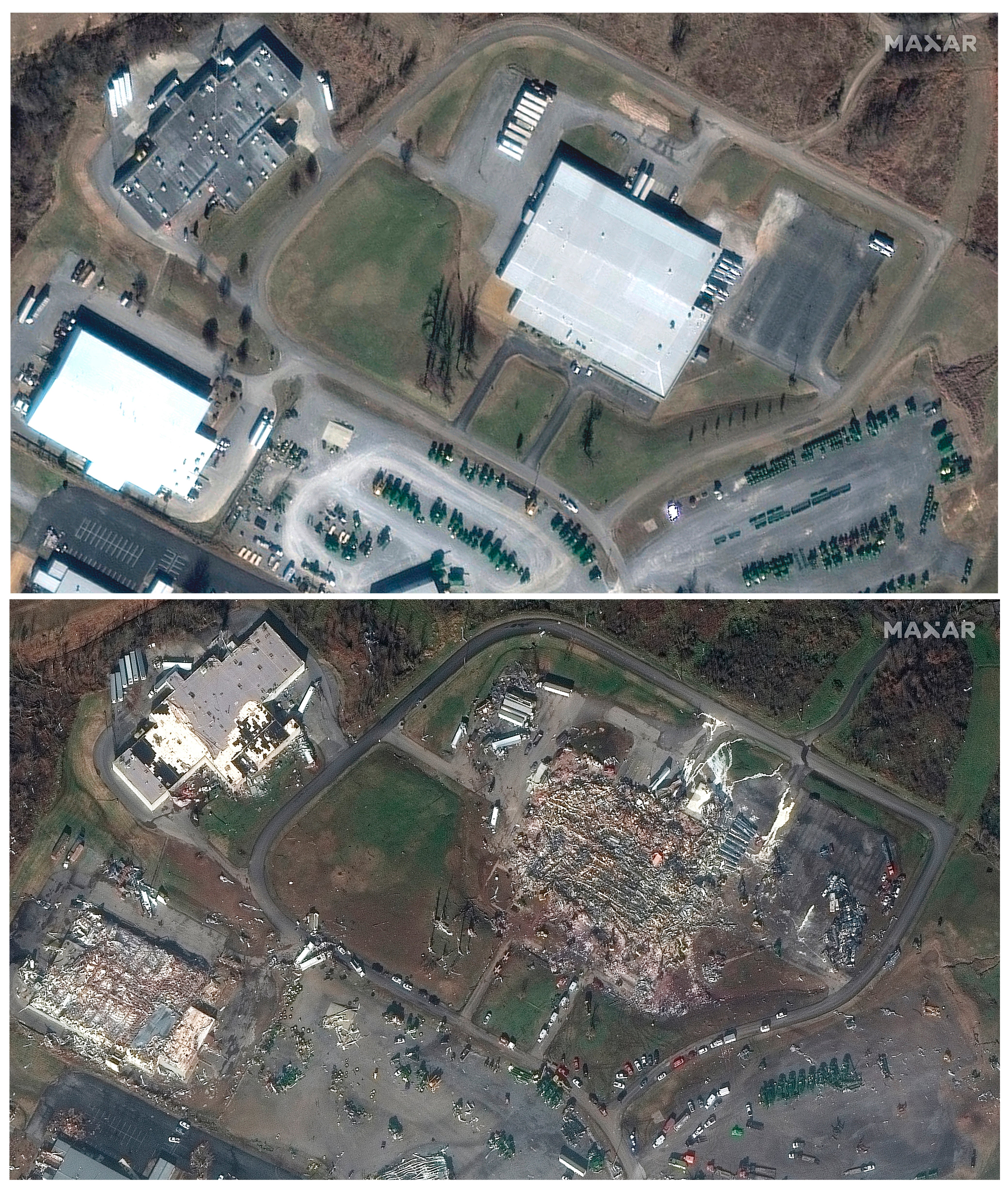
In Illinois, an Amazon warehouse, where the roof and a wall the length of a football field caved in, collapsed, killing at six people.
Images provided by Colorado-based space technology firm Maxar Technologies showed the destruction of the warehouse in Edwardsville.
A nursing home in Monette, Arkansas, was also hit by a Tornado, killing a 94-year-old man. In Tennessee, four people were reported dead. A candle factory in Kentucky was completely devastated by the tornado, leaving eight employees dead and six still missing.
Kentucky governor Andy Beshear said on Sunday that the estimated death toll might cross 75. He said more than 70 people could have died after “one of the toughest nights in Kentucky history”.
Rescue teams are still combing through the devastation and wreckage left by the tornadoes and are looking for any survivors. On Sunday, officials said the death toll was more than 80.


US President Joe Biden said on Saturday that he had approved an emergency declaration for Kentucky, allowing federal resources to flow into the state.
“We’re going to get through this, and we’re going to get through this together. The federal government is not going to walk away,” Joe Biden said at a press conference.
The tornadoes that tore across the US this weekend may have produced the single longest twister in US history. The cluster, now being called the “Quad-State Tornado,” spawned more than 30 different tornadoes that traveled across six different states, including one tornado that may have traveled more than 230 miles alone.
The National Weather Service is now conducting ground surveys to analyse the historic storms and their record-breaking potential.
Researchers have suggested that in recent years, tornadoes seem to be occurring in greater “clusters”, according to The New York Times.
It has also been noticed that the tornado alley in the Great Plains — where most tornadoes occur — appear to be moving eastward.
According to PowerOutage.us, an ongoing project created to track, record, and aggregate power outages across the United States, hundreds of thousands of customers in Kentucky, Tennessee, Michigan and New York are without power.
Join our commenting forum
Join thought-provoking conversations, follow other Independent readers and see their replies
Comments
Bookmark popover
Removed from bookmarks