For free real time breaking news alerts sent straight to your inbox sign up to our breaking news emails Sign up to our free breaking news emails
What are we now sure of?
That a Malaysia Airlines Boeing 777, flight number MH370, departed Kuala Lumpur airport at 12.41am local time on Saturday 8 March. There were 227 passengers and 12 crew on board. It flew north-north-east towards its intended destination, Beijing. But before it reached the east coast of Malaysia, the ACARS data-transmission system was disabled, Shortly afterwards the transponder, which provides identification data to ground radar and also handles the aircraft’s “hi-jack alarm,” was switched off. The last voice communication was when Malaysian air-traffic controllers handed over the flight to their Vietnamese counterparts. All normal channels of contact had ended by 2.40am. However, it has now emerged that flight MH370 was deliberately diverted – and the jet was still flying seven-and-a-half-hours after take-off.
How do we know it was still airborne?
One communication channel remained open. Inmarsat operates communications satellites for navigation by shipping and aviation. A satellite over the Indian Ocean sent hourly interrogations to the aircraft. Electronic responses were sent automatically, confirming the aircraft was still in flight. The final satellite contact was at 8.11am, five-and-a-half hours after the jet’s last known position. During that time, the aircraft could have flown 3,000 miles at its normal cruising speed.
A map has been issued using data from the satellite. Does it show the flight path the aircraft may have followed?
No, far from it. It shows only that the extent of possible locations of the aircraft when it sent the last “ping”.
Map constructed using satellite data showing extent of possible locations
Why 'two corridors'?
The calculation has been made from the distance of the plane from a geo-stationary satellite 22,250 miles above the Indian Ocean, which produces a circle with a radius of about 5,000 miles. Using other data, the possible locations have been narrowed down to a northern arc and a southern arc of this circle. The northern arc runs from northern Thailand via south-west China to southern Kazakhstan. The southern arc extends south from western Java into Indian Ocean, passing about 1,000 miles from the coast of Western Australia.
Does that mean the aircraft is somewhere along those lines?
Not necessarily. The last “ping” was at 8.11am, Malaysian time. Another signal was sent out by satellite one hour later, and no response was received. But in that time, the jet could have travelled up to 500 miles in any direction – subject to having sufficient fuel.
Show all 115 1 /115The search for missing Malaysia Airlines plane The search for missing Malaysia Airlines plane MH370 search A Chinese People's Liberation Army Air Force Illyushin Il-76 flies over on its final approach to Perth International Airport having just completed a search mission trying to locate missing Malaysia Airways flight MH370
The search for missing Malaysia Airlines plane MH370 search A US Navy P-8 Poseidon aircraft flies out from Perth International Airport to help in the search for missing Malaysia Airlines flight MH370
The search for missing Malaysia Airlines plane MH370 search A Japanese P3 Orion takes off from RAAF Pearce as part of a search to locate missing Malaysia Airways Flight MH370 on April 15, 2014 in Perth, Australia. The search continues as an oil slick has been discovered in the search area in the Indian Ocean
The search for missing Malaysia Airlines plane Press Conference Malaysian Defence Minister and acting Transport Minister Hishammuddin Hussein speaks during a media conference at the 14th Defence Services Asia exhibition in Kuala Lumpur
The search for missing Malaysia Airlines plane Chinese Relatives Relatives of Chinese passengers onboard the missing Malaysia Airlines 370 walk out from a video-conference with Malaysian officials in protest at the difficulties of communications in Beijing
The search for missing Malaysia Airlines plane MH370 search Crew members aboard the Australian Navy ship 'HMAS Success' work as linesmen as they conduct a refuelling in the southern Indian Ocean in order to continue their search for the missing Malaysia Airlines Flight MH370
The search for missing Malaysia Airlines plane MH370 search Phoenix International workers Chris Minor (R) and Curt Newport inspect the U.S. Navyís Bluefin 21 autonomous underwater vehicle (AUV) before deployment in the southern Indian Ocean to look for the missing Malaysia Airlines flight MH370
The search for missing Malaysia Airlines plane MH370 search Operators aboard ADF Ocean Shield move US Navys Bluefin-21 into position for deployment in the search of missing Malaysia Airlines flight MH370. Using side scan sonar, the Bluefin will descend to a depth of between 4,000 and 4,500 meters, approximately 35 meters above the ocean floor and will spend up to 16 hours at this depth collecting data, before potentially moving to other likely search areas.
The search for missing Malaysia Airlines plane MH370 search HMAS Success conducts a Replenishment at Sea with United States Navy Ship (USNS) Cesar Chavez, as USNS Cesar Chavez's helicopter, a Super Puma, conducts a Vertical Replenishment at Sea onto HMAS Success' flight deck, during Operation in the Southern Indian Ocean, in search of missing Malaysia Airlines Flight MH370
The search for missing Malaysia Airlines plane MH370 search HMA Ships Success and Toowoomba conduct a Replenishment at Sea with United States Navy Ship (USNS) Cesar Chavez, whilst on Operation Southern Indian Ocean, in search of missing Malaysia Airlines Flight MH370
The search for missing Malaysia Airlines plane MH370 search Survey ship HMS Echo, as a Lockheed P-3 Orion flies overhead, in the southern Indian Ocean helping in the underwater search for the flight recorder from the missing Malaysia Airlines flight MH370
The search for missing Malaysia Airlines plane MH370 search Crew on board survey ship HMS Echo in the southern Indian Ocean helping in the underwater search for the flight recorder from the missing Malaysia Airlines flight MH370
The search for missing Malaysia Airlines plane MH370 search The hunt for the black box from missing flight is proving "challenging", but the crew of a Royal Navy ship are working 24/7 in their efforts to help the search, their captain has said
The search for missing Malaysia Airlines plane MH370 search Seen from the Royal New Zealand Airforce (RNZAF) P-3K2-Orion aircraft, a RHIB (rigid hull inflatable boat) is deployed from the Australian ship HMAS Perth after it was guided into position by the RNZAF aircraft to recover a red object during the search for missing Malaysia Airlines flight MH370 in flight over the Indian Ocean off the coast of Perth
The search for missing Malaysia Airlines plane MH370 search Co-pilot and Squadron Leader Brett McKenzie of the Royal New Zealand Airforce (RNZAF) P-3K2-Orion aircraft, helps to look for objects during the search for missing Malaysia Airlines flight MH370 in flight over the Indian Ocean off the coast of Perth
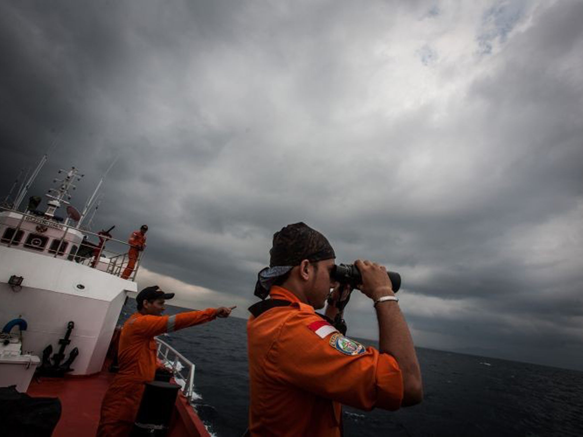
The search for missing Malaysia Airlines plane MH370 search Gunner Richard Brown (L) of Transit Security Element looks through binoculars as he stands on lookout with other crew members aboard the Australian Navy ship HMAS Perth as they continue to search for missing Malaysian Airlines flight MH370
The search for missing Malaysia Airlines plane MH370 search Crew aboard the Australian Navy ship HMAS Perth watch lines as they are refuelled by HMAS Success during a replenishment at sea, as they continue to search for missing Malaysian Airlines flight MH370
The search for missing Malaysia Airlines plane MH370 search A submarine built by Bluefin Robotics is lowered into the water by systems engineer Cheryl Mierzwa in Quincy. Bluefin Robotics shipped a version of their submarine to help locate the missing Malaysian Airlines Flight 370, by using its side-scan sonar
The search for missing Malaysia Airlines plane MH370 search Seaman Georgina Brooks signals HMAS Success for a replishement at sea (RAS) on the starboard bridge wing of HMAS Perth as part of Operation Southern Indian Ocean
The search for missing Malaysia Airlines plane MH370 search A Royal Australian Air Force AP-3C Orion fly past the Australian Defence Vessel Ocean Shield on a mission to drop sonar buoys to assist in the acoustic search in support of Operation Southern Indian Ocean
The search for missing Malaysia Airlines plane MH370 search A fast response craft from Australian Defence Vessel Ocean Shield tows Able Seaman Clearance Diver Michael Arnold as he searches the ocean for debris in the search zone in the southern Indian Ocean for the missing Malaysian Airlines flight MH370
The search for missing Malaysia Airlines plane MH370 search Crew members ride a fast response craft from the Australian Defence Vessel Ocean Shield as they continue to search for debris in the southern Indian Ocean for the missing Malaysian Airlines flight MH370
The search for missing Malaysia Airlines plane Chinese Relatives A family member cries as she and other relatives pray during a candlelight vigil for passengers onboard the missing Malaysia Airlines Flight MH370 at Lido Hotel in Beijing
The search for missing Malaysia Airlines plane MH370 search A Royal New Zealand Air Force (RNZAF) Flight Engineer conducts a pre-flight check on a P-3K2 Orion's wingspan prior to its departure from RAAF Base Pearce, located near Perth, as they prepare to participate in the search in the southern Indian Ocean for the missing Malaysian Airlines flight MH370
The search for missing Malaysia Airlines plane MH370 search The Bluefin 21 Artemis autonomous underwater vehicle (AUV) being hoisted back on board the Australian navy vessel Ocean Shield after successful buoyancy testing in the Indian Ocean. Joint Task Force 658 is supporting Operation Southern Indian Ocean, searching for the missing Malaysia Airlines flight MH370
The search for missing Malaysia Airlines plane MH370 search Commander James Lybrand (R), Mission Commander on the Australian Defence Vessel Ocean Shield, with Captain Nick Woods (C), master of the ship during the search for missing Malaysia Airlines flight MH370 in the southern Indian Ocean
The search for missing Malaysia Airlines plane MH370 search Crew on the Royal Malaysian Navy ship KD Lekiu looking at the HMAS Success as the ships complete a replenishment at sea whilst taking part in the search for missing Malaysia Airlines flight MH370 in the southern Indian Ocean
The search for missing Malaysia Airlines plane MH370 search Australian Defence shows a helicopter leaving the flight deck of HMAS SUCCESS as it completes a replenishment at Sea with Royal Malaysian Navy frigate KD Lekiu whilst taking part in the search for missing Malaysia Airlines flight MH370 in the southern Indian Ocean
The search for missing Malaysia Airlines plane MH370 search Australia's Defence Department shows Lieutenant Kedar Shah (R) presenting the commanding officer (L-name unavailable) of the Royal Malaysian Navy ship KD Lekiu with a plaque on behalf of the HMAS SUCCESS after both ships completed a "Replenishment at Sea" whilst taking part in the search for missing Malaysia Airlines flight MH370 in the southern Indian Ocean
The search for missing Malaysia Airlines plane MH370 search The towed pinger locator is deployed off the Australian Defence Vessel Ocean Shield, in the Indian Ocean
The search for missing Malaysia Airlines plane MH370 search (L-R) Mike Unzicker, Andrew Vachon (Bluefin), Charlie Kapica, Chris Minor and Chris 'Sharkie' Moore (Phoenix Team Lead), personel from Phoenix International and Blue Fin with the towed pinger locator (TPL-25) on the deck of Australian Defence Vessel Ocean Shield, in the Indian Ocean
The search for missing Malaysia Airlines plane MH370 search A S-70B-2 Seahawk helicopter from Australian Navy ship HMAS Toowoomba unloads supplies on the deck of HMAS Success in the southern Indian Ocean during the continuing search for the missing Malaysian Airlines flight MH370
The search for missing Malaysia Airlines plane MH370 search HMAS Success readying a Rigid Hull Inflatable Boat (RHIB) near dusk following a reported sighting of potential debris in the vicinity during the search for missing Malaysia Airlines flight MH370 in the southern Indian Ocean
The search for missing Malaysia Airlines plane Press Conference Angus Houston, head of the Joint Agency Coordination Centre leading the search for missing Malaysia Airlines flight MH370, displays a graphic of the search area during a media conference in Perth
The search for missing Malaysia Airlines plane Malaysian Buddhists offer prayers Malaysian Buddhists offer prayers for passengers onboard missing Malaysia Airlines (MAS) flight MH370 in Kuala Lumpur
The search for missing Malaysia Airlines plane Chinese Relatives Chinese relatives of the passengers on missing Malaysian Airlines flight MH370 attend a special prayer at a Buddhist Temple in Petaling Jaya
The search for missing Malaysia Airlines plane Chinese Relatives Chinese relatives of passengers onboard the missing Malaysia Airlines Flight MH370 prepare to recite prayers for her loved ones at Fo Guang Shan Buddhist temple in Petaling Jaya
The search for missing Malaysia Airlines plane Chinese Relatives Chinese relatives of the passengers on missing Malaysian Airlines flight MH370 speak to media after holding special prayers at a Buddhist Temple in Petaling Jaya, Malaysia
The search for missing Malaysia Airlines plane MH370 search South Korea's Navy Lieutenant Commander Oh Kang-min (R) is pictured wearing a Malaysia Airlines flight MH370 search and rescue team patch on his sleeve as he waits to meet Australia's Prime Minister Tony Abbott in front of a Royal Australian Air Force AP-3C Orion aircraft at RAAF Base Pearce near Perth
The search for missing Malaysia Airlines plane MH370 search Australian Prime Minister Tony Abbott is guided around a Royal Australian Air Force AP-3C Orion aircraft by Australian Air Force Group Commander Craig Heap (2nd L) during his visit to RAAF Base Pearce in Perth
The search for missing Malaysia Airlines plane MH370 search Royal Australian Air Force (RAAF) Warrant Officer Ron Day looks out from the flight deck of a AP-3C Orion as he flies over the southern Indian Ocean
The search for missing Malaysia Airlines plane MH370 search Flight Lieutenant Jayson Nichols looks at a map as he flies aboard a Royal Australian Air Force AP-3C Orion aircraft searching for missing Malaysian Airlines flight MH370 over the southern Indian Ocean
The search for missing Malaysia Airlines plane MH370 search AP-3C Orion during a search mission for missing Malaysia Airline flight MH370 in the Southern Indian Ocean
The search for missing Malaysia Airlines plane MH370 search A Royal Australian Air Force AP-3C Orion returns to RAAF base Pearce from a search for Malaysian Airlines flight MH370 over the southern Indian Ocean
The search for missing Malaysia Airlines plane Malaysia Press Conference Malaysian Defense Minister and acting Transport Minister Hishammuddin Hussein (L) and Malaysia's Department Civil Aviation Director General, Azharuddin Abdul Rahman (R) show pictures of possible debris during a media conference in Kuala Lumpur
The search for missing Malaysia Airlines plane Chinese Relatives Chinese relatives of the flight MH370 gesture in protest as they sit on the bus waiting to go to the Malaysian embassy in Beijing. Hundreds of protesters, including many relatives of missing flight MH370 passengers, marched on the Malaysian Embassy in Beijing demanding answers from Malaysian authorities about the fate of the flight
The search for missing Malaysia Airlines plane Indonesian Relatives Suwarni the mother of Sugianto Lo, who was onboard the Malaysia Airlines plane MH370 with his wife Vinny, shows her son's family portraits at her residence in Medan, North Sumatra
The search for missing Malaysia Airlines plane Malaysia Press Conference Malaysia's Prime Minister Najib Razak (C) makes an announcement on the latest development on the missing Malaysia Airlines MH370 plane
Reuters
The search for missing Malaysia Airlines plane Chinese Relatives Chinese relatives of passengers onboard the missing Malaysia Airlines plane, flight MH370, shout in protest as they march towards the Malaysia embassy in Beijing
AP
The search for missing Malaysia Airlines plane Missing flight MH370 Distraught relatives of missing passengers on Malaysia Airlines flight MH370 weep after hearing the news that the plane plunged into Indian Ocean
AFP/Getty Images
The search for missing Malaysia Airlines plane Search for debris Graphic shows the latest search efforts of planes scouring the southern Indian Ocean for debris
The search for missing Malaysia Airlines plane Satellite images The satellite picture from CCTV NEWS, the English news channel of China Central Television
CCTV News
The search for missing Malaysia Airlines plane MH370 search Acting Australian Prime Minister Warren Truss walks with RAAF Wing Commander James Parton and RAAF Group Captain Craig Heap after inspecting a P-3 Orion aircraft
Paul Kane/Getty Images
The search for missing Malaysia Airlines plane MH370 search Flight Leuitenant Neville (Smokey) Dawson discusses the search area with Flight Officer Brittany Sharpe on board a Royal Australian Airforce AP-3C Orion
Justin Benson-Cooper - Pool/Getty Images
The search for missing Malaysia Airlines plane MH370 search The Australian Maritime Safety Authority map of the planned search area for missing Malaysian Airlines Flight MH370 on March 21, 2014
AMSA/Getty Images
The search for missing Malaysia Airlines plane MH370 search Royal Australian Air Force Loadmasters, Sergeant Adam Roberts (L) and Flight Sergeant John Mancey (R), preparing to launch a Self Locating Data Marker Buoy from a C-130J Hercules aircraft in the southern Indian Ocean as part of the Australian Defence Force's assistance to the search for Malaysia Airlines flight MH370
The search for missing Malaysia Airlines plane MH370 search Royal Australian Air Force (RAAF) Flight Leiutenant Neville Dawson (C) monitors his instruments aboard the Royal Australian Airforce AP-3C Orion, some 2,500 km southwest of Perth, over the Indian Ocean
The search for missing Malaysia Airlines plane Missing Malaysian airliner Malaysian Defence Minister and acting Transport Minister Hishamuddin Hussin (2-L), Malaysia's special envoy to China , Ong Ka Ting (2-R), Malaysian Airlines CEO Group Ahmad Jauhari Yahya (R) and Malaysia's Department of Civil Aviation Director General, Azharuddin Abdul Rahman (L) during a media conference at a hotel near Kuala Lumpur International Airport, Sepang, Selangor, Malaysia
The search for missing Malaysia Airlines plane Missing Malaysian airliner Maintenance personnel from No.10 Squadron, No. 92 Wing, conduct post-flight checks after the arrival of an AP-3C Orion to Royal Australian Air Force Base Pearce, Western Australia, following a sortie in support of the Australian Maritime Safety Authority-led search for Malaysia Airlines Flight MH370 in the Indian Ocean
The search for missing Malaysia Airlines plane Missing Malaysian airliner Royal Australian Airforce (RAAF) Flt. Lt Russell Adams (C), Captain of an RAAF AP-3C Orion from 92 Wing gives a brief press conference after arriving back at RAAF base Pearce in Perth, Western Australia after completing a search mission for flight MH370
The search for missing Malaysia Airlines plane Missing Malaysian airliner Royal Australian Air Force pilot, Flight Lieutenant Russell Adams from the tenth Squadron, steering his AP-3C Orion over the Southern Indian Ocean during the search for missing Malaysian Airlines flight MH370
EPA
The search for missing Malaysia Airlines plane Missing Malaysian airliner Royal Australian Air Force (RAAF) Warrant Officer Ron Day, flight engineer from No.10 Squadron, No. 92 Wing, conducting flight checks on the engine of an AP-3C Orion aircraft at RAAF Base Pearce, Western Australia, prior to participating in the search for Malaysia Airlines Flight MH370
The search for missing Malaysia Airlines plane Missing Malaysian airliner Family members of missing Malaysia Airlines flight MH370 passengers arrive for a briefing on the current situation at a hotel where other passenger's relatives are in Cyberjaya, outside Kuala Lumpur
Reuters
The search for missing Malaysia Airlines plane Missing Malaysian airliner Satellite images reveal the large lumps of floating debris
Reuters
The search for missing Malaysia Airlines plane Missing Malaysian airliner A woman is dragged away by the authorities as she screams
EPA
The search for missing Malaysia Airlines plane Missing Malaysian airliner Crew members look outside windows from a Malaysian Air Force CN235 aircraft during a search and rescue (SAR) operation to find the missing Malaysia Airlines flight MH370 plane over the Strait of Malacca
AFP/Getty
The search for missing Malaysia Airlines plane Missing Malaysian airliner A message for pilot Zaharie Ahmad Shah, captain of the missing Malaysia Airlines Flight MH370, is pictured at an event to express solidarity to the family members of passengers onboard the plane
Reuters
The search for missing Malaysia Airlines plane Missing Malaysian airliner Malaysian Defense Minister and acting Transport Minister Hishamuddin Hussin, right, and Malaysia's Department Civil Aviation Director General, Azharuddin Abdul Rahman, left, attend a press conference at Kuala Lumpur International Airport, Sepang, Selangor, Malaysia
EPA
The search for missing Malaysia Airlines plane Missing Malaysian airliner The search area has expanded massively to include the territory of a dozen countries
REUTERS
The search for missing Malaysia Airlines plane Missing Malaysian airliner Police drove to the residential compound in Malaysia where the missing plane's pilot Fariq Abdul Hami lives, according a guard and local reporters
EPA
The search for missing Malaysia Airlines plane Missing Malaysian airliner A Royal Malaysian Navy Fennec helicopter prepares to depart to aid in the search and rescue efforts for the missing Malaysia Airlines plane over the Straits of Malacca, Malaysia
The search for missing Malaysia Airlines plane Missing Malaysian airliner Taiwan has sent three coast guard patrol ships, several P-130 military transport planes and a frigate to join in the search, and will dispatch another frigate to join in the search
The search for missing Malaysia Airlines plane Missing Malaysian airliner Soldier discuss the search plan at the Pingtung Air Base in Pingtung County, southern Taiwan
The search for missing Malaysia Airlines plane Missing Malaysian airliner A soldier looking out for the missing Malaysia Airlines plane from a Taiwan Air Force C-130 military transport plane over the South China Sea
The search for missing Malaysia Airlines plane Missing Malaysian airliner Taiwan Navy's La Fayette-class frigate Cheng De prepare to leave Tsoying Naval Base in Kaohsiung, southern Taiwan
The search for missing Malaysia Airlines plane Missing Malaysian airliner Rescue members use binoculars to look for the missing Malaysia Airlines flight MH370
The search for missing Malaysia Airlines plane Missing Malaysian airliner An Indonesian air force personnel during a search mission for a Malaysian Airlines aircraft on board of a military surveillance airplane over the Malacca straits
The search for missing Malaysia Airlines plane Missing Malaysian airliner Commander Tan Sri Abdul Aziz Jaafar (L), Lieutenant General Dato' Sri Ackbal bin Hj Abdul Samad (2nd L), Malaysian Defence Minister, Minister of Defence & (Acting) Minister of Transport Dato' Seri Hishammuddin Hussein (2nd R), and Malaysian Defence Forces chief Tan Sri Zulkifeli Mohd Zin discuss their strategy during a search and rescue mission flight in Kuala Lumpur
The search for missing Malaysia Airlines plane Missing Malaysian airliner Vietnamese Navy's Deputy Commander Rear Admiral Le Minh Thanh (R) points at a map to show the area where Vietnam is conducting search activities for the missing Malaysia Airlines flight 370 in Phu Quoc island
The search for missing Malaysia Airlines plane Missing Malaysian airliner People from Vietnam tie messages expressing hope for family members and those on board the missing Malaysia Airlines flight MH370 in Kuala Lumpur
The search for missing Malaysia Airlines plane Missing Malaysian airliner Crew members of a Vietnamese Air Force helicopter walk upon returning from their search for the missing Malaysia Airlines flight MH370
The search for missing Malaysia Airlines plane Missing Malaysian airliner A Vietnamese Air Force helicopter lands at Ca Mau airport after searching for the missing Malaysia Airlines flight MH370
The search for missing Malaysia Airlines plane Missing Malaysian airliner The mother of missing Firman Chandra Siregar (R) is comforted by a relative as they wait for the news of the missing plane at their house in Medan, Indonesia
The search for missing Malaysia Airlines plane Missing Malaysian airliner Two men look out window inside a Vietnamese Air Force plane during search and rescue operations for a missing Malaysian Airlines flight, off Vietnam's Tho Chu island
The search for missing Malaysia Airlines plane Missing Malaysian airliner Ships are seen from a flying Soviet-made AN-26 of the Vietnam Air Force during a search operation for the missing Malaysia Airlines Boeing 777 over the South China Sea
The search for missing Malaysia Airlines plane Missing Malaysian airliner Chinese students hold up a signed banner calling for more help for relatives of victims from the missing Malaysia Airlines Boeing 777-200 plane in Beijing
The search for missing Malaysia Airlines plane Missing Malaysian airliner Cameramen and photographers taking aerial pictures during a search flight over the southern seas off the coast of Vietnam for Malaysia Airlines flight MH370
The search for missing Malaysia Airlines plane Missing Malaysian airliner A journalist takes pictures of an ethnic Tibetan delegate after she was given a placard to hold outside the Great Hall of the People before the third plenary session of the National People's Congress (NPC) in Beijing. The placard reads 'Pray for the passengers of Malaysia Airlines flight MH370'
The search for missing Malaysia Airlines plane Missing Malaysian airliner Personnel from the Republic of Singapore Air Force (RSAF) scanning the seas about 140 nautical miles north-east of Kota Baru, Malaysia, for any signs of the Malaysia Airlines plane which went missing
The search for missing Malaysia Airlines plane Missing Malaysian airliner Oil slicks seen from the Republic of Singapore Air Force (RSAF) plane scanning the seas about 140 nautical miles north-east of Kota Baru, Malaysia, for any signs of the Malaysia Airlines plane which went missing
The search for missing Malaysia Airlines plane Missing Malaysian airliner An iPad is used as an equipment to support orientation by a military official inside a Vietnamese Air Force plane during search and rescue operations for a missing Malaysian Airlines flight, off Vietnam's Tho Chu island
The search for missing Malaysia Airlines plane Missing Malaysian airliner Malaysia aviation authorities say the search for the missing jet will not stop until the aircraft is located: 'There is no time frame in the search operations'
The search for missing Malaysia Airlines plane Missing Malaysian airliner An Indonesian relative of victims from the missing Malaysia Airlines Boeing 777-200 grieves at the Soekarno Hatta airport in Jakarta before departing for Kuala Lumpur
The search for missing Malaysia Airlines plane Missing Malaysian airliner Vietnamese military personnel prepare a helicopter for a search and rescue mission for the missing Malaysia Airlines (MAS) flight MH370 off Vietnam's southern coastline, at a military base on the southern island of Phu Quoc
The search for missing Malaysia Airlines plane Missing Malaysian airliner U.S. Navy MH-60R Sea Hawk helicopter from Helicopter Maritime Strike Squadron (HSM) 78, Det 2, assigned to the guided-missile Destroyer USS Pinckney (DDG 91), lands aboard Pinckney during a crew swap before returning on task in the search and rescue for the missing Malaysian airlines flight MH370 at sea in the Gulf of Thailand
The search for missing Malaysia Airlines plane Missing Malaysian airliner Hugh Dunleavy (C) Head of commercial - Malaysia Airlines speaks to media at Lido Hotel in Beijing
The search for missing Malaysia Airlines plane Missing Malaysian airliner Taiwanese Buddhist nuns and monks and Malaysian monks praying for those on board the missing Malaysian Airlines' aircraft at the Kuala Lumpur International Airport in Sepang, Selangor, Malaysia
The search for missing Malaysia Airlines plane Missing Malaysian airliner Admiral Datuk Mohd Amdan Kurish, Director General of the Malaysian Maritime Enforcement Agency, looks at a radar screen while searching for a missing Malaysia Airlines plane in the South China Sea
AP
The search for missing Malaysia Airlines plane Missing Malaysian airliner Vietnamese air force crew stand in front of a plane at Tan Son Nhat airport in Ho Chi Minh City, Vietnam before heading out to the sea area between Vietnam and Malaysia where a Malaysian airliner vanished
AP
The search for missing Malaysia Airlines plane Missing Malaysian airliner Malaysian coast guard ship during search and rescue operations for a missing Malaysian Airlines flight off the coast of Malaysia
EPA
The search for missing Malaysia Airlines plane Missing Malaysian airliner Director General of the Malaysian Maritime Enforcement Agency Admiral Mohd Amdan Kurish (left) briefs his officers before the start of searching for the missing Malaysia Airlines plane at Pasir Puteh in Kelantan, Malaysia
AP
The search for missing Malaysia Airlines plane Missing Malaysian airliner A patrol vessel of Malaysian Maritime Enforcement Agency searches for the missing Malaysia Airlines plane off Tok Bali Beach in Kelantan, Malaysia
AP
The search for missing Malaysia Airlines plane Missing Malaysian airliner A member of the Chinese navy stands next to Chinese navy warship "Jinggangshan" as it prepares to leave for the search and rescue operations of the missing Malaysia Airlines flight MH370
Reuters
The search for missing Malaysia Airlines plane Missing Malaysian airliner A view of oil slicks spotted in an area of the South China Sea near Tok Bali Beach in Malaysia's Kelantan state
Reuters
The search for missing Malaysia Airlines plane Missing Malaysian airliner Members of a Special Assistance Team from Malaysia arrive at a hotel where relatives of passengers of a missing Malaysia Airlines plane are meeting in Beijing, China. A total of 22 aircraft and 40 ships are combing the South China Sea to locate the Malaysia Airlines passenger jet
EPA
The search for missing Malaysia Airlines plane Missing Malaysian airliner Members of a Special Assistance Team from Malaysia arrive at a hotel where relatives of passengers of a missing Malaysia Airlines plane are meeting in Beijing, China
EPA
The search for missing Malaysia Airlines plane Missing Malaysian airliner A Vietnamese air force pilot at the controls during the search and rescue operations
AP
The search for missing Malaysia Airlines plane Missing Malaysian airliner Senior management spokesman for Malaysia Airlines, Ignatius Ong (right), speaks during a press conference in Beijing, China
EPA
The search for missing Malaysia Airlines plane Missing Malaysian airliner A relative of a passenger onboard Malaysia Airlines flight MH370 cries out at a local hotel where families are gathered
GETTY IMAGES
The search for missing Malaysia Airlines plane Missing Malaysian airliner A family member of passengers aboard a missing Malaysia Airlines plane is mobbed by journalists at Kuala Lumpur International Airport
The search for missing Malaysia Airlines plane Missing Malaysian airliner A woman, center, surrounded by media covers her mouth on her arrival at a hotel which is prepared for relatives or friends of passengers aboard a missing airplane, in Beijing, China Saturday, March 8, 2014. A Malaysia Airlines Boeing 777-200 carrying 239 people lost contact over the South China Sea early Saturday morning on a flight from Kuala Lumpur to Beijing, and international aviation authorities still hadn't located the jetliner several hours later
AP Photo/Andy Wong
The search for missing Malaysia Airlines plane Missing Malaysian airliner Family members gather to wait for the latest information on the search of Malaysia Airlines flight MH370 jetliner that went missing over the South China Sea
AP
The search for missing Malaysia Airlines plane Missing Malaysian airliner A Chinese relative of the passengers aboard the missing Malaysia Airlines plane passes a demand letter for the airlines, signed by other relatives, to the media at a hotel, in Beijing, China
AP
The search for missing Malaysia Airlines plane Missing Malaysian airliner Family members comfort Chrisman Siregar (left) and his wife Herlina Panjaitan, the parents of Firman Siregar, one of the Indonesian citizens thought to have boarded the Malaysia Airlines jetliner
AP
The search for missing Malaysia Airlines plane Missing Malaysian airliner Members of Fo Guang Shan rescue team offer a special prayer for passengers aboard a missing plane, at Kuala Lumpur International Airport in Sepang, Malaysia
AP
How far could it have travelled?
The maximum range of the Boeing 777ER aircraft type is over 8,000 miles, but the flight will have been carrying only enough fuel for the planned 2,700-mile flight to Beijing plus a contingency for holding and diversions. The “block time” for the scheduled flight is just under six hours. It would be standard practice to add enough fuel for up to two more hours.
Click here for enlarged view of graphic
What runway length would a 777 need to land?
Given that it would have been almost empty of fuel, a mile or so would suffice – less than half the length of Heathrow’s shorter runway.
What was the plan of whoever was directing the aircraft?
That is one of the many baffling aspects of the disappearance. If the person or people responsible wanted to destroy the aircraft, it could simply have been downed at once – or indeed flown into a target such as the Petronas Towers in Kuala Lumpur, formerly the world’s tallest building. So presumably there was a more audacious plan.
How can a plane vanish - are there radar blackspots?
Many travellers have been astonished to learn that there is no global system tracking all aircraft at all times. Over oceans, coverage is very patchy – and over populated areas, if a pilot chooses to disable communications equipment, even a 250-ton aircraft can be elusive.
Who could have been responsible?
One or more of the passengers; one or more of the crew; or even, as the aviation security expert Philip Baum has speculated, one or more stowaways.
There are reports that the pilots’ homes are being searched. Is this unusual?
No. The surprise is that it has not happened sooner. Given that one of the many possibilities was pilot involvement, it would appear routine to check their homes for anything untoward, if only to eliminate a line of enquiry.
What are the key questions the investigators need to address?
If the pilots were acting under duress, why did they not activate an emergency distress signal on the flight deck when events began? Why were the crew not challenged about the disabled ACARS system? And, as events unfolded, were any mobile phone calls made or SMS messages sent by passengers? If the answer to the last question is “no”, then one conclusion may be that the aircraft was well out to sea.

Join our commenting forum
Join thought-provoking conversations, follow other Independent readers and see their replies