Russia launches satellite to monitor climate in Arctic
Project is part of push by Kremlin to expand activities in remote region

For free real time breaking news alerts sent straight to your inbox sign up to our breaking news emails
Sign up to our free breaking news emails
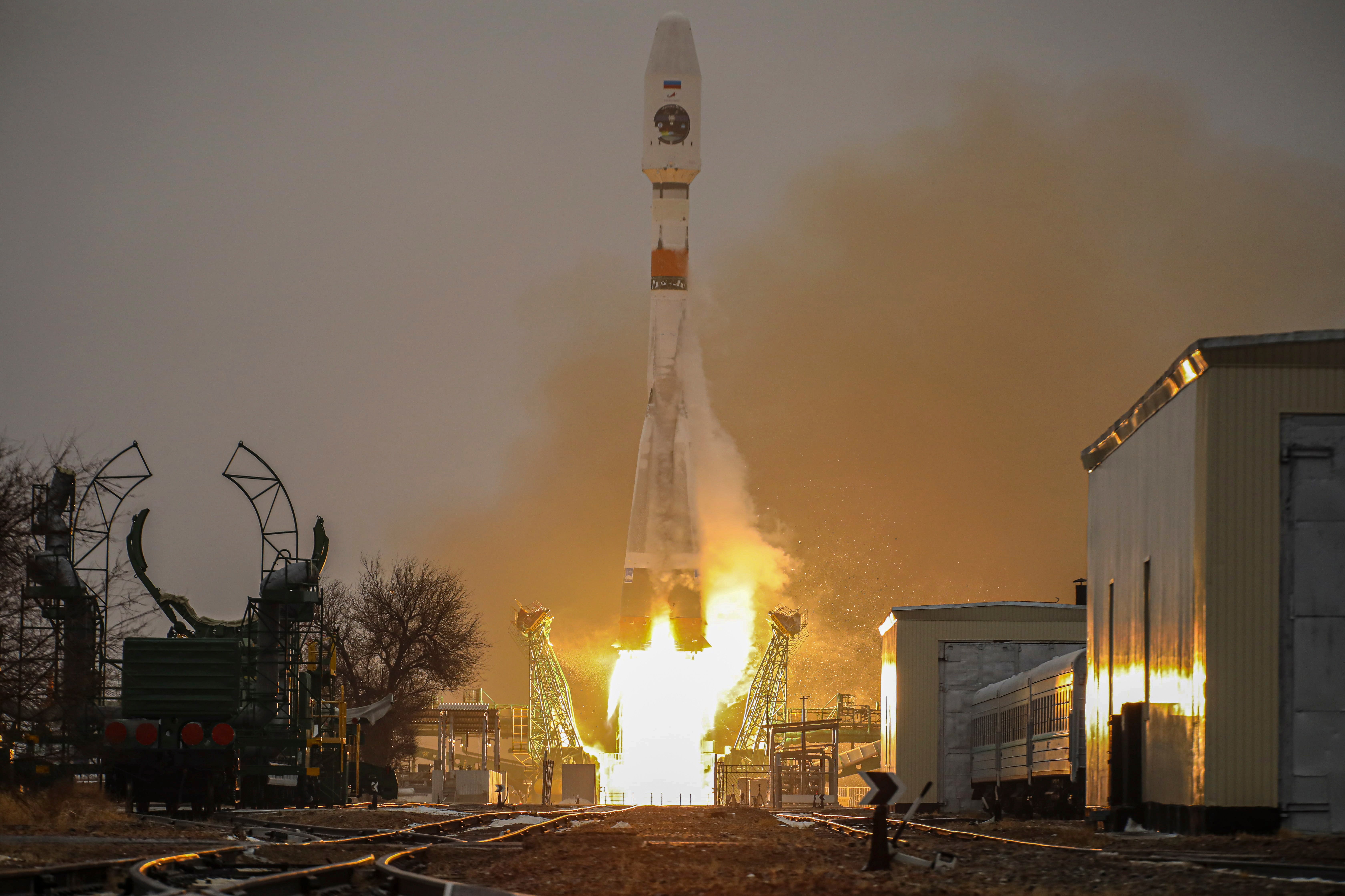
Russia has launched a satellite into space to monitor climatic changes in the Arctic.
The satellite, Arktika-M, successfully reached its intended orbit after being launched from Kazakhstan’s Baikonur cosmodrome by a Soyuz rocket on Sunday.
The launch is part of the Kremlin’s push to expand its activities in the Arctic region as Russia seeks to develop the energy-rich region, investing in the Northern Sea Route for shipping across its long northern flank as ice melts.
The Arctic has warmed more than twice as fast as the global average over the past three decades and Russia plans to send up a second satellite in 2023. Combined, the two will provide round-the-clock, all-weather monitoring.
The Arktika-M will pass high over northern latitudes, allowing it to monitor northern regions for lengthy periods before it loops back down under Earth.
“As more activity takes place in the Arctic and as it moves into higher latitudes, improving weather and ice forecasting abilities is crucial,” said Mia Bennett, a geographer at the University of Hong Kong.
Мониторинговый спутник #АрктикаМ вышел на околоземную орбиту. Наши специалисты установили с ним связь 📡🛰️
— РОСКОСМОС (@roscosmos) February 28, 2021
📸 И мы делимся с вами космическими фотографиями пуска ракеты-носителя с космодрома Байконур 👉https://t.co/ZjyYY1l7vo pic.twitter.com/5JyoRrj2x8
“There is also an element of data nationalism that is feeding into all this. Countries, especially those that see themselves as space powers, want to be able to rely on their own satellites and data to inform their activities, whether commercial or military in nature.”
At the right orbit, the satellite will be able to monitor and take images every 15-30 minutes of the Arctic, which cannot be continuously observed by satellites that orbit above the Earth's equator, the country’s Roscosmos space agency said.
The satellite will also be able to re-transmit distress signals from ships, aircraft or people in remote areas as part of the international Cospas-Sarsat satellite-based search and rescue programme.
Subscribe to Independent Premium to bookmark this article
Want to bookmark your favourite articles and stories to read or reference later? Start your Independent Premium subscription today.
Join our commenting forum
Join thought-provoking conversations, follow other Independent readers and see their replies