Satellite images reveal scale of destruction after Nova Kakhovka dam attack
Imagery captures more than 2,500 sq km of area around Nova Kakhovka before and after its collapse
Satellite images have revealed the damage from the massive collapse of a major dam and hydroelectric power plant in southern Ukraine.
The critical soviet-era Nova Kakhovka dam, which lies along the Dnipro river in Russia-held Kherson, was blown up on Tuesday and collapsed soon after, sending water gushing into nearby villages and towns in the region with a 42,000-strong population.
The UN said the collapse will have “catastrophic” and “far-reaching consequences” for thousands of people with the loss of homes, food, safe water and livelihoods even as Russia and Ukraine traded accusations over the incident.
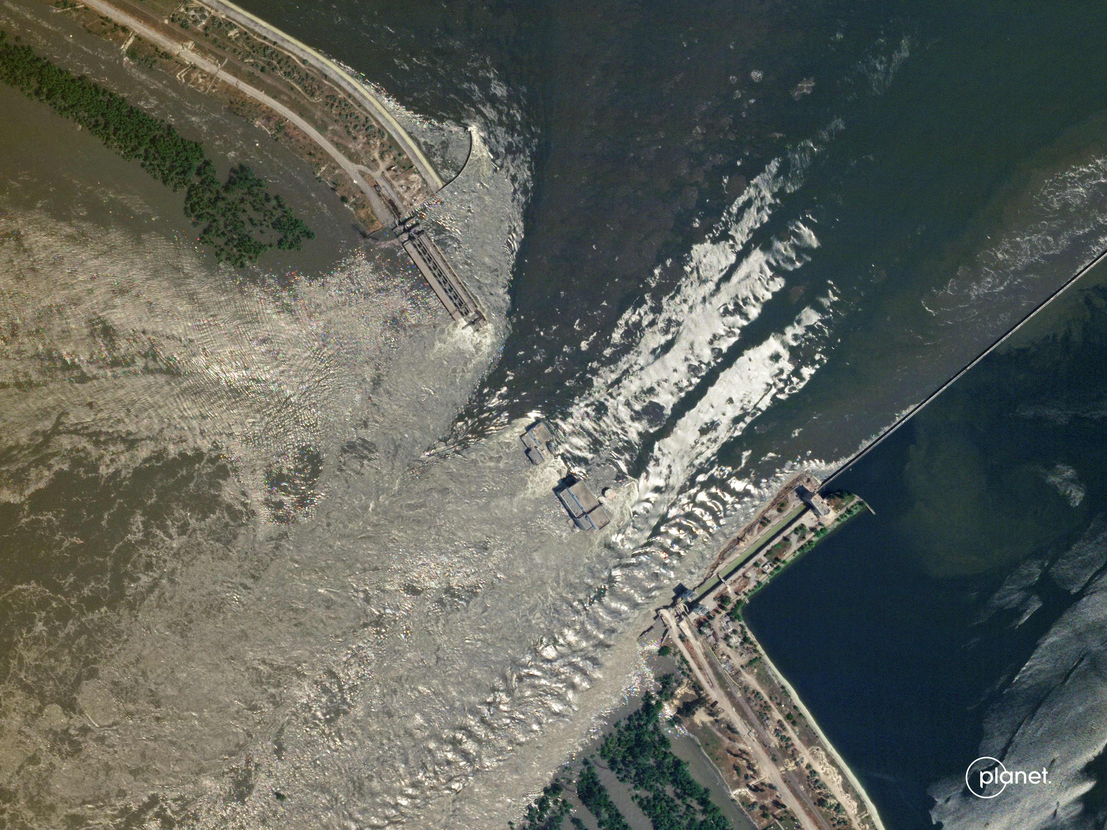
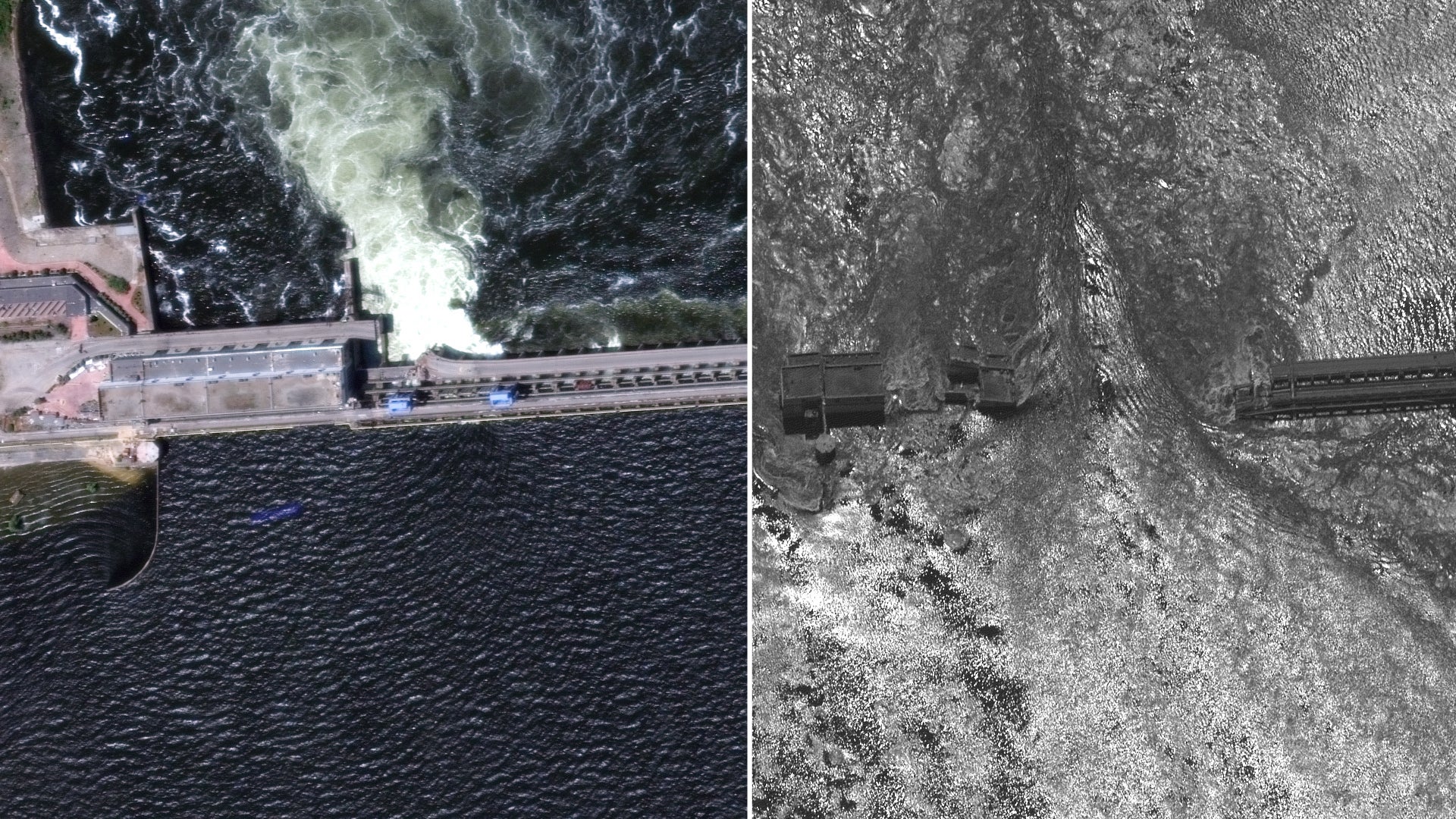
The latest satellite images provided by Maxar Technologies to The Independent on Tuesday showed the “largely destroyed” Nova Kakhovka dam and the hydroelectric plant as well as wide swathes of heavily flooded towns and villages.
The imagery captured more than 2,500 sq km of the area around Nova Kakhovka and the Dniprovska Gulf, southwest of Kherson city on the Black Sea. Comparison images showed the dam before and after the collapse.

The latest close-up view of Nova Kakhovka showed the dam and the adjoining area completely damaged and water gushing through the remnants. The first image of the fully functional dam was taken on Monday, just a day before the explosion.
“The Nova Kakhovka dam and the hydroelectric plant has been largely destroyed and few structures remain,” Maxar said in a statement.
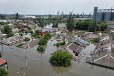
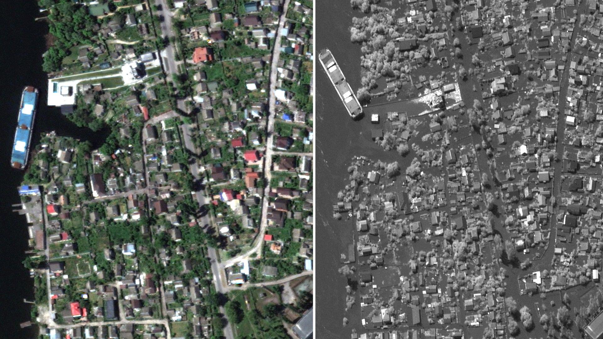
A comparison of images from 15 May of homes along the Dnipro in the southeast of Kherson showed houses and buildings submerged in water with only roofs showing, and flooded parks, land and infrastructure.
The explosion and subsequent flooding have threatened the population of 42,000 people who need to be evacuated, deputy prosecutor-general Viktoriya Lytvynova said on Ukrainian television.
The official said those people include a population of 17,000 Ukrainians in the Ukraine-controlled territory west of the Dnipro and 25,000 in the Russian-controlled east.
Ukrainian president Volodymyr Zelensky said in a statement on Wednesday that the collapse has led to thousands of people being deprived of normal access to drinking water.
The water level has risen to 3.5 metres (11.5ft), around 60km downstream from the dam.
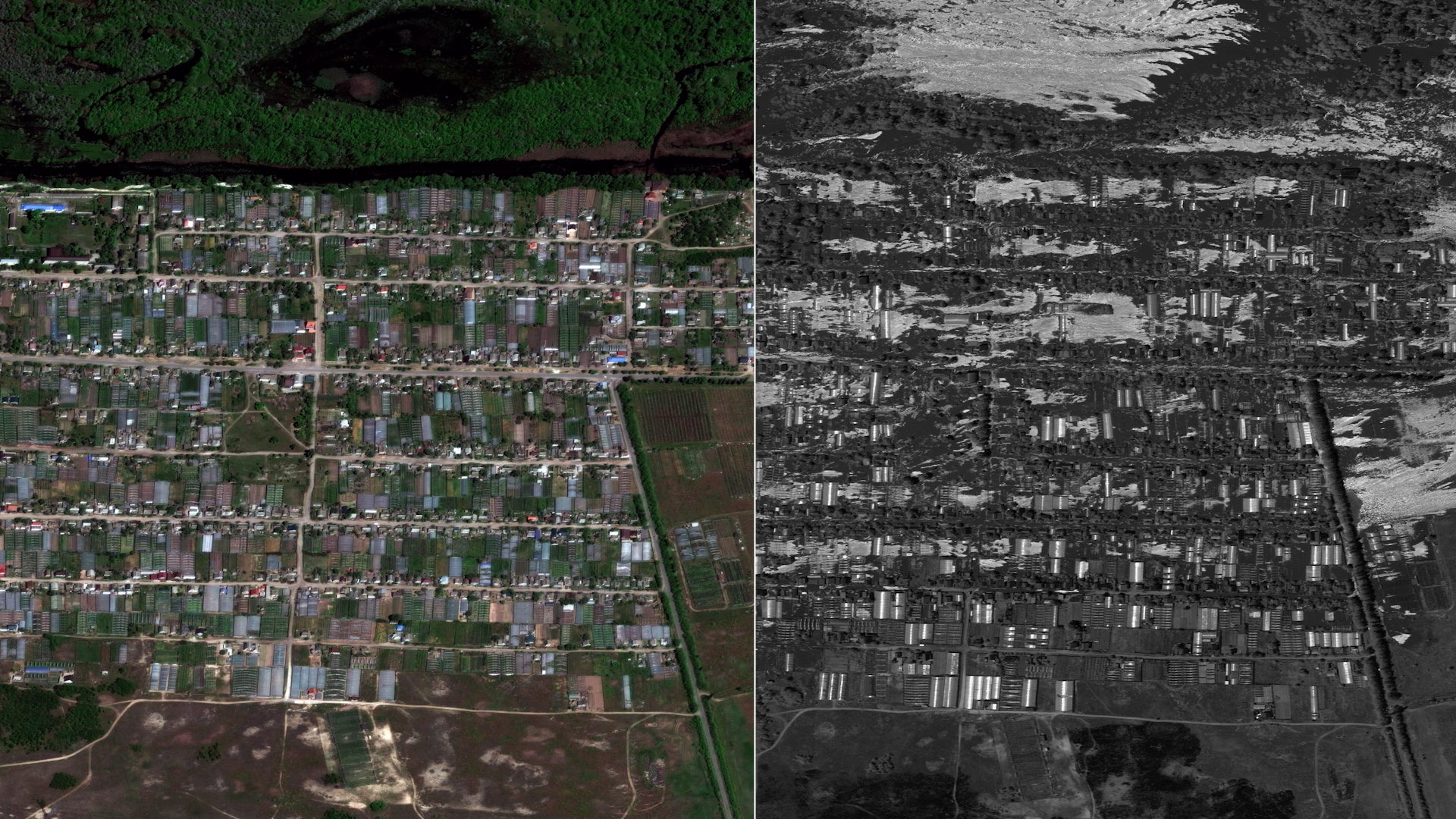
A 15 May image of Korsunka village on the left bank of the Dnipro showed the destruction of farmland and water entering residential areas on the outer side of the settlement.
Millions of cubic metres of water had already partially submerged several areas and killed thousands of animals, with water reaching as far as Mykolaiv in a few days, a region some 90km away, Mykhailo Podolyak, a chief adviser to Mr Zelenksy previously told The Independent.
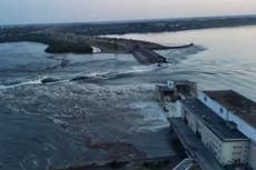
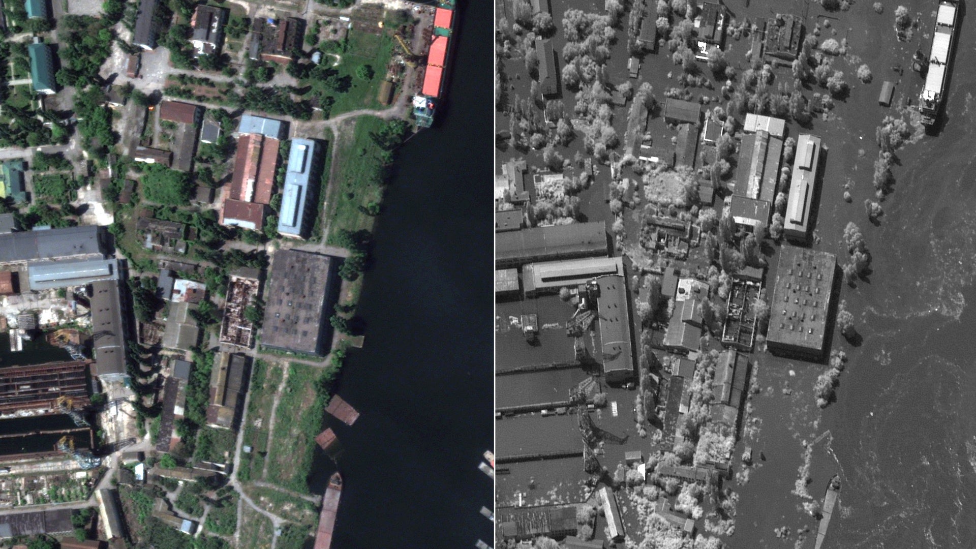
The aerial images of a port facility and industrial area showed a deluge of water and water gushing through the water way at high speed.
No deaths have been reported by either side yet. US spokesman John Kirby, however, claimed the flooding had probably caused “many deaths”.
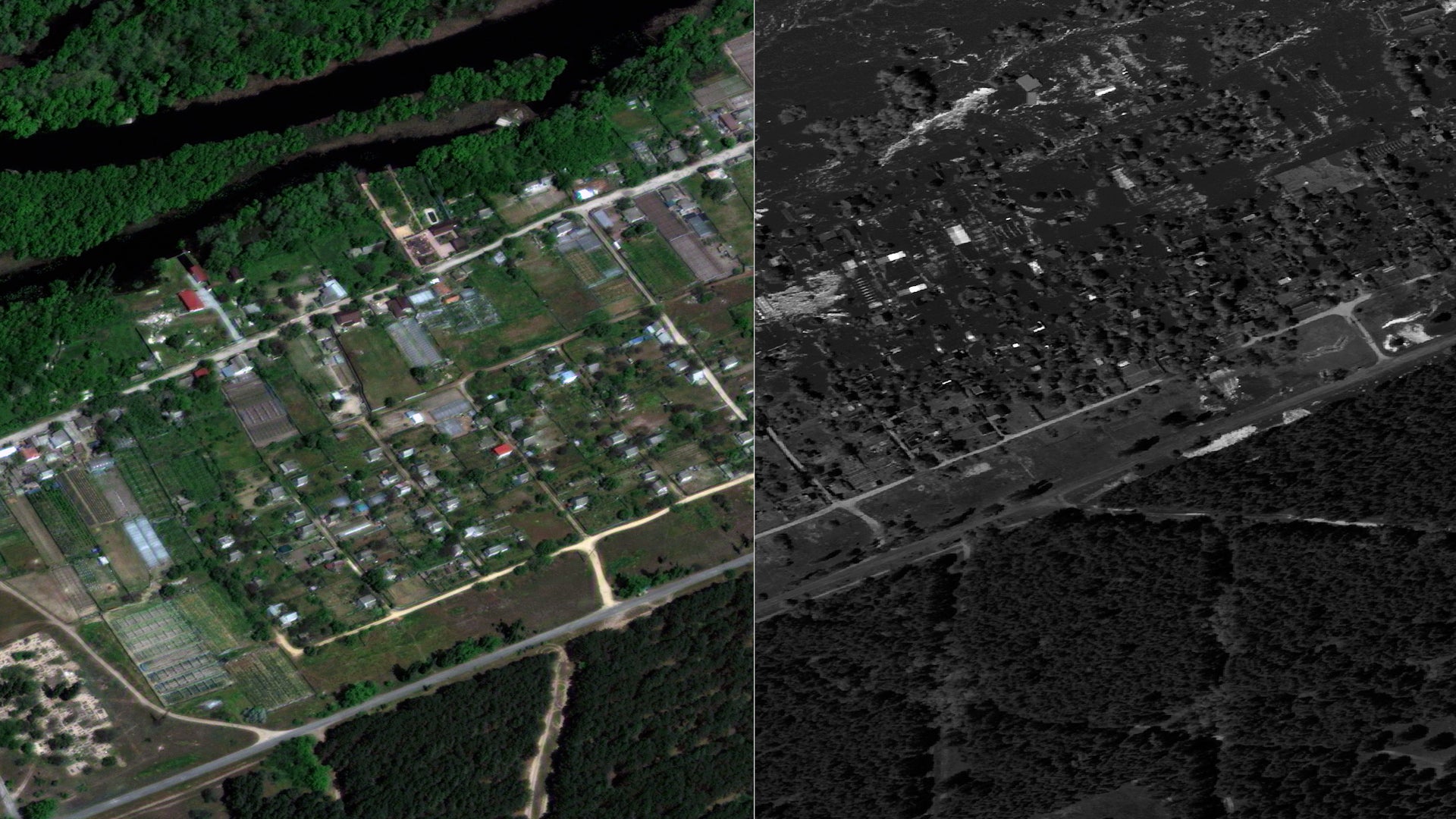
Another comparison of the latest image from an image taken of Krynky village on 15 May showed vast stretches of once-lush farmlands submerged under an expanse of water. Rising floodwater has engulfed crops and vegetation and inundated buildings and homes.
A resident, Oskana, 53, who goes by a single name, told Reuters: “Everything is submerged in water, all the furniture, the fridge, food, all flowers, everything is floating. I do not know what to do.”
To conduct evacuations, buses, trains and private vehicles were marshalled to carry people to safety in about 80 communities threatened by flooding.
Mr Zelensky has accused Russian forces of blowing up the Kakhovka Hydroelectric Power Station from inside the facility and said Russia must be held to account for a “terrorist attack”.
“At 02.50, Russian terrorists carried out an internal detonation of the structures of the Kakhovskaya HPP. About 80 settlements are in the zone of flooding,” he said after an emergency meeting of senior officials.
The Ukrainian military said it was Russia’s attempt to prevent Ukrainian troops from crossing the Dnipro to attack the occupying forces.
Russia, however, blamed Kyiv for sabotaging the dam by cutting off water supplies to Crimea and to distract attention from its alleged faltering counteroffensive.
“We can state unequivocally that we are talking about deliberate sabotage by the Ukrainian side,” Kremlin spokesperson Dmitry Peskov told reporters.
Join our commenting forum
Join thought-provoking conversations, follow other Independent readers and see their replies
Comments
Bookmark popover
Removed from bookmarks