Satellite images reveal scale of devastation in Ukraine’s Bakhmut over recent months
Images reveal extensive damage to buildings, homes, infrastructure and fields in and surrounding the city in eastern Ukraine
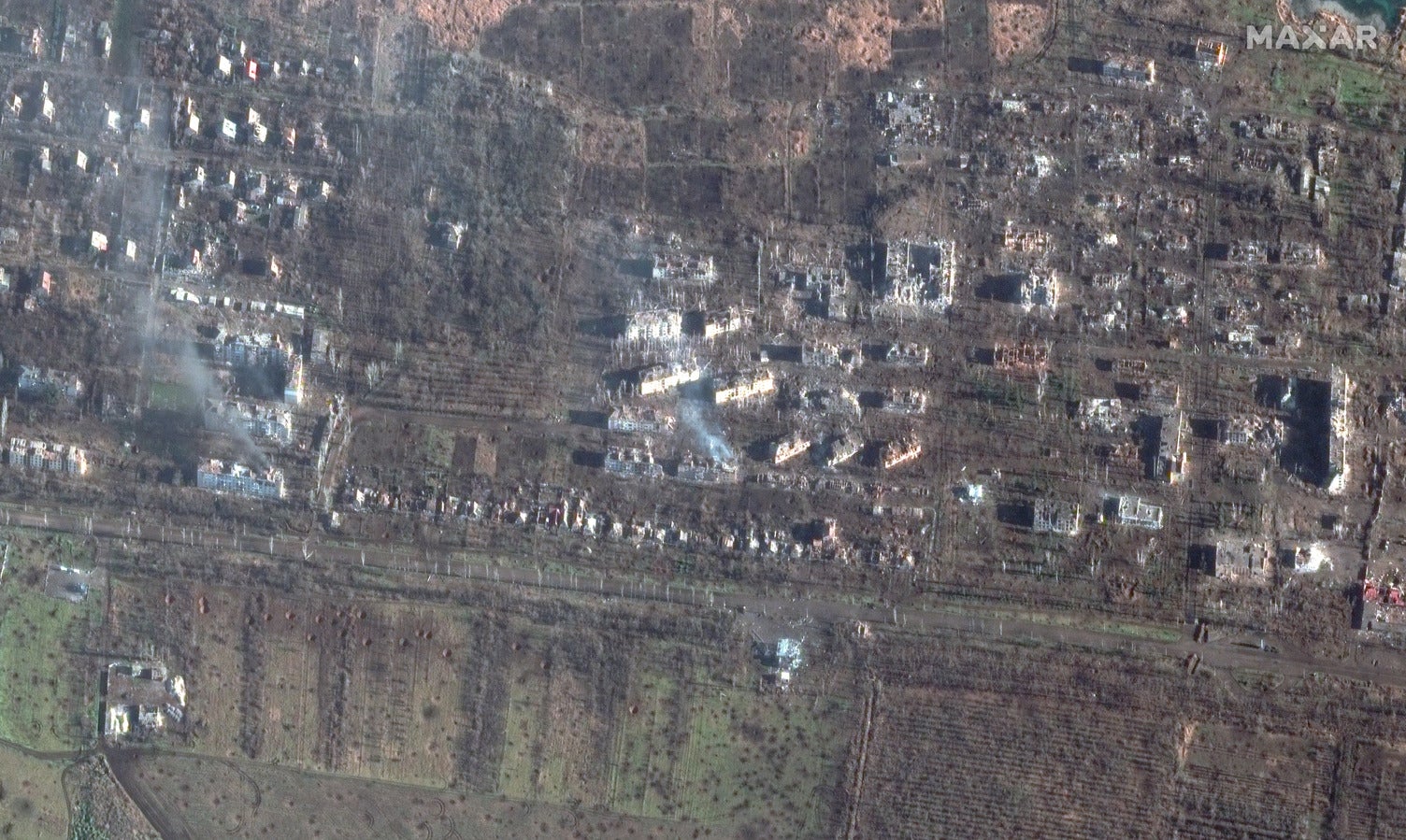
The scale of the destruction of the besieged Ukrainian city of Bakhmut has been laid bare by new satellite images.
Maxar Technologies published a series of before and after images of the city, which has been the focal point of intense fighting between forces from Ukraine and Russia.
The images, comparing sites photographed between August and the end of December/beginning of January, reveal extensive damage to buildings, homes, infrastructure and the fields in and surrounding Bakhmut, which had a pre-Russian invasion population of around 70,000.
Subscribe to Independent Premium to bookmark this article
Want to bookmark your favourite articles and stories to read or reference later? Start your Independent Premium subscription today.
Join our commenting forum
Join thought-provoking conversations, follow other Independent readers and see their replies