Satellite launched to pinpoint climate-driven wildfires in US West
GOES-T launched from Cape Canaveral, Florida on Tuesday
The Western hemisphere will have new eyes in the sky watching for extreme weather events and wildfires being driven by the climate crisis following the launch of the Geostationary Operational Environmental Satellite, GOES-T, on Tuesday.
GOES-T is the latest in a series of next-generation geostationary weather satellites planned by the US National Oceanic and Atmospheric Administration (Noaa), the federal agency that monitors atmospheric and oceanic conditions and issues weather forecasts, among other activities.
GOES-T launched from Cape Canaveral, Florida, and will now begin moving to its operational position 35,888 kilometers above the Pacific Ocean at the Earth’s equator. At that altitude and position, the satellite’s speed matches the rotation of the Earth, allowing it to stay in one position relative to the planet’s surface.


Once in position in early 2023, GOES-T will replace the existing GOES-17 and take on the GEOS-18 designation. As GOES-18, the satellite will track storms and fog over the ocean, and on land ranging from Hawaii to Alaska to California.
With a vantage point over remote and mountainous regions not covered by radar, GOES-T will help monitor storms and fog that can disrupt airport and airline operations. It will also monitor for lightning strikes which in recent years have led to unprecedented wildfires that have ravaged California.
Being able to pinpoint the initial location of a wildfire is crucial for emergency response teams fighting the fires and initiating evacuations.
Heatwaves and drought conditions caused by climate change are exacerbating wildfires, leading larger, more unpredictable blazes.
“GOES-T joins the suite of advanced technology providing critical data and imagery to forecasters and researchers tracking hazardous weather and working toward building a climate ready nation,” Noaa administrator Rick Spinrad said in a statement.
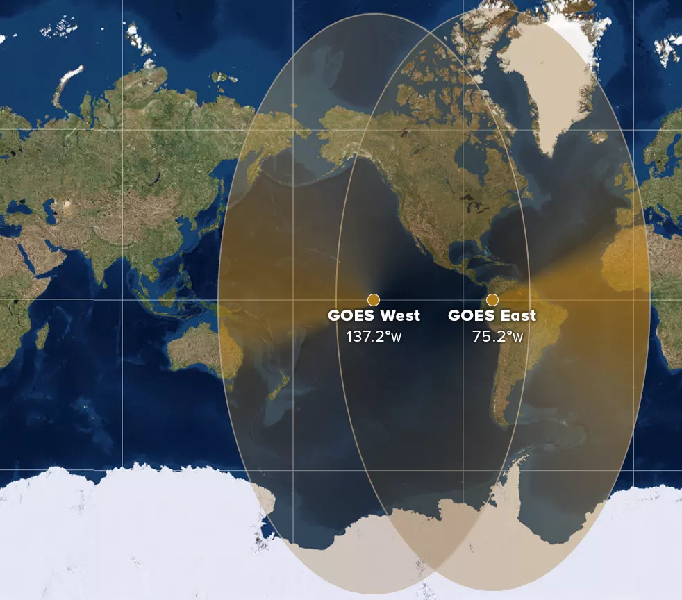
The newly launched GOES-T satellite will work with the already operational GOES-16, which orbits just over 60 degrees further east along the equator.
The two satellites will monitor the entire Western Hemisphere with their combined field of view stretching from Western Africa to Eastern Australia, and from Alaska to Antarctica.
The fourth satellite in the current generation of GEOS satellites, GEOS-U, is scheduled to launch in April 2024 and will focus on space weather rather than Earth’s climate.
Noaa and Nasa are already researching the next generation of geostationary weather satellites, GeoXO, which are expected to launch sometime in the 2030s.
Join our commenting forum
Join thought-provoking conversations, follow other Independent readers and see their replies
Comments
Bookmark popover
Removed from bookmarks