10 best UK walking routes and scenic hikes for an active adventure
See the best of the country on foot on these exciting trails
The UK possesses a wealth of variety in its cities, towns and natural landscapes, all of which have contributed to making it a wonderful staycation destination.
Places such as the Scottish Highlands, Pembrokeshire and Cornwall showcase the rolling hills, dramatic coastlines, verdant countryside and picturesque beaches that the UK has become known for.
Such expansive rural and coastal areas offer excellent opportunities to get outdoors. Walking is one of the most popular ways to explore the country: in 2019, the UK government reported that in the six months leading up to Boxing Day, over 21 million walking trips had been taken on the country’s coastal paths alone.
Many of the UK’s most popular routes lend themselves to walking or hiking year-round. Read on for a selection of some of the best trails to explore in 2024, from Cotswolds trails to Lake District fell hikes.
Chipping Campden to Broadway, the Cotswolds
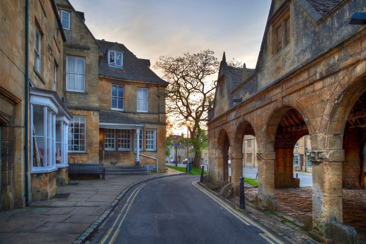
This six-mile looping route is part of the area’s famous Cotswold Way, and it takes you on a trip to two of the region’s most well-known towns. It begins in Chipping Campden, a historic market town known for its terraced high street (parts of which date back to the 14th century). The trip takes you across the meadows and woodlands of both Gloucestershire and Worcestershire, with views over the Vale of Evesham and Dover’s Hill.
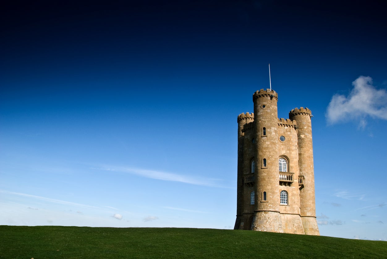
You’ll eventually arrive at Broadway Tower, an 18th-century folly from which you can supposedly see up to 16 counties. After taking in the views, carry on to Broadway –another honey-hued market town with a historical high street and period houses – before heading back to Chipping Campden. The entire walking time should be around four hours.
Helvellyn, Lake District
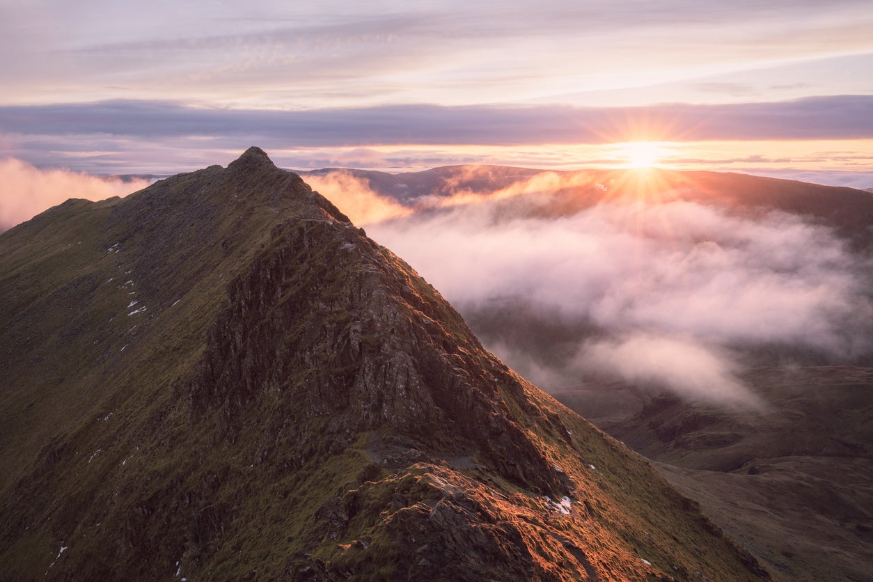
This trail fought off stiff competition from other Lake District routes like Catbells and Buttermere to be voted as the nation’s favourite walk in a 2018 vote carried out by ITV and the National Trust. It takes around six hours and covers roughly 10 miles while scaling the Lake District’s (and England’s) third-highest peak.
It starts in Glenridding, a village at the southern end of Ullswater, and carries on via Keppel Cove. While still a challenging route, it avoids the difficult terrain of Striding Edge and Swirral Edge, instead taking the ‘Pony Path’ and ascending the mountain via Whiteside. Upon reaching the summit, on the way down you’ll pass Nethermost Pike and return via Grisedale, with views of Ullswater, Grisedale Tarn and Birkhouse Moor.
Read more on UK travel:
Causeway Coast Way, Northern Ireland
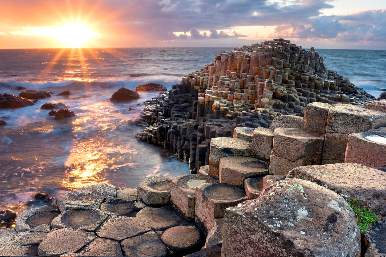
The Causeway Coast Way covers 32 miles of scenic Northern Irish coast, running from Ballycastle to Portstewart. Though a relatively easy walk, the route still takes between two and three full days of walking, and anyone wanting to see more of the coast can tackle the Ulster Way (a 636-mile trek that the Causeway Coast Way is merely one section of).
The route will take you between two of the country’s most popular seaside resorts via a number of its most-visited attractions, including the Giant’s Causeway and Carrick-a-Rede rope bridge. Along the way it crosses a range of different terrain, from towering cliffs and rolling hills to long stretches of beach and promenade. The walk is usually split into six different stages, each ranging between five and seven miles in length, so those who don’t fancy tackling the entire Way are free to just trek certain sections.
Malham to Horton-in-Ribblesdale, North Yorkshire
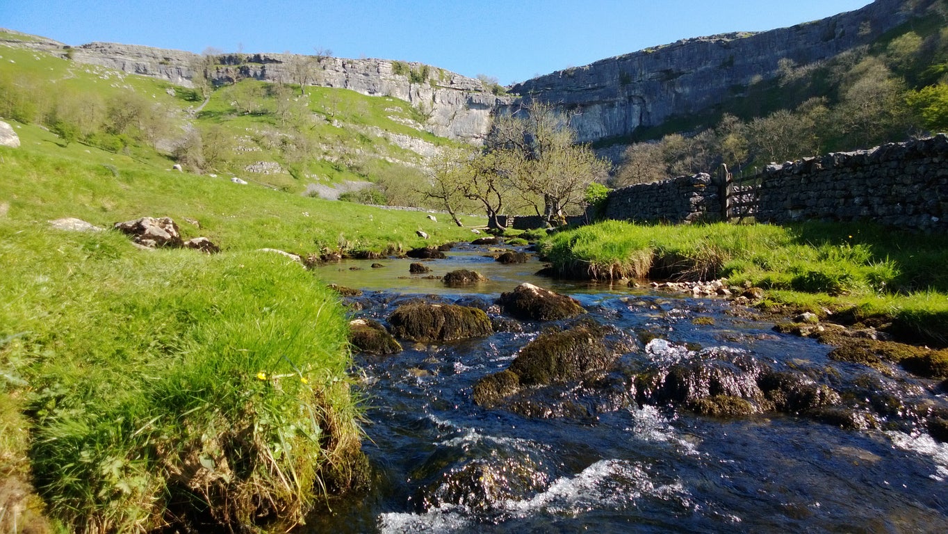
This route forms part of the famous 268-mile Pennine Way, but assuming you don’t have the time (or desire) to cover that distance, this stage takes in two of the best sights in the Yorkshire Dales. The total distance is around 14 miles, so it can be completed in a day at a strenuous pace, or split over a weekend for a more relaxing experience. You’ll come across the 80-metre limestone cliff of Malham Cove early in the journey, climbing it (via steps) and enjoying views of the surrounding hills before moving on to Malham Tarn, one of the highest lakes in England.
You’ll be ascending again before long, as Pen-y-ghent (the shortest of Yorkshire’s Three Peaks at 694m) appears, offering more sweeping views of the surrounding dales. The rest of the route is a merciful downhill trail to Horton-in-Ribblesdale; just reward for the almost 800 metres of ascent.
Jurassic Coast (South West Coast Path), Dorset
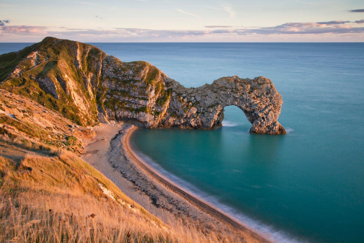
If the distance of the Pennine Way seemed too far, the 630-mile South West Coast Path is even more daunting. Fortunately, this Path is split into seven parts, including areas in Cornwall and Devon; for the more scenic choice, walk the 115-mile Jurassic Coast section (or any part of it). This section starts in Exmouth and goes as far as Studland (a village not too far from Bournemouth) over nine days (the furthest distance in one day is 14.5 miles).
The route covers a great variety of sights, from Dorset towns such as Weymouth and Lyme Regis to beach areas like Lulworth Cove and Chesil Beach. You’ll see the red sandstone Triassic cliffs near Exmouth and the white chalk cliffs of Beer, the “closest thing to a tropical rainforest in England” at the Undercliffs National Nature Reserve, and even the natural limestone arch of Durdle Door while walking across 185 million years of Jurassic, Triassic and Cretaceous history.
West Highland Way, Scotland
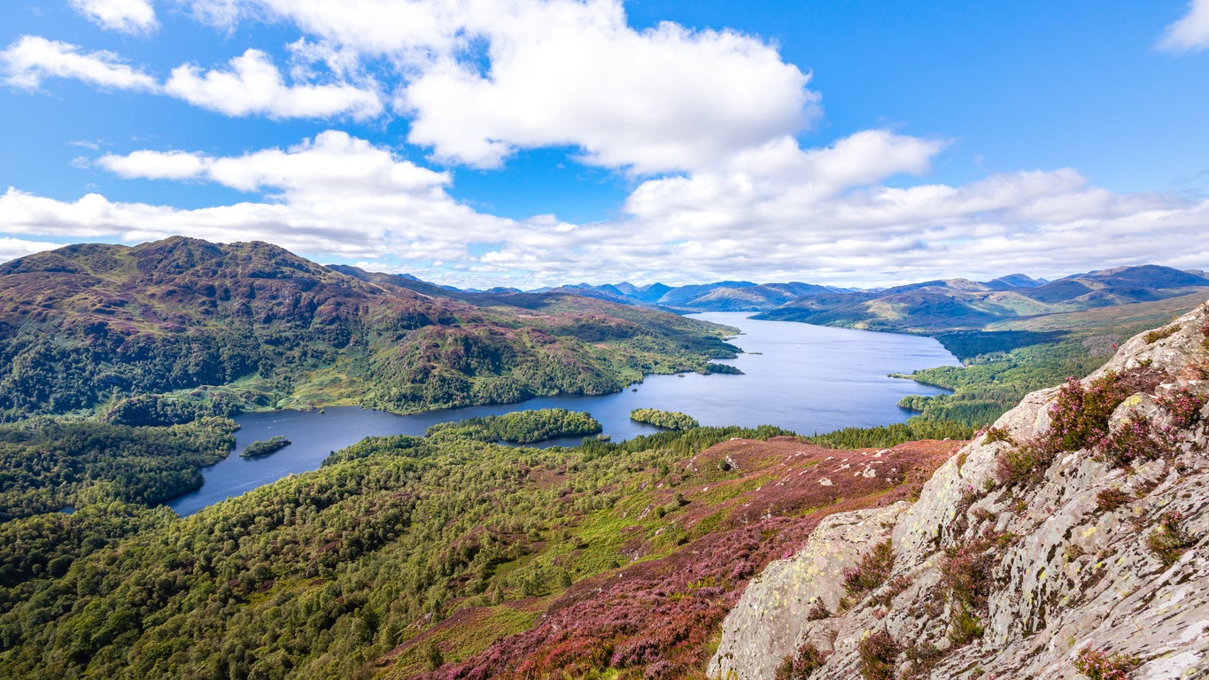
Scotland’s most-loved long walking route is a 96-mile trek from Milngavie to Fort William. Split over eight stages of between nine and 15 miles each, the official website is keen to remind potential walkers that the stages are not necessarily considered a one-day activity. The journey is usually completed from south to north; between Inverarnan and Kinlochleven are the most difficult parts in terms of elevation (you’ll climb over 200 metres on some days), but the first three stages are relatively flat.
This is a particularly isolated and rural route, and with countryside parks, open moorlands, steep mountains and views of natural sites such as Loch Lomond, you’re unlikely to be disappointed.
Snowdon Llanberis Path, Wales
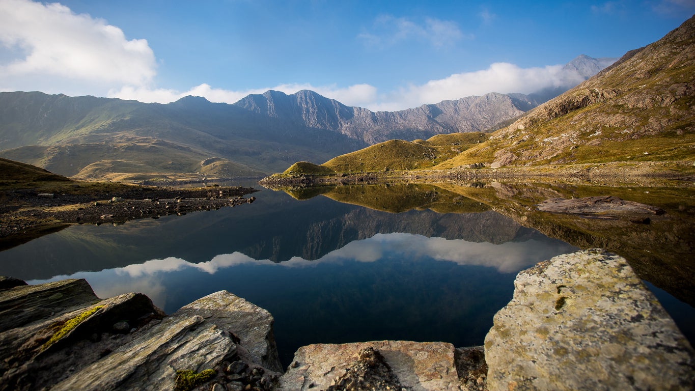
Wales’ largest National Park is also home to its largest mountain. Snowdon’s 1,085m summit is the Welsh leg of the Three Peaks challenge and is one of the country’s most popular walking routes. There are six trails up the mountain, and while the Llanberis Path is the longest (lasting nine miles, or four-and-a-half each way) it is also the most popular and steady trail.
The path starts in Llanberis village and climbs the northwestern side of Snowdon, alongside part of the Snowdon Mountain Railway. Hikers get great views of Glyder Fawr and Cwm Glas Bach, as well as other parts of the Eryri National Park.
The route will merge with three of the other Snowdon paths at Bwlch Glas before it heads to the summit, which is likely to be busy with fellow climbers, walkers and fell runners. Follow the same circuit on the way back; the whole walk should take between six and seven hours.
Derwent and Howden Reservoirs, Peak District
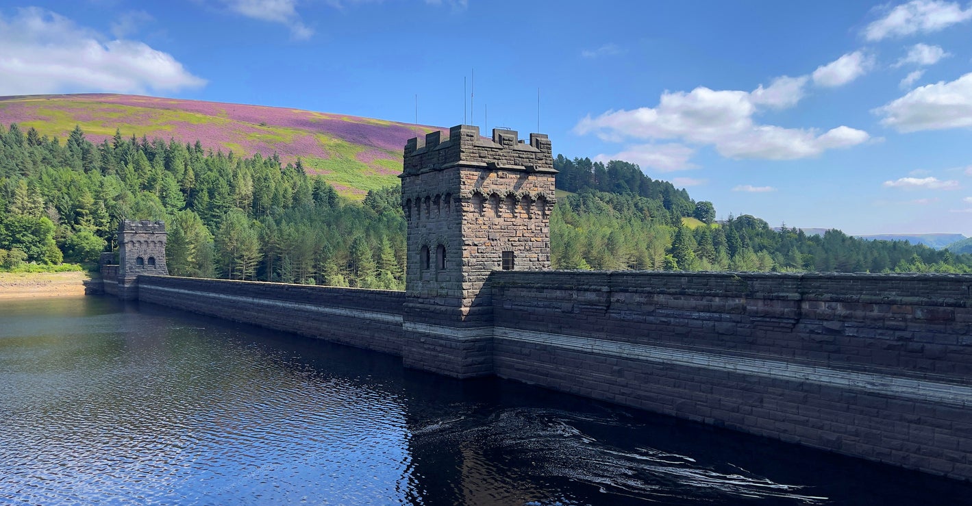
This Peak District walk around the Derwent and Howden reservoirs stands out in a region renowned for its amazing hikes. It offers a scenic, more relaxing alternative to routes like the Mam Tor circular walk. Though it is a 10-mile journey, there is very little climbing and the paths are flat and accessible, while you’ll also get opportunities for wild swimming at Slippery Stones (it’s also a popular circuit for bikes).
The start point is at the Ladybower Reservoir, heading north past a Dambusters memorial (the squadron ran dummy runs here before the raid) and then the impressive gritstone structure of Derwent Dam. While walking along the reservoir you’ll come to Howden Dam and then Slippery Stones before heading back into the woodland. Before the end, there are fantastic views of the Dark Peak moorlands.
Saundersfoot to Tenby (Pembrokeshire Coast Path), Pembrokeshire
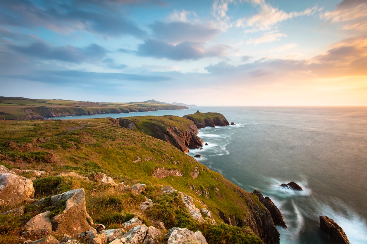
Britain’s only coastal National Park is home to the 186-mile Pembrokeshire Coast Path, providing some of the finest coastal views in the UK. Several sections are worthy of a list of Britain’s best walks, but the route from Saundersfoot to Tenby takes in long stretches of golden sands, dramatic cliffs and a harbour town that is one of the most picturesque in the county.
This circular walk is eight miles long, but it is likely that you’ll break it up by spending considerable time in Tenby. From the resort of Saundersfoot, follow the beach’s harbour wall before climbing steps up the cliff face. Upon joining the Path itself there are views of Saundersfoot Bay, Monkstone Point and eventually Tenby and its North Beach. From here, you can wim in the Atlantic before heading into Tenby and then circling back to Saundersfoot.
South Downs Way, Hampshire and East Sussex
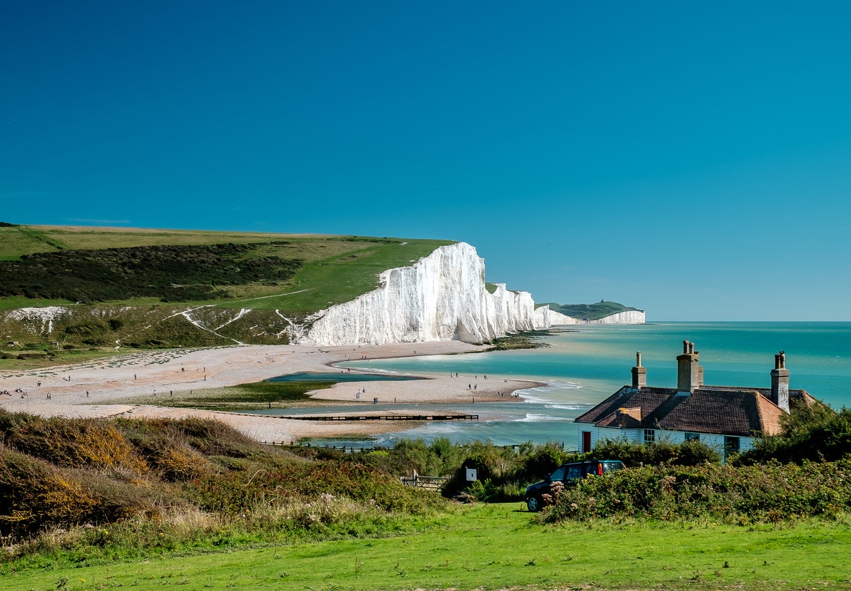
Another of the UK’s exceptionally long walks, the South Downs Way spans 100 miles between Winchester and Eastbourne. Most people take eight or nine days to complete the whole trail, though many will decide to tackle just one (or several) of the eight main sections. Most of the trail takes walkers through the glorious South Downs countryside and villages such as Exton, Amberley and Buriton. Expect scenic views, vast expanses of lush greenery, rolling hills and empty fields before arriving in Alfriston.
Upon leaving Alfriston on the last stage, the route takes a spectacular turn to offer amazing views out over the English Channel and the white chalk cliffs of Seven Sisters. It finishes in Eastbourne, where you can enjoy a visit to a classic English seaside resort with pristine beaches and a 19th century pier.
Read our reviews of the best UK hotels
Join our commenting forum
Join thought-provoking conversations, follow other Independent readers and see their replies
Comments
Bookmark popover
Removed from bookmarks