The Independent's journalism is supported by our readers. When you purchase through links on our site, we may earn commission.
Coast to coast on Cornwall’s newest walking trail, through landscapes most tourists skip
Most visitors journey west to Cornwall’s coastal towns and villages, but a new walking route encourages people to explore inland along the border with Devon. Tom Mulvihill treks north through unsung beauty (and Plymouth)
With a skitter of stones, the earth gave way beneath my feet. Landing on my back, I began an inexorable slide downhill towards a tangle of brambles and nettles at the foot of the hill. I travelled several yards down the implausibly steep footpath before I was snagged on a tree root protruding from the slope. Bruised, and a little shaken, I scrambled sidelong to the trunk of the oak that had saved me and sat for a spell while I caught my breath. Far below me, the River Tamar flickered in the autumn sunlight.
It was my third day of walking on the Tamara Coast to Coast Way, a new waymarked route that launched this summer with the publication of a dedicated guidebook. It passes through a rural hinterland that most visitors bypass altogether as they journey west to Cornwall’s coastal towns and villages.
It was created by the Tamara Landscape Partnership Scheme which, with the aid of lottery funding, cobbled together an existing network of public footpaths to plot a route that follows the course of the Tamar from mouth to source, and then continues the short distance to the Atlantic coastline at Morwenstow.
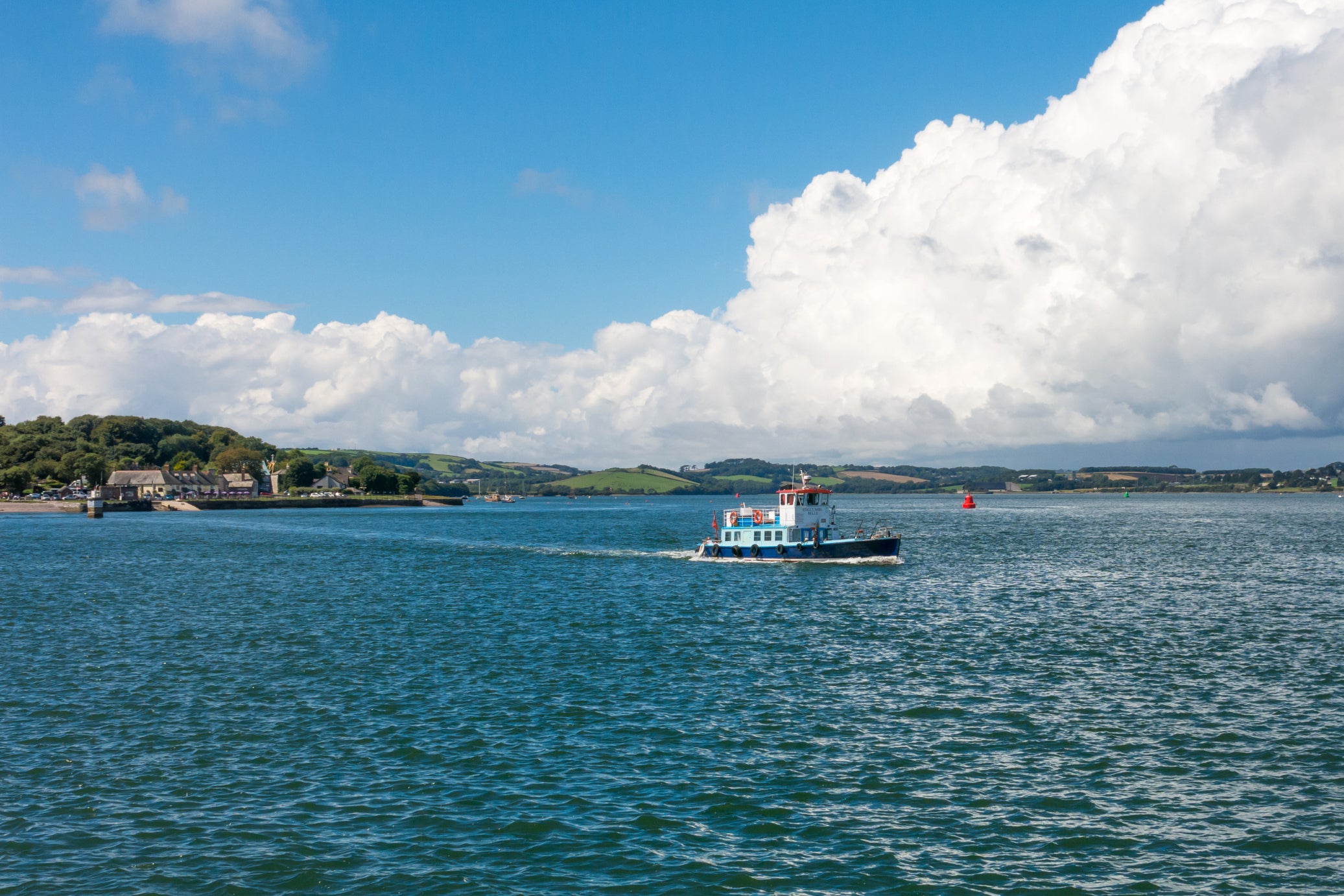
My journey had begun at the trail’s official start point in Cremyll, a tiny settlement on a spit of land reaching out from the Cornish side of the Tamar Estuary towards the Plymouth docks. From there it twists and turns inland, wending its way for 90-odd miles up towards the north coast.
Read more on England travel:
It links up at both ends with the South West Coast Path, and for many dedicated walkers (myself included), this is foremost in its allure: an inland extension which affords the means to complete the Kylgh Kernow (a complete circumnavigation of Cornwall). A marginally shorter route sticks entirely to the Tamar’s western banks, but I’d opted to take the longer option, which criss-crosses the border between Devon and Cornwall.
The first two days were to encapsulate the rest of the way: long stretches of unsung beauty, interrupted by sections that were to be endured, rather than enjoyed. The first 10 miles or so, following the shoreline of the Rame Peninsula from Cremyll round to Torpoint, largely belonged to the former. The subsequent haul through Plymouth is less appealing, and frankly could be skipped entirely with no regrets by anyone who isn’t hell-bent on completing the entire journey from start to finish.
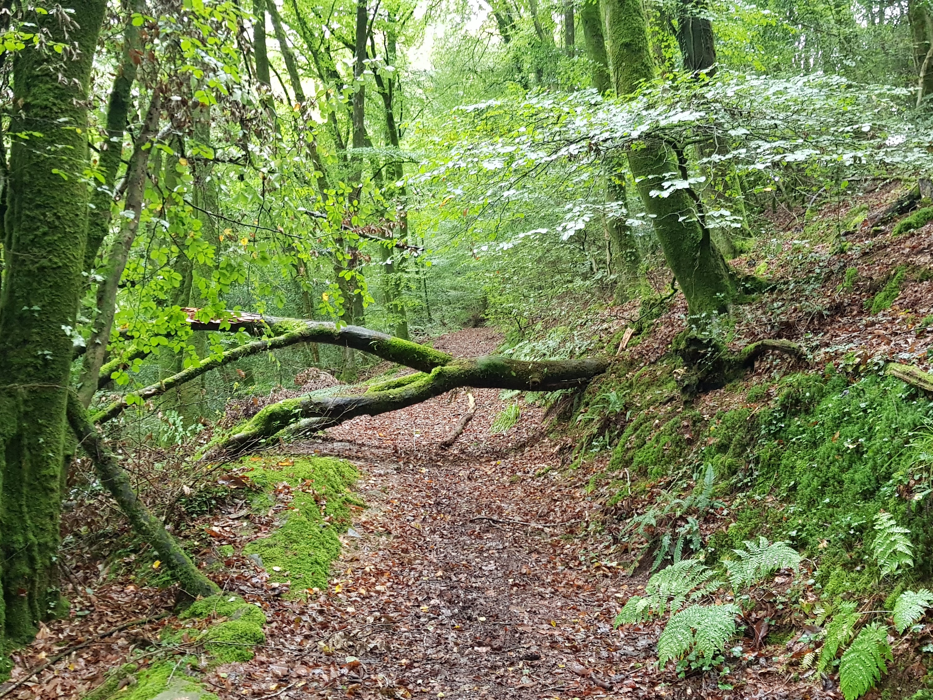
After leaving the city limits, I was soon enveloped by rolling woods and muddy creeks. The footpath rose and fell as it wove a course towards Bere Alston. Buzzards keened overhead and the hoot of an owl drifted through the trees, while out on the broad flats that stretch out from the Tamar’s banks I could see egrets and oystercatchers wading to and fro in search of nourishment.
Read more: Best hotels in Padstow
The way was frequently hard going. Fallen trees blocked the path at regular intervals and had to be clambered over or crawled under. There were plenty of lung-busting climbs and perilous descents as I dipped in and out of the river valleys. It’s not a peaceful walk in the countryside, but a hard slog that requires a great deal of fitness, especially if you aim to complete it in the seven days recommended in the guidebook.
I encountered other obstacles, too, such as a tidal crossing at Lopwell Dam that only appears for around two hours either side of low tide, and a herd of belligerent bullocks blocking the way out of a farmer’s field.
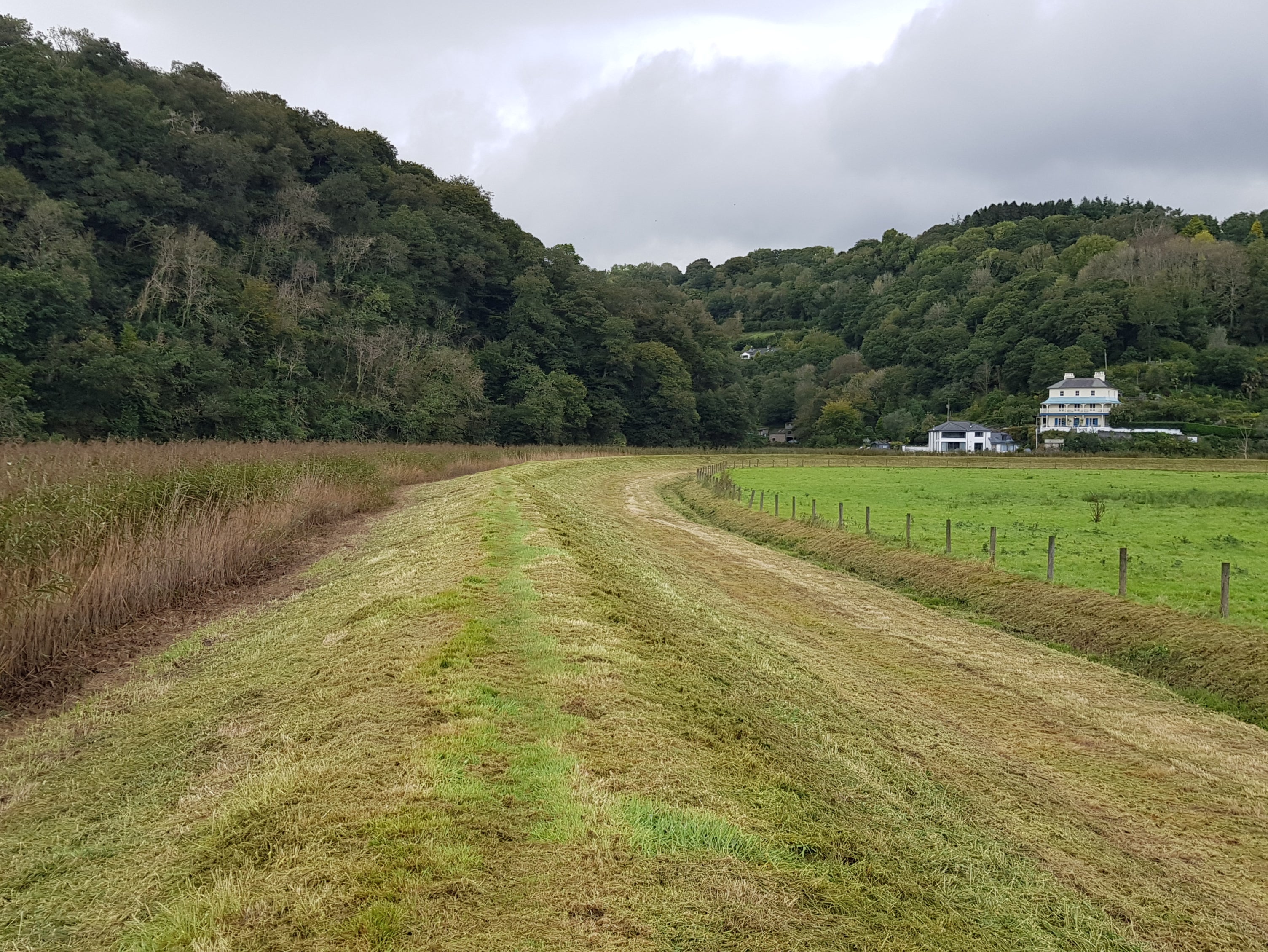
After Bere Alston, the route continues up the Tamar Valley towards Gunnislake. From there, it’s a steady climb into an upland area mainly given over to farming. Here the trees gave way to fields, and the views opened out to the horizon, with the brooding heights of Dartmoor visible in the east, and those of Bodmin Moor rising in the west. The footpaths also became more sporadic; the distinctive green and blue waymarkers that denote the Tamara Trail’s route (accurately and consistently for the most part) now pointed down country lanes that were fairly busy with farm traffic.
It was while walking down one of these roads, the view having been obscured for several miles by tall hedgerows, that it occurred to me that I hadn’t come across a single other person following the trail. The only people I’d encountered had been those who live and work along the route: farmers, boatyard workers, orchard hands, apiarists. However, most agreed that the trail had indeed brought an increase in footfall to this forgotten corner of the West Country over the summer, and were pleased at the prospect of sharing in the wealth brought by tourism.
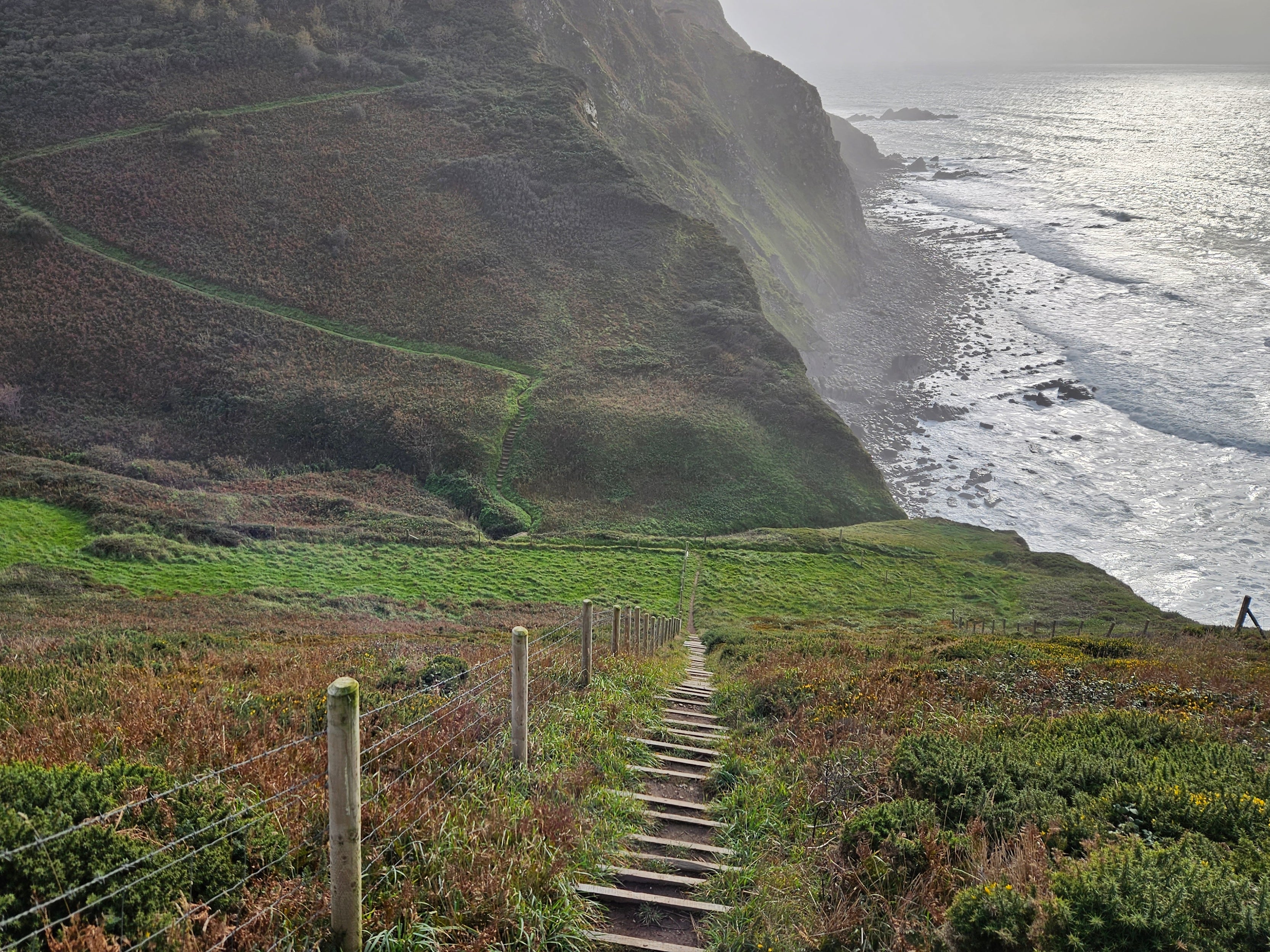
On the final day, I was thankful to leave the road for a deep wooded valley of oak and beech, with a carpet of bracken sprouting from its slopes and a small stream trickling through its centre. There was nobody else there. Like other sections of the trail, it felt a world away from anywhere else, left behind, a remnant of ancient landscape that is all too hard to find in modern Britain (and particularly in usually tourist-heavy Cornwall).
When I emerged from the woodland, I could instantly feel a salty breeze on my face, and hear waves crashing against rocks. A brief walk brought me to the top of Marsland Cliff, looking out over the Atlantic as a ferocious swell hammered the shoreline. Thinking back to the placid flow of the Tamar as it empties into the English Channel, I felt a palpable sense of achievement – far more so than I had expected. With some miles of hard terrain left to go before I reached my final stop at Morwenstow, I turned onto the familiar, well-trodden South West Coast Path and began the walk home.
Travel essentials
Getting there
Great Western Railways runs direct services to Plymouth from London Paddington and Bristol Temple Meads. You can reach the trail’s start point via the Cremyll Ferry, which departs from the Stonehouse area of Plymouth.
Staying there
There are plenty of hotels, inns and B&Bs on route. A notably comfy option is the Horn of Plenty, near Tavistock, a Victorian manor house hotel with 16 rooms and an excellent restaurant.
For palpable luxury, opt for the Hotel Endsleigh, set in Humphry Repton-designed gardens overlooking the Tamar Valley.
Guidebooks can purchased at tamarvalley.org.uk
Read more about the best hotels in Cornwall
Join our commenting forum
Join thought-provoking conversations, follow other Independent readers and see their replies
Comments
Bookmark popover
Removed from bookmarks