Walk of the month: Mullion Cove, Cornwall
Take a hike along the Lizard Peninsula, with its rocky cliffs and Atlantic swells
It’s off to the south coast this month to meet some old friends. They’ve been away since last September, have spent the winter in Africa and began to fly back as our clocks went forward. Welcome home to the hirundine family - to you and me that means sandmartins, housemartins and, in their wake, swallows.
Where better to see them than the southernmost point of mainland Britain? The Lizard peninsula is one the first places where these plucky birds make landfall in the UK; and on this walk from Mullion Cove you are likely to see their sleek silhouettes along with several other charismatic migrants such as the cuckoo, all against a fetching backdrop of classic Cornish coastal scenery.
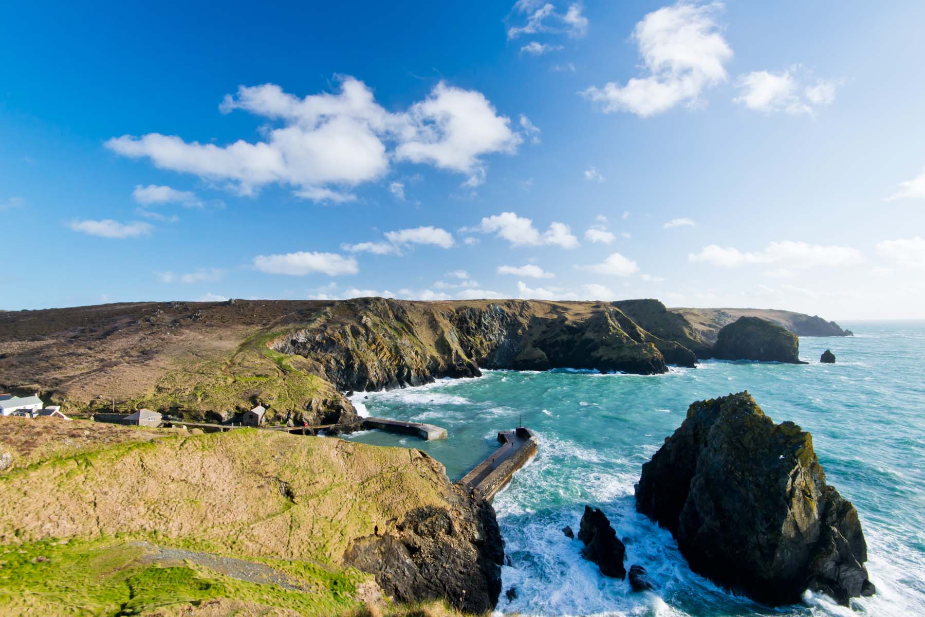
Mullion Cove may be a diminutive starting point but, guarded by solid sea walls, it’s sheltered, snug and squeezed by cliffs on both sides and you can find yourself lingering here. Dexter cattle graze on the headlands high above: short and stumpy, these nerveless animals edge down the cliffs in pursuit of what must be particularly succulent grass.
We climb our way out of the harbour, making a mental note to find out whether cows suffer from vertigo. The views from the coast are stirring: much of the route is laid out ahead, and looking west the vast expanse of Mount’s Bay arcs away to the tapering tip of Cornwall. The sea stacks and outcrops of rock around Men-te-heul and Predannack Head are almost prehistoric in appearance, with fractures and fissures in the rock creating incisor-like features eating their way out into the sea. One of the prevailing rocks here is serpentine, aptly named for its resemblance to a lizard’s skin.
The path threads through the Predannack Estate, full of colour in the form of the perennial pink of thrift, spring squill, campions and orchids and even the first of the vetches and clovers. Choughs have returned here over the past 15 years - thriving on the dung deposited by grazing livestock - and are numerous enough now to fly in flocks.
The coastal path edges briefly inland to circumnavigate a huge gulch. Fleetingly, it feels more like a moorland hike, with spongy heather and marshy tracts of bog to negotiate or sink ankle deep in. We edge our way past track ruts that hold puddles where tadpoles are swimming.
These are the Lizard Downs, part of the Lizard National Nature Reserve and a gentle reminder Cornwall is not all coast and beaches: its hinterland is an otherworldly and rather moody landscape. For a while, it seems as though we’ve left the sun behind too and through the mists that descend the incongruous shapes emerge a rusting aircraft and helicopter, parked at the edge of Predannack airfield. Here, though, we see the first swallows, feeding hungrily on the midges that breed in these watery lands.
Kynance Cove opens up far below but it’s a quick enough descent to the beach. The café here, set back from the beach but facing the Atlantic swells and winds head on, is well and truly on the map and has a popular following, not just because of its location at a geographical extreme but its green credentials that include solar panels and a turfed roof. These features along with its food elevate it a few notches above your average beach shack. The crab and burgers are tempting but with nearly two miles to go we opt for the sugar-rush of ice creams to push us towards the finishing line.
At Caerthilian Cove it seems I have my answer to my question about bovine fear of heights: they don’t suffer from vertigo, and this can get them into trouble. Along the coast here farmers have installed an invisible “fence” for both cattle and introduced Shetland ponies. The animals are each given a radio collar and should they stray too close to the edge - where a cable is buried - the collar delivers an electric shock.
The best part of an hour after leaving Kynance Cove, we turn to follow a right-angle of Serpentine rock cliff - the geology of the Lizard is similar to that found in Oman - and the headland finally comes into view. Tucked high above an old lifeboat station, the Lizard Point is relatively tat-free compared to Land’s End. There’s just the one cafe and a small-scale souvenir shop waiting to fulfil your desire to buy a metronomic waving cat. It’s the landscape, though, that dominates rather than the cachet of being at Britain’s Ultimate South. The coast is crenulated and breathtaking, the cliffs above Polpeor Cove much more sheer, the sea drop more spectacular than had seemed the case as we walked along. From here, the only way is north.
Travel essentials
Distance: 11km/ 7 miles
Time: Three hours
OS map: Explorer 103 The Lizard
Directions: The route follows the South West coast path (www.southwestcoastpath.org.uk) all the way, waymarked by an acorn sign on posts and fingerposts. At the Lizard it is an uphill plod to the bus stop.
Staying there
Mark Rowe stayed at the Mullion Cove hotel (01326 240328; mullion-cove.co.uk). Doubles from £130, B&B.
More information
Join our commenting forum
Join thought-provoking conversations, follow other Independent readers and see their replies
Comments
Bookmark popover
Removed from bookmarks