The Independent's journalism is supported by our readers. When you purchase through links on our site, we may earn commission.
Dracula, fossils, whales and one of the world’s longest coastal walking routes: this isn’t just any stroll in Yorkshire
A newly opened section of the England Coast Path offers never-before-seen views of the Yorkshire coast. It's nice to see some proper investment being put into simple joys, says our writer
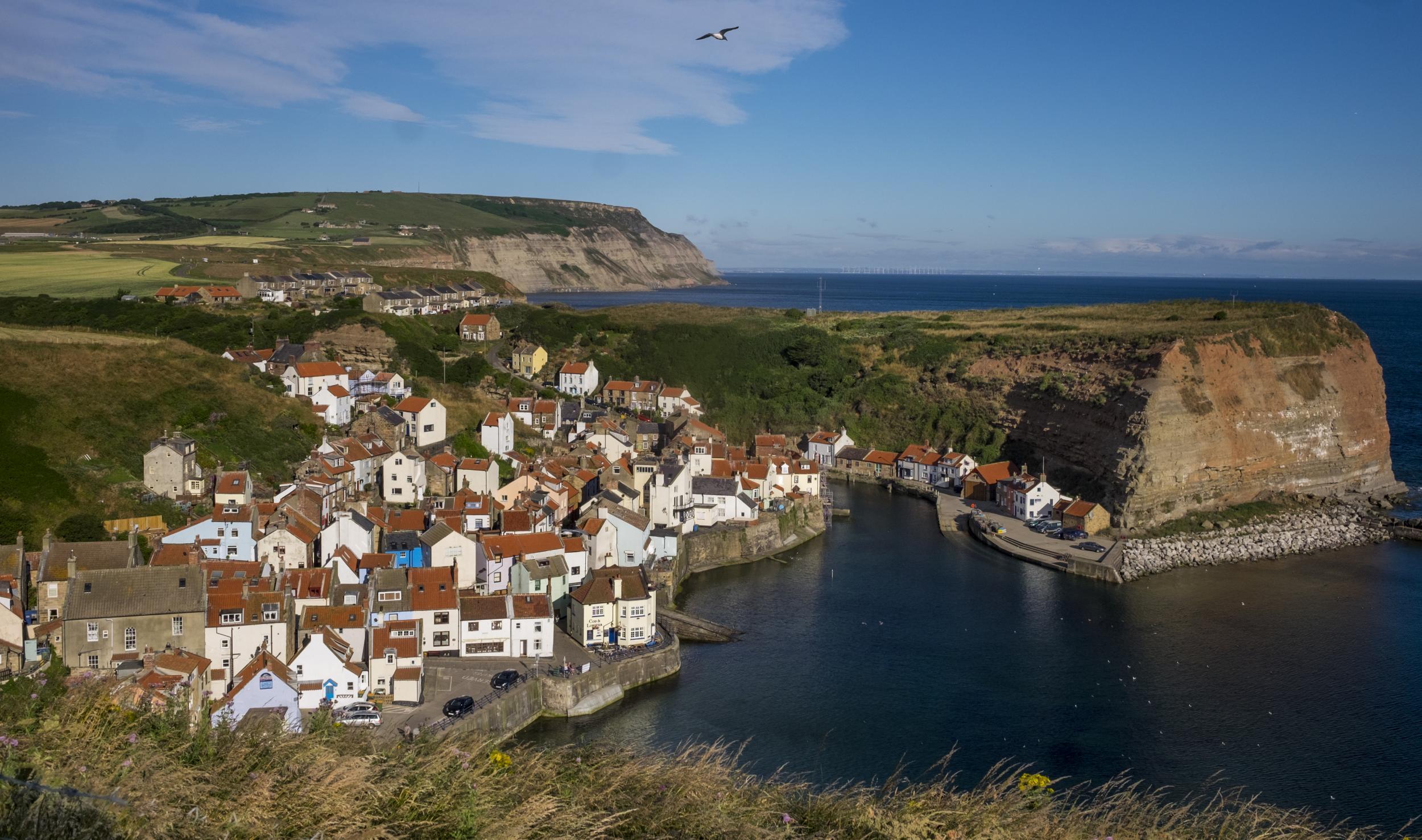
In such a well-trodden country, it’s rare for walkers to experience a new view. Yet standing on a headland high above the village of Staithes on the coastline of the North York Moors National Park, I’m doing just that.
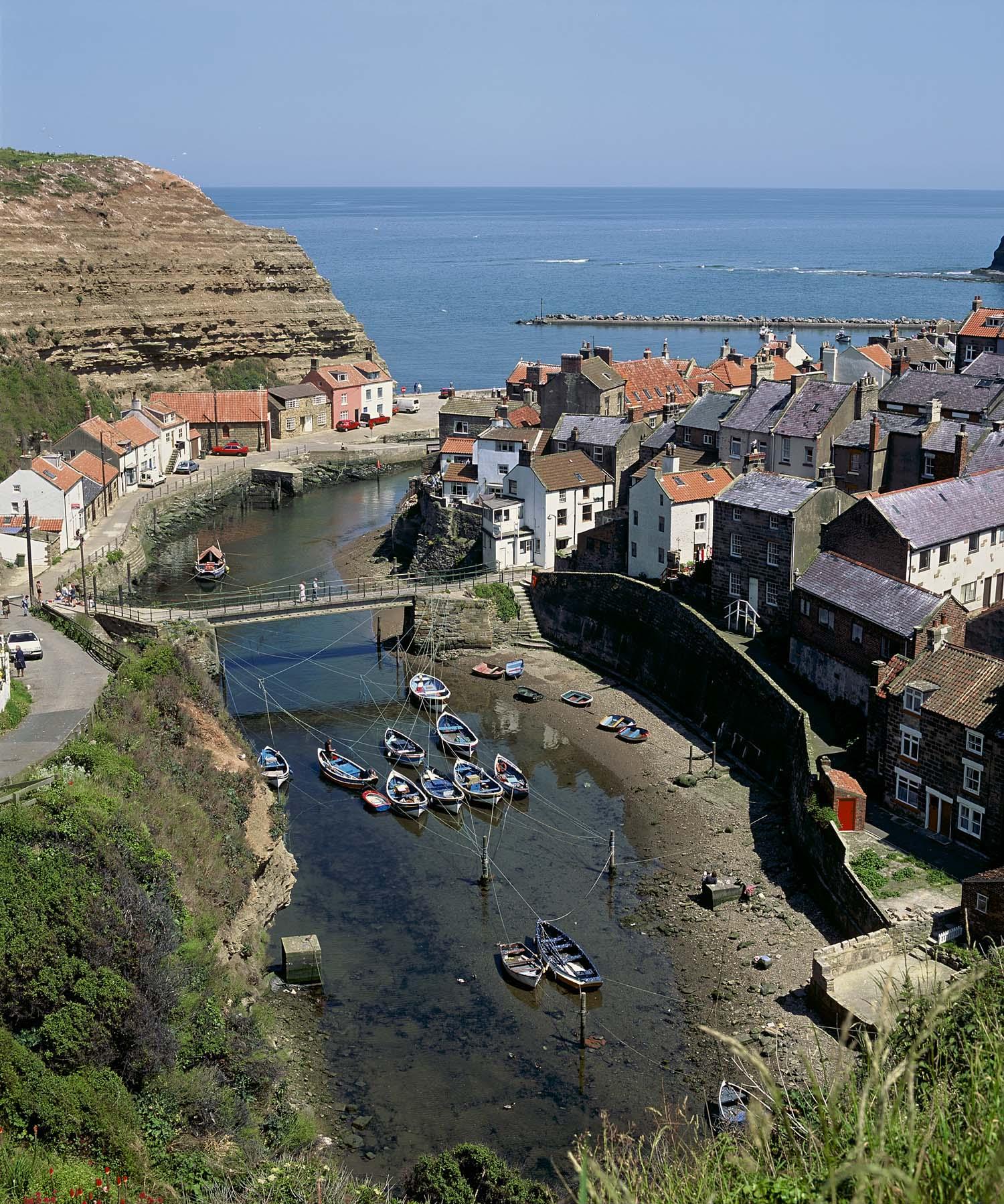
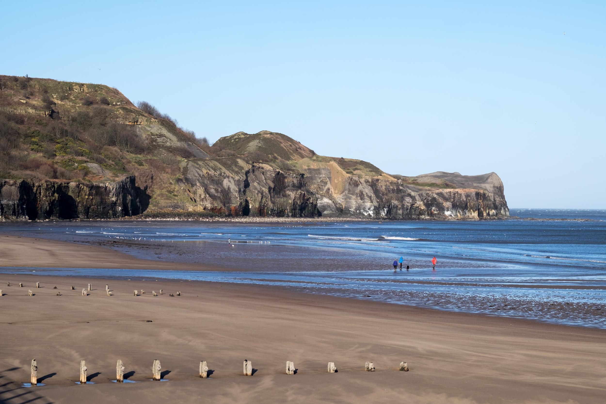
Below, crowded around the coastal gully of Roxby Beck, are Staithes’ oddly-shaped, squeezed and shrunken houses and cobbled streets. The tide is low and the wave-cut platforms that push out across the bay are handily exposed for rockpooling children.
Staithes is known for its artists’ community, typified by Paul Czainski’s eight trompe l’oeil works on the walls of cottages and other buildings within the village. Yet it seems remarkable that until this month, no artist would have had legal access to this sensational view of the bay and harbour.
Previously out of bounds, the headland is reached by a new path cutting at right angles south of Staithes, and is the latest legacy of the England Coast Path. It’s encouraging that, in an era of swingeing cuts, and when every political utterance includes the joyless phrase “hard-working”, this route – aiming to improve coastal experiences for walkers – has not been heaped on the bonfire with other “indulgences” such as libraries and public toilets.
The £50m scheme was launched in 2010 with the aim of creating a walking corridor along the coast from Marshall Meadows Bay in Northumberland to Land’s End in Cornwall, a projected length of 2,795 miles. So far, 293 miles of the path are open and a further 1,500 miles are being worked on. When completed by 2020, it will be one of the longest continuous coastal walking routes in the world and, for the first time, people will have the right of access around the entirety of England’s coast (aside from when the trail understandably skirts a few nuclear power plants).
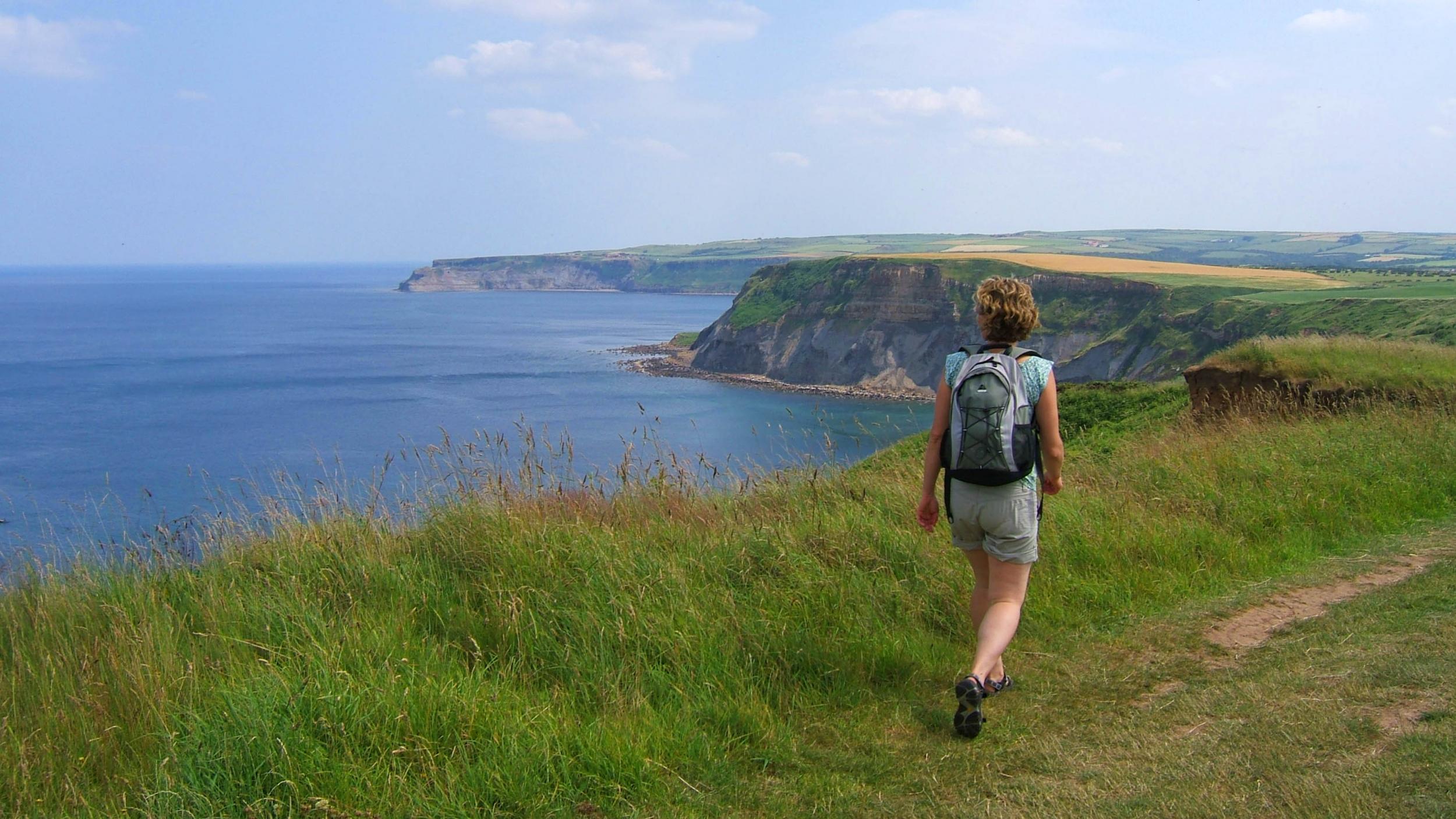
The Staithes section is part of a 68-mile stretch in Yorkshire that opened this summer, and walking it is proving an uplifting experience: sand martins flit back and forth and grasshoppers are whirring in the straw-coloured coastal banks. The views are stirring in both directions, the coast visible to the north almost all the way to Newcastle while a succession of headlands to the south jut their chins into the North Sea.
Suddenly, Staithes is hidden from view and I pass above sloping cliffs smothered in purple heather and through the miniscule hamlet of Port Mulgrave. Just a few houses remain from a 19th-century heyday when the village thrived on the demand for ironstone, which was mined from the cliffs and shoreline.
It’s a reminder that while the North York Moors are an idyllic place to visit, the sentiment has not always been shared with those who worked here. Passing another promontory, vast Runswick Bay emerges, stretching for more than two miles in a crescent shape. At its far end, the land at Kettleness was long worked for alum – processed into crystals for the textile and tanning industries – though the village slipped into the sea in 1829. The headland retains the scars, with spoil heaps, hills, and pits perched on the cliff top, exposing the underbelly of the land.
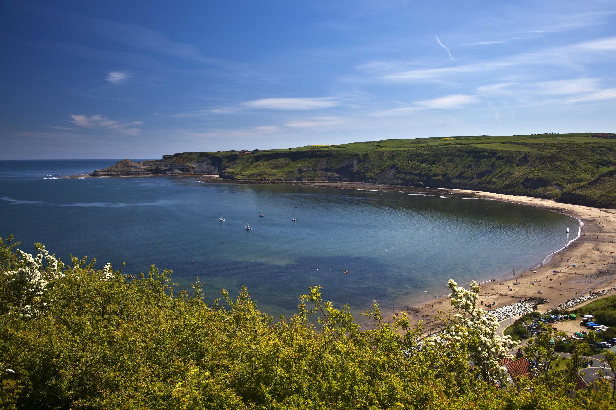
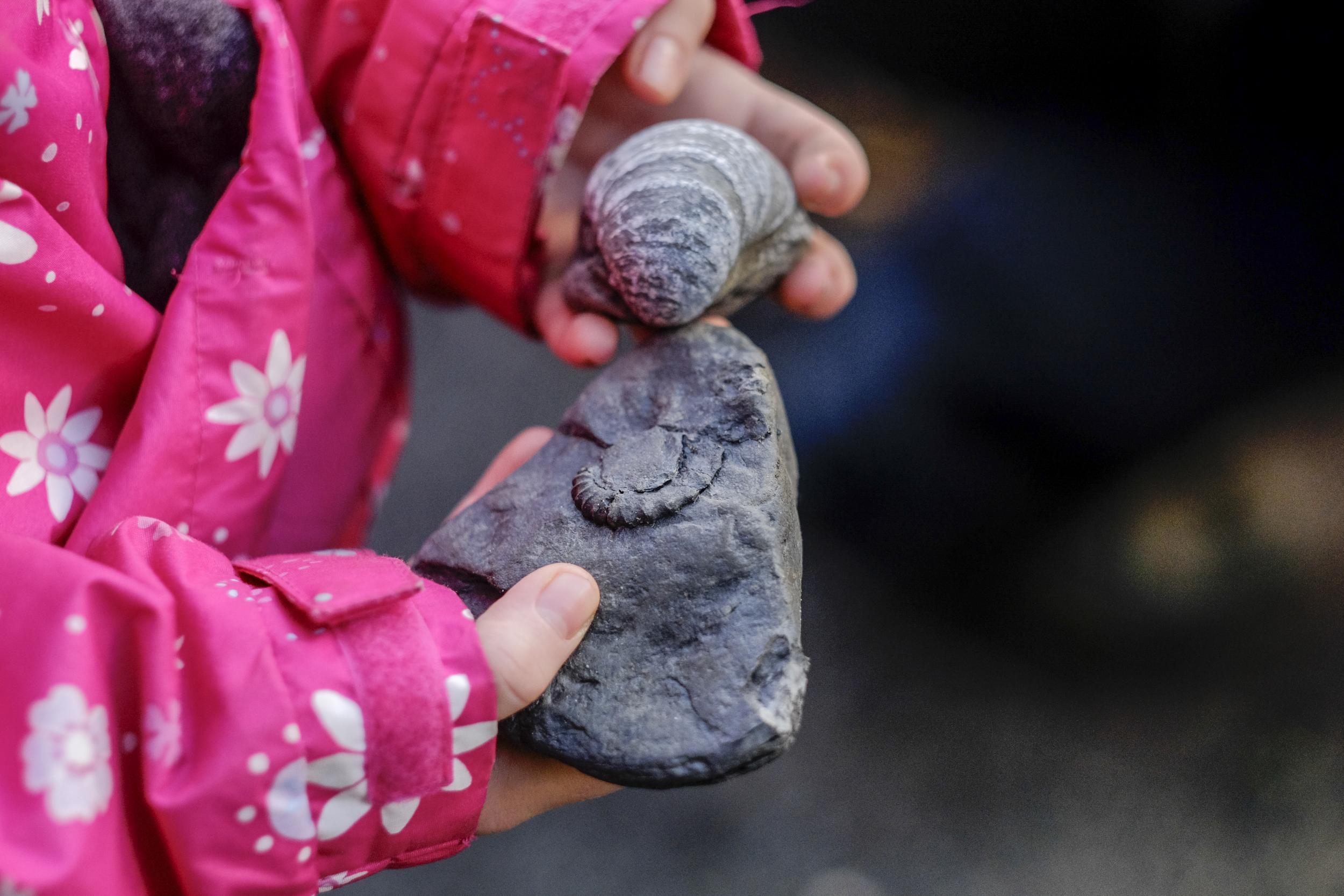
Halfway through this walk, Runswick Bay is a good place to pause, take off the boots and reward your feet with a paddle (to avoid an inland detour, you should time the walk either side of high tide here). The back of the beach is remarkably fertile fossil territory, thanks to its dark coloured Jurassic rock of shale and limestone, with ammonites and plant remains turning up in almost any rock you care to turn over.
The route leaves the southern edge of the bay via a narrow and charming gully cut by a small beck and passes above Kettleness. The eerie landscape appealed to Bram Stoker, who was known to walk around here; after hearing about the sightings of a mythical black dog, he incorporated the apparition into Dracula.
The final stretch of trail represents a metaphorical pat on the back for the steep climbs and follows an old railway line in spirit-level flat fashion to the appealing resort of Sandsend. The East Row Beck tumbles into the sea here, overlooked by the Hart Inn, co-operatively placed for weary walkers. Just offshore, boats pursue the salmon as they gird themselves to head upstream.
I see no salmon, and no elephants either: upstream from Sandsend are the remains of Mulgrave Castle, occupied in the mid-19th century by an Indian Maharajah, Duleep Singh. The story goes that the Maharajah built the road between Sandsend and Whitby to save his elephants the distress of getting sand between their toes.
Less apocryphal are the increased late summer sightings of whales, including minke, fin, sei, pilot and humpbacks as they follow the shoals of herring and mackerel migrating southwards. When I walked, they remained as elusive as elephants but at least, with ever greater access to the coast, hikers now have a better chance of seeing them.
Travel essentials
Walking there
This seven-mile route, taking three to four hours, begins at Staithes and finishes at Sandsend. The walk is clearly signposted as both the Cleveland Way (nationaltrail.co.uk/cleveland-way) and the England Coastal Path (nationaltrail.co.uk/england-coast-paath/plan), and waymarked with an acorn symbol.
Getting there
Mark Rowe travelled with Cross Country trains (crosscountrytrains.co.uk) to York and Transpennine Express (tpexpress.co.uk) to Scarborough.
Bus X93 runs from Scarborough to Whitby. From here, bus X4 runs between Whitby, Sandsend, Runswick Bay and Staithes (northyorkstravel.info).
Staying there
Estbek House (estbekhouse.co.uk) in Sandsend offers B&B from £125.
More information
Join our commenting forum
Join thought-provoking conversations, follow other Independent readers and see their replies
Comments
Bookmark popover
Removed from bookmarks