UK weather: Maps show which parts of Britain could see snow this week
Band of rain could fall as snow on higher ground amid largely bright, chilly weather
The UK is set for bright and sunny spells with milder temperatures returning to the country, but some areas could see snow by the end of the week as conditions turn colder.
Although last month saw some of the warmest days on record for the month of February, the country has been experiencing a frosty start to spring due to a column of polar air moving through Iceland and into the UK from the west.
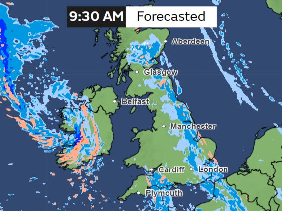
Tuesday is largely expected to be bright and sunny but a band of rain entered southwest England late on Monday, which will move across the east through the day bringing some rain and drizzle.
“The weather system that brings the wet weather on Monday to the Southwest is lingering and some outbreaks of rain continuing throughout much of the day for East Anglia and the Southeast,” said Aidan McGivern, meteorologist at Met Office.
Southeast England, parts of the midlands and the northeast will see some rainfall as the band moves eastwards with occasionally strong winds. Some snow is possible over the higher ground in Scotland.
The west will enjoy brighter weather with long sunny spells developing through the day.
The temperatures will hover around the usual averages for March after a chilly start to the spring season which saw snow blanketing higher ground over the weekend.
The north could see temperatures in higher single digits while some regions in the south could see up to 12C.
The rest of the week looks generally calm, featuring bright or sunny spells. There might be a sprinkle of showers, especially on Tuesday, coupled with brisk winds up in the northwest.
“It’s not going to be entirely rain-free, but certainly compared with recent weeks, there will be less wet weather around now,” Mr McGivern said.
Temperatures are likely to be a bit above average, creating a pleasant feel in the sunshine.
However later in the week some snow is likely to hit the northeast as temperatures drop for parts of Scotland, in contrast with the south which continues to see 12-13C.
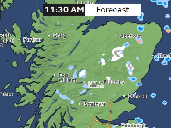
“A marked temperature contrast starts to form through Wednesday, Thursday and Friday,” he said. “We’re going to see 6-7C and a brisk wind coming in from the North Sea.”
Join our commenting forum
Join thought-provoking conversations, follow other Independent readers and see their replies
Comments
Bookmark popover
Removed from bookmarks