UK weather: Snow set to return as Britons brace for ‘colder and unsettled’ conditions
After a couple of days of milder weather, Thursday’s forecast shows possibility of snow and icy conditions, showers and gales
More rain and wintry showers have been forecast for the UK as the weather turns “colder and unsettled” over the next few days.
After a couple of days of milder weather, Thursday’s forecast shows the possibility of snow and icy conditions, showers and gales. The unsettled conditions are expected to continue over the weekend.
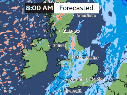
The day kicks off with rain expected in the southeast, accompanied by drier spells further north.
Showers are expected in the west, with the potential to turn wintry over higher ground as the day progresses.
Coastal areas in the far northwest will experience gales, adding to the varied weather patterns.
Here are some maps showing various weather conditions in different regions.
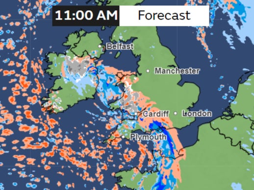
A band of rain will move across Southern England, affecting parts of Wales in the morning and later parts of the Midlands as the Northern areas remain dry with some hail in a few regions.
But as the day progresses, the rain will move away from the country with more icy conditions developing on higher grounds in the North and West.
The weather is set to turn colder and more unsettled on Friday and Saturday, with “heavy rain in some places” and a “risk of sleet and hill snow, possibly reaching lower levels,” the Met Office says.
Parts of Wales and England can be covered in snow on Friday, the maps show.
Temperatures will remain in single digits, “nearer to or a little below the seasonal average” for the time of the year.
While the mercury may recover a bit on Sunday, the forecast suggests continued unsettled and showery conditions for early March, particularly in the south, where persistent rain and strong winds may prevail.
As the week progresses, there is some uncertainty, but indications point towards the likely development of high pressure to the east. This could bring drier and more settled conditions, accompanied by some spring sunshine, especially in eastern areas. Western regions, however, remain susceptible to additional spells of rain and strong winds.
Join our commenting forum
Join thought-provoking conversations, follow other Independent readers and see their replies
Comments
Bookmark popover
Removed from bookmarks