Britain to be blanketed with snow and ice for new year as Met Office issues fresh weather warnings
Forecasters are predicting the country could see snow on the first day of the new year
Britons are set to begin the new year with snow showers as the Met Office issues new weather warnings.
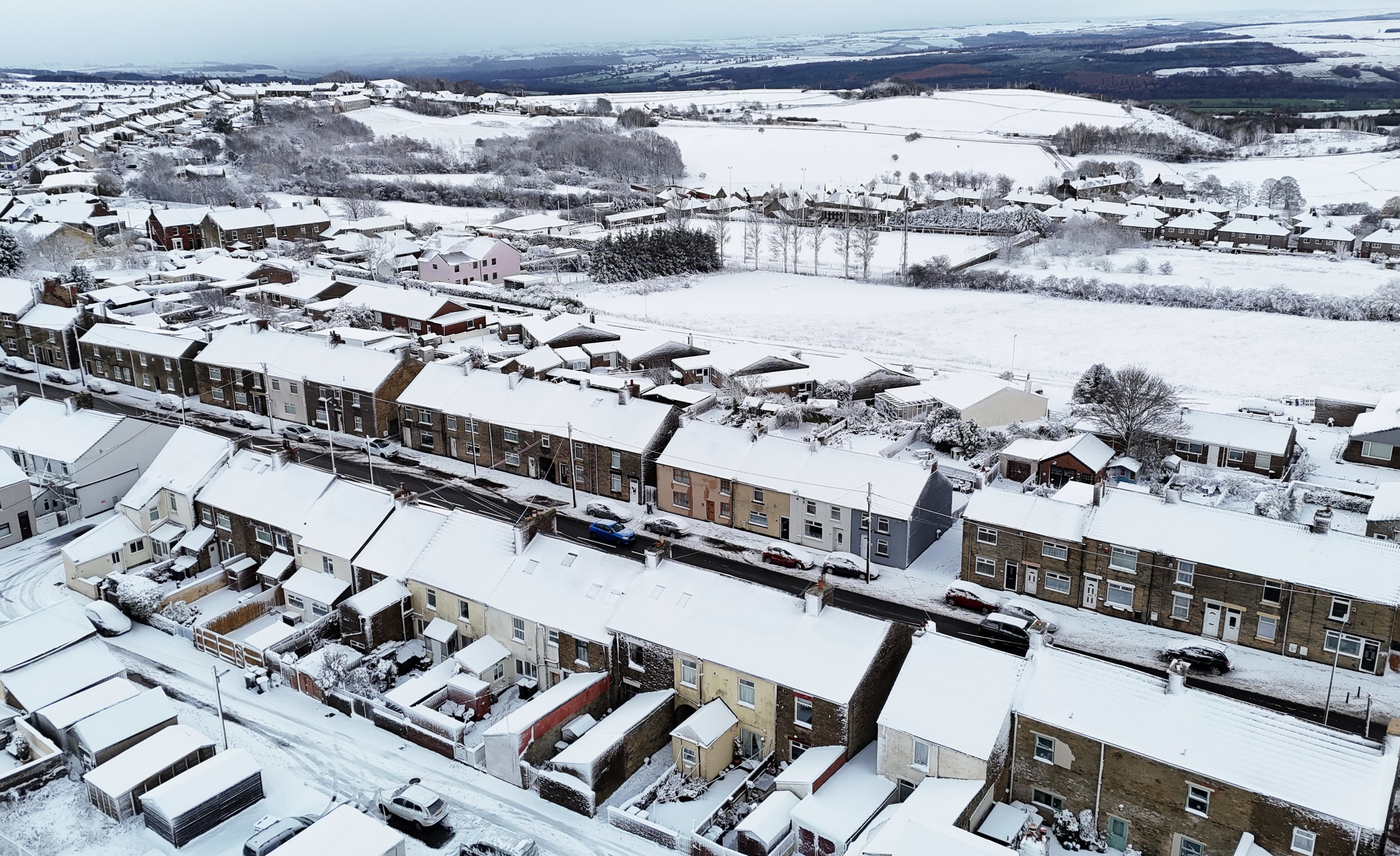
Up to 5cm of snow is expected to cover parts of the country from midnight on 1 January as a cold snap brings frosty temperatures for many. Icy conditions are also set to cause disruption as people travel across the country following new year celebrations.
A yellow warning for snow and ice is in place from midnight until noon on Friday and covers a large swathe of England and Wales, including Chester and Greater Manchester down to London and Kent.
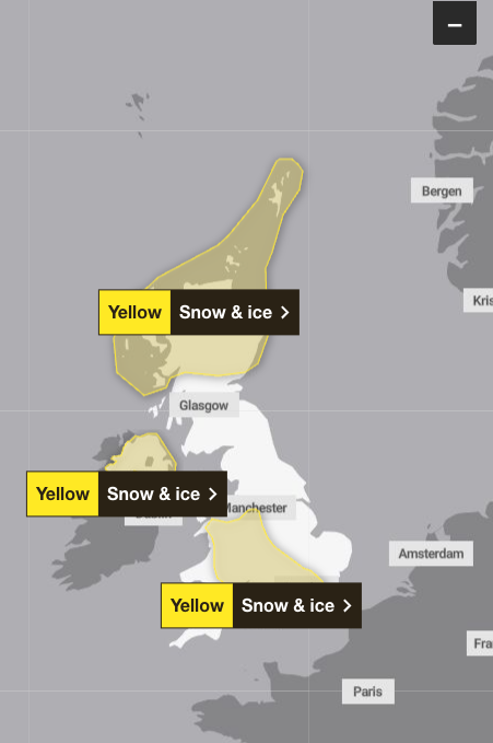
Separate yellow warnings are also in place for Northern Ireland between midnight and 10am on Friday, and in northern Scotland between 6am on New Year’s Day and the end of Friday.
Forecasters are warning parts of Scotland could see up to 10cm of accumulated snow by Friday as showers turn to snow north of Glasgow. The freezing conditions are then expected to move southeast across parts of England and Wales on Thursday, with blizzards predicted to last between two and three hours.
Around 1 to 2cm of snow is expected to accumulate where it falls, with 5cm possible across the higher ground of north Wales and the northwest of England.
The Met Office is advising people to leave the house at least five minutes earlier than usual in order to reduce the risk of slips and falls. It also urged people to check roads and public transport before travelling and to leave extra time for journeys.
Met Office deputy chief forecaster Mark Sidaway said: “It certainly looks like we are in for a taste of ‘winter’ as we welcome in the new year, initially in the north, but more widely across the UK for the first week of 2026.
“Arctic air and strong northerly winds will bring cold or very cold conditions to all parts of the UK, and it will feel especially cold in the strong winds. Widespread and locally severe frosts are expected, along with the first snow of the winter for many.
“A yellow warning for snow and ice has been issued for northern Scotland on New Year’s Day and beyond, where frequent and heavy snow showers may lead to some travel disruption.
“These colder conditions and wintry hazards – snow, ice and strong winds – will develop more widely as we enter the new year, with more warnings for snow and ice likely. It looks like this cold spell will last through at least the first week of January, so it’s important people keep up to date with the latest forecast and warnings.”
The UK Health Security Agency (UKHSA) has also issued more severe warnings for the start of the year.
It previously issued amber cold health alerts in the North East and North West of England.
However, yellow alerts have been upgraded to amber across the East Midlands, West Midlands, South East, South West, East of England, Yorkshire and the Humber, and London.
These warnings will be in place from 8pm on December 31 until 10am on January 6.
The UKHSA said it means the weather is “likely” to cause significant impacts across health and social care services, including a “rise in deaths” among those with health conditions or aged 65 or over.

Dr Paul Coleman, consultant in health protection at the UKHSA, said: “The weather is forecast to be very cold across England over the coming few days.
“Low temperatures like these can have serious impacts on the health of some people, particularly older people and those with serious health conditions.
“Exposure to cold can lead to increased risk of heart attacks, strokes and chest infections.
“It is therefore really important, as the colder weather sets in, to check in on friends, family and neighbours that are most vulnerable.”
Wednesday
A dry New Year's Eve for much of England and Wales with sunny spells. Cloudier elsewhere with some scattered showers. A cold day, with winds increasing later in the north. Showers turning wintry over higher ground of Scotland later.
Overnight
Windy with rain followed by wintry showers across Scotland. Drier elsewhere with clear spells, especially in the south. Frost and patchy mist or fog under clearer skies. Feeling cold.
New Year’s Day
New Year’s Day will be chilly and windy, especially in the north and east. Wintry showers across northern Scotland and extending down western coasts. Dry elsewhere with sunny spells.
Friday to Sunday
Remaining cold with overnight frosts. Mainly dry with some sunny spells, but wintry showers likely too, especially in the north and at times extending down western and eastern coasts.
Join our commenting forum
Join thought-provoking conversations, follow other Independent readers and see their replies
Comments
Bookmark popover
Removed from bookmarks