Storm Isha map: Met Office issues amber warning for wind as 80mph to batter the UK
New storm to cause chaos across the country as UK still grappling with freezing temperatures
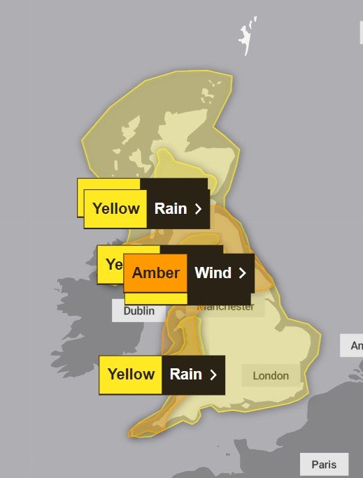
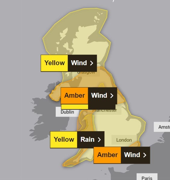
Danger to life amber wind warnings have been issued across parts of the UK as Storm Isha is set to cause anarchy with 80mph gales over the weekend.
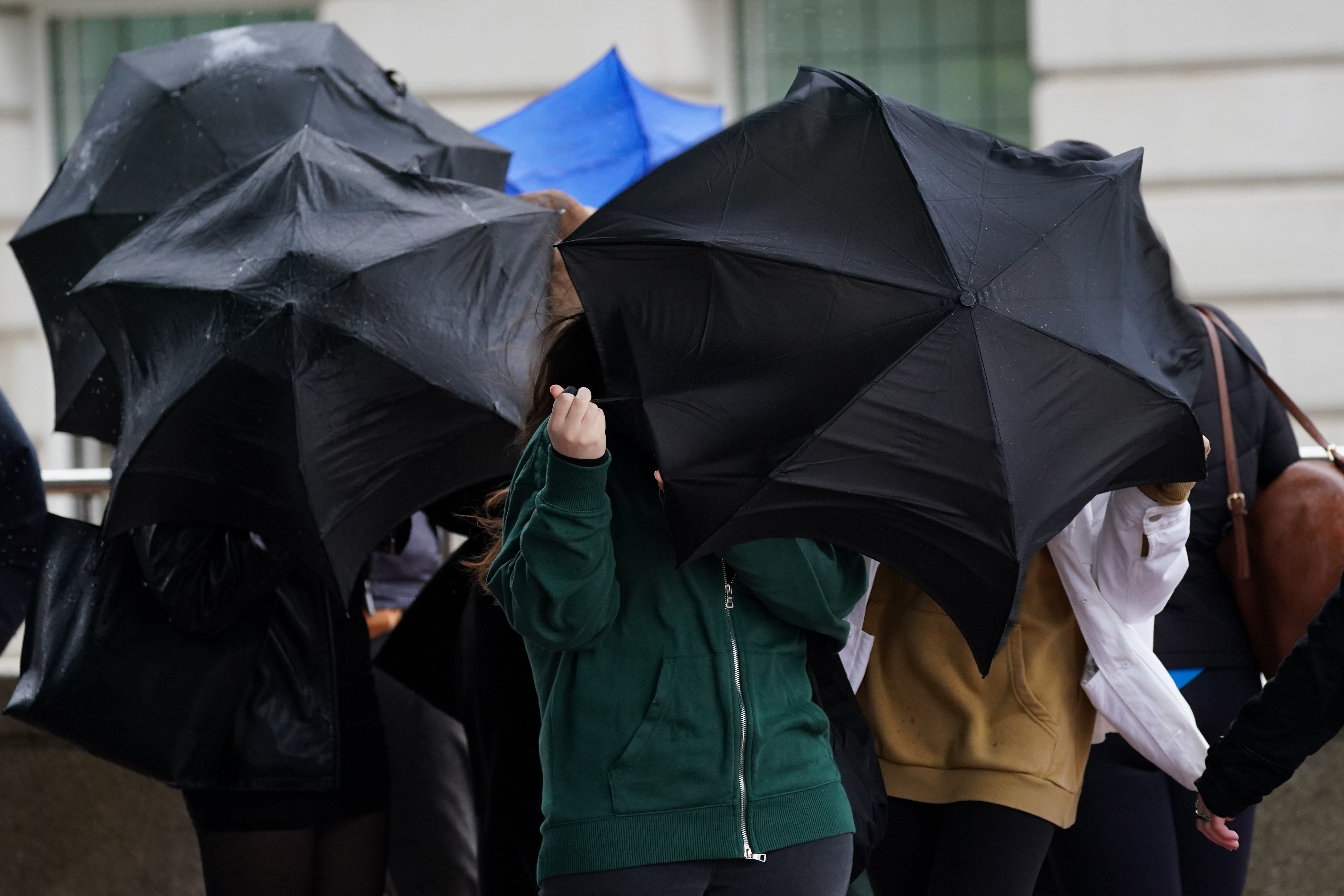
The Met Office also warned of power cuts and damage to buildings due to the gusts while yellow warnings for rain have been issued covering the whole of the UK.
Roads and bridges are likely to be shut and rail and bus services could face delays and cancellations.
The Met Office weather warnings extends to Central, Tayside & Fife, north east England, north west England, Northern Ireland, SW Scotland, Lothian Borders, south west England, Strathclyde, Wales, Yorkshire & Humber, London and south east England.
The amber warnings are in place from 6pm Sunday until 9am Monday while the rain warnings come into force at 6am on Sunday until 6am on Monday.
Chief Meteorologist, Dan Suri, said: “In these regions we could see gusts frequently between 50-60mph and even up to 80mph in exposed coastal locations.
“As the storm starts to move away on Monday morning very strong winds will also develop in the far southeast of England, bringing the risk of 70-80mph gusts here too in the early hours of Monday morning.
“Storm Isha will bring a disruptive spell of weather to the UK with strong winds across the whole country. Heavy rain will cause additional hazards, particularly in the west.”
As the warnings highlight the possibility of travel disruption, power cuts and dangerous conditions near the coast with high waves and flying debris, a spokesperson for Energy Networks Association, which represents Britain’s energy network operators, said: “An amber warning brings an increased risk of damage to homes and vital infrastructure. Energy network operators are preparing to deal with any damage quickly and safely.
“With severe weather forecast, our advice to customers is to prepare, care and share. Prepare by going online to PowerCut105.com for advice and call 105 for free if you have a power cut. Check in with people who might need extra help, and share this information so friends and family know what to do too.
“If you see damaged power lines or lines brought down over the coming days, stay well clear and call 105 for free to report it, or dial 999 if there’s an immediate danger to life.”
UK five-day forecast:
Tonight:
Winds strengthening in the west and cloud thickens as rain approaches later in the evening. Elsewhere dry and clear with some fog and frosty patches, mainly in the southeast.
Saturday:
A cloudy and breezy start for many. Patchy rain at first but turning more persistent for western parts during the evening. Milder with snow melting at low levels.
Outlook for Sunday to Tuesday:
Mild, wet and windy through the weekend and continuing into next week. Gales or severe gales likely on Sunday, especially in the northwest. Locally heavy outbreaks of rain at times.
Join our commenting forum
Join thought-provoking conversations, follow other Independent readers and see their replies
Comments
Bookmark popover
Removed from bookmarks