UK school closures after cold weather spell brings snow and ice
Met Office warns of ‘substantial disruption’ as cold snap grips northern half of UK
Many schools are facing closure after snow and ice struck across the UK.
The Met Office have warned the wintry weather is likely to cause “substantial disruption” as the cold snap grips the northern half of the UK.
Around a hundred schools are closed in northern Scotland as snow and ice bring further disruption across the area. In Wales, 57 schools were closed, while 41 have shut in England.
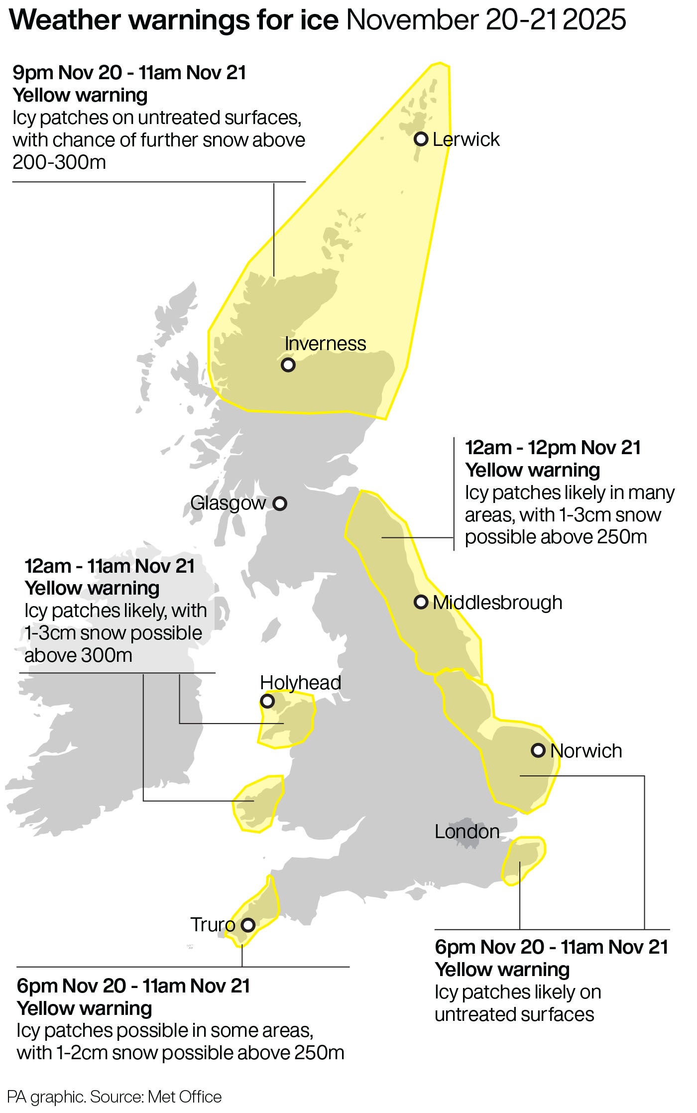
Much of northern Scotland has continues to be subject to a yellow warning for which began on Tuesday and is due to end on Friday. Similar warnings apply from 12am for much of north-east England and Yorkshire, as well as western coastal areas in Wales.
Wintry showers have been widespread across the UK, particularly over higher ground, with lying snow reported in areas including Scotland, Northumberland, Humberside, Powys in Wales, Cornwall, and Northern Ireland, the Met Office have stated.
A yellow weather warning has also been issued for snow and ice across parts of south-west Wales and south-western England from midday on Wednesday to 11.59pm on Thursday.
The Met Office said: “A frosty start with icy stretches in places. It will be a cold but bright day for most, although the sunshine turning increasingly hazy. Thicker cloud and outbreaks of rain arriving into the northwest later. Feeling pleasant in lighter winds.”
“A cold evening, but becoming cloudier and windier with outbreaks of rain pushing south-eastwards overnight. A milder night than of late, but still chilly in the southeast.”
The Met Office warned the “first notable cold snap of this autumn” is likely to cause “particularly tricky travel conditions” as well as power cuts.
Looking to the weekend, the forecaster said: “As we head into the weekend, we expect a shift to milder, more unsettled, Atlantic-driven weather. This will bring cloud, rain and some stronger winds at times, but also a reduction in the wintry hazards we’ve seen over recent days.
“We are keeping an eye on Wales and the Midlands, where saturated ground conditions may increase the likelihood of low impacts.”
For Sunday and Monday, the forecast reads: “Remaining unsettled on Sunday and Monday with further spells of rain and showers. Some brighter spells in between, more so on Tuesday. Less cold, especially overnight and often windy.”
Join our commenting forum
Join thought-provoking conversations, follow other Independent readers and see their replies
Comments
Bookmark popover
Removed from bookmarks