UK weather – today: Snow forecast issued by Met Office as temperatures plummet across UK
Temperatures are expected to plunge, bringing snow to parts of the UK amid yellow warnings for strong winds of up to 55 mph
Temperatures are expected to plunge into the weekend and through the week with temperatures becoming chillier, bringing rain, hail, sleet and snow to parts of the UK.
Most snow is likely to hit northern parts of the UK, with some central parts also affected.
This comes as the Met Office issues three yellow weather warnings for strong winds across parts of Northern Ireland, northwest Wales and England, which are expected to bring widespread disruption to transport and infrastructure.
Gusts up to 55mph are likely for many, with the worst affected areas of England to include Blackpool, Cumbria, Lancashire and Merseyside.
Country Antrim and and Conwy are to be the worst affected in Northern Ireland and Wales respectively, with 70 mph gusts also possible for areas with exposed coasts and hills.
Hundreds of flood alerts have been cautioned in England by the Environment Agency after relentless rain left towns and other residential areas under several feet of water.
Images and videos have captured how settlements across the southwest have been effectively transformed into islands after the River Severn burst its banks following days of torrential rain.
Meteorologist Aidan McGivern said: “It’s going to stay blustery, with some strong gusts in the west in particular and these lows will continue to send us outbreaks of rain and showers heading into the weekend.”


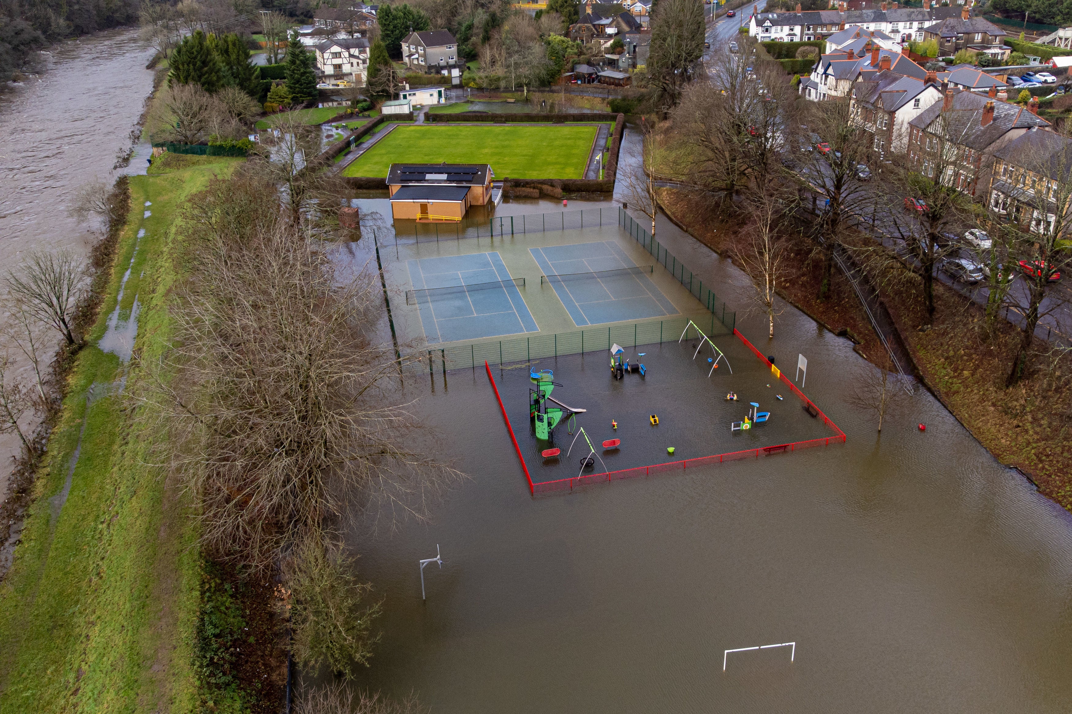
In pictures: Burst banks of submerges a park in Wales
Pictures show flooding next to the River Taff has submerged a play park in Taffs Well, Wales.
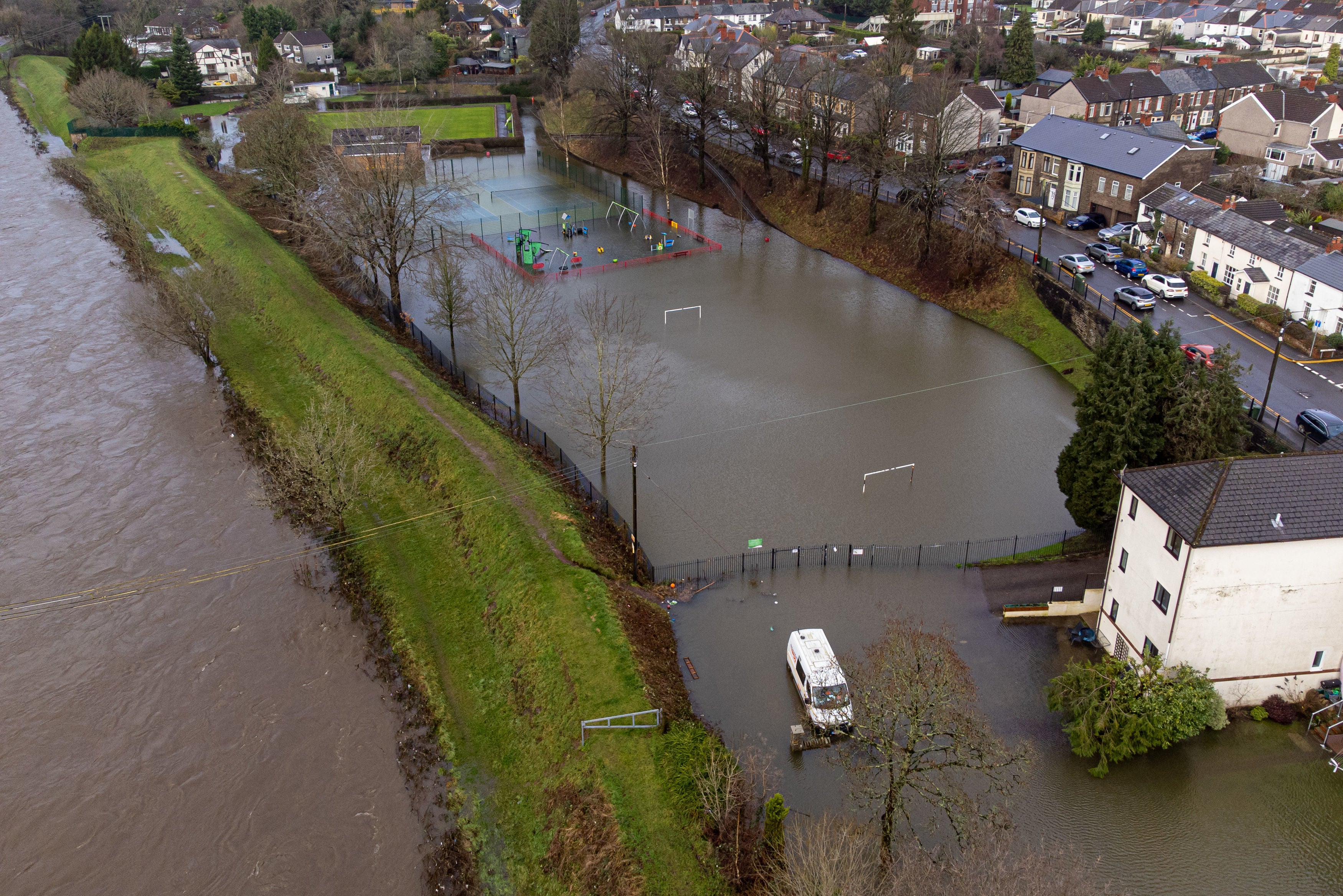
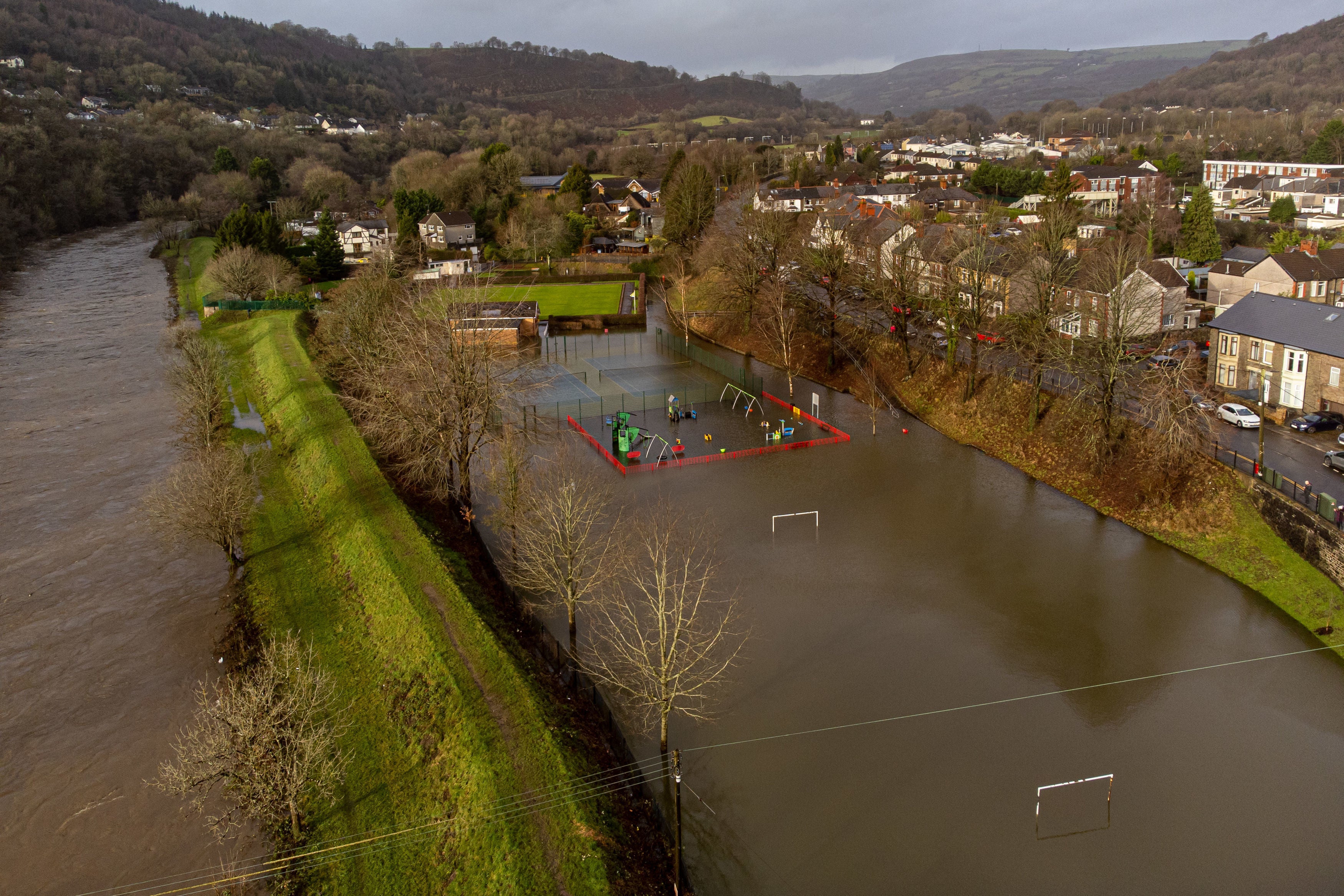
River Taff bursts banks amid torrential rain in Wales
Cars submerged in floodwaters in southwest England
A Twitter user posted a video of cars submerged in floodwaters in the village of Exebridge between Devon and Somerset.
Showers to continue into Thursday afternoon
Despite some clearer skies, the Met Office has said “showers and longer periods of rain will continue pushing into western Scotland and Northern Ireland, with gales developing as well”.
Here is an outlook for Thursday afternoon:
Yellow wind warnings in place across UK
More yellow weather warnings were issued earlier today as strong winds push across Northern Ireland, northwest Wales and England.
Wet and windy start to Thursday
Thursday started wet and windy across most of the UK as the Met Office’s radar show here:
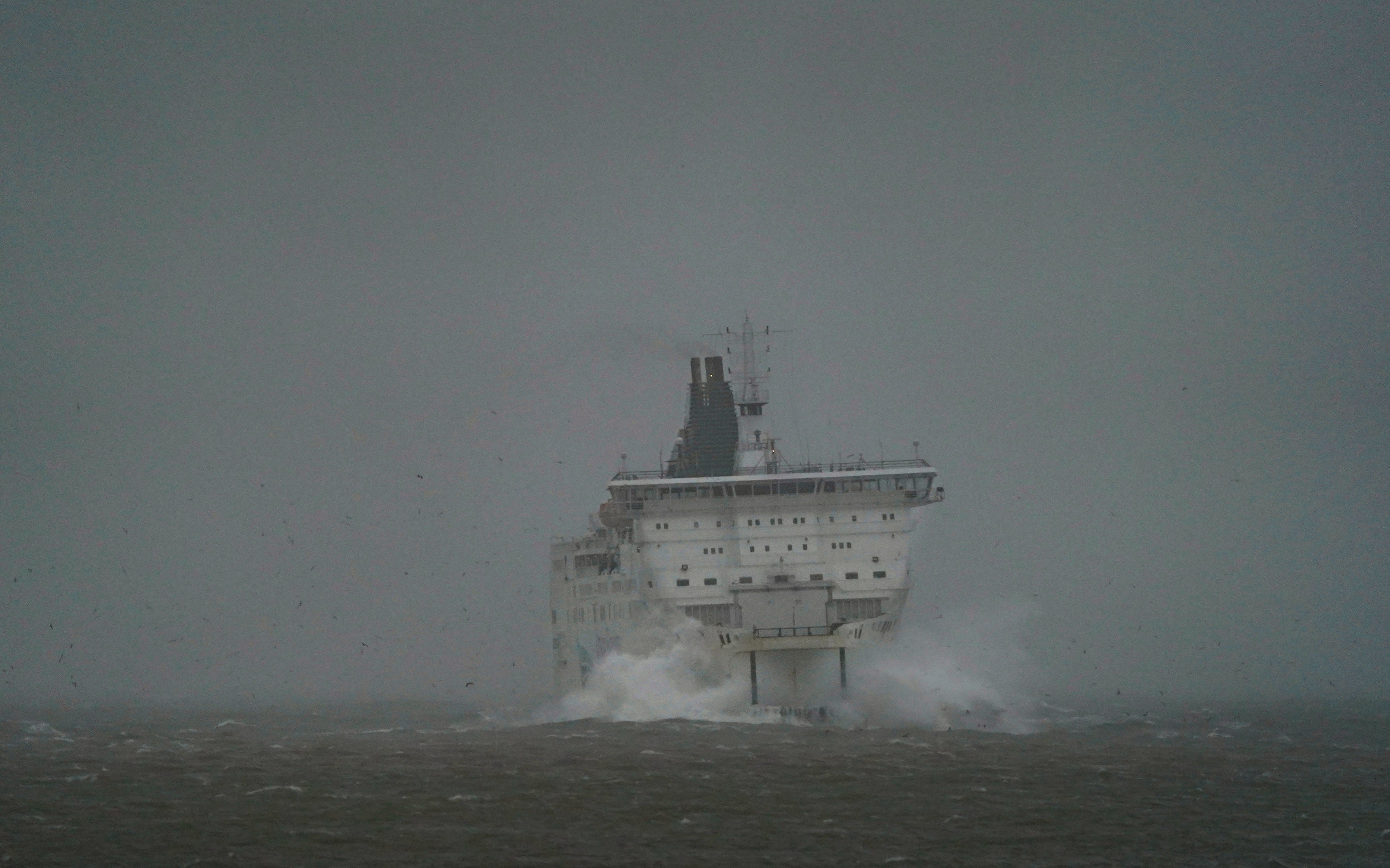
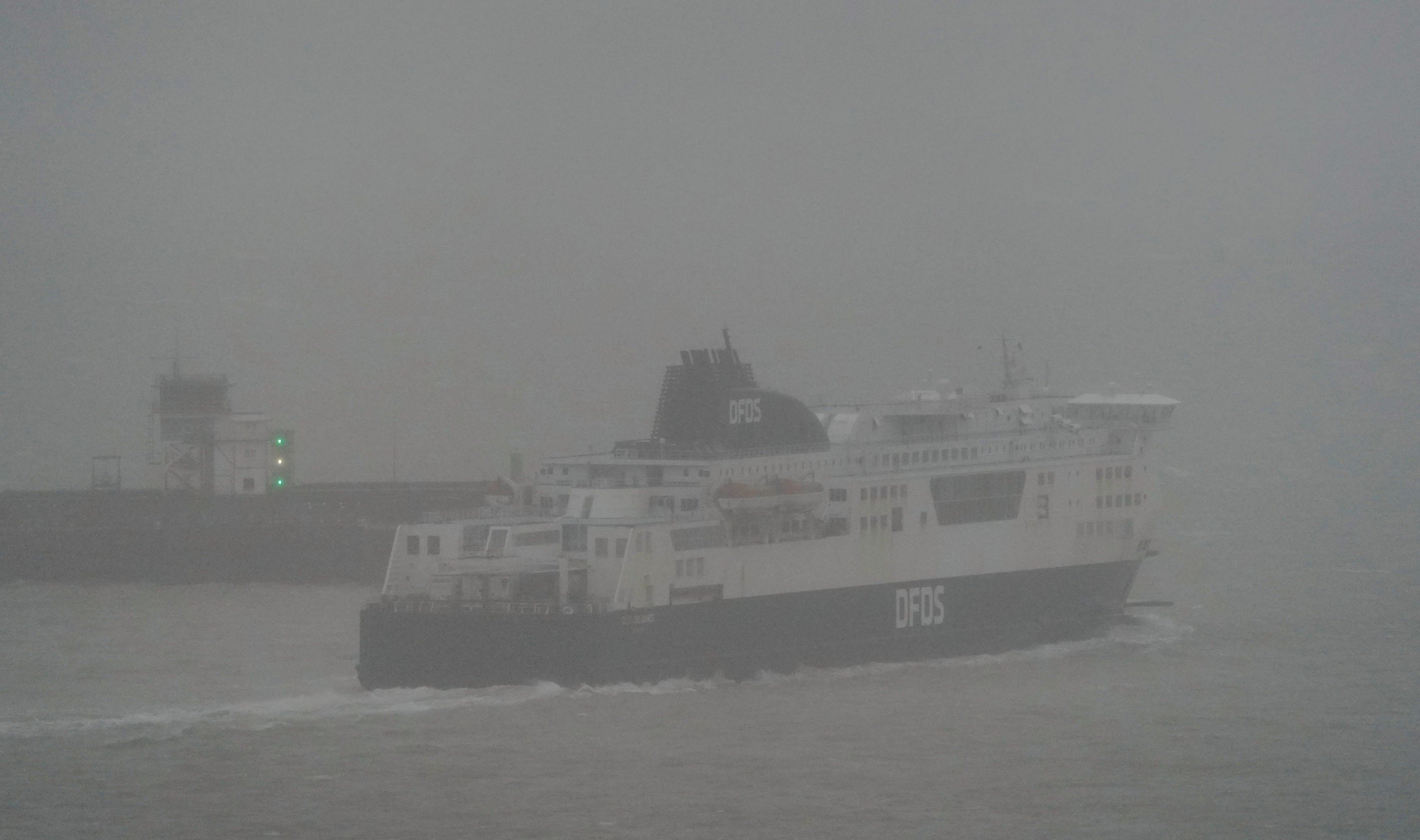
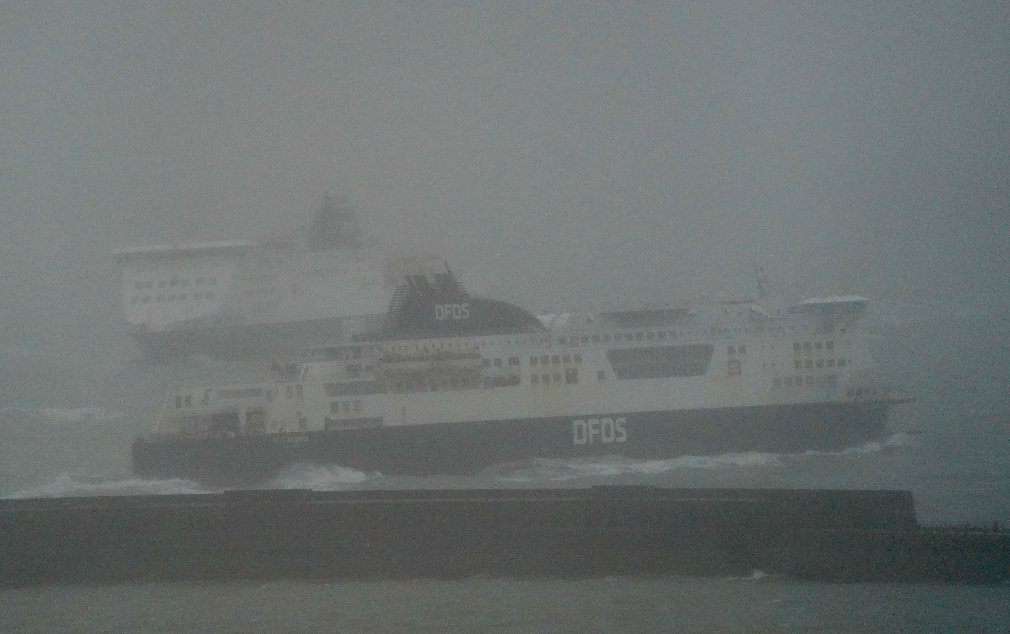
A DFDS ferry makes its way through choppy waters as it leaves Port of Dover in Kent during rough weather as rain and strong winds continue.
The major ferry port also faces coastal gales, as well as heavy rain.
The Met Office forecasts that things should be looking a little drier and brighter in southern parts of the UK this afternoon, as rain and clouds gradually clear away.
A mountain road in Wales has turned into a waterfall after being battered by torrential rain.
The Bwlch Mountain road was closed following the landslide in Nantymoel this morning which resulted in rocks and heavy rainwater rushing over the mountain.
Join our commenting forum
Join thought-provoking conversations, follow other Independent readers and see their replies
Comments
Bookmark popover
Removed from bookmarks