London flooding: Areas of city flooded as post-heatwave thunderstorm warning issued
Thunderstorms followed a week of high temperatures in the capital
A “major incident” has been declared across hospitals in London after floods caused chaos throughout the capital.
Ambulances have been redirected after the A&E department at Newham Hospital was closed because of floodwater. Wards at Whipps Cross hospital, including the maternity department, were also forced to shut.
Patients have been asked to attend other hospitals were possible due to “operational issues” at the two hospitals in east London.
A spokesperson for Barts Health NHS Trust said: “We are experiencing operational issues at Whipps Cross Hospital and Newham Hospital due to the heavy rainfall.
“We are working closely with our local partners to resolve the issues and maintain patient care and – while services remain available for people in an emergency – patients are asked to attend alternative hospitals where they can, to help us put solutions in place as quickly as possible.”
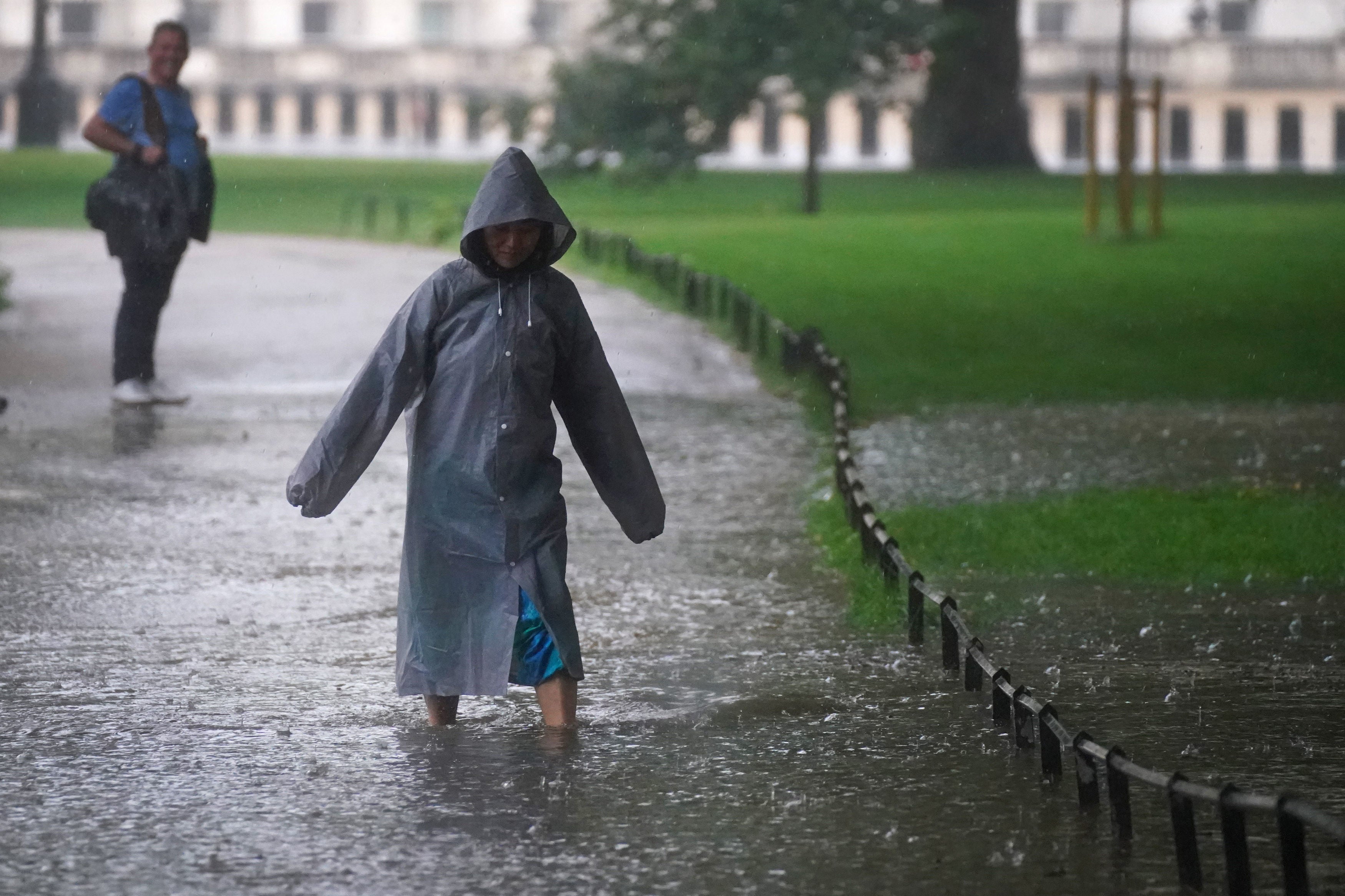
Torrential rain and thunderstorms, that followed the heatwave of the last week, caused many homes, roads, and tube stations to be left out of action.
Motorists had to be rescued by emergency services after the rain caused severe surfacing flooding.
A number of drivers had to abandon their cars on the main roads after they became half-submerged in the deluge, which got worse as rain became heavier while the day wore on.
Cars were mainly affected by water collecting in dips under bridges, on roads that included dual carriageways.
A boat had to be used by a rescue crew to reach motorists stuck in their cars under a bridge in Worcester Park, Sutton.
Also in Worcester Park, a man is seen walking through flood water that reaches his mid-thigh in a photo posted to Twitter.
Two flood warnings have been in place for Worcester Park and nearby West Barnes, due to the flooding of the river Beverley Brook.
“River levels have risen as a result of localised thunderstorms,” the government’s Environment Agency said.
Other affected areas were Clapham and Camberwell, as well as Kingston in southwest London, and parts of east London such as Leyton and Walthamstow.
London Fire Brigade said that they have taken more than 300 calls concerning flooding. The mayor of London, Sadiq Khan, said that Metropolitan Police and local authorities were also assisting people that were affected.
Cars half-submerged by floods under a bridge were stranded by the drivers on the A406 near the Walthamstow turnoff, a video posted on Twitter shows.
The M11 slip road on to the A406 North Circular, at junction four, was shut because of the severe flash floods, the Metropolitan Police warned, and caused severe disruption in Woodford, east London, and parts of Essex.
The Met Police’s Special Constabulary has urged motorists not to drive through deep water in flooded areas.
It said: “Rescuing people uses a lot of resources, and so it’s wiser to apply good judgement and find a different route.”
Eight Tube stations – Covent Garden, Edgware Road’s Circle line station, Gants Hill, Kennington, North Greenwich, Pudding Mill Lane, Stepney Green, Stockwell, and Surrey Quays – had to close.
A video posted on social media by Tube traveller Rob Day shows floodwater gushing through the entrance to Pudding Mill Lane station near Stratford, east London.
A number of Londoners have said that they had never seen flooding of this scale before.
One restaurant owner in Woodford reportedly said that it was the worst flooding he had ever seen in the capital.
Buses have been left stranded on waterlogged roads in Battersea. Eddie Elliott cycled past the area outside Queenstown Road station, where he said the road had been “totally shut down”.
“Having been born and raised in London, I have never seen anything quite like it,” the 28-year-old writer told PA.
“Stands out as the worst I’ve experienced personally,” he added.
Labour staff have been advised to not attend the party’s parliamentary offices on Monday as the building will be closed, according to reports.
The suite of offices in the Norman Shaw building, which is attached to Portcullis House, is where the offices of leader of the opposition Sir Keir Starmer, his staff, and members of the shadow cabinet are situated.
Sir Keir said: “Thoughts with all those affected by today’s flooding. Thanks to all the emergency services and local authorities working to support local people.”
Amber warnings for thunderstorms have been issued for this weekend by the Met Office. The meteologists warned that southern and central parts of England and Wales would see flash flooding.
The Met Office has issued an amber warning for storms covering London and some of the Home Counties where homes and businesses are at risk of flooding, lasting until 7pm on Sunday.
A yellow warning for storms – which could cause travel and power disruption – also covers a wider area of the south from Norwich to Plymouth, and lasts until midnight.
Met Office meteorologist Steven Keates said parts of the south between south Suffolk and the Isle of Wight could be deluged by 100mm of rain in just a few hours on Sunday evening.
Storms are being caused by a “convergence” of air currents, due to warmth in the earth’s surface from the recent heatwave rising into cooler air in the atmosphere, he added.
Temperatures are set to rise slightly in most places on Monday as the storms clear, with the mercury predicted to reach 26C in London, 25C in Edinburgh, 24C in Cardiff, and 22C in Belfast.
The Met Office has predicted early cloud in some northern and eastern parts, which will move up to Scotland, and sunny spells and scattered showers in most places throughout the day.
Spells of heavier rain, with a risk of hail and thunder, are expected from Tuesday until the end of the week.
The Met Office has predicted that “above average” temperatures will make a return from about mid-August.
This weekend is the second time that London was hit by flooding this month. Last week, homes and businesses in west London, mainly Notting Hill, were ruined by flash floods.
Join our commenting forum
Join thought-provoking conversations, follow other Independent readers and see their replies
Comments
Bookmark popover
Removed from bookmarks