UK weather: Storm Babet named by Met Office as heavy rain and strong winds to batter Britain this week
Britons brace themselves for torrential rain and powerful winds

The UK faces torrential rain and powerful winds in the second named storm of the season later this week.
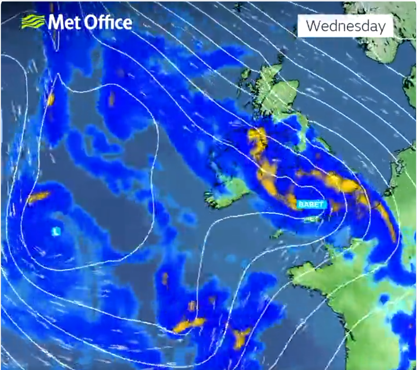
Storm Babet will bring “impactful” weather to the UK from Wednesday, the Met Office has said as it issued a four-day warning for most of the country.
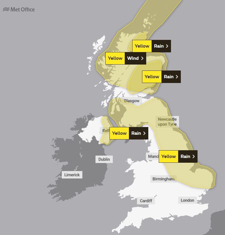
Yellow severe weather warnings cover much of Scotland, eastern Northern Ireland, the northeast of England, Yorkshire, the East Midlands and East Anglia.
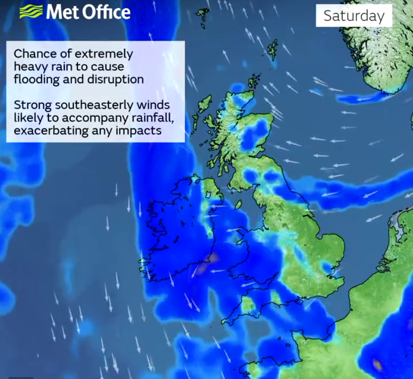
As much as 150mm to 200mm of rain is expected to fall on central and eastern areas of Scotland and there is a possibility of 70mph gale-force winds affecting northern parts of the UK, forecasters warned.
Scotland typically receives 168mm of rainfall in October, but the country will receive more than this in the span of a few days.


The heavy rain may also cause “fast-flowing and deep floodwater” that could pose a “danger to life,” and there is also a chance of essential services like gas, water and mobile phone signals to be disrupted.
Parts of England can expect more than 100mm of rainfall during the week with some isolated areas facing up to 150mm.
Deputy chief meteorologist Steven Keates said: “Storm Babet will bring impactful rain to many parts of the UK, but especially parts of eastern Scotland, Northern Ireland and northern England later this week.
“Heavy and persistent rain will fall onto already saturated ground bringing a risk of flooding. It is important to stay up to date with warnings from your local flood warning agency as well as the local authorities.
“As well as heavy rain, storm Babet will bring some very strong winds and large waves near some eastern coasts too. Gusts in excess of 60mph are possible in eastern and northern Scotland from Thursday. It is likely Met Office warnings will be updated through the week.”
David Morgan, flood duty manager for the Scottish Environment Protection Agency (SEPA), said: “Storm Babet will bring heavy rain and high winds across Scotland from Wednesday evening, starting in the southwest before moving across to the northeast through Thursday and into the weekend.
“Flood alerts and warnings will be issued as required, and we continue to work with the Met Office to monitor the situation 24/7.
“Impacts from surface water and rivers are likely, and with catchments saturated from recent heavy rain and flooding, we’re urging people to be prepared for potential flooding. There is also concern that surface water flooding may be exacerbated by debris blocking drainage, culverts, etc as a result of the high winds.
“If you live or work in an area that could be affected, consider any steps you need to take now to be prepared and stay safe, and to take extra care if you need to travel.
“If you have not already signed up to Floodline, you can do so now to receive free updates for where you live, or travel through, directly to your phone. Follow SEPA’s social media, especially @SEPAflood on X for the latest information.”
The Royal National Lifeboat Institution (RNLI) has urged the public to exercise “extreme caution,” particularly along exposed cliffs, seafronts and piers.
Sam Hughes, the charity’s water safety partner, said: “The forecasted strong winds along with heavy rain are likely to cause dangerous conditions for those visiting the coast around the UK and Ireland.
“The RNLI advises staying a safe distance away from the water and cliff edges as the conditions could knock you off your feet or wash you into the sea. It is not worth risking your life.
“If you see someone else in danger in the water, call 999 or 112 and ask for the Coastguard if by the coast, or the fire service if inland. If you have something that floats that they can hold on to, throw it to them. Don’t go in the water yourself – you may end up in difficulty too.”
MET OFFICE OUTLOOK
Monday evening:
Mostly dry overnight but turning chilly once again with a local frost possible. However, not as widespread as previous nights as cloud will increase from the southwest.
Tuesday:
Another mostly dry day with bright or sunny spells for many. Turning windier from the southwest later with some rain in southwest England and southwest Wales likely too.
Outlook for Wednesday to Friday:
Turning increasingly unsettled through the period, with outbreaks of rain, heavy at times and stronger winds, especially over the higher ground. Temperatures returning back to average with milder nights.
Join our commenting forum
Join thought-provoking conversations, follow other Independent readers and see their replies
Comments
Bookmark popover
Removed from bookmarks