UK weather mapped: Met Office issues urgent warnings as more rain to lash Britain
Up to 70mph wind gusts can hit some regions with three yellow warnings in place
More rainfall is set to lash the United Kingdom with three yellow weather warnings for wind and rain issued by the Met Office.
Britons have been warned to brace for possible flooding, travel chaos, power disruptions, and dangerous conditions near the coast.
The forecaster says unsettled conditions are expected to continue for the rest of the week, with warnings covering much of Southern England and Wales on Thursday.
“After what has been a wet February so far, further rain is on the way on Thursday, accompanied by some gusty winds and potential impacts for those within the warning areas which cover much of southern, central and eastern England,” Met Office chief meteorologist Paul Gundersen said.
There are currently three yellow weather warnings in force today.
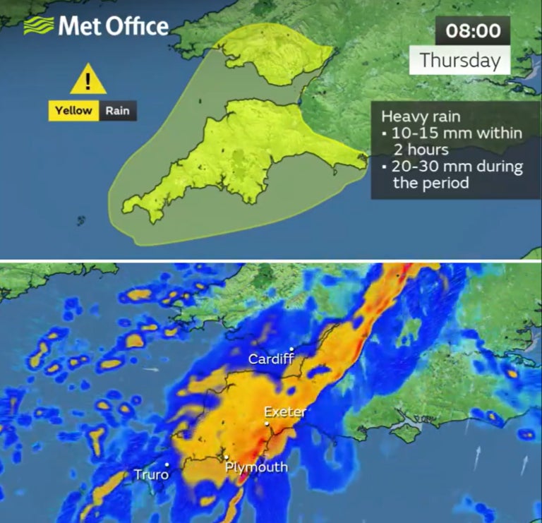
A yellow weather warning for rain was issued for Southwest England and Wales, including Plymouth, Cardiff and Swansea, for more flooding risk after a Wednesday washout.
The warning is in place between 3am until 2pm.
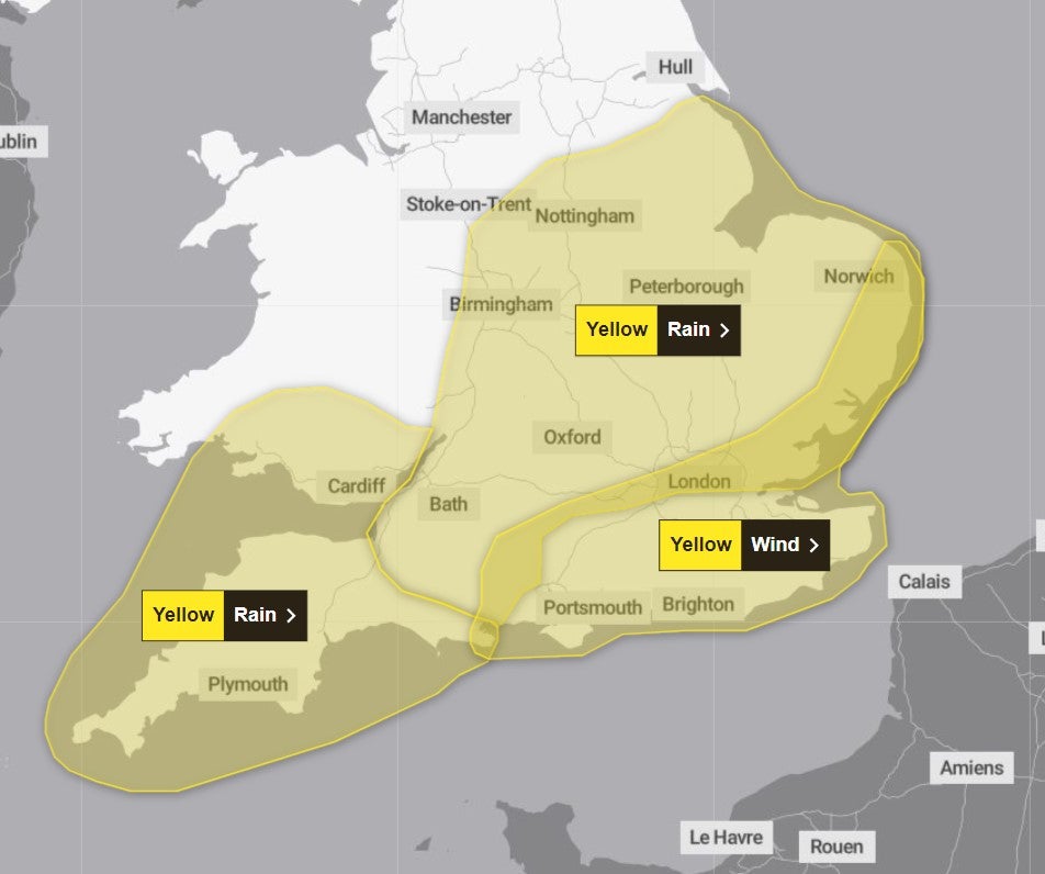
Another warning for wind has been issued for Southern and Eastern England, including London, Portsmouth and Brighton, with up to 50-70mph of wind gusts expected in certain regions.
The warning will stay in place until 4pm.
“There’s a small chance that wind gusts could reach 60-70mph, mostly likely on exposed coasts, though more widely we’re likely to see a shorter spell of heavy, squally rain with hail and thunder in a few places and gusts to around 50mph,” Mr Gunderson said.
Another warning for rainfall covers parts of Southern England and Midlands, including Bath, Oxford and Peterborough from 5am to 6pm.
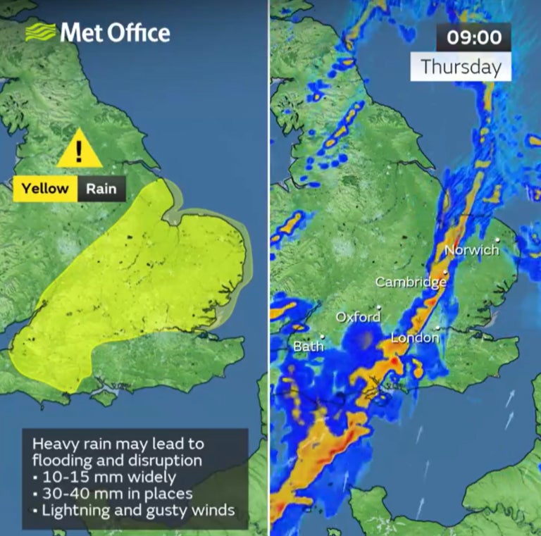
“Most places within the warning areas are likely to see 10-15mm of rain, with a chance of 30-40mm in a few places,” Mr Gunderson said.
“This is falling on saturated ground, which elevates the chances of flooding and disruption.”
Wet and windy conditions are expected to continue for much of the UK for the rest of the week, with Arctic air dipping temperatures slightly, bringing them closer to the average, the forecast shows.
Friday will be a breezy day for many, with showers feeding into many areas, though these will generally be more frequent in the west, the Met Office says.
Further persistent rain and locally strong winds are likely to move into some southern areas on Sunday, though those further north are likely to see drier conditions.
Join our commenting forum
Join thought-provoking conversations, follow other Independent readers and see their replies
Comments
Bookmark popover
Removed from bookmarks