Some parts of the US are finally warming up – but more snow could still be on the way for millions
A storm that’s about to hit California may also bring snow to the Northeast over the weekend
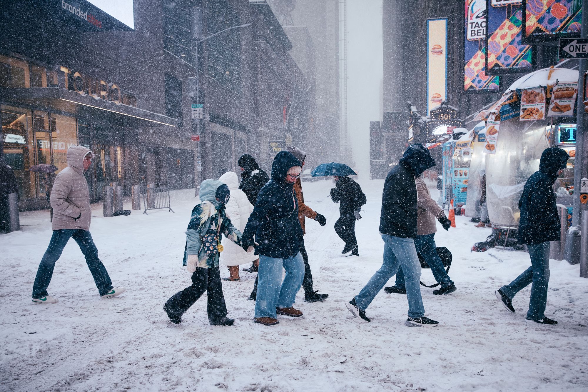
The frigid air that has gripped much of the United States is starting to ease for some, though some unlucky parts of the country may see yet another round of snowfall this weekend.
Much of the Midwest has been warming, while the eastern part of the country hasn’t been as lucky. To add insult to injury, early models circulating on social media show either rain, snow or ice hitting the Northeast through the holiday weekend.
“The middle part of the country is going to be warming. They’ll see temperatures warmer than they should be at this time of year through at least Friday,” Tom Kines, a senior meteorologist at AccuWeather, told The Independent.
While warming in the Midwest is certain, what’s to come in the Northeast this weekend remains up in the air.
“As far as snow is concerned in the East, there’s only the potential later in the weekend or very early next week. This would be from a storm that hasn’t moved to shore on the West Coast yet. It’s got a lot of ways to go. There’s still a lot of question marks with it,” Kines said.
A storm is set to move into Northern California over the next few days, ending the Golden State’s “snow drought” with the biggest rain and snow seen in months.
Precipitation is expected to linger over the next day or two before the storm moves over the Rocky Mountains — but where the storm heads from there is still a mystery.
“From there, if it starts to track more toward the Northeast, there could be some snow or ice or even rain for parts of the Northeast,” Kines said.
However, the storm may also stay south of New York City, Philadelphia and Boston, bringing little precipitation to that region.
“There’s still a lot of possibilities out there,” Kines added.
Meteorologists won’t have a better idea of what’s to come in the Northeast this weekend until later this week, Kines said.
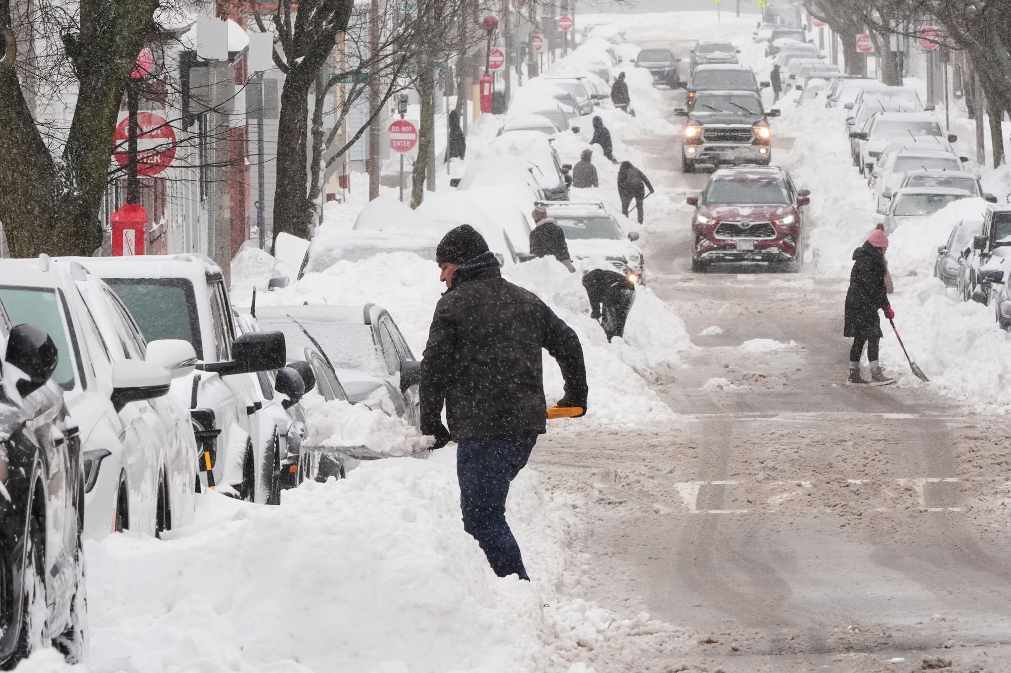
Two major winter storms have left much of the U.S. blanketed in snow, as temperatures remain below freezing, preventing the piles of snow and ice from melting. The extreme cold has persisted, and will likely continue for much of the Northeast through the end of the week, according to Kines.
“We’re not talking about temperatures in the 50s or 60s, temperatures are going to trend closer to where they should be at this time of the year,” Kines said.
In the meantime, areas from Upstate New York to New England may see one to three inches of snowfall starting Tuesday afternoon.
Areas of higher elevation in Vermont, New Hampshire and Maine could see up to eight inches, according to the Fox Forecast Center.
A storm is also expected to hit southeastern parts of the country over Valentine’s Day, bringing widespread rain and thunderstorms, according to AccuWeather.
The storm has two potential tracks: One that would keep the Northeast dry and the Southeast wet, and another that would also dump even more snow, ice and rain on the Northeast.
Join our commenting forum
Join thought-provoking conversations, follow other Independent readers and see their replies
Comments
Bookmark popover
Removed from bookmarks