Mapped: Where 65mph winds and lashing rain will hit as Met Office issues warnings
Warnings come just days after Storm Kathleen hit the UK
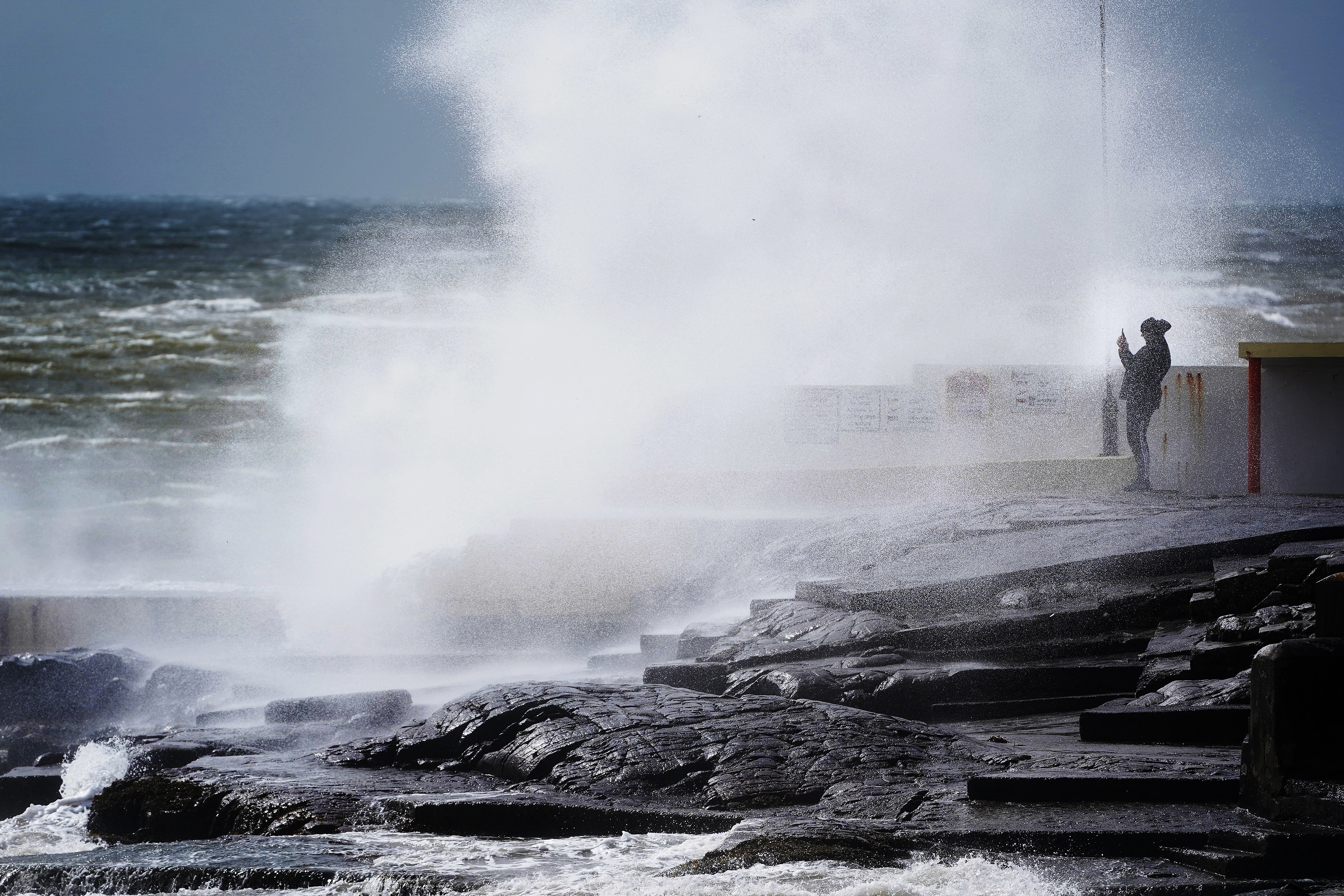
Britons are being lashed by strong winds and torrential rain on Tuesday, with the Met Office issuing three warnings while hundreds of flood alerts are in place.
Warnings of 65mph winds and power cuts come just days after Storm Kathleen battered the UK over the weekend.
Residents in Cornwall, Devon and Somerset are set to face the strongest winds but impacts are expected to be felt in Wales, northwest England, and along many English Channel coasts including Kent.
There is a yellow weather warning for wind in place along England’s south coast until 9am on Tuesday, while a second wind warning in place along the coast of Wales and West England is set to remain in place until 3pm.
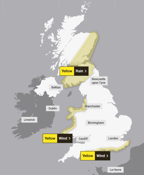
Both areas have been warned of potentially 65mph winds in exposed coastal spots while gusts will reach 45 to 55mph inland.
Locals have been warned of power cuts and delays to journeys.
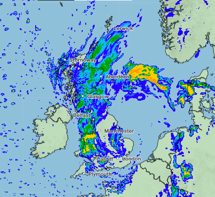
Elsewhere, the forecasters have issued a yellow weather warning for rain until 6pm on Tuesday, covering large swathes of Scotland.
Homes and businesses could be flooded as some spots could see up to 60mm of rain fall.
Frank Saunders, a Met Office Chief meteorologist, said: “This system is in its deepening phase at present and will bring the strongest gusts to areas on its western and southern flanks.”
Alongside the Met Office weather warnings, hundreds of weather warnings and alerts have been issued by the Environment agency across the country.
As of Tuesday morning, there are 216 flood alerts and 107 more severe flood warnings in place across England.
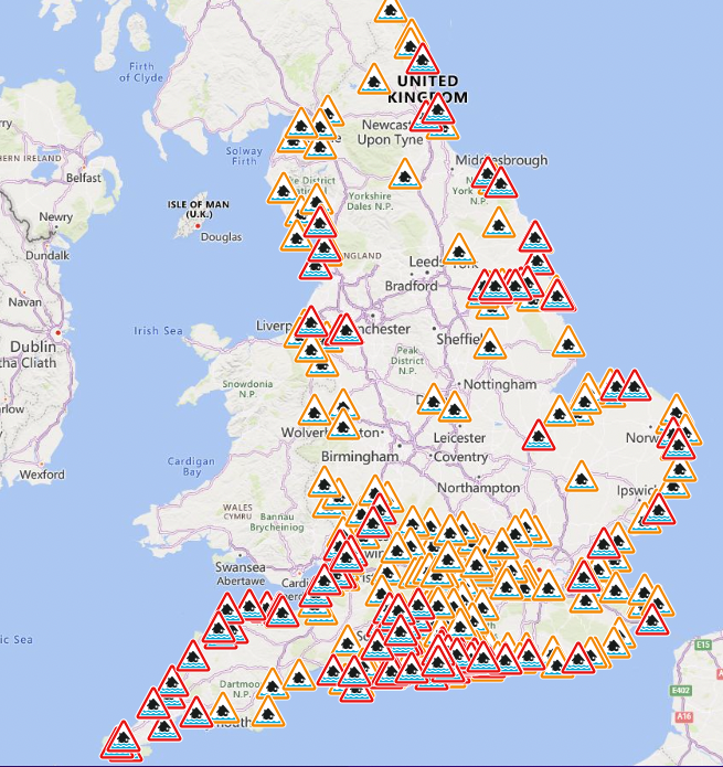
In Scotland, there are 14 flood alerts and seven warnings while Wales has 24 alerts and 13 warnings.
The Environment Agency said that teams are “on the ground” to reduce flooding impacts as they urge people to take “extreme care” on coastal paths.
Met Office Deputy Chief meteorologist Helen Caughey said: “The forecast contains a brief, quieter interlude thanks to a ridge of high pressure which becomes established across the country later on Tuesday. This will bring dry conditions for most areas for a time, but also a chance of some overnight frosts for prone locations.
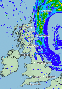
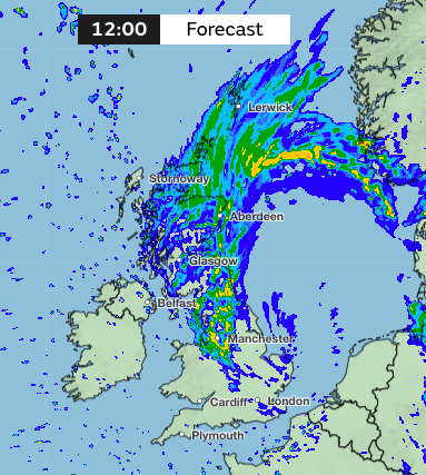
“However, through Wednesday another band of rain pushes in from the west bringing some heavy and persistent rain, especially for higher ground in the west and north, with warnings already issued for parts of western Scotland.
“This system is accompanied by some strong and gusty winds, especially for coastal locations and across high ground, in the northern half of the country. The best of any drier and brighter conditions are likely across the south and east of the country.”
Join our commenting forum
Join thought-provoking conversations, follow other Independent readers and see their replies
Comments
Bookmark popover
Removed from bookmarks