Danger to life as UK set to be hit by 70mph winds and heavy rain
The UK is set to be battered by heavy rain and winds of up to 70mph as Storm Kathleen moves away from the country
The UK is set to be battered by heavy rain and winds of up to 70mph as Storm Kathleen moves away from the country, the Met Office said.
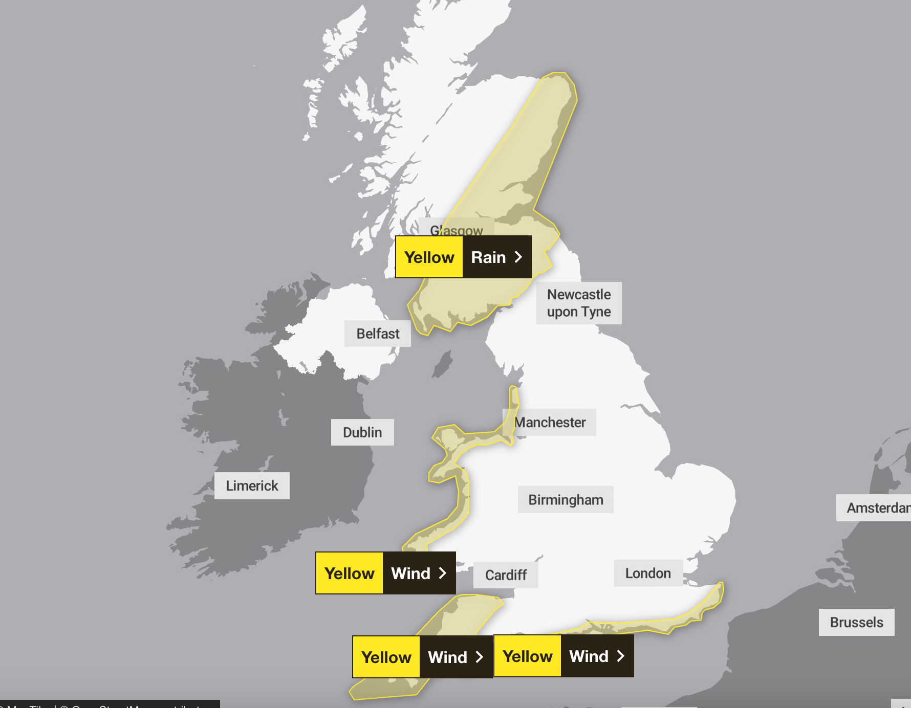
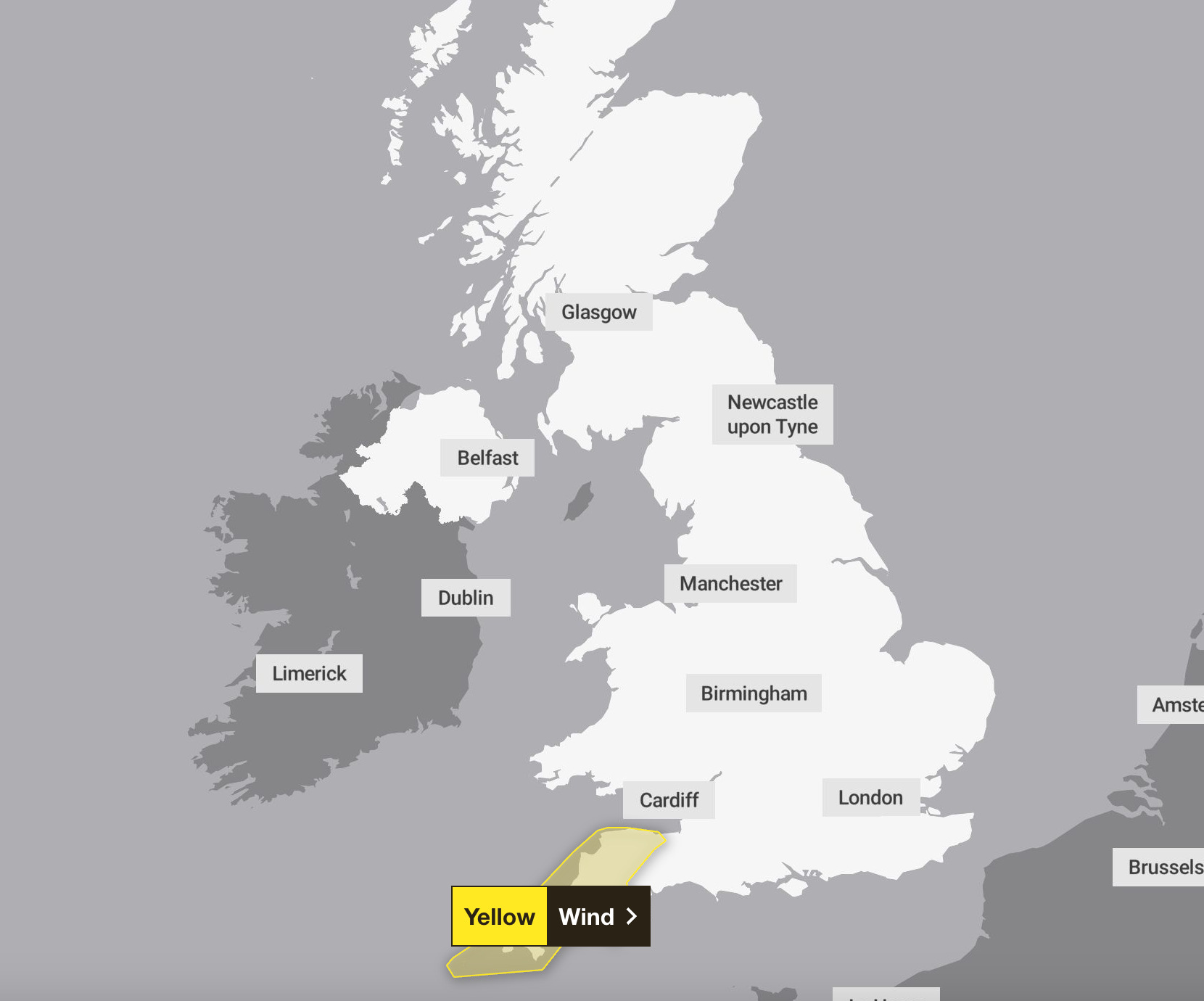
The forecaster warned of a danger to life across much of the South West between 6pm on Monday and 6am on Tuesday as a yellow wind warning was issued.
Three yellow wind warnings and a rain warning were also put in place across much of Scotland, the west coast of Wales and the south-east coast of England on Tuesday.
Met Office meteorologist Marco Petagna said: “Storm Kathleen is moving off the scene now but there is low pressure gathering once again towards the South and South West.
“It is this area of low pressure that will bring more wind and rain to pretty much all of the UK through Monday into Tuesday.

“As for Monday, we will see some brightness for a time across the South and East of England but there will be showery bursts of rain working up from the South as we go through the day.
“Certainly into the afternoon, some of those bursts will turn quite heavy, whereas Northern Ireland will get off to a fine start and see some rain arriving later in the day.”
Gusts are forecast to reach 40-50mph widely and 60-70mph along exposed coasts in places such as Cornwall and the Isles of Scilly.
Strong winds and large coastal waves may cause some disruption, according to Met Office yellow weather warnings covering parts of England and Wales for the start of the new week.
Residents in the South West and London and the South East are also set for unsettled conditions. A spell of strong onshore winds looks set to hit parts of the England Channel coastline overnight on Monday and into Tuesday morning, according to the Met Office yellow warning for wind which runs from 1am to noon on Tuesday.
Hazardous coastal conditions and some travel disruption may also hit north-west England and Wales on Tuesday, which is covered by a yellow warning for wind from 1am to 3pm.
Some “heavy and persistent” downpours could cause flooding affecting transport and homes and businesses, according to a warning across parts of Scotland from 1am to 6pm on Tuesday.
Some areas could see 20-40mm of rain, and there is a slight chance one or two spots could see 50-60mm.
The warning, covering Central, Tayside & Fife, Grampian, south-west Scotland, Lothian Borders and Strathclyde, adds: “Given the saturated ground in this region following recent heavy rainfall, the rainfall totals quoted above have the potential to cause greater impacts than would be typical.”
Meanwhile, temperatures across the northern UK are set to reach about 12C, while in the south and south east it will not feel quite as warm amid outbreaks of rain.
Saturday was the warmest day of the year so far with a maximum temperature of 20.9C in Santon Downham, Suffolk. It beat 19.9C recorded in Achfary, Sutherland, on 29 January. Sunday’s top temperature was 17.8C in Weybourne, Norfolk.
Join our commenting forum
Join thought-provoking conversations, follow other Independent readers and see their replies
Comments
Bookmark popover
Removed from bookmarks